Philippi
Philippi, a flourishing Roman colony
The archaeological site of Philippi is one of the most important in Greece. Since 2016, Philippi has been inscribed on the UNESCO World Heritage List as an outstanding example of a Roman city, organised according to Roman standards, reminiscent of a “little Rome”, which in Early Christian times evolved into an important ecclesiastical centre with splendid and imposing buildings.
Philippi lies almost in the centre of the great fertile plain of Drama, roughly midway between Drama and Kavala, 21 km from the former and 15 km from the latter. In antiquity the area was swampland, the “marshes of Philippi” mentioned in the sources. Efforts were made to drain them from the time of Alexander the Great (336-323 BC) onwards. The marshes were eventually drained in the early 1930s and turned into arable land. However, they remain one of the greatest problems facing the area to this day.
The geographical position of Philippi between the coast and the hinterland, its acropolis offering an unobstructed view of the surrounding area, allowing it to control the communication routes between Macedonia and Thrace, was key to the city’s prosperity. This affluence was based in antiquity on its fertile lands and the famous gold and silver mines of Mount Pangaion.
The traces of the Via Egnatia in the plain of Philippi
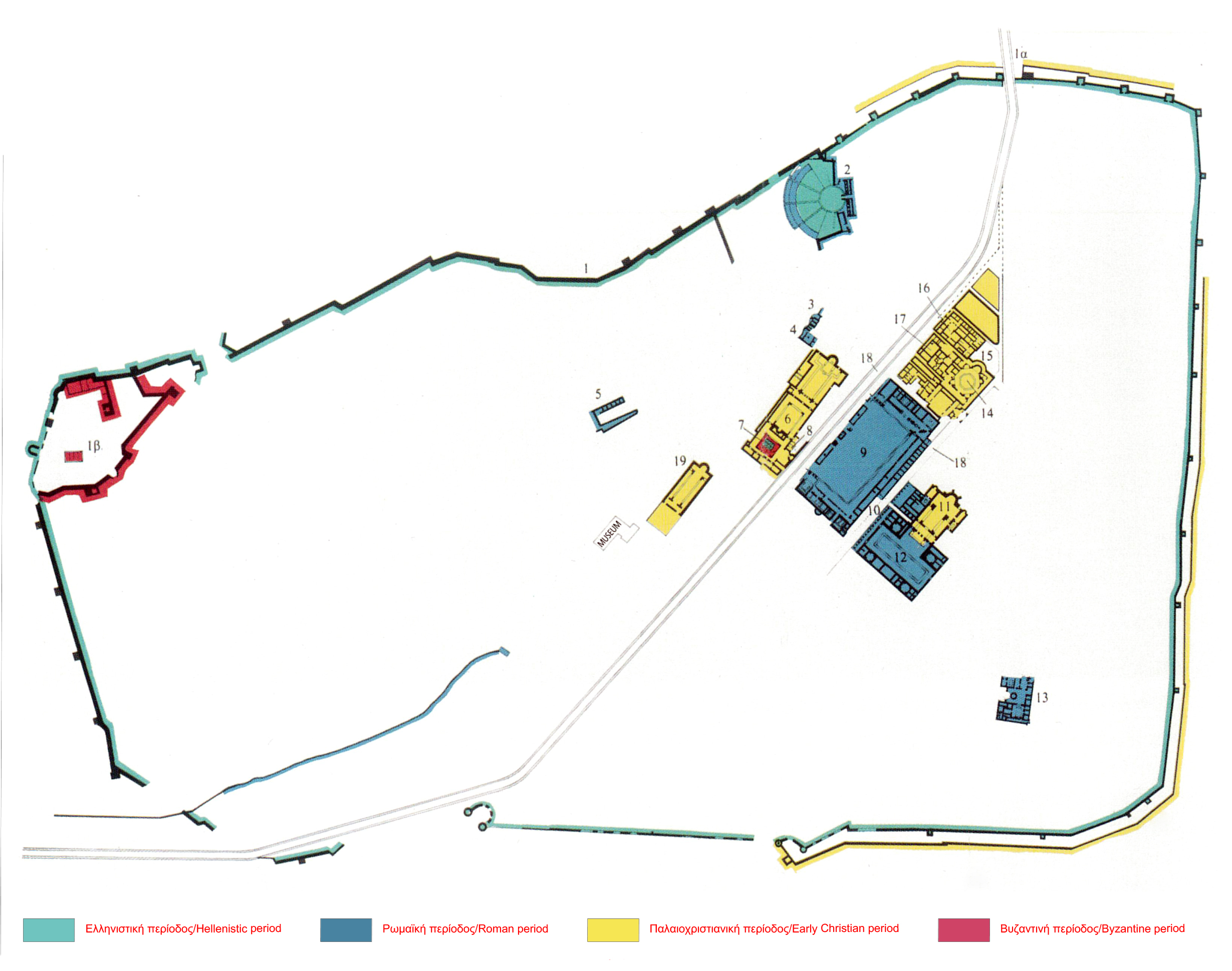
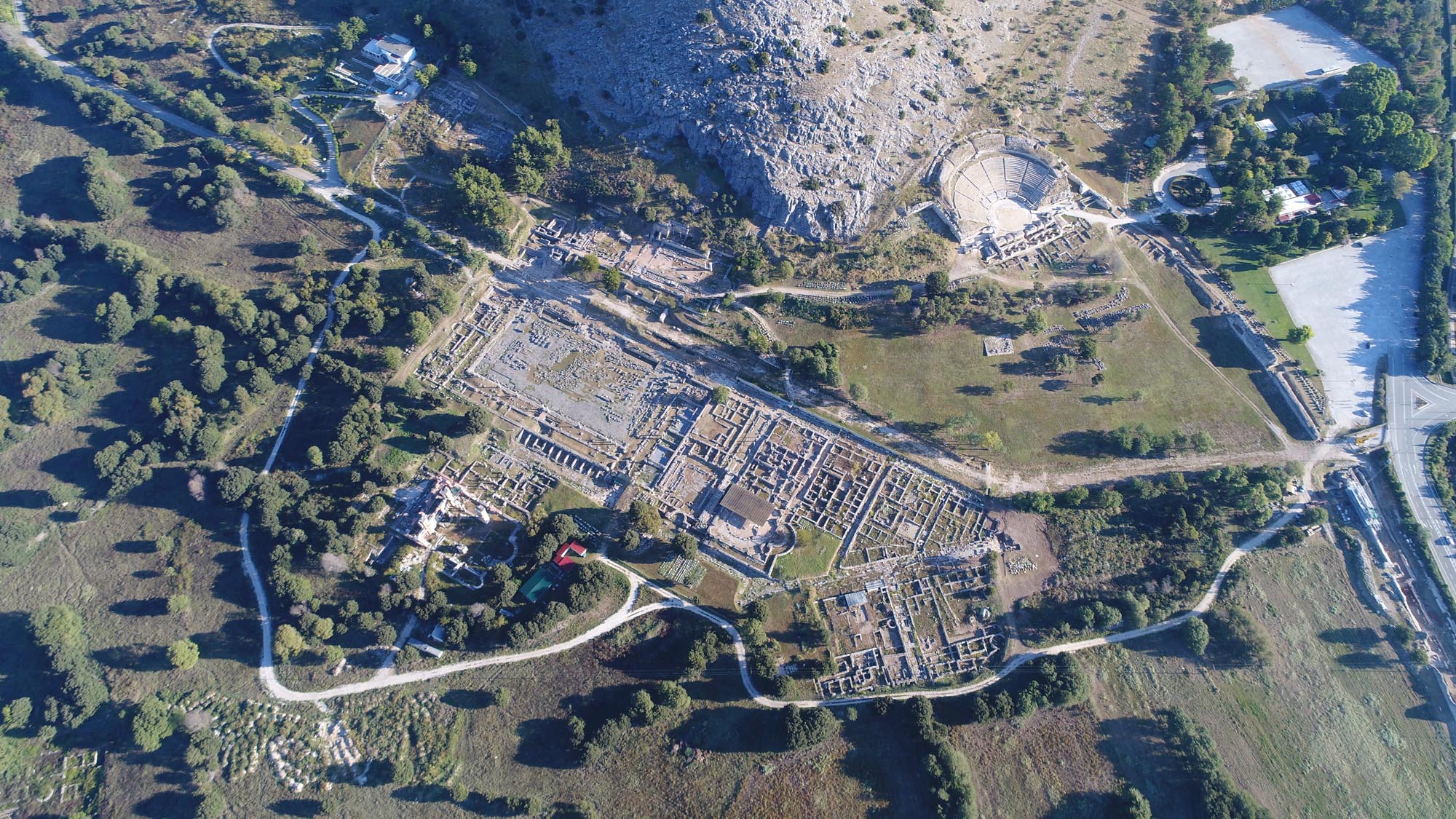
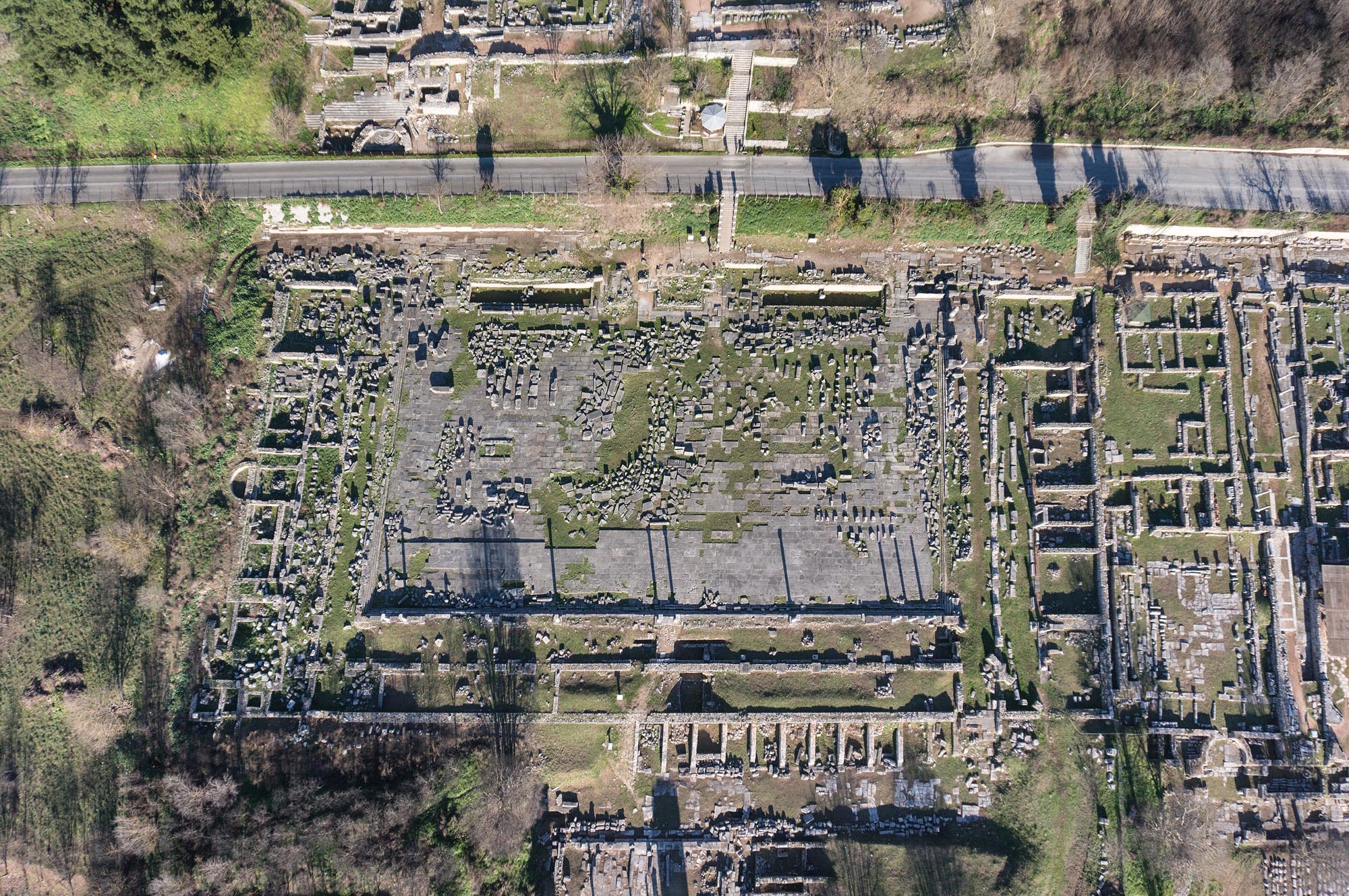
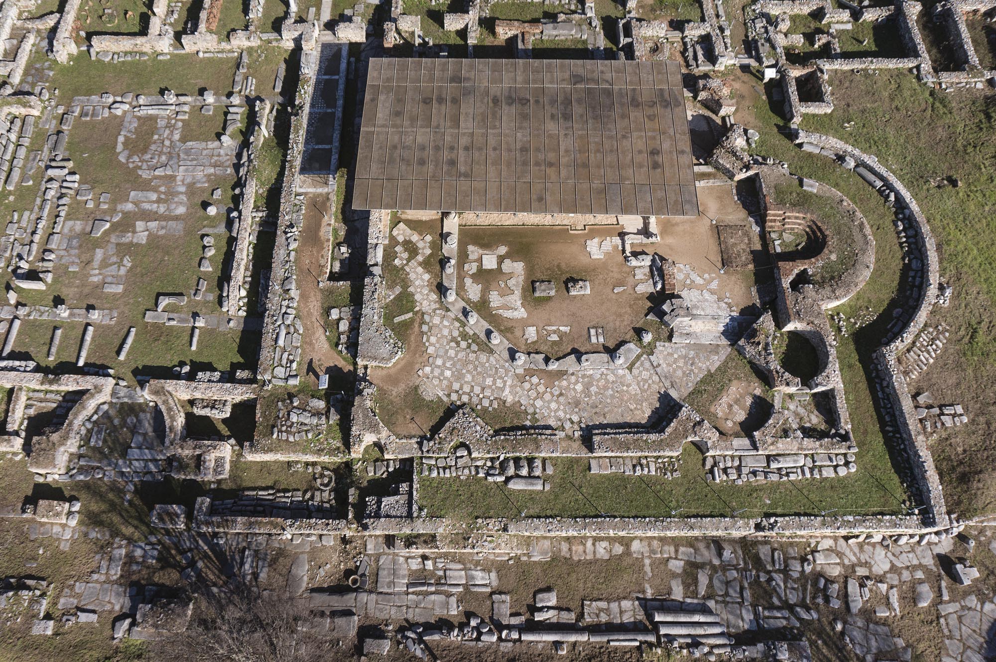
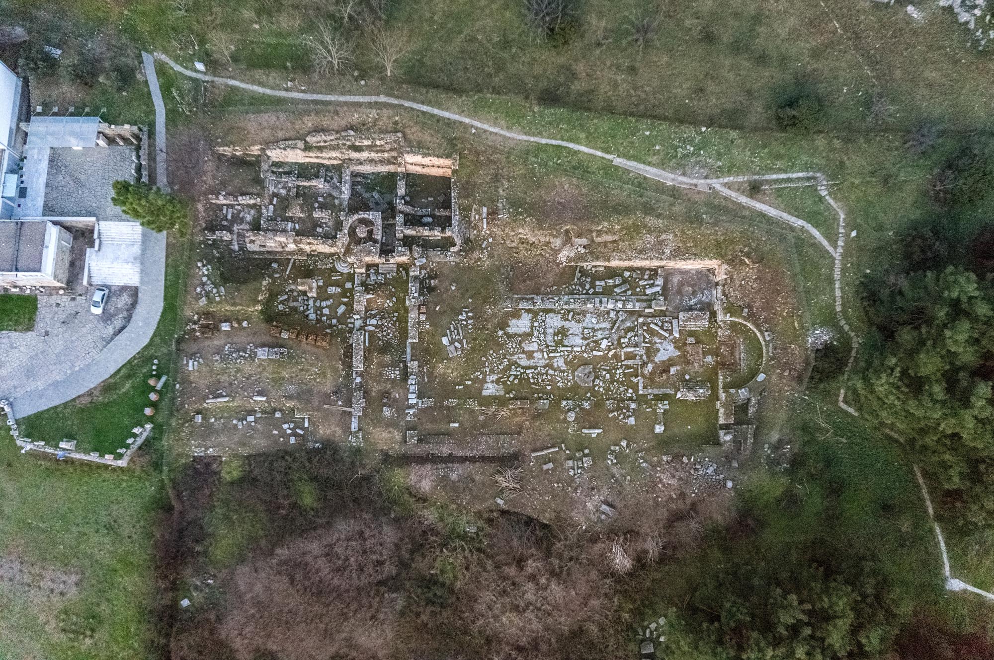
The prosperity of Philippi, from the 2nd century BC to the 6th century AD, was largely based on the fact that the Via Egnatia passed through the city; according to all the itineraries, Philippi was a station (mansio) on that route. The ancient road ensured the communication of Philippi with Amphipolis in the west, the capital of the First Meris (province) of Macedonia, to which the city belonged in Roman times, and with the port of Neapolis (present-day Kavala). Traces of the ancient road have been located in the wider area of Philippi.
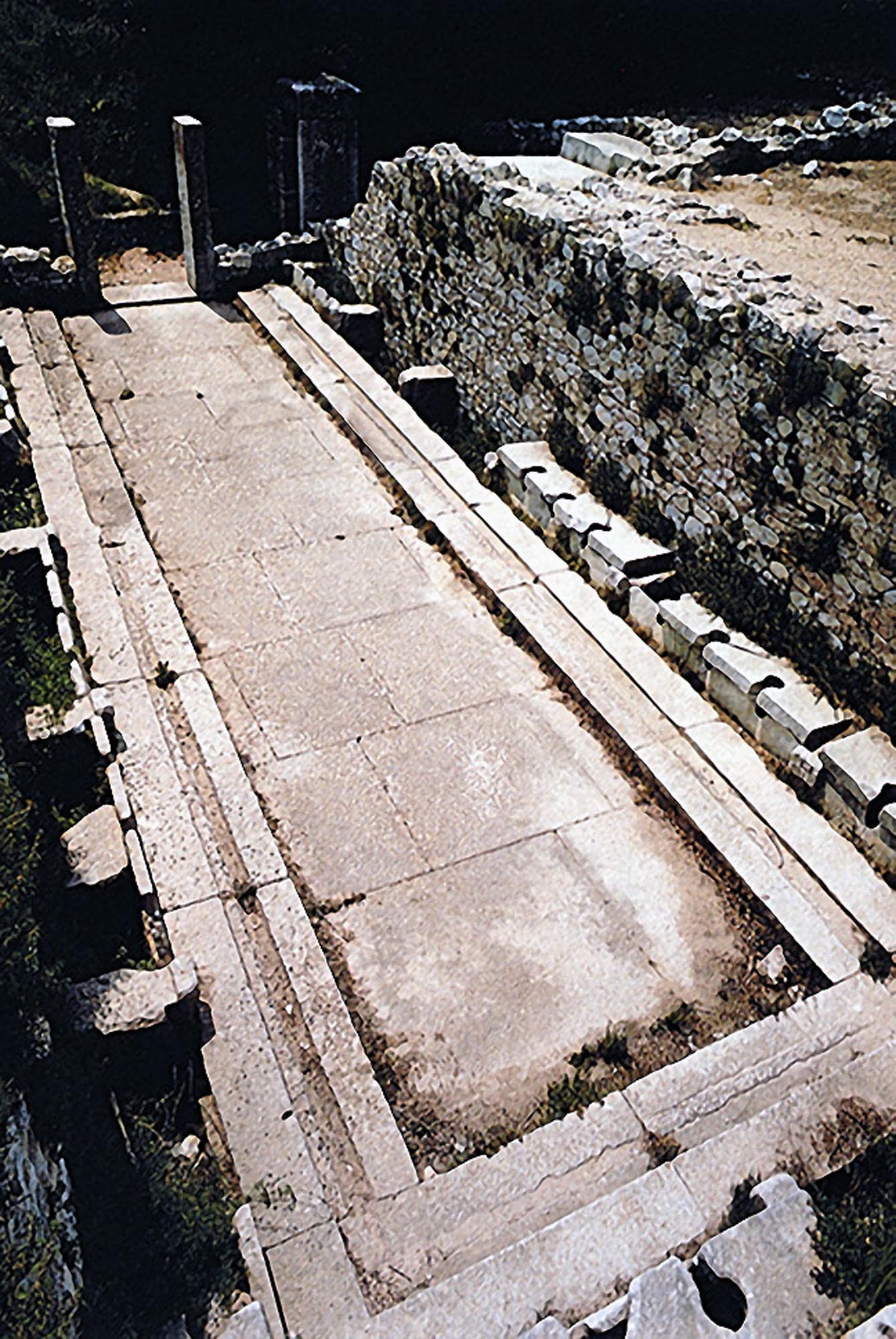
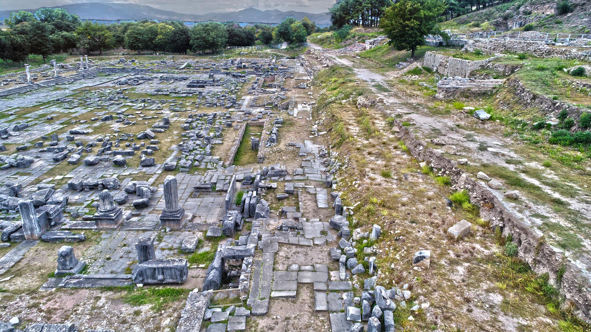
The roadway is paved with large marble slabs, worn with ruts made by cartwheels.
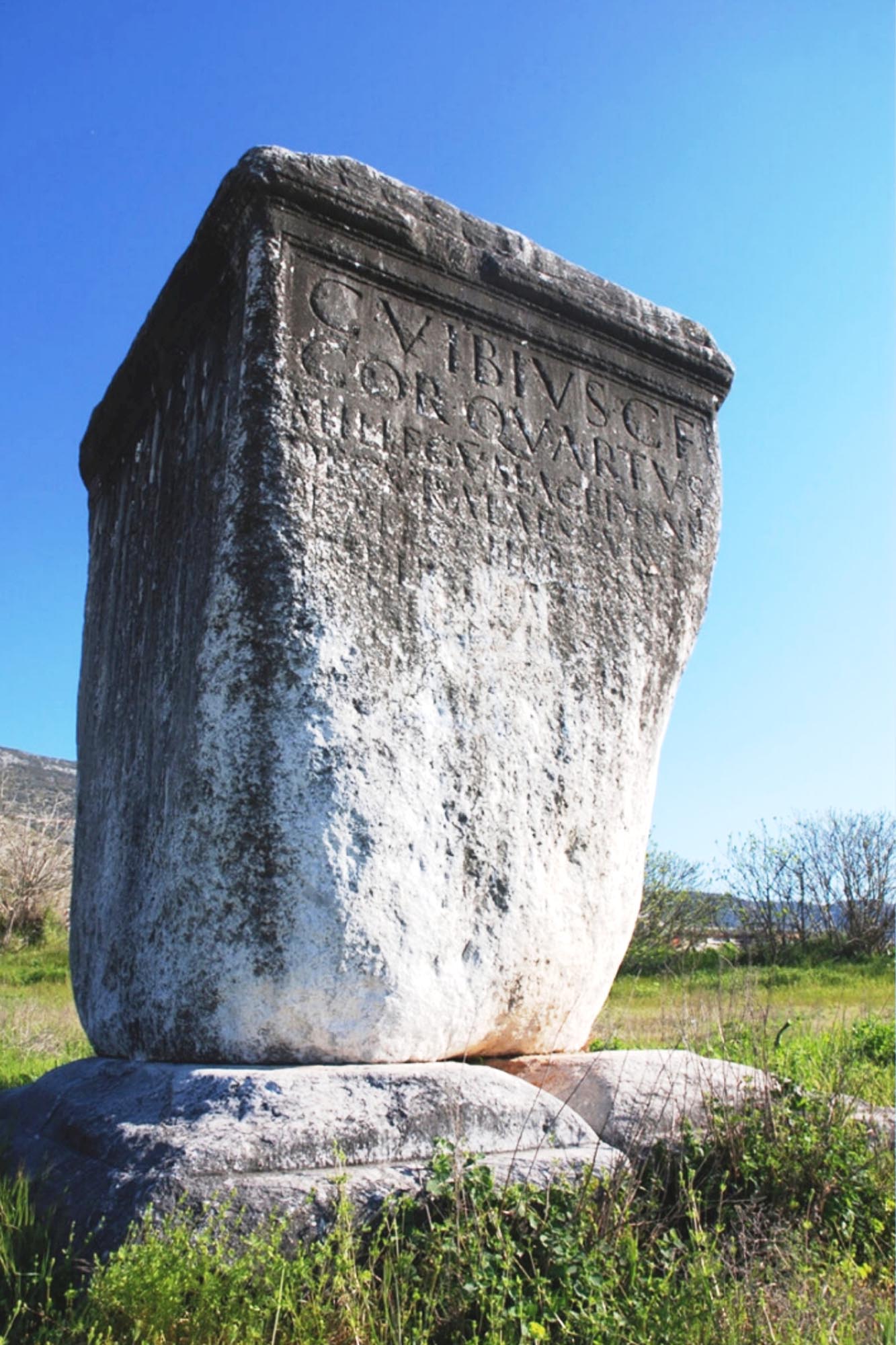
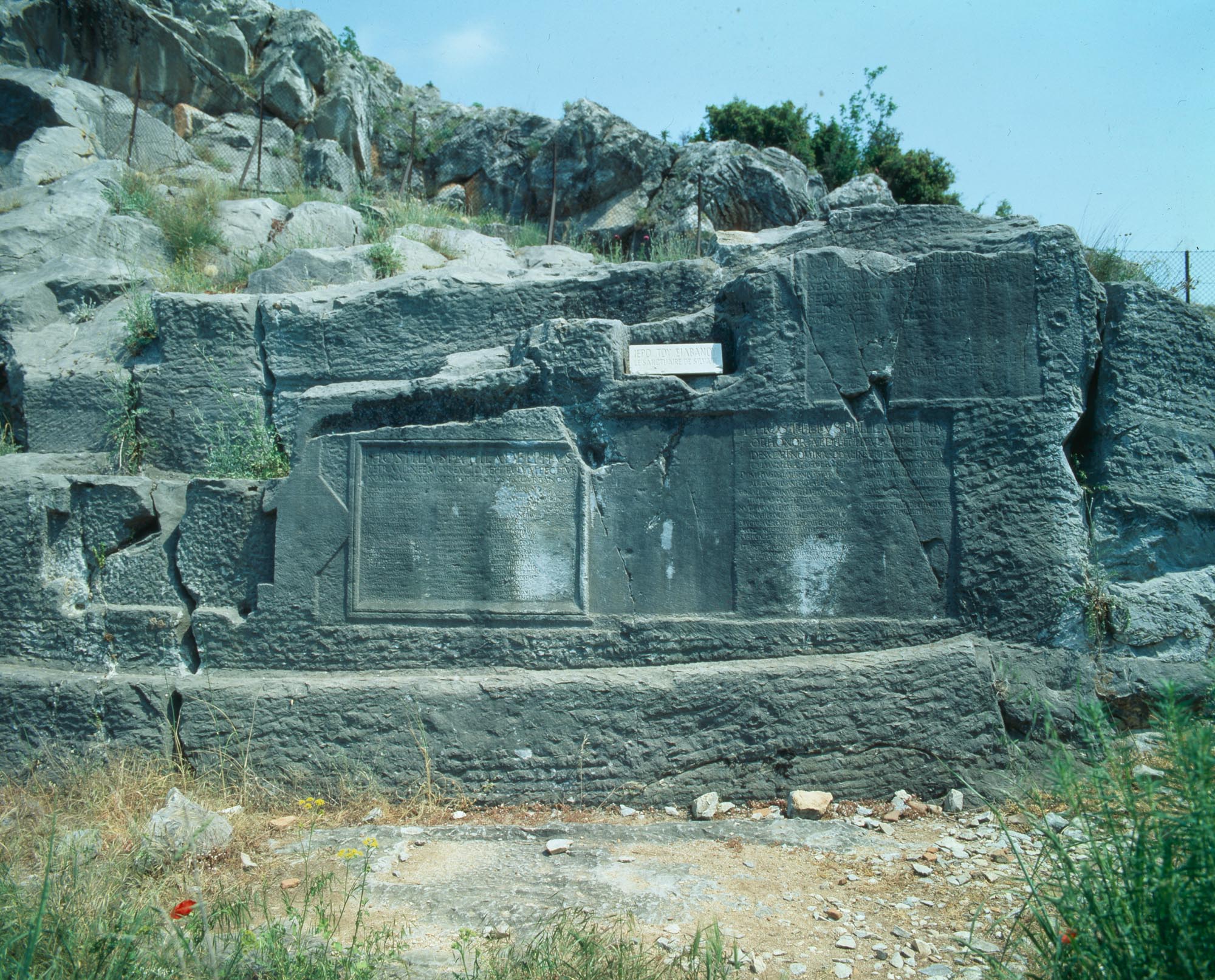
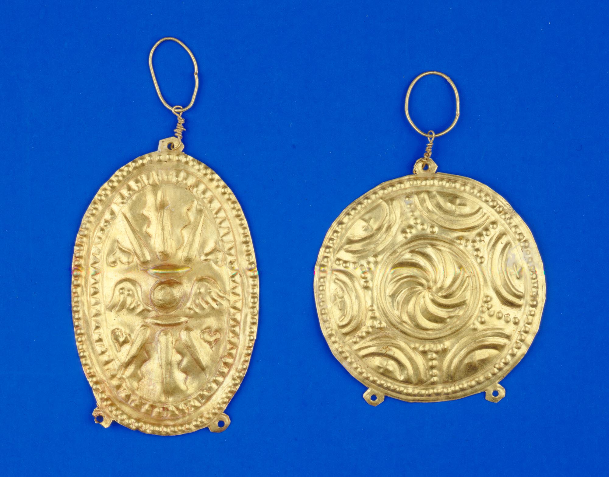
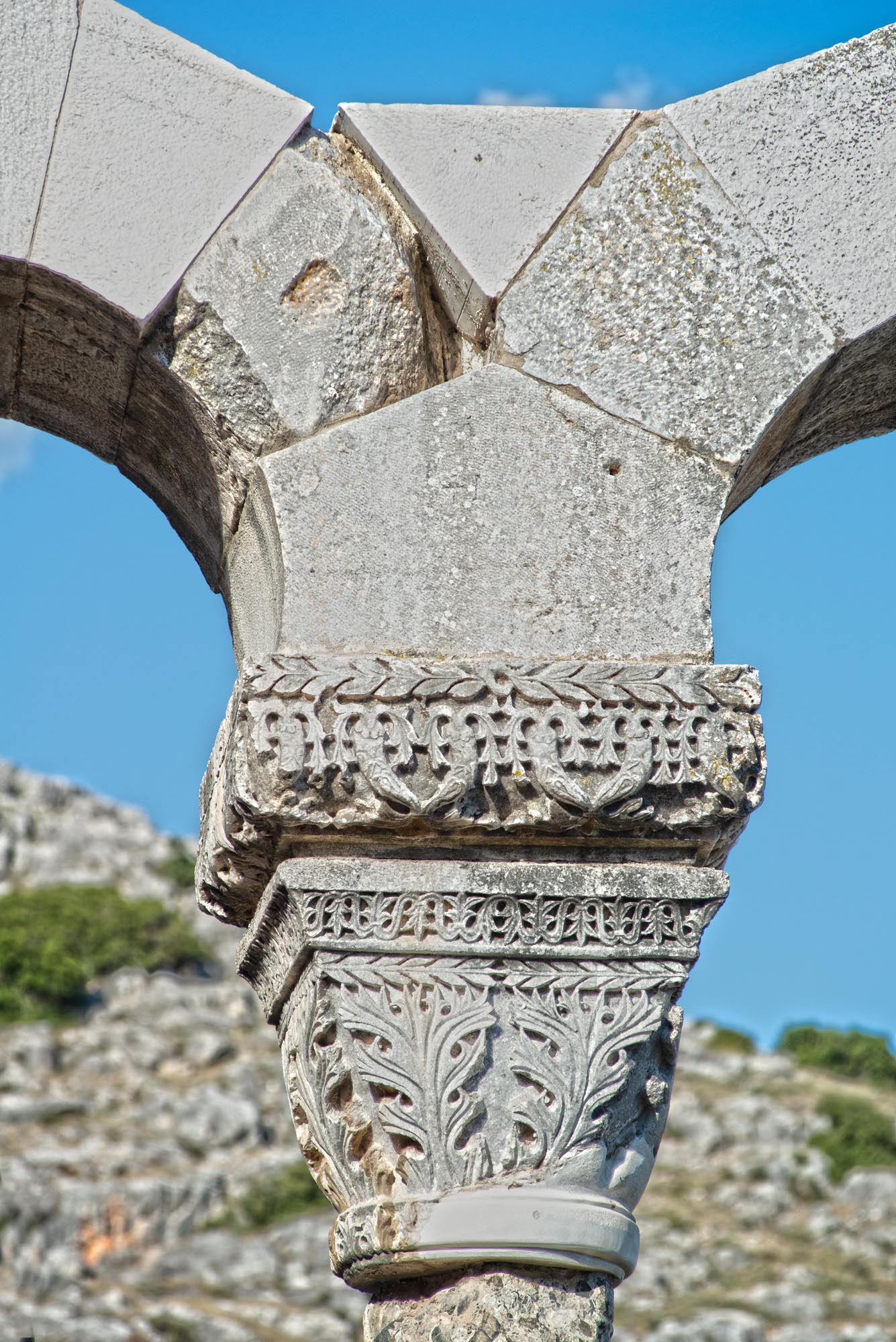
Outside the eastern and western walls, the Via Egnatia crossed the two cemeteries of the city. On either side of the ancient road stood imposing Roman tombs, extending at least 2 km outside the eastern walls: the French archaeologist Léon Heuzey, impressed, called it the “Street of Tombs”. Of these, the massive funerary monument of the Roman officer Caius Vibius Quartus (1st c. AD) is preserved almost intact to this day at the east end of the village of Krenides, near the prehistoric settlement of Dikili Tash. The monument is a four-sided monolithic piece of marble almost 4 metres high. It once stood on the north side of the Via Egnatia, inspiring the Greek place-name Megalo Lithari (“great stone”), as well as the Turkish name Dikili Tash, meaning “upright stone”. The monument is also known as the “Manger of Bucephalus”:The lower part is damaged, as the local inhabitants used to scrape its surface, in the widespread belief that women who drank the scraped marble dust would produce milk or give birth to male children as strong as Alexander the Great. In the early 20th century there was a han here, a travellers’ inn.
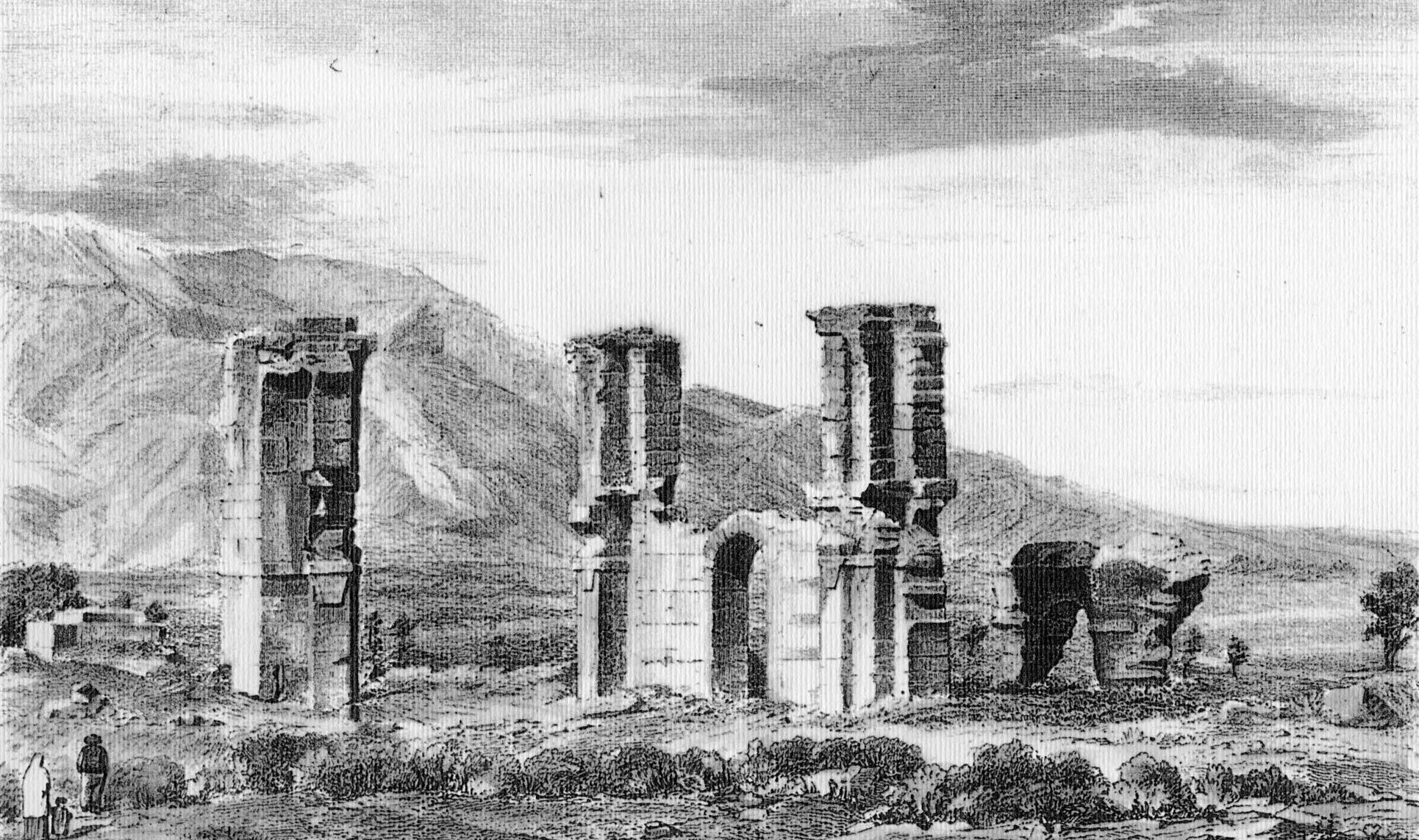
Outside the western walls of the city, about 2 km from the west gate, at the Kiemer site, the entrance to the territory of Philippi was marked by a large arch through which the Via Egnatia passed. The arch, made of white marble, does not survive today, but we know what it looked like thanks to the drawing by Léon Heuzey and the French architect Honoré Daumet, who carried out the first scientific expedition to Philippi in 1861. An excavation in 2004 revealed the remains of the ancient roadway and the arch; the latter was found to have a span of 4.95 m, the same width as the roadway.
The archaeological evidence and the information provided by written sources allow us to clearly trace the course of the Via Egnatia from Philippi to Neapolis. Marble bridges were built at intervals across the marshes formed along the plain. One of them is now encased in a storm drain under the Kavala–Drama highway, outside the small town of Amygdaleonas. We know that the Via Egnatia passed through this last settlement because a milestone of the second half of the 2nd century BC was found here. The bilingual inscription on the milestone, in Greek and Latin, mentions the name of the builder of the ancient road and governor of the province of ancient Macedonia: “Gnaeus Egnatius [son of] Gaius, Proconsul of the Romans”. This is the second milestone that preserves the name of Egnatius, to whom the road owes its name; the first was found in the silted-up banks of the River Gallikos near Thessaloniki (see Thessaloniki). The inscription also records the distance of 6 Roman miles (9 km) from the last station of the Via Egnatia, namely Philippi. A small excavation at the site where the milestone was found brought to light a section of the ancient road, paved with small slabs and stones, 3.80 m wide.
South of Amygdaleonas, on the hill of Vasilaki, where a settlement of Roman and Byzantine times has been discovered, is believed to have been situated the Fons Co changing station (mutatio) of the Via Egnatia, which, according to the Roman itineraries, lay between the stations of Philippi and Neapolis. In ancient times, there was a spring at this station which supplied water to travellers heading to Neapolis before they crossed the saddle of Mount Symbolon. There was a Byzantine village called Chlebina in the area, near which emissaries of Emperor Nikephoros III Botaneiatis (1078-1081) blinded the pretender to the throne Nikephoros Basilakes (Basilakios).
History
The first traces of habitation in the plain of Philippi date back to prehistoric times. East of Philippi is the archaeological site of Dikili Tash, which was inhabited from the Neolithic period (6400-4000 BC) to the Bronze Age (3000-1100 BC). There is also evidence of habitation on the acropolis and in the plain of Philippi during the Iron Age (1050-700 BC).
There are significant gaps in our knowledge of the origins of the city of Philippi. The area, which was inhabited by Thracians due to its wealth of metals and timber, necessary for shipbuilding, attracted the interest of the Thasians, who founded a series of colonies between the Strymon and the Nestos (Peraia Thasion or Thasion Epiros, the “Thasian mainland”). One of the cities which the Thasians settled or founded in the area of Philippi, at least from 464 BC, is Daton or Datos. A century later, in 360/59 BC, the Thasians, led by the exiled Athenian orator and politician Callistratus, founded a second colony in the same area, named Krenides (“Springs”). In the past, some scholars identified Daton with Krenides, but according to more recent research, Daton, which was a powerful city of the region, should be placed in the area of southeast Mount Pangaion, around present-day Eleftheroupoli.
In 357/6 BC, the inhabitants of Krenides were threatened by the Thracians and requested the aid of King Philip II of Macedon (359-336 BC), who descended on the area and founded in its present location the city that took his name, according to the usual practice of the rulers of the Hellenistic era. By founding Philippi, Philip II, having occupied Amphipolis in the previous year, succeeded in strengthening the Greek element in the region inhabited by Thracians and in extending his kingdom to the east, from the River Strymon, its border until then, to the Nestos.
Little is known about the size and form of the city during the time of the Macedonian kings, as archaeological excavations have brought only a few remains of the period to light. Only the city theatre and the lower part of the wall in some places belong to the Hellenistic period.
In 168 BC, after the battle of Pydna, Macedonia and the city of Philippi passed into the hands of the Romans. In the 1st century BC, when Rome was torn by civil strife, Philippi came to the forefront of major historical events. In 42 BC, outside the city walls, in the plain of Philippi, the great battle took place that pitted the combined forces of two of Julius Caesar’s assassins, Cassius and Brutus, against the armies of two members of the triumvirate that had assumed control of Rome after his assassination, Octavian and Mark Antony. The size of the two armies was unprecedented in the civil wars of Rome. The victors were Julius Caesar’s successors, Octavian and Mark Antony, while the defeated Cassius and Brutus committed suicide.
The outcome of the battle had momentous consequences for the ancient world, as it marked the end of the Roman Republic. The Battle of Philippi inspired the Roman lyric poet Horace, who fought in the army of Cassius and Brutus, although he admits “he cast away his shield” (abandoned the battle), as well as later writers including Shakespeare. The ominous expression “Thou shalt see me at Philippi” is proverbial, meaning that we will soon have to settle a score with someone and pay them back for what they have done to us. It is based on the story told by the historian Plutarch, that the dead Julius Caesar appeared to Brutus, one of the protagonists of his assassination. During their brief conversation, Julius Caesar, after telling Brutus that he was his evil genius, closed with the threatening phrase: “Thou shalt see me at Philippi”, a threat proved true by Brutus’ suicide.
Mark Antony, who after his victory took over the administration of the eastern provinces of the empire, turned Philippi into a Roman colony (Colonia Victrix Philippensium), settling there a large number of Roman colonists and army veterans to whom he granted land. There followed a civil war between the two victors of the Battle of Philippi, ending in Octavian’s victory over Mark Antony at the Battle of Actium in 31 BC. Octavian re-established Philippi as a Roman colony (Colonia Julia Philippensis), bringing new colonists from Italy. The practice of founding or re-founding cities was widely used, especially by Octavian, as a means of consolidating Roman rule. Shortly afterwards, in 27 BC, on becoming the first Roman Emperor and obtaining the title of Augustus, he renamed Philippi the Colonia Augusta Julia Philippensis.
With the two colonisations, the city’s population increased significantly. The settlers of Italian origin formed the ruling class of the city, which was also inhabited by Greeks and native Thracians. The government of the city was based on Roman institutions, while Latin became the official language. The worship of predominantly Roman gods was established, alongside that of deities common to both Greeks and Romans, such as Artemis (Diana) and Dionysus (Bacchus). The city, especially during the Antonine period (2nd half of the 2nd c. AD), enjoyed a period of great prosperity and was embellished with magnificent buildings (Roman Forum, Commercial Market, palaestra, scholae, baths, villas, etc.), along the lines of the great cities of the Empire.
A pivotal moment in the history of Philippi was the arrival in 49/50 AD of St Paul the Apostle, who founded the first Christian church on European soil here. Paul’s turbulent stay in Philippi, which he would visit twice more (56 and 57 AD), is recounted in the Acts of the Apostles. The Christian religion was gradually established in the city, which became an episcopal see in the 4th century AD.
During the 5th and 6th centuries AD the city flourished, as we see from the large number of ecclesiastical monuments erected during this period, their monumental dimensions dominating the urban space. Three basilicas were built on either side of the Decumanus Maximus and the Forum (Basilicas A-C), while the Octagonal Church complex was erected on the east side of the Forum. The four churches are impressive in their monumentality, their numerous annexes including chapels, atria and baptisteries, and their rich decoration (marble inlay floors, sculptures, frescoes, etc.) echoing the art of Constantinople. Their construction in close proximity to each other and their capacity to serve a large number of worshippers, disproportionate to the population of the city, has puzzled researchers, especially given that they are not the only ecclesiastical monuments in the city. Another, as yet unexcavated basilica has been discovered on the west side of the Forum, while outside the east wall of the city, three large funerary basilicas have been identified (Cemetery Basilicas A-C), of which only Cemetery Basilica B — the earliest of the three — has been fully excavated. It dates to the late 4th–early 5th century AD.. According to one view, the four churches around the Forum were pilgrimage churches erected on sites associated with the visit, imprisonment and martyrdom of St Paul, who set his seal on the historical course of the city. Beyond the ecclesiastical monuments, within the urban fabric of the city, excavations have revealed numerous residential remains of the Early Christian period. These include various workshops, such as glassmaking, pottery and stone-carving workshops, providing valuable information on the city’s flourishing economy and commercial activity during this period.
In the first half of the 7th century, Philippi was destroyed, probably by an earthquake, and subsequently shrank, showing signs of severe decline. The city was raided by Slavs in the second half of the 7th and in the 8th century, and by Bulgarians in the 9th. Life, however, continued in the city of Philippi despite the raids and destruction. The excavation finds show that the city was laid out in districts and the cemeteries were moved within the urban fabric, around small parish churches built in the Middle Byzantine period. The city walls were repaired in the 10th century, during the reign of Emperor Nikephoros II Phokas (963-969). From the beginning of the same century and during the 11th, Philippi was a metropolitan see. Probably in the 11th century, the period when Philippi formed administrative part of the Theme of Voleron, Strymon and Thessaloniki, a small, triangular castle was built near the west gate, the “Marsh Gate”. In the mid-12th century, the Arab geographer Muhamadal-Idrisi described Philippi as a large commercial centre, where vines and other plants were cultivated. In Late Byzantine times, Philippi shared the fate of most Eastern Macedonian cities, being occupied by the Latins (1208) and the Serbs (1345).
At the end of the 14th century, Philippi fell to the Ottomans and was abandoned. A picture of Philippi in the 16th century is provided by the French traveller Pierre Belon, who visited the area between 1546 and 1549 and reports that it was deserted, with only six to eight houses outside the walls. A similar picture is painted a century later by the Ottoman traveller Evliyâ Çelebi (late 1670s), who also mentions a small hamlet of just 70-80 houses outside the castle.
In the centuries that followed, the glorious Greco-Roman city gradually fell into ruin. Of its glorious past, only the huge pillars of Basilica II remained impressively standing, giving the site the name Direkler, Turkish for a tall, vertical support.
Monuments - Antiquities
Urban plan
Philippi flourished during the Roman and Early Christian period, when it was a large, populous city with a total area of approximately 68 hectares, of which about 40 were built up. The city has two parts: the acropolis, which dominates the higher northern side of the city, built on the top of a steep, conical hill, and the main urban fabric, which extends across the large plain south of the hill of the acropolis. The city, like all Roman colonies, is laid out in horizontal and vertical streets, creating a grid of rectangular blocks of almost identical size, 27 x 82.80 m, known as insulae. The city extended around two main roads, the Decumanus Maximus, the continuation of the Via Egnatia within the city (which, for this reason, was previously established to be called “Via Egnatia”), and the Diagonal Road, which intersected the Decumanus Maximus near the “Neapolis Gate”. A third major road was the so-called Commercial Road, which ran parallel to and south of the Decumanus Maximus and passed in front of the Commercial Market and the palaestra.
The decumanus maximus led from the west gate, the “Krenides Gate”, to the east gate, the “Neapolis Gate”, so named because the Via Egnatia passed through it to Neapolis. The ancient road divided the city into two sections of almost equal size: the north upper part, which was sparsely populated, and the south main part of the city. Along the Decumanus Maximus, both in Roman and in Early Christian times, rose the most important public and religious buildings of the city. In the mid-1st century AD, the monumental Roman Forum, the administrative centre of the city, was built on either side of the decumanus maximus. The length of the Decumanus Maximus within the walls is estimated at more than 600 m, with an average width of 6 m.
The urban area of Philippi has undergone successive transformations during its long history, attested by the remains of buildings that show successive phases of use and alterations.
Fortifications
The city was protected by strong walls about 3.5 km long. They underwent extensive rebuilding and modifications over the centuries, but their main construction phase is considered by modern researchers to date from the 4th century AD. Inside the acropolis stands a large four-sided tower of the Late Byzantine period.
Roman Forum
The Forum was erected in the “heart” of the city in the middle of the 1st century AD, during the reign of the Emperor Claudius (41-54 AD), and underwent major reconstructions during the Antonine era, in the third quarter of the 2nd century AD (161-175 AD). Following the typical plan of a Roman forum, it is a uniformly designed complex of temples and public buildings, set out around a rectangular paved courtyard. 148 m long and 70 m wide, it is the largest building complex in the city, the lower square alone occupying five insulae. The Forum continued in use during the Early Christian period, although with obvious changes to the buildings and their functions.
Commercial Market
The large building complex (macellum), where the commercial activities of the city were concentrated, is located south of the Roman Forum and dates from the Antonine era (3rd quarter of the 2nd c. AD).
Palaestra
The Palaestra has been uncovered west of Basilica B and occupies two insulae. It dates from the second half of the 2nd century AD. The best-preserved part of the complex is the Vespasianae, i.e. the latrines, in its southeast corner. Around three sides of the hall is a continuous bench with 42 circular holes for seats, under which ran a sewer with a continuous flow of water to keep the area clean.
Villas – Scholae
Excavations have brought to light many of the residences of the city of Philippi, some of them particularly large and luxurious, such as the villa in Insula 4, east of the Episkopeion. During its first building phase (first half of the 4th c. AD), it had an area of 1,400 m2, boasted two triclinia, and some of its rooms featured mosaic floors.
Some of the city’s secular buildings are identified as scholae, the headquarters of religious societies or professional associations (collegia). One is believed to be the schola of the charioteers’ guild, based on the mosaic floor adorned with a rare chariot-racing theme (3rd c. AD). In the southwest corner of the city, the “House of the Wild Animals”, measuring 2,310 m2, has come to light. According to one view it, too, functioned as a schola (mid-3rd c. AD). It includes a large bath complex and is adorned with magnificent mosaic floors depicting wild animals in fighting scenes or devouring their prey, as well as birds of various species.
Bathhouses
The city had a large number of public and private bathing facilities. The large public bathhouse in the north part of the Octagon complex stands out. It has an area of about 800 m2 and was built around 30 BC.
Rock Sanctuaries
These are located on the southern slopes of the citadel, facing the city and the plain of Philippi. They were founded in Roman times in the trenches of earlier quarries, from which material was extracted for the building of the Roman Forum. They include sanctuaries of Artemis (Diana), the god of the Roman pantheon Silvanus, Cybele and the Egyptian gods (Isis, Sarapis, Horus and perhaps Telesphorus). The finds from the sanctuaries are mainly inscriptions and reliefs depicting the deities worshipped, such as Artemis, Athena (Minerva) and Dionysus, as well as reliefs of the Hero-Rider, whose cult became widespread in Macedonia and Thrace during Roman times.
Theatre
The Theatre is set against the east wall and is one of the few surviving Hellenistic monuments of the city (mid-4th c. BC). During Roman times it underwent extensive alterations in order to adapt it to the staging requirements of the performances of the time (wild beast fights, etc.).
Octagon Complex
This is one of the most important monuments of Philippi, occupying a large area of approximately 1.2 hectares east of the Roman Forum. Besides the octagonal church, it includes numerous buildings (a phiale, a baptistery, a bathhouse, a two-storey building identified as the bishop’s residence, etc.). The octagonal church was built in the mid-6th century AD on the site of the “Basilica of Porphyrios” or “Basilica of Paul”, a simple rectangular single-nave building with a tripartite division, which has been interpreted either as an oratory or, according to other scholars, as a martyrion. It is the oldest Christian monument in the city, dating to the mid-4th century AD, and preserves remarkable mosaic floors. According to an inscription, they were created at the expense of Bishop Porphyrios, known for his participation in the Council of Serdica (342/3 or 343/4 AD). The octagonal church built above the “Basilica of Porphyrios” was a square building on the outside, which was internally converted into an octagon by means of four niches at the corners of the square. The church included a spacious narthex and a large atrium with a two-storey colonnade, on the western side of which stood an impressive fountain structure.
“Macedonian Tomb” - Funerary heroon
An underground barrel-vaulted (“macedonian”) tomb of the 2nd century BC has come to light adjacent to the northern part of the octagonal church . An undisturbed burial was excavated inside it with rich grave gods, including a gold wreath and gold ornaments from the clothing of the deceased. It probably belonged to a child, who held an official position in the ancient city of Philippi, given that the hero-colonists of a city were buried inside the walls of ancient cities. Over the tomb was a temple-shaped building interpreted as funerary heroon. Its incorporation into the octagonal church suggests that cult at the funerary heroon survived in a modified form into Early Christian times.
Basilica A
The basilica was built at the end of the 5th century AD, on the north side of the Roman Forum. It is a three-aisled timber-roofed basilica with transept, featuring a large atrium and a spacious peristyle court on the west side. It stands out for its monumental dimensions (130 x 50 m) and its rich sculptural decoration. On the west side of the atrium was a monumental two-storey fountain with rich architectural decoration, while in the southwest corner is a vaulted cistern of the Roman period, which according to tradition was the prison of St Paul the Apostle. In the 9th or 10th century , a chapel was built on top of the cistern. It contains fragments of contemporary frescoes, which, according to the testimonies of scholars and travellers, depicted scenes of St Paul’s deeds in Philippi.
Basilica Β
Basilica B was erected in the middle of the 6th century AD south of the Roman Forum. It, too, is a large building (62 x 47 m), a three-aisled basilica with a central dome. The four massive pillars supporting the dome stood in this position for many centuries, giving the area the Turkish name Direkler (“Columns”). The basilica appears to have been destroyed when its dome collapsed in an earthquake before its construction was completed. Its sculptural decoration is considered particularly fine.
Basilica C
This is located just a few metres west of Basilica A and was built in the first quarter of the 6th century AD. Like Basilica A, it is a three-aisled timber-roofed basilica with transept. It stands out for its rich sculptural decoration and luxurious inlaid marble floors.
Dikili Tash
The first traces of habitation on the prehistoric tell, the artificial hill of Dikili Tash, about 2 km east of the archaeological site of Philippi, date from the Neolithic era (mid-7th millennium BC). Its name, meaning “upright stone” in Turkish, is due to the Roman monument located very close to the prehistoric settlement. With an area of about 4.5 hectares and a height of 17 m, it is one of the largest tells in the Balkans. The remains of a Byzantine tower have been uncovered on the hilltop.
The ancient mines of Mount Pangaion
The mines in the area east of Philippi and northeast of the ancient port of Neapolis, dated mainly to the Classical period, have been identified with those that the historians Herodotus and Thucydides refer to as “Skapti Hyle” (“dug wood”). Philip II intensively mined the rich gold deposits of the area in order to circulate the Philippian stater, a coin with an extremely high gold content, and to finance his projected campaign in the East.
The galleries, up to 350 m long, include large working chambers consisting of two and sometimes three levels of workings: an early, probably prehistoric level, a Classical and a Roman one.
Museum
Archaeological Museum of Philippoi
The Museum is located next to the archaeological site and houses finds from both the city of Philippi and the wider area (Dikili Tash), dating from prehistoric to Byzantine times.
-
![Μιλιοδείκτης Εγνατίας οδού από τον Αμυγδαλεώνα, όπου αναφέρεται το όνομα του ρωμαίου Ανθύπατου Γναίου Εγνατίου Γαΐου, κατασκευαστή της αρχαίας οδού. Αρχαιολογικό Μουσείο Φιλίππων, ΔΒΜΑ, φωτ. Κ. - M. Ξενικάκης / Milestone of the Via Egnatia from Amygdaleonas, mentioning the name of the Roman Proconsul Gnaeus Egnatius [son of] Gaius, who built the ancient road. Archaeological Museum of Philippi, DBMA, photo: K. - M. Xenikakis](https://culturalegnatia.culture.gov.gr/wp-content/uploads/alpha_placeholders/100x163.jpg)
Μιλιοδείκτης Εγνατίας οδού από τον Αμυγδαλεώνα, όπου αναφέρεται το όνομα του ρωμαίου Ανθύπατου Γναίου Εγνατίου Γαΐου, κατασκευαστή της αρχαίας οδού. Αρχαιολογικό Μουσείο Φιλίππων, ΔΒΜΑ, φωτ. Κ. - M. Ξενικάκης / Milestone of the Via Egnatia from Amygdaleonas, mentioning the name of the Roman Proconsul Gnaeus Egnatius [son of] Gaius, who built the ancient road. Archaeological Museum of Philippi, DBMA, photo: K. - M. Xenikakis -

Ψηφιδωτή επιγραφή από τον τάφο του εκκλησιαστικού αξιωματούχου Δανιήλ, από κτήριο πλησίον της Κοιμητηριακής Βασιλικής των Κρηνίδων, μέσα 6ου αι. μ.Χ. Αρχαιολογικό Μουσείο Φιλίππων, ΔΒΜΑ, φωτ. Κ. - Μ. Ξενικάκης / Mosaic inscription from the tomb of ecclesiastical official Daniel, from a building close to the cemetery Basilica at Krenides, mid-6th c. AD. Archaeological Museum of Philippi, DBMA, photo: K. - M. Xenikakis


