Kavala
Neapolis – Christopolis – Kavala, an important post on the Thracian Sea
Neapolis, Christopolis and Kavala are the three names of the city, corresponding to the three major periods of its long history: the ancient, the Byzantine and the modern, respectively. The city has been continuously inhabited since prehistoric times and has always been one of the most important North Aegean ports. Today it serves as the capital of the eponymous regional unit and of the Region of Eastern Macedonia and Thrace, continuing to play a central role as an economic and commercial centre of Northern Greece.
The highly strategic location of the city, on the pass between Macedonia and Thrace, with easy access to the “gold-bearing” Mount Pangaion and the plain of Philippi, led the French archaeologist Léon Heuzey to call it the “Thermopylae of Macedonia”. Neapolis, according to all the itineraria, was a station (mansio) of the Via Egnatia, between the changing station (mutatio)of Fons Co (see Philippi) and the station (mansio) Akontisma.
Large sections of the Via Egnatia are preserved a few kilometres northwest of Kavala, between the villages of Stavros and Agios Syllas. At this part of its route, after passing through the marshes of Philippi, the Via Egnatia ran through what is now the village of Stavros, over the saddle of Mount Symbolon and through the present-day village of Agios Syllas before descending to Neapolis, and vice versa. The road was quite winding, as it followed the contours of the hill and foot of Mount Symbolon. The pass over Mount Symbolon has always connected the city of Kavala with Drama, Thessaloniki and the rest of the Balkans, with the result that the modern road network has destroyed the ancient road in some places.
The best-preserved section of the road is 1,100 m long, near the Monastery of St Silas the Apostle, which was founded in 1946 in the place where, according to tradition, St Paul the Apostle sat down to rest with his “faithful brother” Silas. Here visitors can walk around and enjoy the beautiful view of the city and castle of Kavala. Another section of the road is preserved in the village of Stavros, looking out over the fertile plain of Philippi. The paved surface of the Via Egnatia is 3.5 to 3.8 m wide and is made of slabs and rough stones, delimited along both sides of the roadway by larger stones and sometimes by retaining walls.
Three milestones have been found in the Kavala area. The first, dated between 198 and 201 AD, was found near the port of the city and mentions the Emperor Septimius Severus (193-211 AD). The second was found near the village of Lefki and is probably associated with the station of Akontisma (see Akontisma), while the third was found in situ in the community of Amygdaleonas and is connected with the station of Philippi (see Philippi).
History
The first traces of habitation in the city of Kavala date back to the Late Neolithic Age (4500-3200 BC). There is also evidence of settlement during the Early Iron Age (1050-700 BC), when, according to literary sources, the area was inhabited by local Thracian tribes such as the Edoni, the Satrae and the Sapaeans. Neapolis, according to the prevailing view, was founded in the mid-7th century BC by Parians who had colonised Thasos and then turned to the Thracian coast opposite, from the River Strymon in the west to the River Nestos in the east (Peraia Thasion or Thasion Epiros, the “Thasian mainland”), engaging in fierce battles with the local Thracian tribes. The first Thasian settlement in Neapolis was located on the small triangular peninsula of Panagia, which until the 19th century almost resembled an island, as the sea penetrated even deeper into the small strait connecting it to the mainland.
Neapolis quickly grew into a major port with a flourishing economy. In the late 6th and early 5th century BC it came under Persian rule. The accumulated wealth of the city quickly led to its independence from its metropolis, Thasos, allowing it to mint its own silver coinage bearing the apotropaic head of Medusa Gorgo on the obverse. After the Persian Wars, during the struggle between the Athenians and the Thasians for control of the Thasian colonies in Peraia, Neapolis was always on the side of the Athenians as a member of the Delian League. The Athenian conquest of Thasos (464 BC) marked a new period of prosperity for Neapolis, thanks to the revenues from the mines of Mount Pangaion and the traffic of its port. Later, when during the last period of the Peloponnesian War the violent clashes between Athens and Sparta shifted to the Northeast Aegean (late 5th c. BC), Neapolis remained a loyal ally of the Athenians. Around the middle of the 4th century BC, despite their active support, the city was conquered by King Philip II of Macedon (359-336 BC).
The continuous habitation of the Panagia peninsula from ancient times to the present day prevents us from forming a picture of the city during the first centuries of its life. However, the wealth of movable finds, especially the imported vases, attests to the city’s commercial and cultural relations with all the major Greek centres of antiquity, including Athens, Laconia and Corinth. Of the buildings of ancient Neapolis, the remains of the sanctuary of the Parthenos (“the Maiden”) have come to light; she was the tutelary deity of the city, probably a Hellenised form of the Thracian Artemis Tauropolos. At the beginning of the 5th century BC, the city acquired a fortified enceinte of local granite boulders, which followed the outline of the Panagia peninsula and formed the foundation of the walls of the Byzantine and Ottoman periods.
During Roman and Early Christian times, the history of Neapolis is directly linked to Philippi, the most important urban centre of the region at the time, of which Neapolis was the port. In 42 BC, the port was used by the allied forces of Cassius and Brutus as a base for their fleet before the famous Battle of Philippi (see Philippi), while in 49 AD St Paul the Apostle landed here before going on to preach in the city itself. With the establishment of the Roman colony of Philippi (42 and 31 BC), Roman officials settled in Neapolis, as we see from the architectural members and funerary monuments found in excavations.
The arrival of St Paul and the founding of the first Christian church of Philippi show that the new religion also took root in neighbouring Neapolis from very early on. Of the Early Christian monuments in the city, however, only the remains of a three-aisled basilica have come to light, during the restoration of the Halil Bey Mosque. Architectural elements from ecclesiastical buildings of this period have also been found embedded in the walls of later buildings in the city or during excavations. Of particular importance is the Early Christian pulpit found embedded in the post-Byzantine church of the Virgin (Panagia), now on display in the Archaeological Museum of Kavala.
Few remains of secular buildings of the Early Christian period have been uncovered in excavations. The prevailing view is that the aqueduct, the most important monument of the city, was originally constructed during this period. The city walls also underwent repairs under the emperors Julian (360-363 AD) and Justinian I (527-565 AD).
In Byzantine times, probably before the end of the 8th century, the city was renamed Christopolis, while the episcopal see, which was subject to the metropolis of Philippi, was founded during the same period. Throughout the Byzantine period, as Philippi declined, Christopolis became the most important fortified city in the region, a hub of land and sea communications, a military and administrative part of the Theme of Strymon (later the Theme of Voleron, Strymon and Thessaloniki). Anyone travelling by land between Thessaloniki and Constantinople, or arriving by sea to continue their journey into the interior of Macedonia, came this way. Large armies passed through the city, including those of Alexios I Komnenos (1081-1118) during his campaigns against the Normans (1081-1085), and the Latin emperor of Constantinople, Henry of Flanders (1206-1216), who passed through in 1207 on his march to Thessaloniki.
Christopolis, covering an area of about 17 hectares, had strong walls and was the seat of secular and ecclesiastical officials. During the Byzantine-Bulgarian conflicts of the 9th and 10th centuries it was an important military base and port. Some repairs to the walls in this period (820-830) seem to be connected with the presence in the city of the highest state official, Alexios Mosele. In 926, according to an inscription, the walls of the city were repaired by the general of the Theme of Strymon, Vasilios Kladon. The mid-12th-century Arab geographer Muhamad al-Idrisi remarked on the city’s trade and strongly fortified location.
Around 1185, Christopolis was destroyed by the Normans, who, after conquering Thessaloniki, invaded Thrace, advancing as far as Maximianopolis/Mosinopolis. In 1204, following the Sack of Constantinople by the Crusaders and the dissolution of the Byzantine state, Christopolis passed into the hands of the Lombards. In 1225, the city was captured by the Despot of Epirus, Theodore Doukas Angelos, after his victorious campaign against the Latins in Eastern Macedonia and Thrace. His rule, however, was short-lived. After his defeat by Tsar Ivan Asen II at the Battle of Klokotnitsa on 9 March 1230, Theodore was taken prisoner and many cities of Macedonia and Thrace were captured by the Bulgarians. Between 1242 and 1246, during the campaigns of John III Doukas Vatatzes against Thessaloniki and the Komnenodoukas dynasty, Christopolis became part of the Nicene Empire. During this period, the episcopal see of Christopolis was elevated to an archiepiscopal and then a metropolitan see. In 1305/6, Catalan mercenaries in the service of Andronikos II Palaiologos, dissatisfied with their dealings with the emperor, proceeded to plunder Thrace, reaching as far as Chalcidice. In order to halt the Catalan advance, Andronikos ordered the cross-wall to be erected above the heights of Kavala.
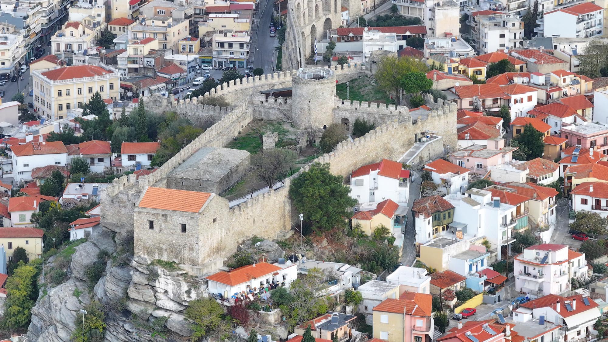
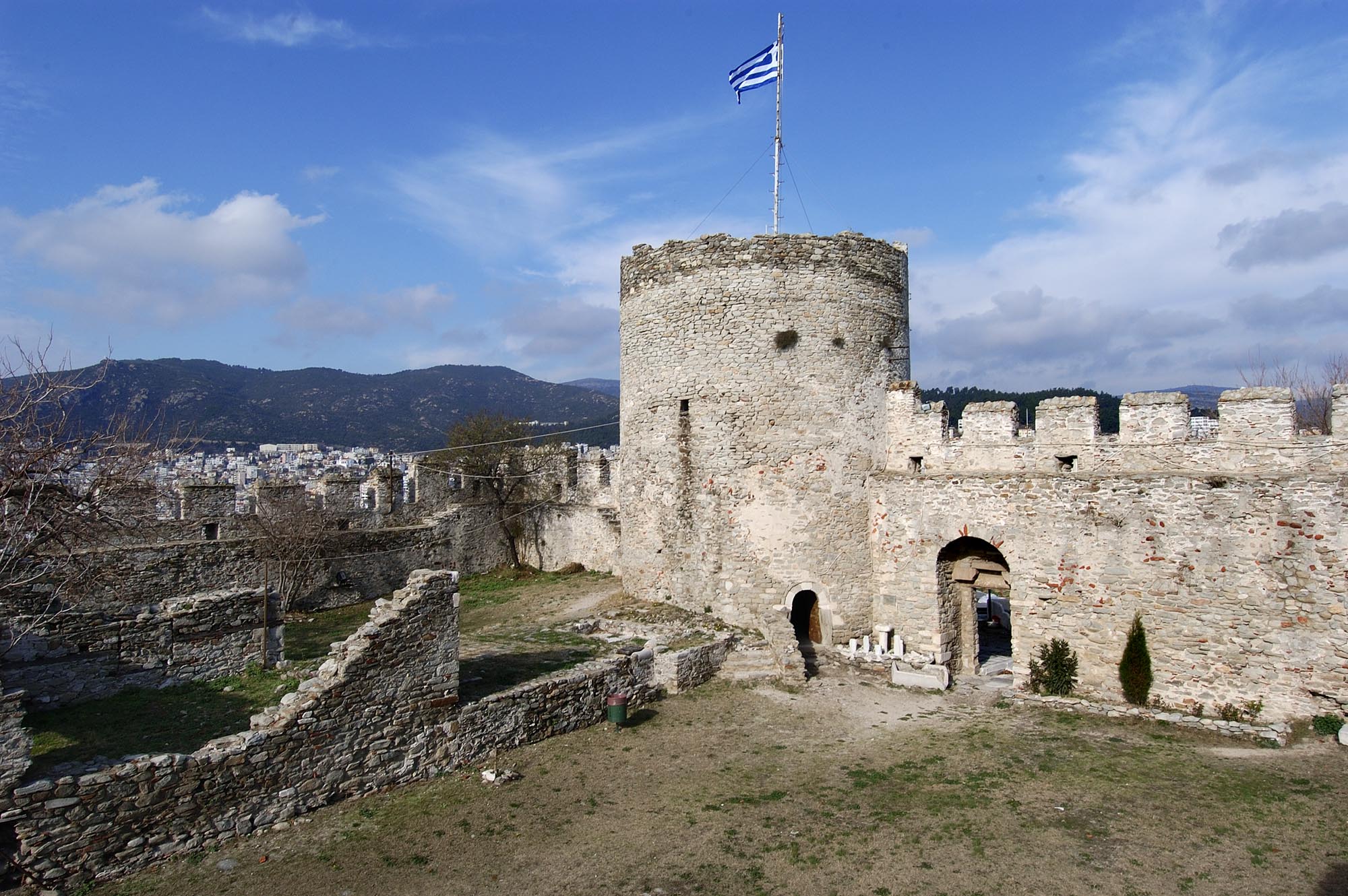
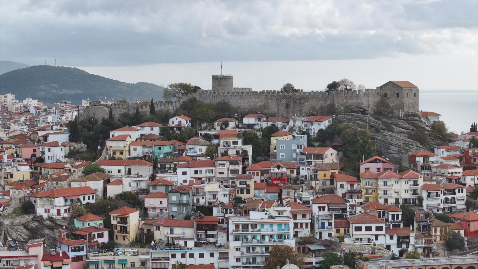
Later, during the Byzantine civil wars (1321-1328 and 1341-1347), Christopolis was at the centre of military operations in the region of Macedonia. Troops heading from Thrace to Macedonia and vice versa followed the Via Egnatia and thus necessarily passed through Christopolis. In general, the written sources of the period emphasise the strategic position of the city and the sense of security that its walls inspired. Nicephorus Gregoras describes the castle as “impregnable”, while Ioannis Kantakouzenos refers to it as “a stronghold by the nature of its construction”. In the 14th century, Christopolis, apart from being a strategic location, also marked the limit of territorial realignments. The terms “as far as Christopolis”, “up to Christopolis” and “around Christopolis” often appear in contemporary chronicles. Thus, for example, the rule of Matthew Kantakouzenos, the eldest son of Emperor John VI Kantakouzenos (1347-1354), in the region of Thrace extended westwards as far as Christopolis, while the territories conquered by the Serbian ruler Stefan Uroš IV Dušan (1331-1355) extended as far as the River Nestos, without including Christopolis.
In the mid-14th century, the Bithynian pirate brothers Alexios and John appeared. Taking advantage of the dynastic disputes rocking Byzantium, they engaged in raids in the North Aegean and captured several castles including Christopolis (before 1357). Emperor John V Palaiologos (1341-1391) was forced to issue a chrysobull surrendering command of the city to them (before 1365). At the end of the 14th century the Ottomans appeared on the scene, expanding their holdings in Thrace and Eastern Macedonia. In 1383 they captured Serres. Several different views have been expressed as to the exact date of the Ottoman conquest of Christopolis. According to one view, the city was subject to the Ottomans shortly before 1383 or 1387 and definitively conquered shortly afterwards, in 1391. A note in a codex of Mount Athos testifies that the city was “razed to the ground” by the Ottomans and its inhabitants forced to flee to the surrounding towns and countryside.
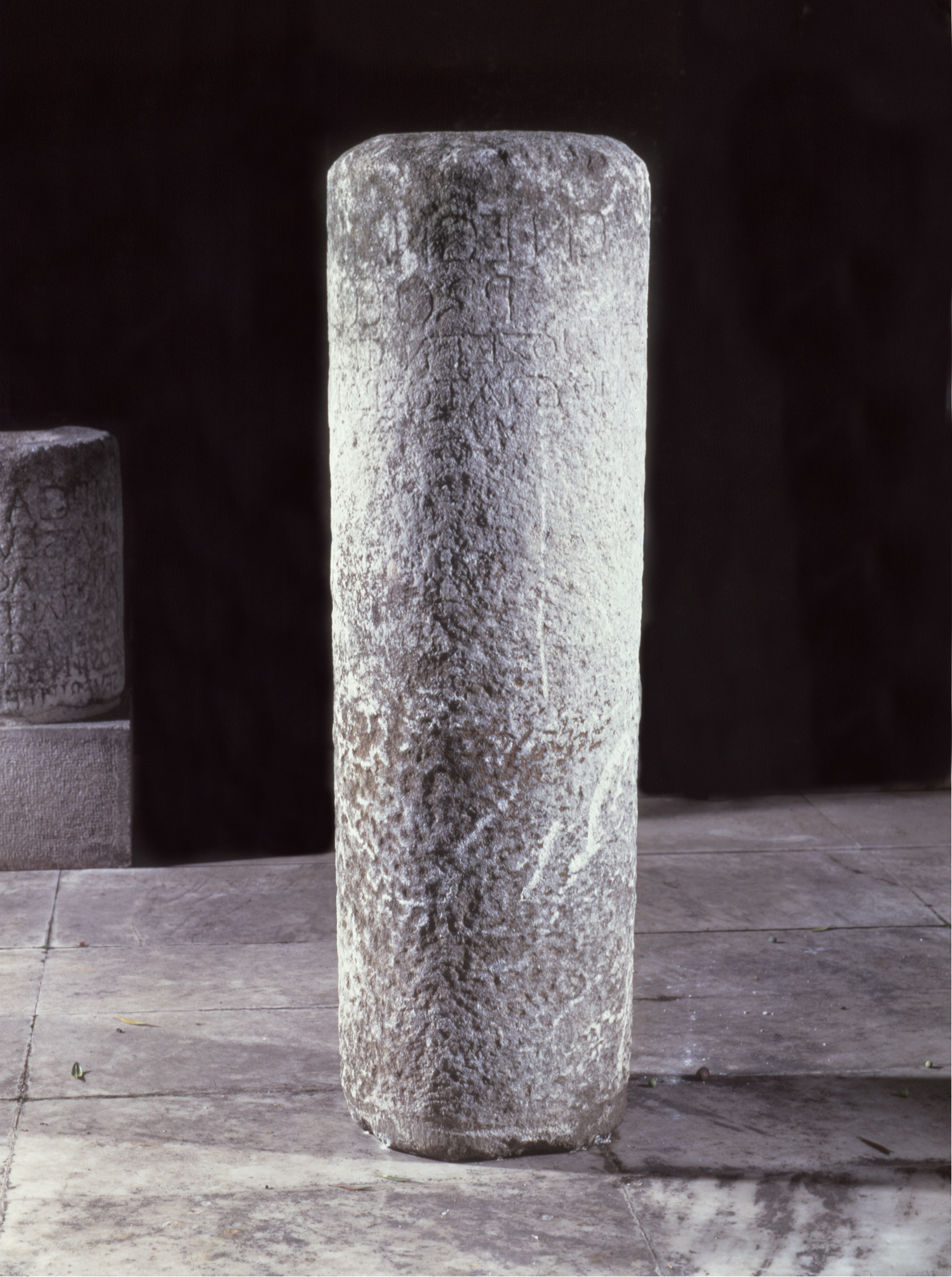
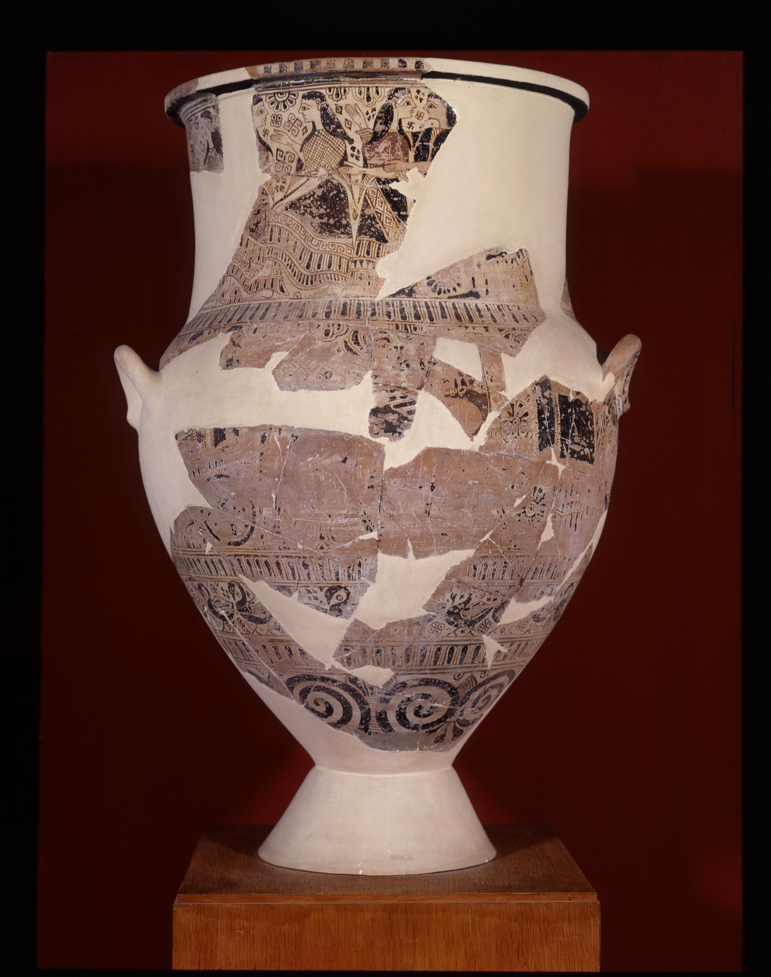
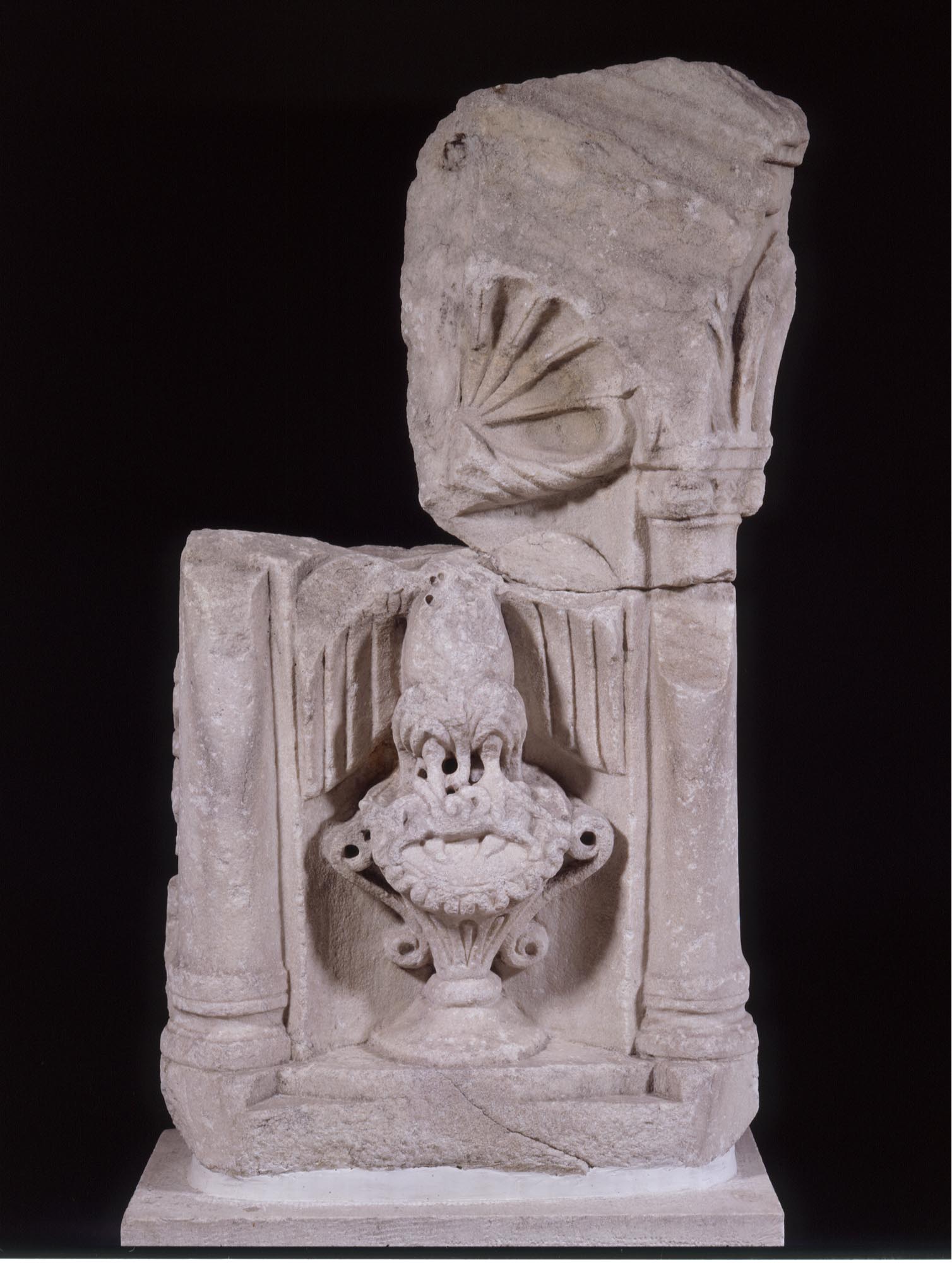
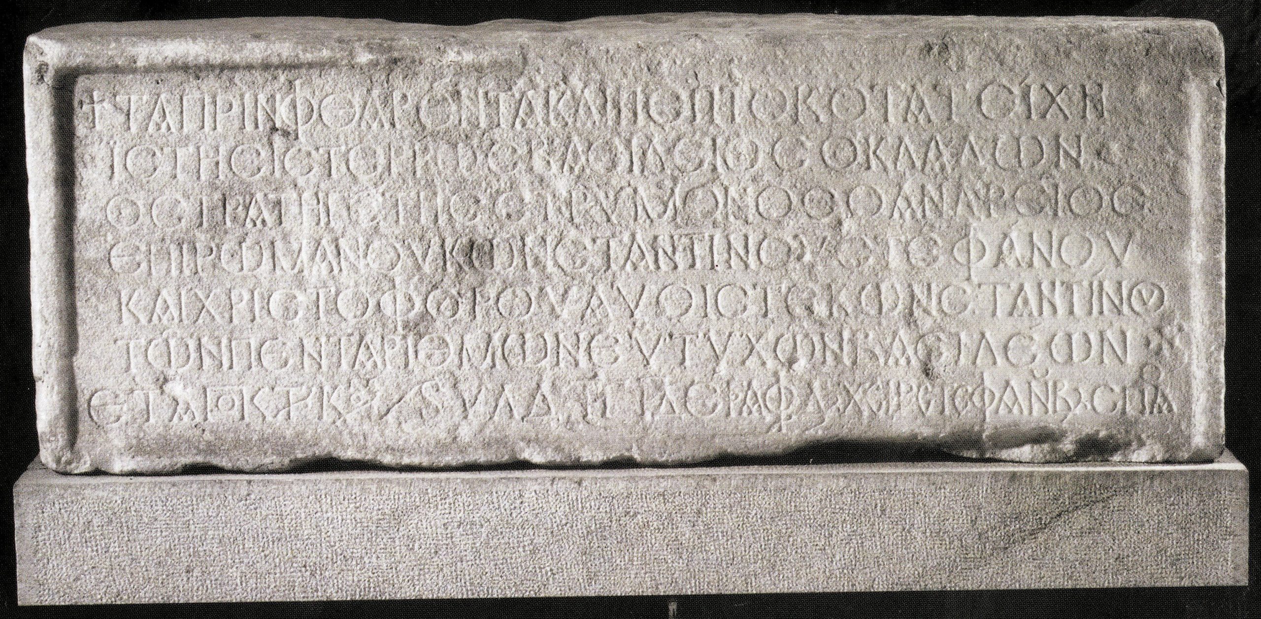
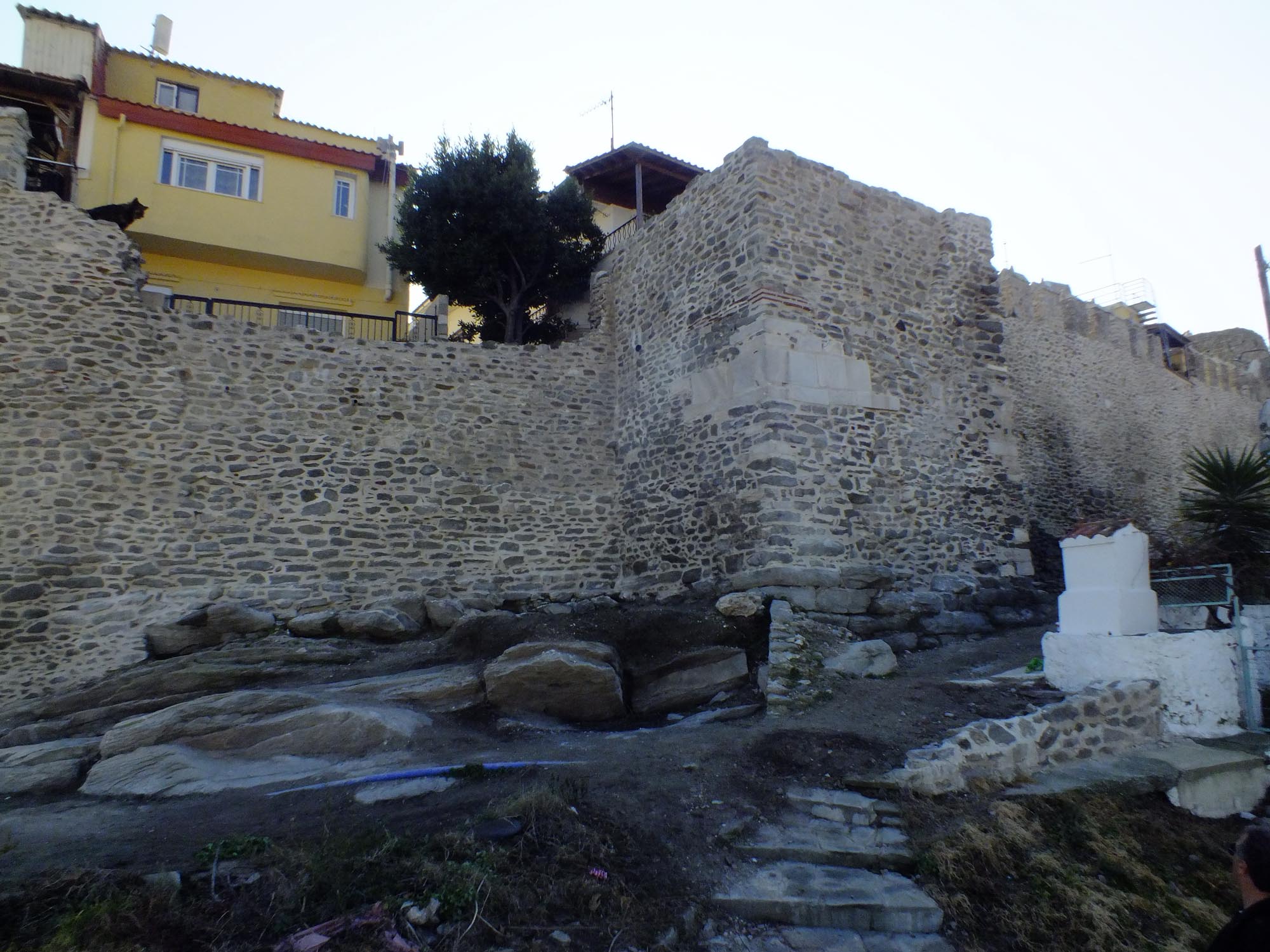
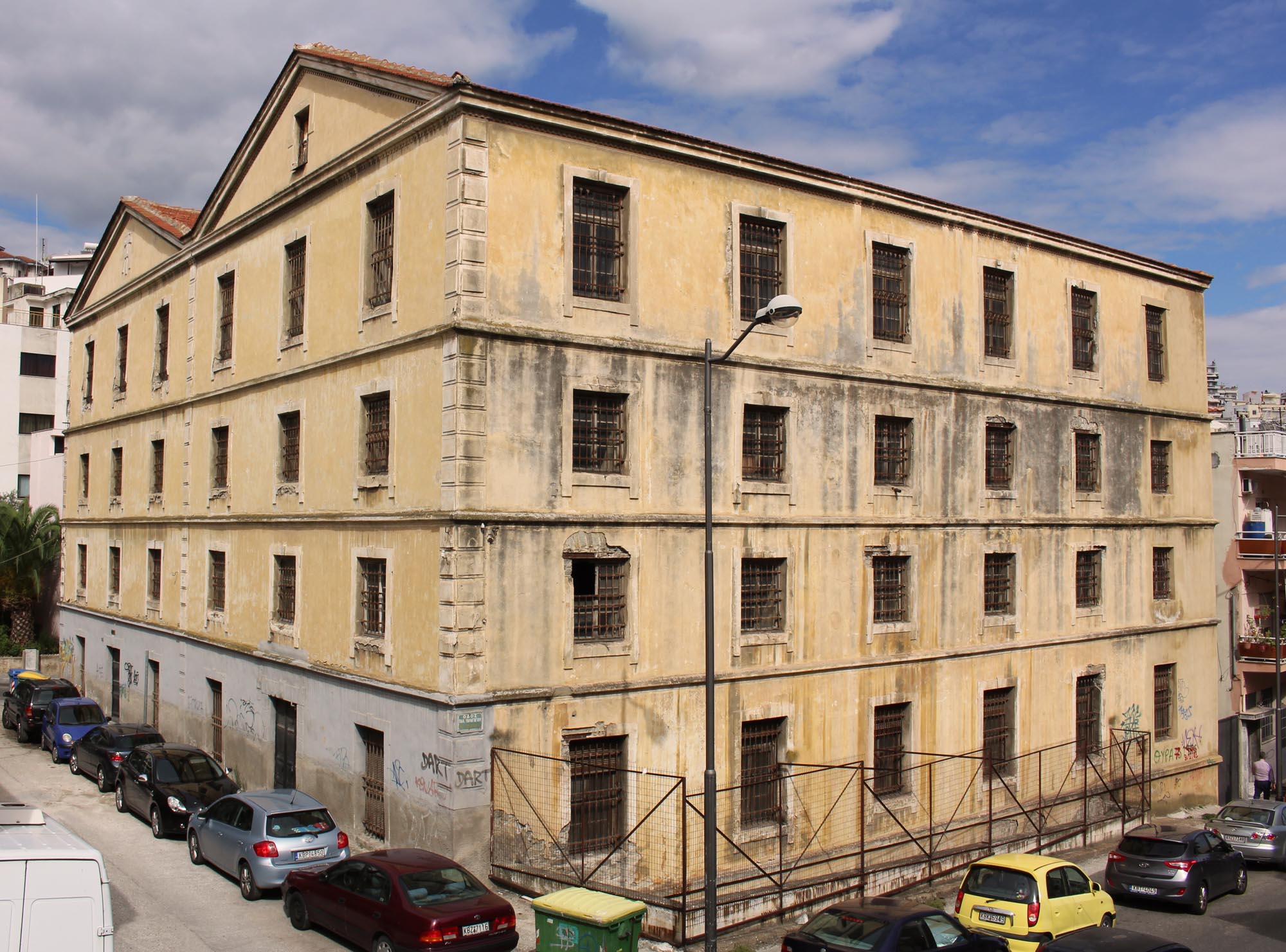
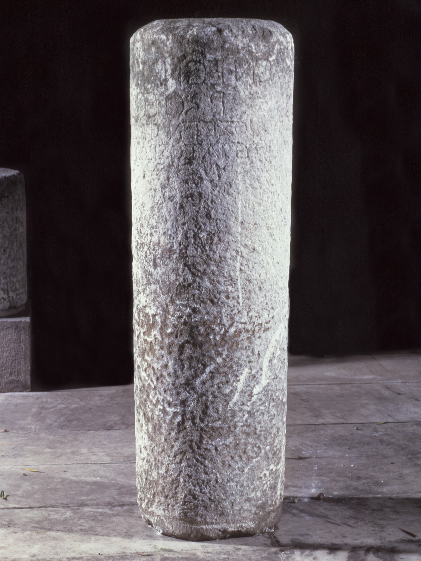
The continuous occupation of the city has meant that some of its Byzantine monuments have been lost, apart from certain sections of the fortifications. The few architectural remains uncovered in excavations, and the rich movable finds such as sculpture, pottery and coins, shed light on the picture of Byzantine Christopolis.
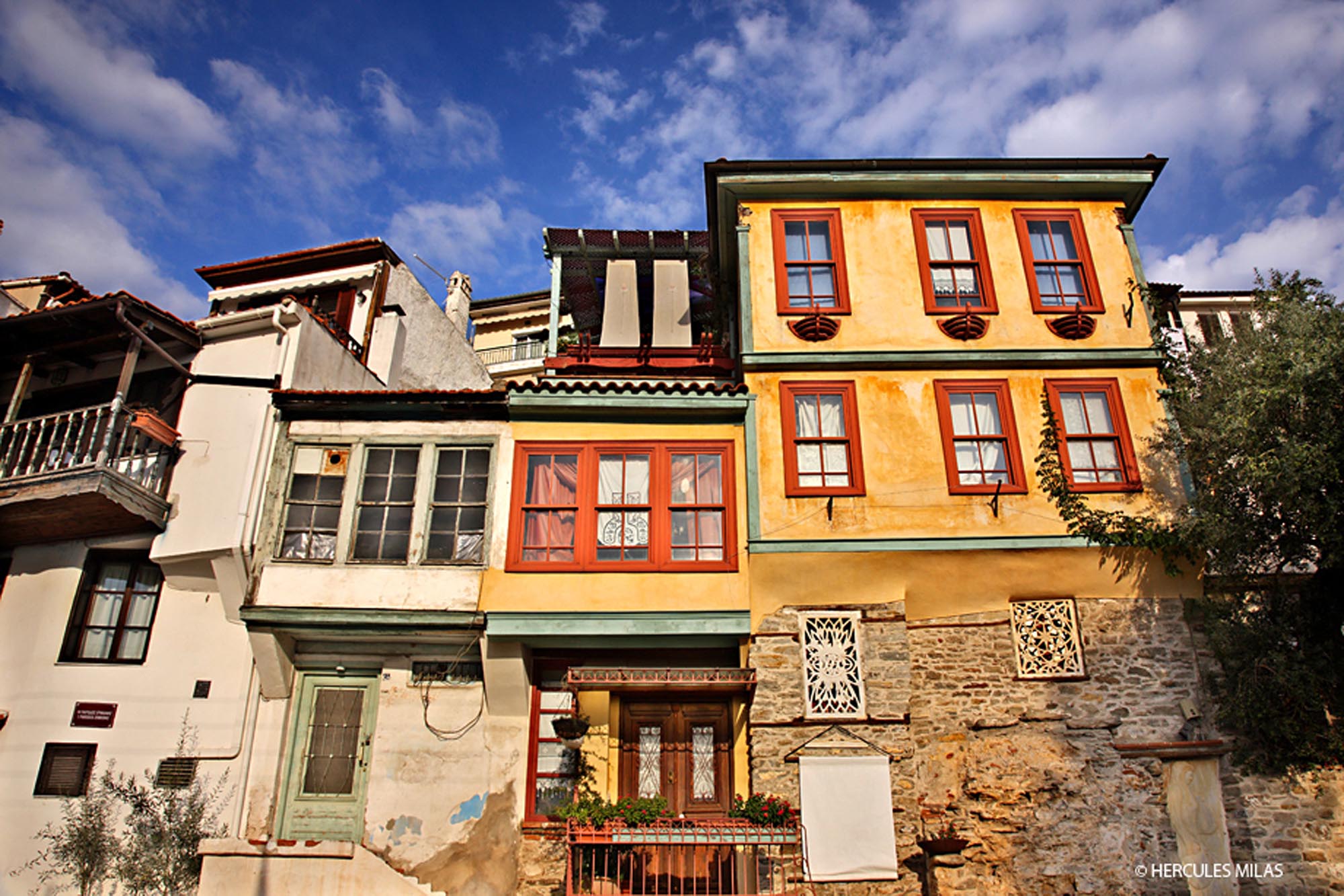
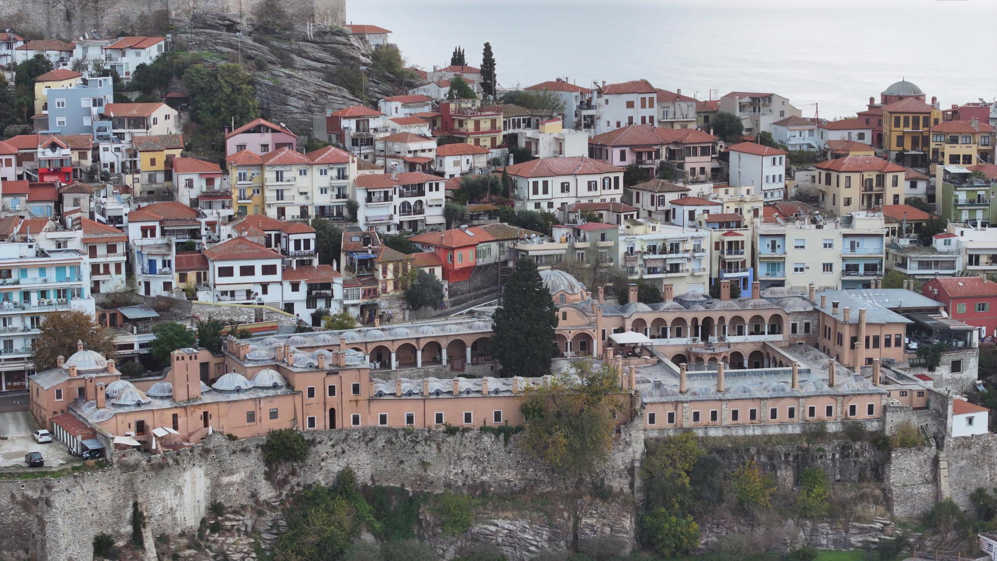
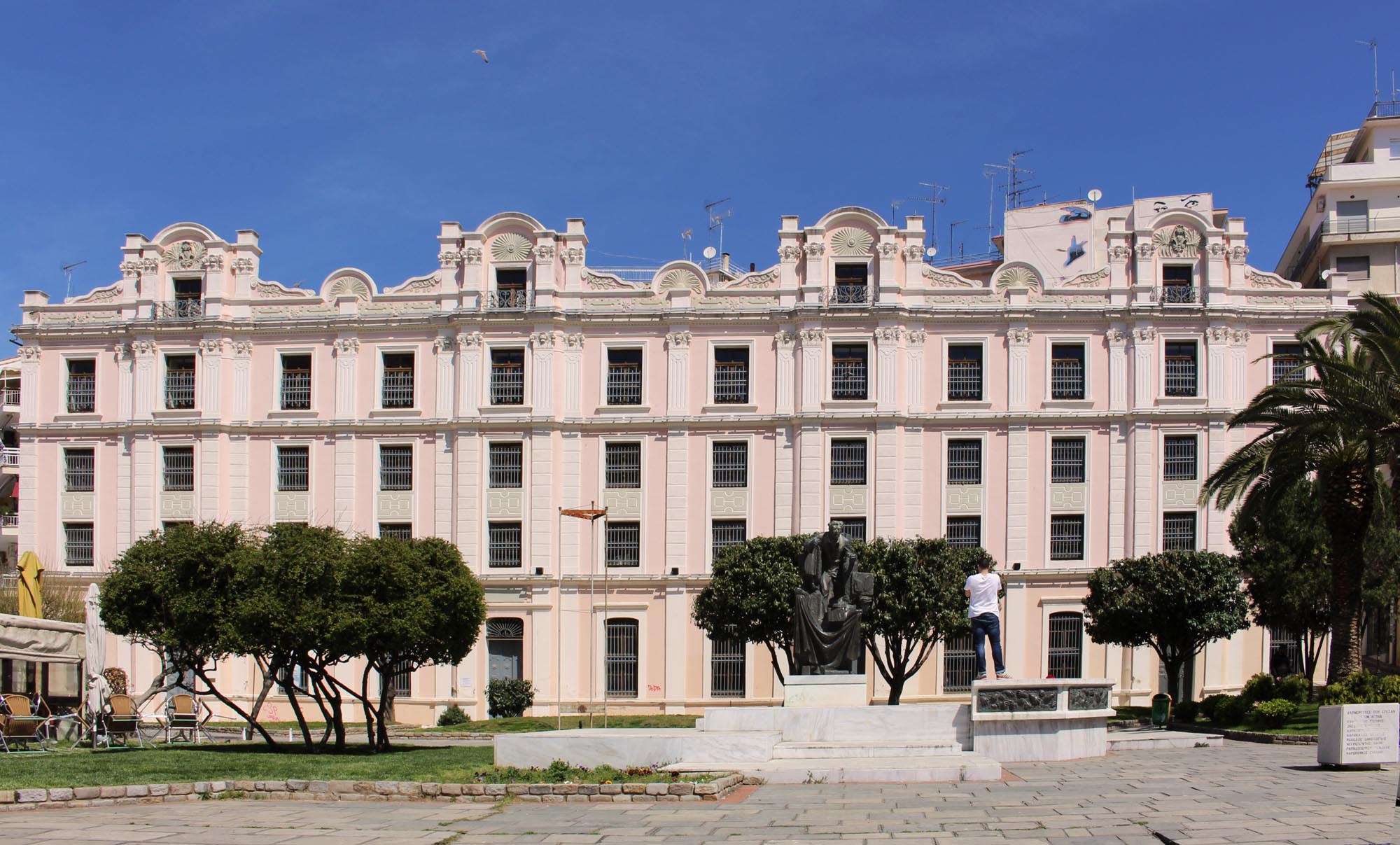
The city, which appears in written sources under its present name, Kavala, after the mid-15th century, was still the focus of interest of those laying claim to the region, as is evident from its occupation by the Venetians for about a month in 1425. The Venetians, led by Francesco Morosini, unsuccessfully attempted to take Kavala again in 1684. Throughout the period of Ottoman rule, the city was the target of raids not only by corsairs but also by other forces, such as the Venetians, the French and the Knights Hospitaller of Rhodes. The main economic interest of the region was focused on Mount Pangaion and its mines, the products of which were transported partly through the thriving port of Kavala. The city’s population was boosted by massive, organised movements of Muslim populations from the end of the 14th century onwards, while in the early 16th century Jews from parts of Hungary settled in the city.
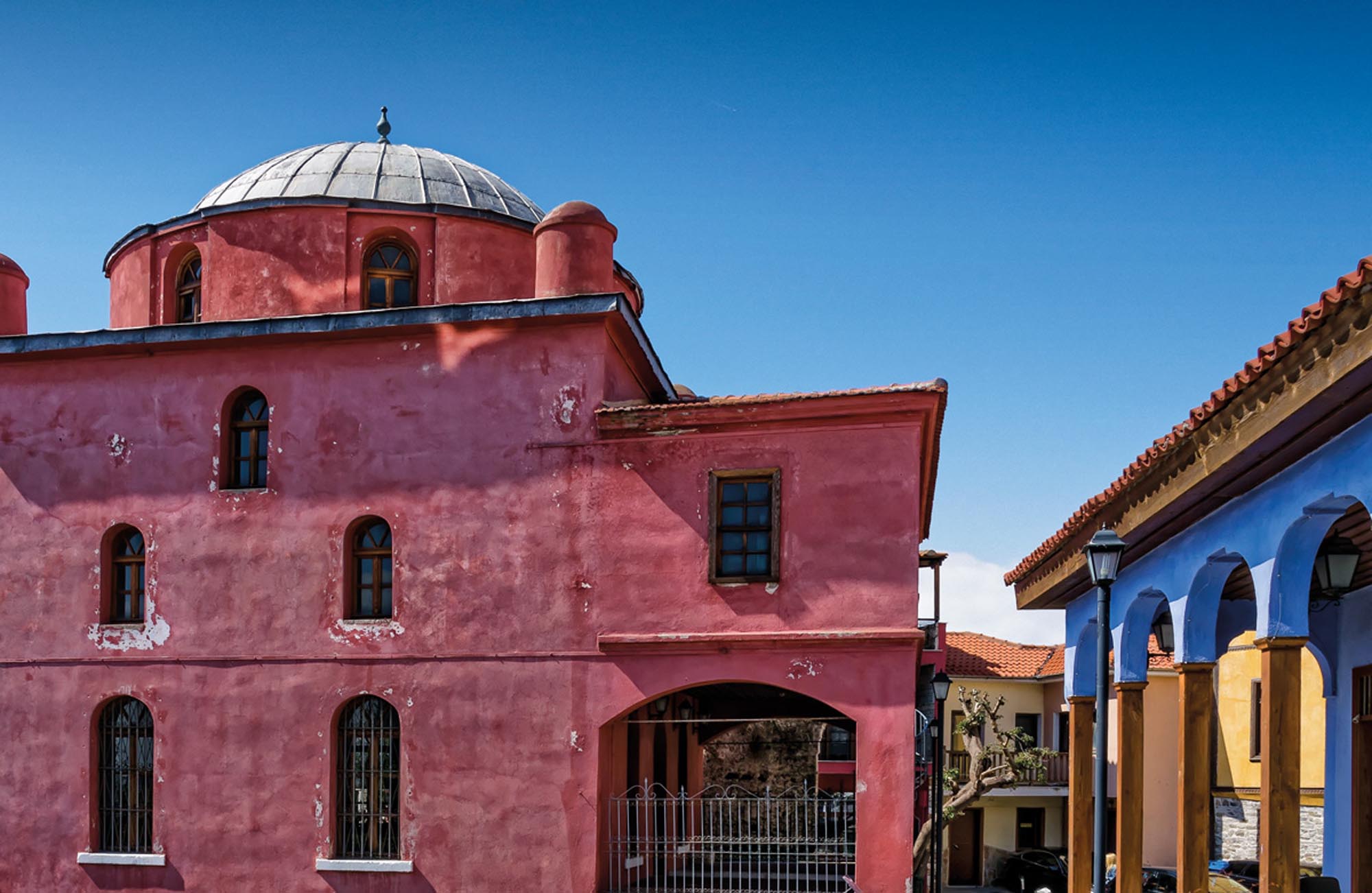
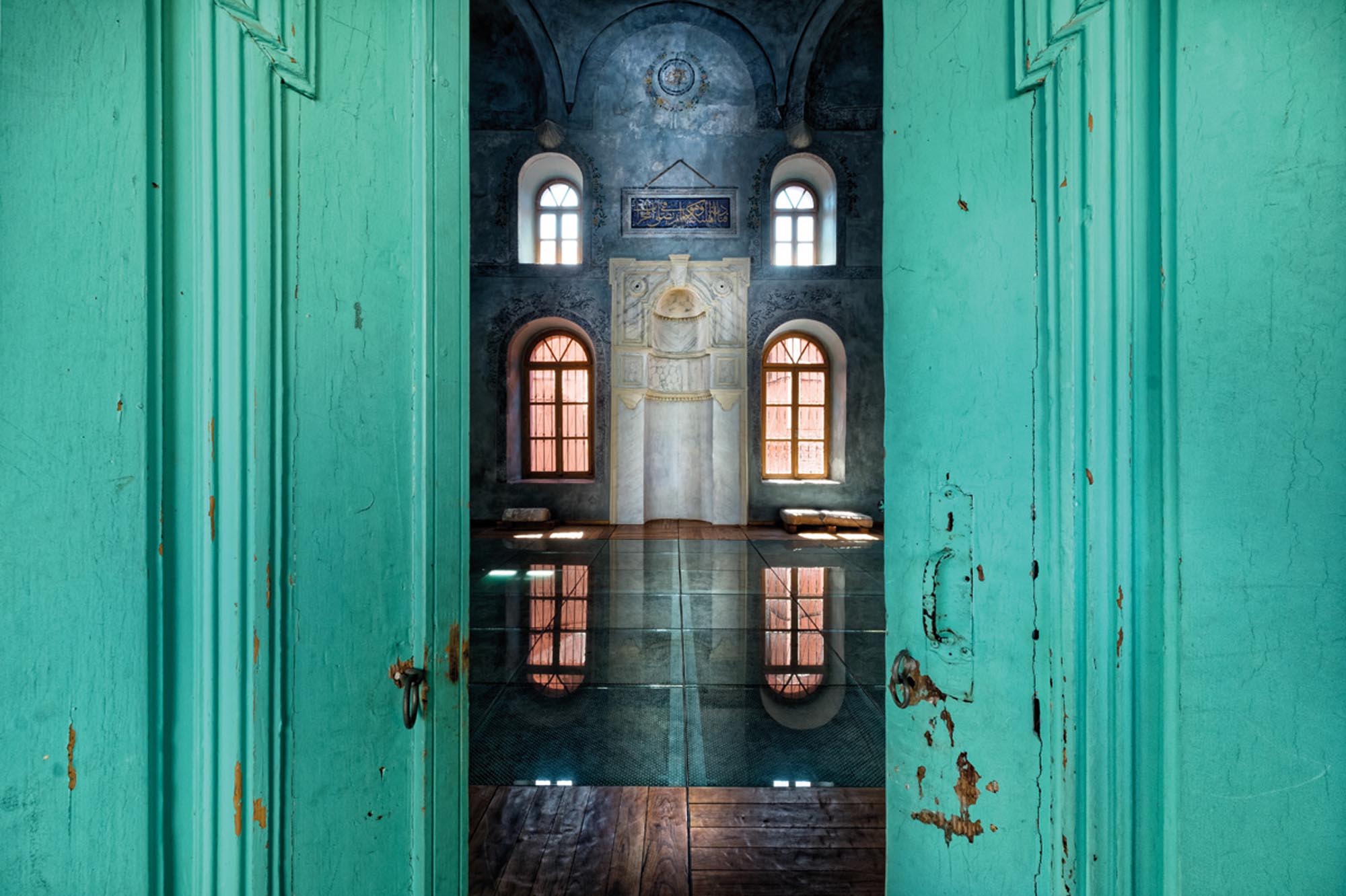
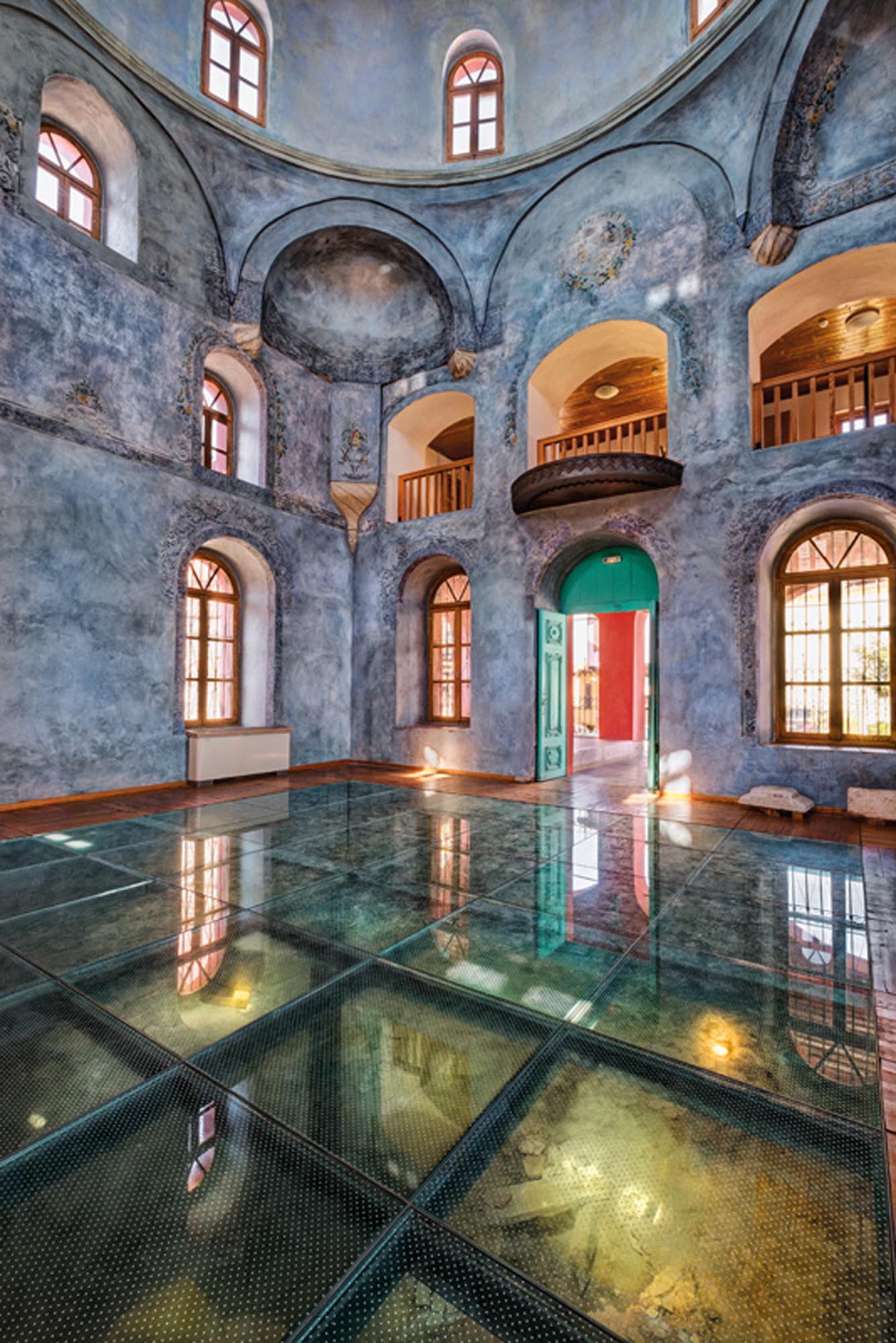
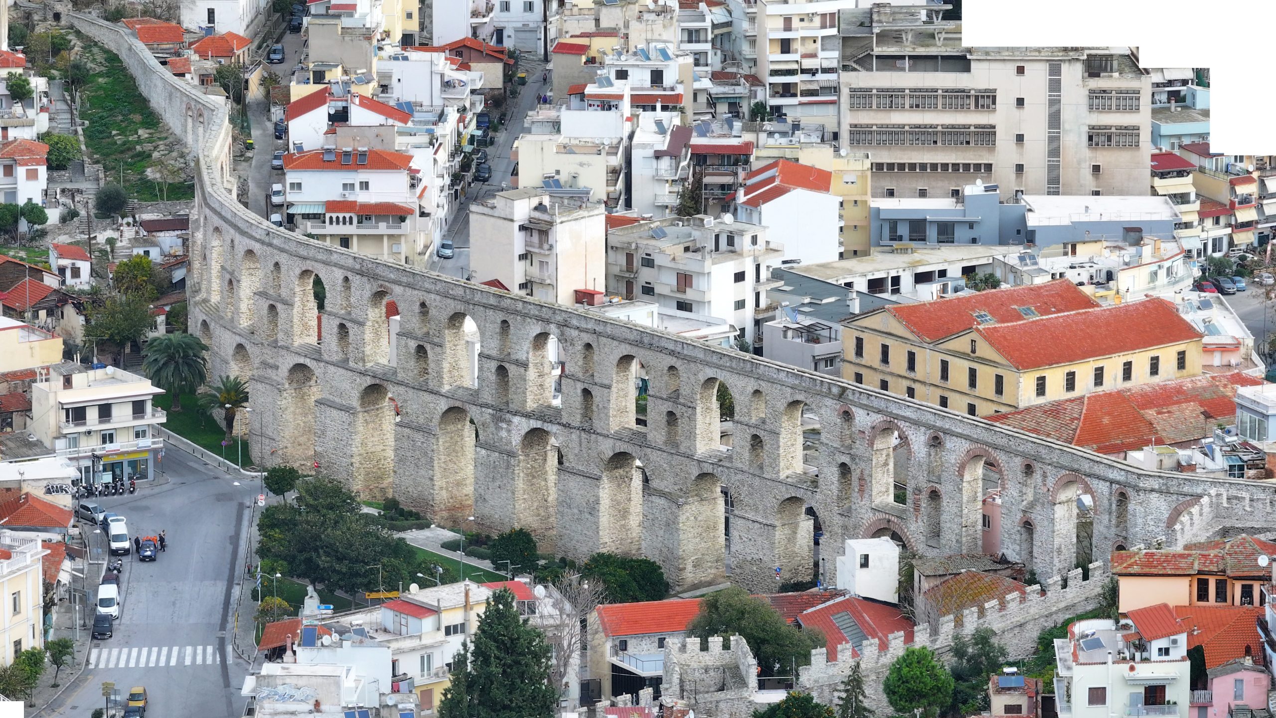
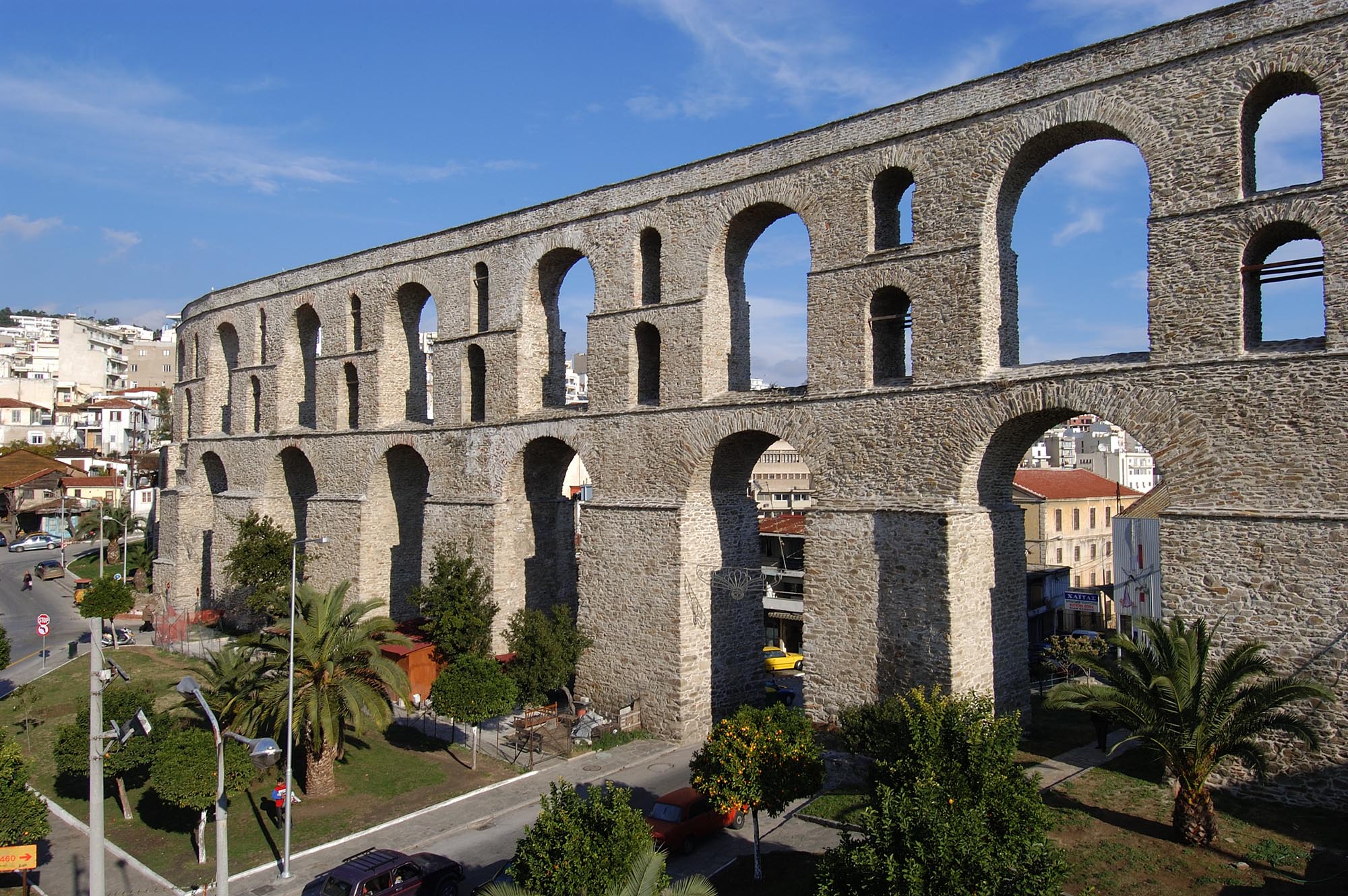
In the third decade of the 16th century, during the reign of Suleiman I the Magnificent (1520-1566), the Ottomans, recognising the city’s value, invested in its infrastructure by carrying out major public works. During this period, its population increased considerably and its image was greatly altered, as the walls were rebuilt and a new fortified enceinte was erected, extending the city’s boundaries beyond the Panagia peninsula. In the same period, Grand Vizier Ibrahim Pasha from Parga in Epirus, known as Makbul (“the Favourite”) and subsequently Maktul (“the Executed”) (c. 1493-1536), the brother-in-law of Sultan Suleiman the Magnificent, repaired the aqueduct and established a vakıf in Kavala, constructing a large mosque and public buildings (caravanserais, hammams, fountains, etc.). The Ottomans, who were well aware of the city’s importance as both a stronghold and a port, selected it in the late 16th century to be the seat of a sancak covering a large area from the Strymon to the Nestos.
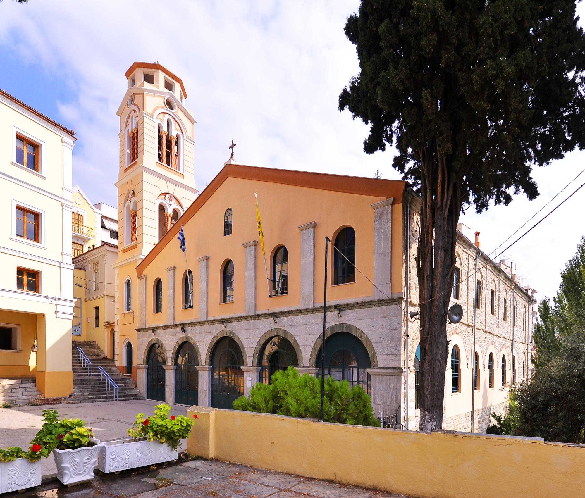
An important milestone in Kavala’s history was the official establishment of the Greek Orthodox Community in 1864. The city’s first Greek school had been founded before 1864 inside the castle, next to the Church of the Dormition of the Virgin. After the establishment of the Greek Orthodox Community, and especially after 1879, with the onset of Bulgarian propaganda, a significant number of educational institutions were founded.
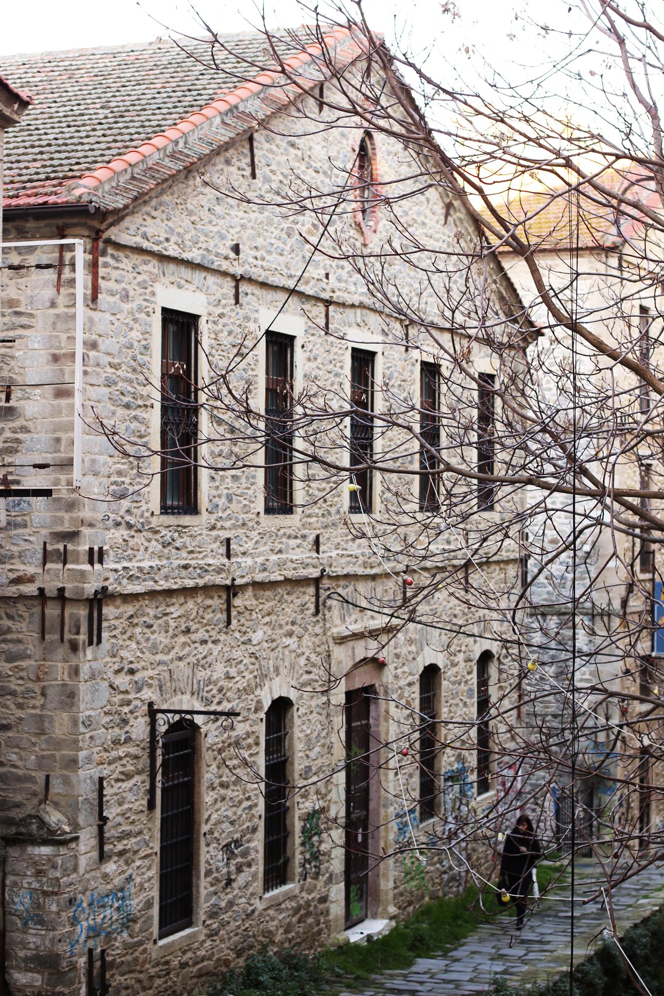
After 1860, the growth of tobacco cultivation, processing and trade led to a great commercial and economic boom in Kavala. The city expanded yet further as new Christian and Muslim quarters arose and large tobacco processing and storage buildings were constructed. The city became a seat of diplomatic representatives and European merchants. The first consulate, the French consulate, was established in 1701. Kavala gradually became the largest export harbour in Macedonia; indeed, after 1907 the value of its exports exceeded that of Thessaloniki. In 1909-1912, Kavala exported almost four times as much tobacco abroad as Thessaloniki, while in 1913 there were 61 tobacco trading companies operating in the city, more than all the other towns of Macedonia. The city’s commercial traffic was served by the hans, which were also used for storing tobacco intended for export.
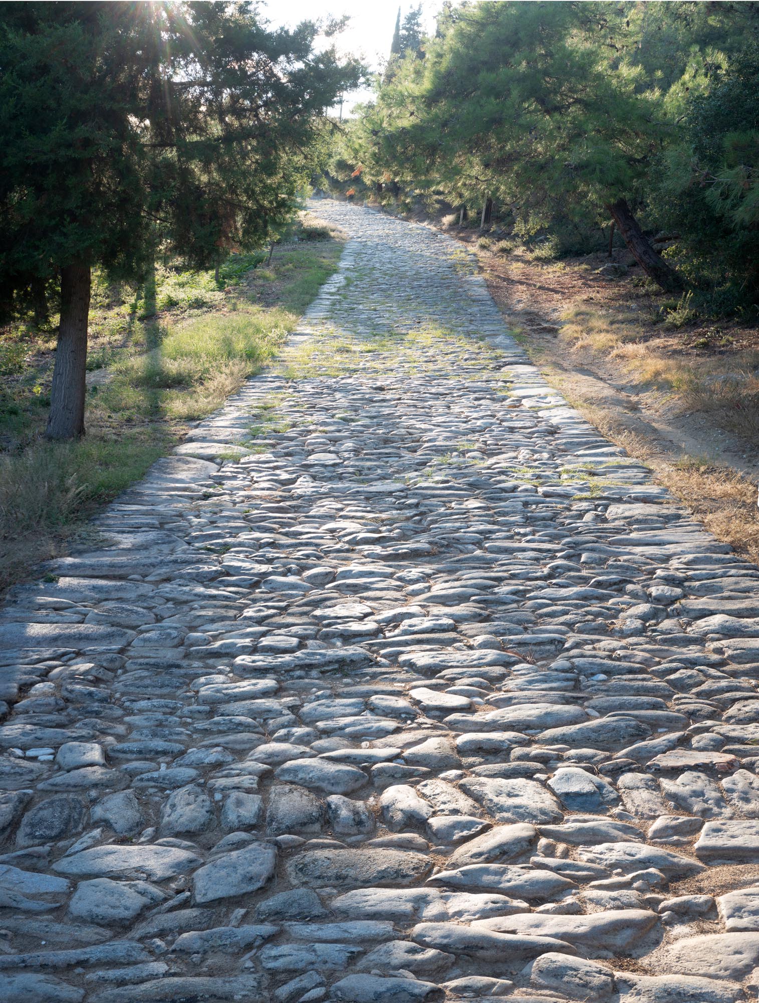
The transport of goods through the port increased significantly after the introduction of steamships. The regular shipping routes multiplied rapidly, and foreign steamship companies began to call at the port of Kavala from the 1840s onwards. Improvement works were carried out on the overland road network of the region between 1864 and 1885. Until then the roads connecting the city of Kavala with the hinterland had been unsuitable for vehicles, and communication between the interior and the port of Kavala, cut off by a mountain peak, was by beasts of burden, horses, mules and occasionally camels, along natural paths. The 35-kilometre-long cart road connecting Kavala with Drama included one stone bridge and about twenty wooden bridges, which decayed rapidly and had to be rebuilt every two years.
In October 1912, Kavala was occupied by the Bulgarians. A year later (25 June 1913), during the Second Balkan War, the city was liberated by the Greek fleet and subsequently incorporated into the Greek State under the Treaty of Bucharest (28 July/10 August 1913). In 1916-1918, during the First World War, the Bulgarians occupied the city for a second time, along with the rest of Eastern Macedonia, imposing a particularly brutal occupation. In the 1910s and especially in the 1920s, Kavala received a large number of refugees, while the Greek-Turkish population exchange of 1923 saw the city’s Muslim inhabitants leave their homes. The population exchange shaped the makeup of the modern city, as the exchangeable refugee population of the Kavala area including Drama numbered about 70% of its population. During the Second World War, Eastern Macedonia and the city of Kavala would once again experience Bulgarian occupation until i until September 13, 1944, when the city returned to Greek rule.
Monuments - Antiquities
The Castle
The castle, the landmark of the modern city, dominates the Panagia peninsula, which had been walled since ancient times (5th c. BC). The ancient fortifications, parts of which are still visible today at the base of the later enceinte, were extended and underwent minor or major repairs throughout the Early Christian and Byzantine periods. In its present form, the castle is the result of extensive repair work by the Ottomans. Two main building phases of this period can be identified, the first dating from 1425 and the second from the 1530s, when the original castle was extended to the north with the addition of a large trapezoidal enceinte.
«“The wall around Christopolis” (Cross-wall)
The strong cross-wall was built by Emperor Andronikos II Palaiologos (1282-1328) in 1306/7, in order to halt the advance of the Catalans who were ravaging Thrace and Macedonia. It ran about 1.5 km from the north side of the city walls in a C-shape up to the opposite heights above the city, where four separate towers are preserved today, one circular and three rectangular.. The wall-walk for the soldiers ran 4.5 m above the ground. The wall, which was also intended to guard or block the Via Egnatia, was so strong that it held enemy troops at bay on several occasions, but after the conquest of the region by the Ottomans it fell into disuse. Today, aside from the four towers, only a few sections of the cross-wall remain.
Old Town
In the area of the castle, in the Panagia district, the old town of Kavala is laid out amphitheatrically, with the colourful mansions with their şahnişins (overhanging covered balconies), the small traditional houses with their picturesque courtyards, the cobbled streets, the church of the Dormition of the Virgin (1956) and the monuments of the Ottoman period.
Church of St Nicholas (former Ibrahim Pasha Mosque) (27-31 Spetses St.)
The church is located in the block surrounded by Agiou Nikolaou, Spetson, Pavlou Kountourioti and Hydras Streets. It is a mosque of monumental scale by the city’s standards, built in 1530 by Ibrahim Pasha, inside the fortified enclosure within which the city expanded during the same period. It was converted into the church of St Nicholas after the repair works of 1926-1927. In front of the church stands the modern monument of St Paul the Apostle, in memory of his visit to the city.
Halil Bey Complex (“Mosque of Music”) (30 Ali Mehmet St.)
The Halil Bey Mosque was erected around 1900 in the centre of the Panagia peninsula on the site of an earlier mosque, probably of the 16th century, of which only the base of the minaret is preserved today. During the same period, an eight-room madrasa (religious school) was built on the north side of the mosque. In 1930-1940, the mosque housed the city philharmonic orchestra and was thus dubbed the “Mosque of Music” (or “Old Music” [hall]). During the restoration of the mosque, the remains of a three-aisled Early Christian basilica were discovered, around which a dense cemetery arose in the Late Byzantine period (13th-15th c.).
Imâret (30 Theodorou Poulidou St.)
This was a monumental Muslim religious and educational complex, covering an area of 4,160 m2 on the west side of the Panagia peninsula. It included two madrasas, two dershane-mescit, a mekteb and a poorhouse. It was constructed as a vakıf by Muhammad Ali Pasha, Wali of Egypt and founder of the last Egyptian dynasty (1805-1848), a native of Kavala, between 1813 and 1821, although work continued with various additions until 1864. The Imâret was leased by the Egyptian government to a private individual in 2001 and, after being restored, has operated since 2004 as a hotel housing the MOHA Research Center.
Konak and Muhammad Ali Pasha Museum (Mehmet Ali Square)
The mansion is located in the large square named after Muhammad Ali Pasha on the Panagia peninsula. Erected in the late 18th century, it is a particularly spacious residence, with a floor area of 330 m2.It is considered one of the most notable examples of Ottoman architecture in Greece.. Today, like the Imâret, it is owned by the Egyptian government and managed by the MOHA Research Center. Today, the mansion operates as a museum which offers visitors a journey to 18th-century Kavala, where the future ruler of Egypt lived until the age of thirty.
Aqueduct (Kamares)
The most characteristic monument of Kavala is part of the large aqueduct, about 6 km long, that carried water to the city until the interwar period. Its construction dates back to Late Roman times, but its long use over the centuries has necessitated extensive repairs, the most significant being carried out in the 1530s by Ibrahim Pasha and in the early 19th century. The surviving section of the aqueduct inside the city, a double arched structure with a maximum height of 25 m, is supported on 18 piers and is 280 m long.
Churches of Kavala after 1864
Up until a little after the mid-19th century, the religious needs of the Christian population living within the castle were served by the three-aisled, wooden-roofed basilica of the Dormition of the Virgin that was built in 1821 on the site of a pre-existing post-Byzantine church. It was demolished in 1958 and replaced by the present church of the Dormition. Immediately after the establishment of the Greek Orthodox Community of Kavala in 1864, the grand Metropolitan Church of St John the Baptist, a three-aisled basilica with a small dome, was built (1865-1867) With the gradual increase in population and economic prosperity of the Greek Orthodox community of the city, two more churches were constructed outside the castle walls: the church of St Athanasios (1886-1888), a three-aisled basilica with a bell tower (138 Agios Athanasios St.), and the church of St Paul the Apostle (1905-1926), designed by the renowned Constantinopolitan architect Periklis Fotiadis, a three-aisled basilica with a large dome and two impressively tall bell towers (116 Omonoia St.).
Monastery of the Lazarists (Kyprou St.)
The first Roman Catholic priests settled in the city in 1887 and founded the Monastery of the Lazarists of Saint Vincent de Paul of the Catholic Church of Kavala, which continues to serve the Catholic community of the city and the surrounding areas to this day.
Armenian Church of the Holy Cross (Surp Khach) (4 Ioakeim Sgourou St.)
Armenians arrived in Kavala in the late 19th century and later on, after the Armenian Genocide of 1915 and the Asia Minor Catastrophe of 1922. To serve the needs of the thriving Armenian community, an Armenian school was established in 1923, as well as the Church of the Holy Cross (1932), which remains in operation to this day.
Public buildings and houses
Today the city preserves a remarkable number of listed public buildings and houses of the late 19th-early 20th century, a time of great prosperity, during which a prominent bourgeoisie maintained close contacts with Europe and had tennis clubs, cinemas, dance halls, restaurants and patisseries for its entertainment. On the cobblestoned Kyprou Street, just 350 m long, stand some of the most iconic buildings of the city: the Mansion of Baron Adolf Wix von Zsolnay, a director of the Herzog Company (1906), the mansion of the Hungarian tobacco merchant Pierre Herzog (late 1890s), now the Town Hall, the Greek Community Club of Kavala (1909-1910) and the mansion of tobacco merchant Dimitrios Tokos (1879), which now houses the Ephorate of Antiquities of Kavala–Thasos. In the city centre (Konstantinidou Poitou St.) stands the old Ottoman school (present-day 1st Gymnasium of Kavala, formerly First Boys’ High School), an impressive building constructed in 1909-1910.
Tobacco warehouses
Today Kavala has more than 50 surviving tobacco warehouses, evidence of the great economic boom that the city experienced from the mid-19th century onwards thanks to the cultivation and trade of tobacco. A notable example is the Municipal Tobacco Warehouse with its typical neoclassical façade in 28th October Square (Kapnergatis), which in the early 20th century housed the business of the tobacco merchant Kiazim Emin, while today it operates as a cultural center and is going to host the art and folklore collections of the Municipality of Kavala.
Museums
Archaeological Museum (17 Erythrou Stavrou St.)
The Museum has operated since 1964 as the central museum of the wider region of Eastern Macedonia, housing finds ranging from the Neolithic to the Roman period. It also hosts a permanent exhibition presenting the history of the city of Kavala through the ages.
Tobacco Museum (4 Konstantinou Palaiologou St.)
The Museum is temporarily housed on the ground floor of the National Tobacco Organisation building. Its rich collection presents the history of tobacco cultivation, processing and trade in the city of Kavala and the wider region of Eastern Macedonia and Thrace. Today, tobacco cultivation has been included on the National Inventory of Intangible Cultural Heritage of Greece.
Naval Museum (1 Chrysostomou Smyrnis St.)
The museum showcases the maritime history and tradition of Kavala with exhibits such as nautical and navigational instruments, models of traditional vessels, books, seascapes and photographs.
Museum of Greek Refugees
The museum houses valuable heirlooms of the Asia Minor refugees, including icons and religious artifacts, embroidery, everyday items, books, documents and photographs


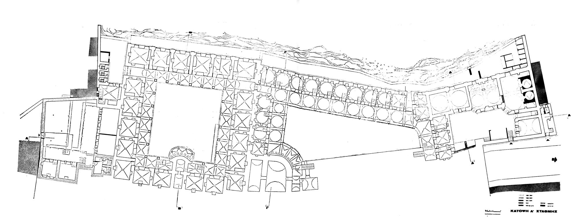
![Ιμαρέτ, κάτοψη ά στάθμης / Imâret complex, ground level plan, in Papageorgiou J. – F. Boubouli (eds.), Ottoman Architecture in Greece, Αθήνα 2023 [2nd edition], p. 434, σχέδιο / drawing: Κ. Παπαντωνίου - Αιμ. Στεφανίδου, αρχιτέκτονες](https://culturalegnatia.culture.gov.gr/wp-content/uploads/alpha_placeholders/100x38.jpg)


