Petropigi

Petropigi, a small castle station of the Via Egnatia

The small castle is preserved in reasonably good condition near the village of Petropigi in the Municipality of Nestos, among cultivated fields next to the Kavala–Xanthi highway. It lies about 7 km from the sea, a distance that would have been shorter in antiquity, as the coastline has shifted due to silting. Nearby, to the west of the castle, near the village of Pontolivado, is the archaeological site of the ancient fortified city of Pistyros, a colony of Thasos, which developed significant commercial activity in the second half of the 6th century BC.

Κάτοψη του κάστρου / Plan of the castle. Ø. Ekroll, “Petropigi: A Byzantine Statio on the Via Egnatia in East Macedonia”, in P.Ettel-A.M. Flambard Héricher -T.E.McNeil (ed), Études de castellologie médiévale: Bilan des recherches en castellologie: Actes du colloque international de Houffalize (Belgique), 4-10 septembre 2006 [= Château Gaillard 23], Caen 2008, fig. 6, digital processing DBMA

The castle dates from the Late Byzantine period (late 13th – mid-14th c.) and is believed to have been a station of the Via Egnatia, which probably ran southwest-northeast past the north side of the castle, following the route of the modern Kavala–Xanthi provincial highway. The purpose of the castle was to control the road and provide safe accommodation and passage to travellers and troops. It is located between two important stations of the ancient road, Akontisma to the west and Topeiros to the east. According to one view, which, however, does not take into account the dating of the castle of Petropigi in Late Byzantine times, it is the site of the changing station (mutatio) of the Via Egnatia known asPurdis. This, according to the Itinerarium Burdigalense, came after the station of Akontisma and was located on the border of the provinces of Macedonia and Rhodope (modern-day Thrace).

The castle, oriented northeast-southwest, has a square plan with four quadrilateral towers projecting from the curtain wall, one at almost each of its corners. The dimensions of the castle are 33 x 33 m, exactly 100 x 100 Roman feet, indicating that the castle was designed from the outset by an experienced architect. The best-preserved southwest side is preserved to its original height of 5.30 m. The masonry is made of rough stones with interspersed bricks at the joints. A band of three rows of bricks runs around all four sides of the castle near the ground.

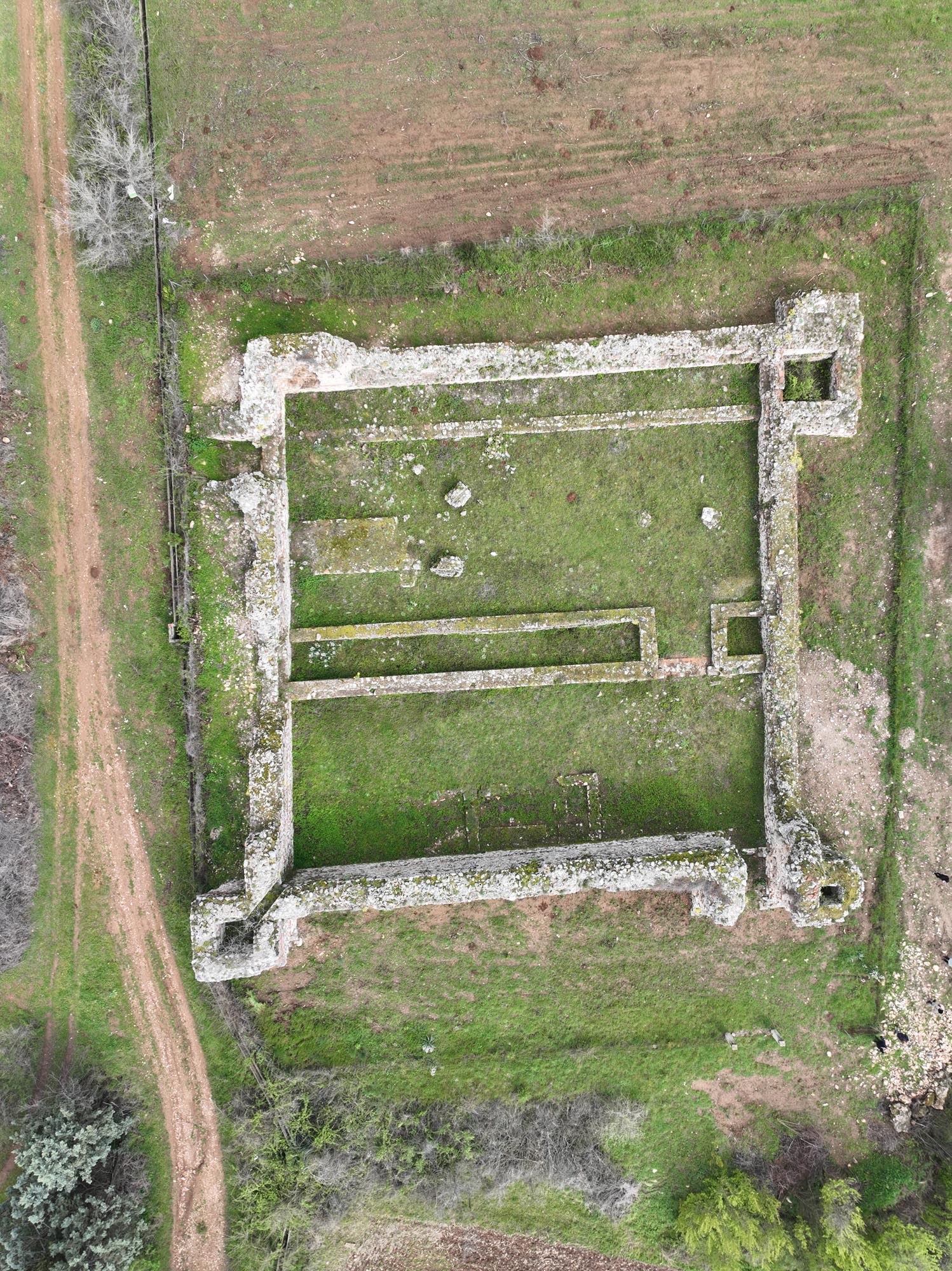
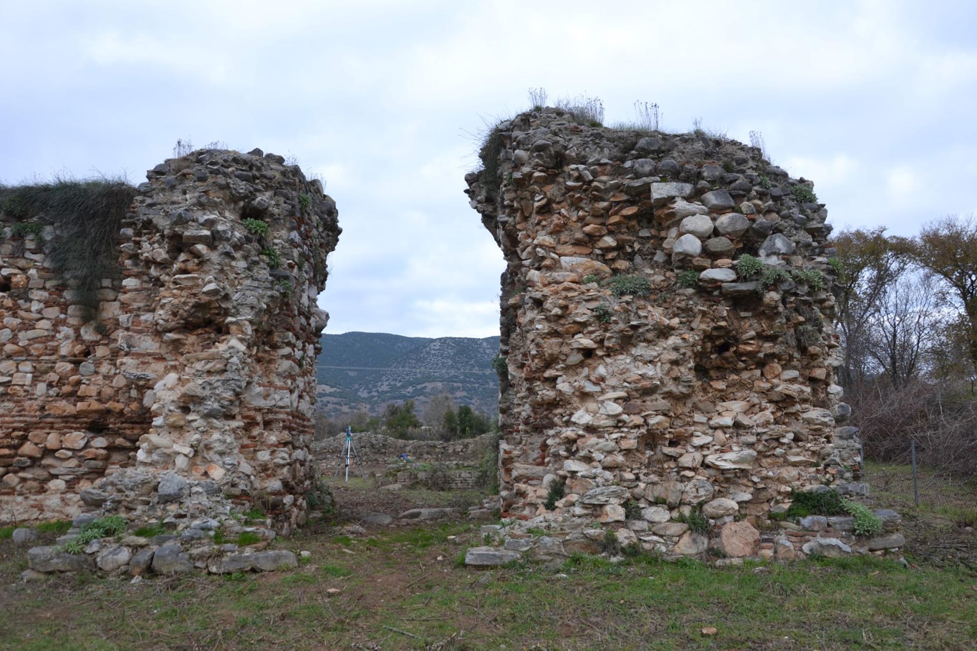
The excavation carried out by the Norwegian Institute at Athens from 1993 to 2002 identified three main building phases. Originally, the castle had three four-sided towers, one in the southeast, one in the northeast and one near the northwest corner. Each tower had a gateway leading into the castle on the ground floor. In the second phase, not long after the first, the three towers were reinforced and raised higher, while the gate in the tower in the northeast corner was removed. At the same time, a fourth four-sided tower was added in the southwest corner of the castle.

During the third construction phase, the second gate near the northwest corner was also removed, meaning that the castle can now only be accessed via the gate in the southeast corner. In this third phase, two long, large, parallel buildings were erected inside the castle, extending east-west across the entire width of the castle.

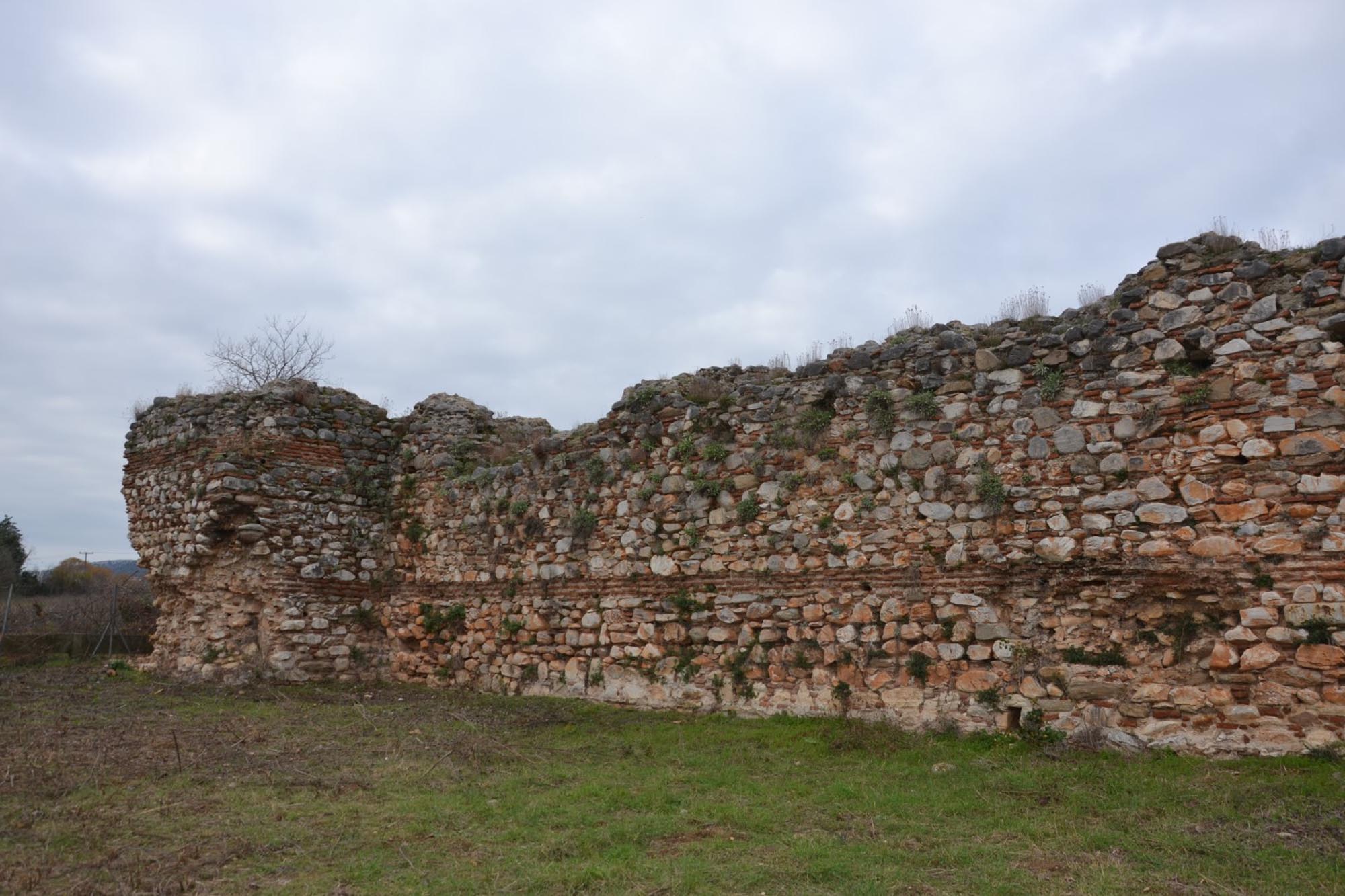
The first building is built in cloisonné masonry, with stone blocks framed by bricks. It extends across the central part of the castle, dividing it internally into a north and a south section. The two sections were connected via an opening in the east side of the building. The second building, along the north side of the castle, was built with a large east-west wall, 3.20 m from the north side of the enceinte.

Αεροφωτογραφία του κάστρου, ΕΦΑ Καβάλας / Aerial photograph of the castle, Ephorate of Antiquities of Kavala
Νότιοδυτικό σκέλος του κάστρου, ΕΦΑ Καβάλας / South-west side of the castle, Ephorate of Antiquities of Kavala

Inside the two buildings are the remains of fireplaces, one in the first building and nine in the second, eight of them equally spaced along the north wall. The presence of fireplaces and the overall shape of the two buildings, together with the movable finds, support the view that the castle was now operating as a han to serve the needs of travellers along the Via Egnatia.

Between the two buildings, in the northeast part of the castle, the excavation revealed a square structure supported on four cylindrical pillars. The excavators have identified it as a mescit, a small mosque commonly found in hans.

The architecture of the castle of Petropigi is strongly reminiscent of the tetrapyrgia of the reign of the Emperor Diocletian (284-305 AD), small rectangular fortresses with a double gate and four towers at the corners. In Macedonia, Roman tetrapyrgia are imitated by the bishop’s residence at Louloudies in Kitros, Pieria, built in 479 AD. However, the archaeological data show that the castle of Petropigi dates from the Late Byzantine period. Radiocarbon dating (C-14) of a piece of wood from the scaffolding used when building the castle indicates a date between 1275 and 1350, the time frame of the first two building phases. The excavators believe that it was erected at the end of the 13th century, when the region of Eastern Macedonia and Thrace were restored to the sphere of influence of the Byzantine Empire after the Reconquest of Constantinople in 1261; the city had fallen into the hands of the Crusaders in 1204.

The excavators date the second building phase, reinforcing the military function of the castle, a little later, in the first half of the 14th century, before the Ottomans occupied the area and advanced into Eastern Macedonia following their victory at the Battle of Marica (1371).

The third building phase, in which the castle was converted into a han, is dated between 1410 and 1425, based on the radiocarbon dating of a piece of burnt wood found in one of the two buildings inside the castle. The excavation finds show that the han remained in use at least into the 16th century.

Η πύλη του κάστρου, ΕΦΑ Καβάλας / The castle gate, Ephorate of Antiquities of Kavala

Other stops in the Regional Unit of Kavala

error: