Feres
Feres, a strong city-castle that arose around the Monastery of Panagia Kosmosoteira
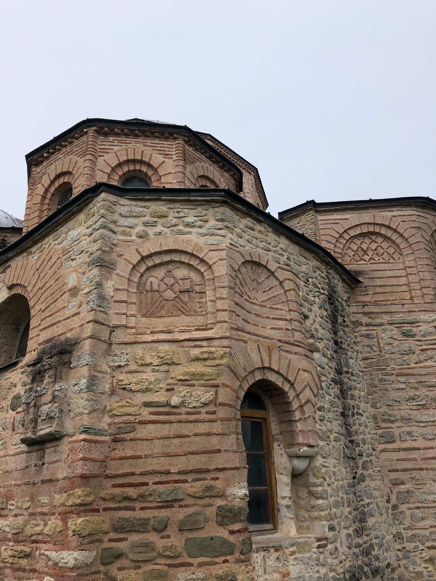
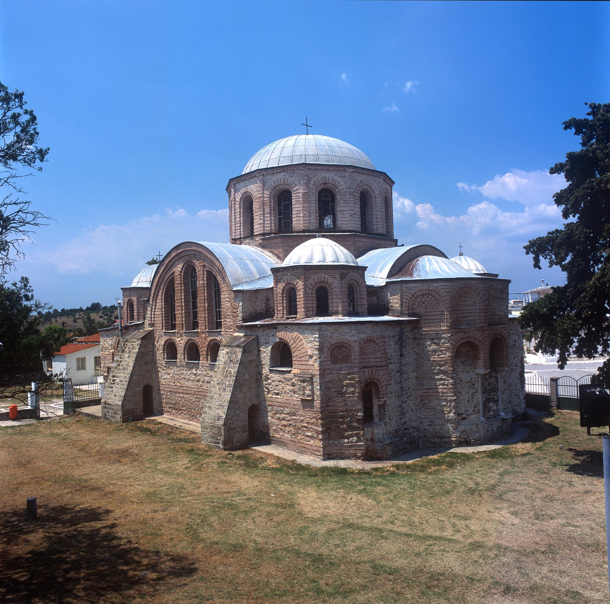
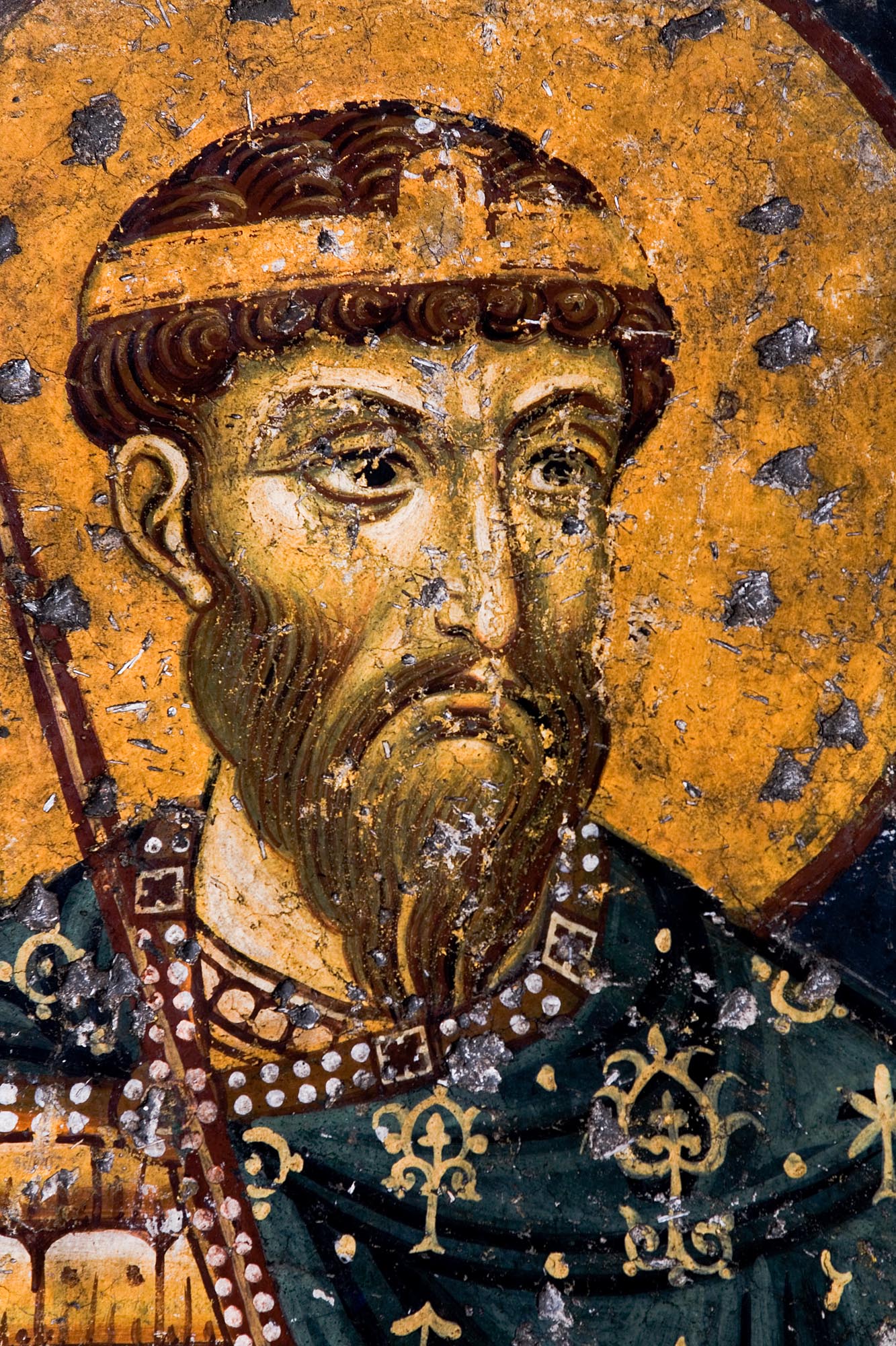
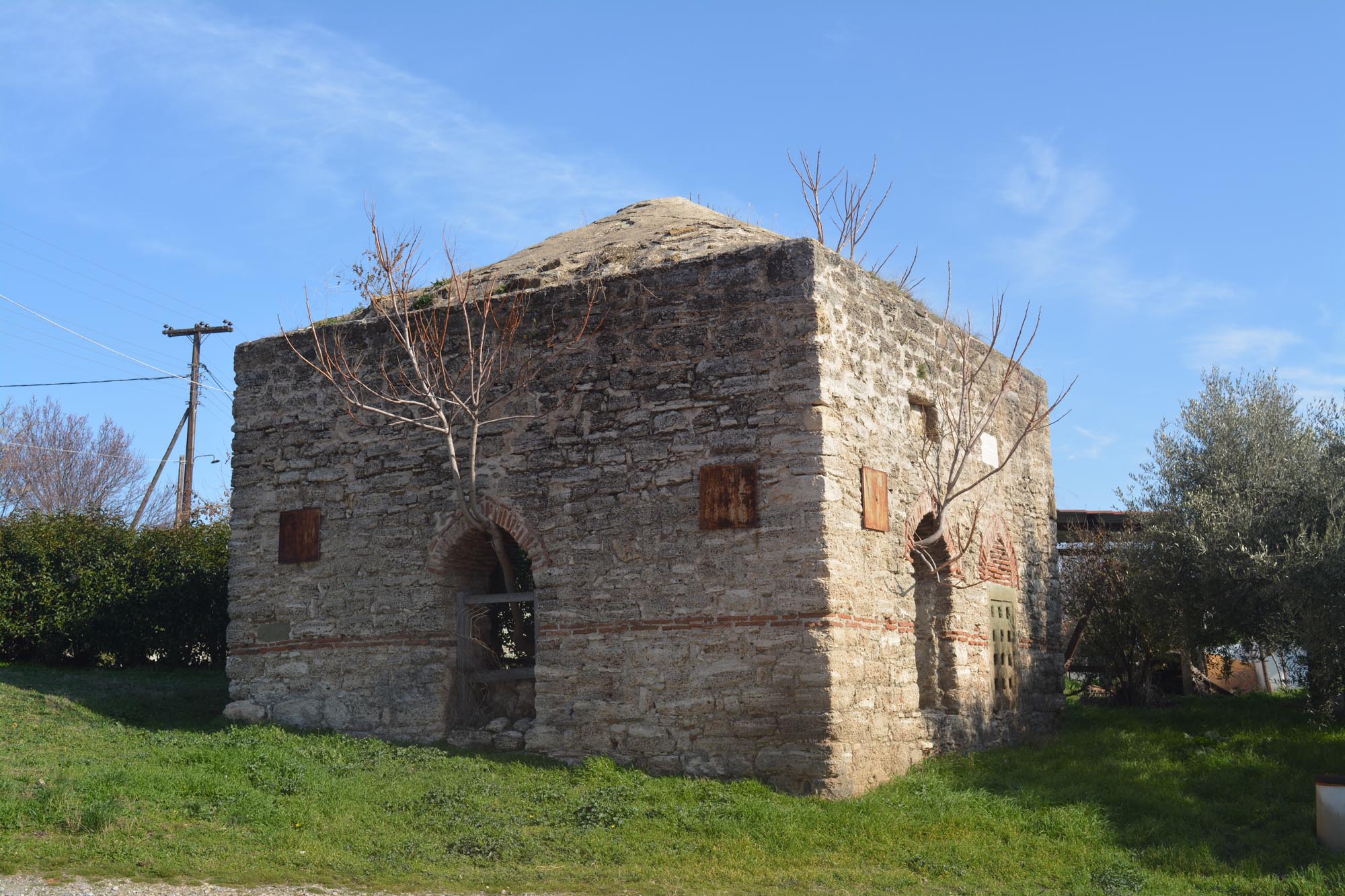
The small town of Feres is located 29 km northeast of Alexandroupolis and just 4 km from the River Evros, in the middle of a fertile plain. It is one of the most historical settlements of Thrace, continuously inhabited since Byzantine times. The founding of Feres, the Byzantine Bera/Pherrai, is closely linked to the Monastery of Panagia Kosmosoteira (the “Virgin Saviour of the World”), one of the most important Byzantine monuments in Greece, of which only the katholikon (monastery church) in the town centre survives today. The history of the founding of the monastery is known from its Typikon, the set of regulations prescribing its rules of operation. The Typikon was written by the founder of the monastery himself, the Sebastokrator Isaac Komnenos, third son of Emperor Alexios I Komnenos (1081-1118) and father of Emperor Andronikos I Komnenos (1183-1185). Isaac Komnenos withdrew to Bera when he was exiled from Constantinople due to his dispute with his brother, Emperor John II (1118-1143). According to the Typikon, Isaac built the monastery katholikon in 1151/2, intending to be buried inside it. To this end, he arranged for the construction of a particularly magnificent tomb, which, however, does not survive today. For the decoration of the tomb, which is described in detail in the Typikon, Isaac would have brought here, among other things, the tomb sculptures he had already prepared in the famous Chora Monastery in Constantinople, whose katholikon he had radically repaired earlier, around 1120.
Isaac, who supervised the construction of the monastery himself, took care to reinforce it with strong fortifications, which is why the Typikon describes it as a “castle”. At the same time, he founded a new settlement around the monastery, gathering together the inhabitants of three nearby villages (Neokastron, Lykochori and Drachos). The settlement which developed around the monastery formed the core of Byzantine Bera. The choice of location for the monastery and the settlement of Bera was largely due to the great estate owned by Isaac Komnenos in the area, which included 33 large farms and villages, two small castles and a harbour. Isaac Komnenos’ sizeable estate, his aristocratic background and his high level of education contributed to the creation of an ambitious work.
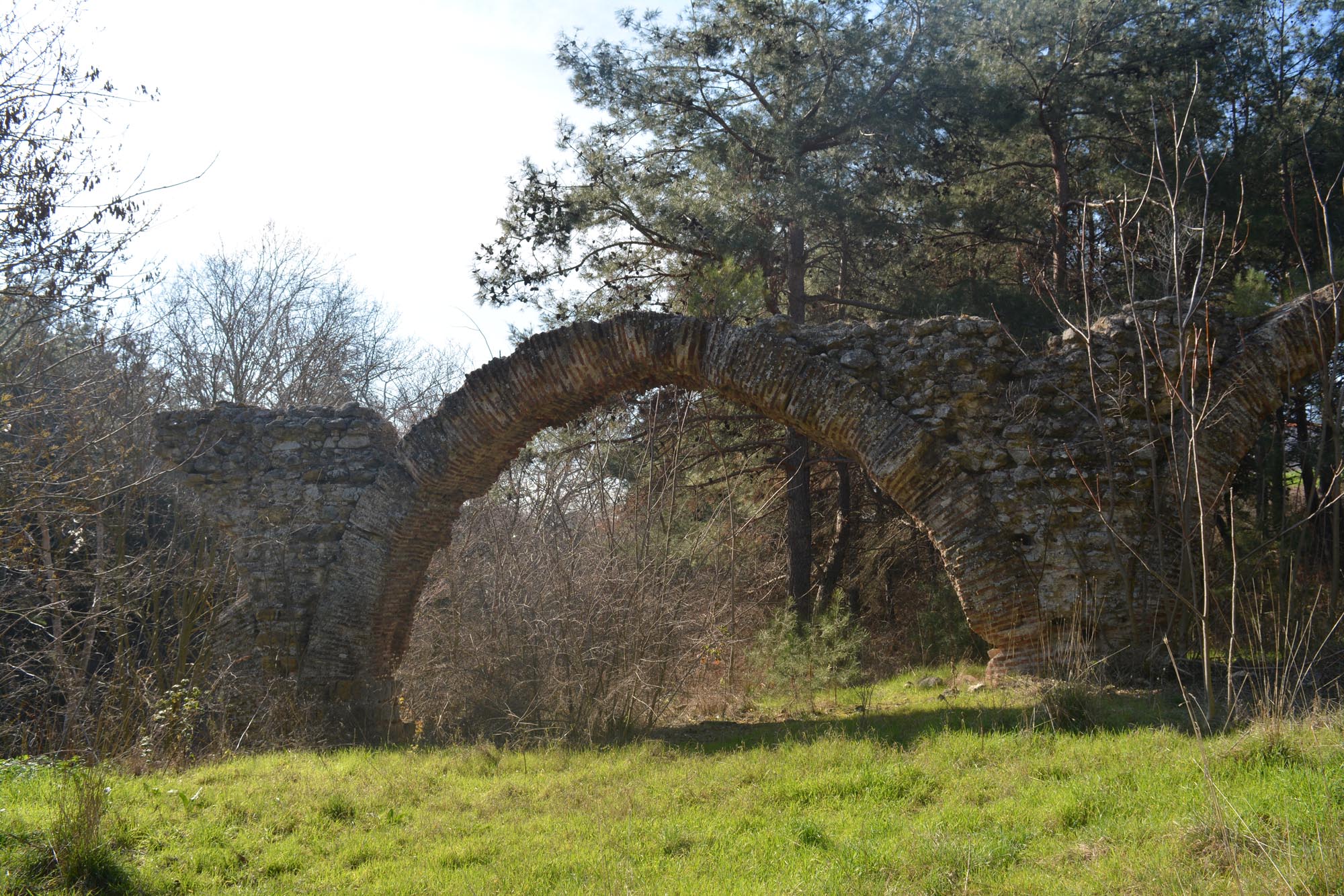
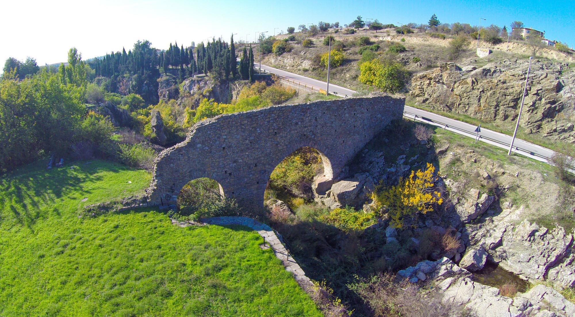
Bera was strategically located very close to the cities of Trajanopolis to the east and Ainos (present-day Enez in Turkey) to the west, on the opposite bank of the Evros. It also stood at the crossroads of two major highways: the Via Egnatia, which connected Bera to the cities of Thrace and to Constantinople, and a second road leading from the Thracian coast to Adrianople. Communication with the latter was also possible via the River Evros, which was navigable until the late 19th century. According to John VI Kantakouzenos, who describes Bera as a “stronghold”, it probably had a port on the river. More specifically, the Via Egnatia passed through Bera in a southwest-northeast direction, parallel to the modern Alexandroupolis–Kipoi national highway, avoiding the marshes of the Evros Delta. Bera was located between two stations of the Via Egnatia: the changing station (mutatio) of Demas (or Dymis), which, according to the prevailing view, is located in the area of the modern villages of Poros and Ardani, west of the Evros, and the station (mansio) of Cypsela (Gypsala or Gipsila), present-day İpsala in Turkey, east of the Evros. At Cypsela, the Via Egnatia crossed the River Evros, which had an average width of 2 km, and continued on towards Constantinople.
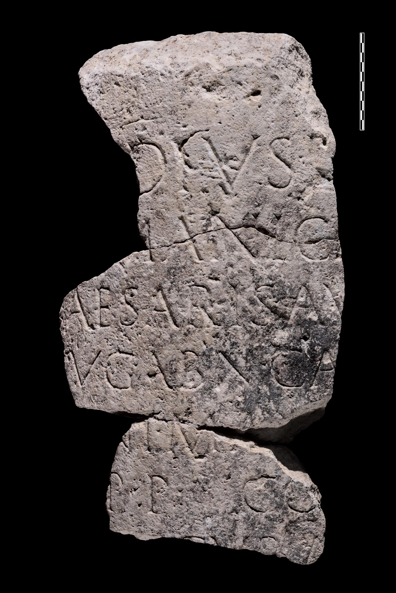
The association of Bera with the Via Egnatia is indicated by two milestones found in the area. The first, now in the Byzantine Museum of Didymoteichon, preserves a Latin inscription referring to road repairs in the region of Thrace between 59 and 62 or 63 AD, carried out on the initiative of the Emperor Nero through the procurator Titus Julius Ustus. The second milestone, the fate of which is currently unknown, bore a Greek inscription according to which it was dedicated either by the city of Ainos or by the otherwise unattested city of Avera – depending on the reading of the last two verses of the inscription – to the Emperor Maximinus, who was of Thracian origin, and his son, Caesar Gaius Julius Verus Maximus (235-238 AD). If the reading of the second city name is correct, it may be identified with Bera.
History
Little is known about the history of the local settlements that predated the construction of the Monastery of Panagia Kosmosoteira (1151/2). The statement in the Typikon of the monastery that Isaac was its renovator suggests that there must have been an earlier monastic establishment on the site.
The written sources referring to the area up to the 13th century usually mention the “monastery in Bera”, but do not refer to the fortified settlement. From the 14th century onwards, however, when Thrace came to the forefront of the wars that shook Byzantium, references to Bera as a castle appear with increasing frequency.
About thirty years after the founding of the monastery, in late 1183 or early 1184, Emperor Andronikos I Komnenos visited the Monastery of Kosmosoteira during a hunting expedition to honour the tomb of his father, the Sebastokrator Isaac. About ten years later, Emperor Isaac II Angelos (1185-1195) was overthrown by his brother Alexios III Angelos (1195-1203) at Cypsela and captured at Makri. From there he was taken to the Monastery of Kosmosoteira, where he was blinded. This is the first time that the monastery is mentioned as a place of punishment. In the 14th century, there was another case in which the “fortress” of Bera (not the monastery) was used as a place of confinement. The two sons of the official Andronikos Asen, John and Manuel, were imprisoned here in 1335 for six years by order of Emperor Andronikos III Palaiologos (1328-1341).
In 1204, with the distribution of the territories of the Byzantine Empire by the forces of the Fourth Crusade, Bera passed into the hands of the Crusaders and from then on it would be caught up in the bloody conflicts between the Bulgars, the Ottomans and the Byzantines of the Empire of Nicaea. In 1246, the Emperor of Nicaea, John III Doukas Vatatzes, passed “near the monastery of Bera” during his victorious campaign in Macedonia and Thrace.
In the 14th century, Bera was sacked by the Bulgarian Tsar Michael Shishman (1323), and shortly afterwards (1329/30) by an army of Turks from the region of Smyrna, who landed in the Evros Delta with seventy ships and besieged Bera and Trajanopolis.
During the second civil war between John VI Kantakouzenos and the guardians of the child-emperor John V Palaiologos (1341-1347), the usurper Kantakouzenos, who had been proclaimed emperor in 1341 in Didymoteichon, established a garrison in Bera. The local inhabitants revolted against the garrison in 1342, with the support of the monks of the monastery, captured the members of the garrison and imprisoned them in the fortress before sending them to Constantinople. Kantakouzenos besieged Bera once again, but without success, thanks to the resistance of the monks and the local peasants. In 1355, Emperor John V Palaiologos regained control of Bera, but it seems that by this time the Monastery of Kosmosoteira had been abandoned and only villagers lived in the fortress.
The Ottoman invasion of Thrace with the capture of Tzympe in 1352 and Gallipoli in 1354 was followed by constant raids in the interior of Thrace and the systematic occupation of its territories. According to one view, Bera was captured in 1357 or 1358 by Süleyman Pasha, the son of Sultan Orhan (1326-1362), who demolished its walls and converted the monastery church into a mosque. It is more probable, however, that Bera was conquered by the Ottomans in 1371. In 1373, the city was captured by the Ottomans a second time. The first capture, in 1371, probably refers to the capture of the city by Ottoman irregulars, while the second, in 1373, probably refers to the victory of Murad I, who appeared in Thrace at this time after a long absence.
In Ottoman times, Bera, now named Ferecik, was a station on the left branch of the Via Egnatia (Sol Kol), with caravanserais and hans for travellers. The Burgundian traveller Bertrandon de la Broquière, who visited the town in 1432-1433, reports that it was inhabited by Greeks and Ottomans and that its beautiful castle had been partly destroyed. He also confirms that the katholikon of the Kosmosoteira had been converted into a mosque. According to an Ottoman tax register of 1454/5, the town had a caravanserai and a hammam. In the 17th century, the town developed into an important Ottoman administrative centre, in fact the most important between the River Evros and Komotini. According to the Ottoman traveller Evliya Çelebi, who visited it in the late 1670s, it was divided into seven neighbourhoods (mahalles), with the Muslim ones occupying the best, central part of the town and the Christian ones “scattered around its edges”. The town had 500 houses with beautiful gardens and vineyards, 100 shops, two hans and a considerable number of religious buildings. Each Muslim quarter had its own mosque (mescit), while the most important mosque in the city was the converted Monastery of Kosmosoteira. Among the Ottoman monuments of the city, the İbrahim Baba Tekke (dervish house), a hammam and parts of the city’s water supply network, mainly aqueducts, are still preserved today. The city’s prosperity is also evidenced by a small pottery kiln excavated 500 m east of Kosmosoteira, dating from the early years of the Ottoman conquest of the city.
Over the following centuries, the town was visited by numerous travellers. The merchants had their warehouses on the banks of the Evros, where goods arrived by water from Adrianople. Ferecik would remain an important economic and political centre until the end of the 19th century, when Alexandroupolis, with the construction of its large port and the Thessaloniki–Constantinople/Istanbul railway line, became the new economic and transport hub of the region.
Feres became part of the Greek State in 1919, along with Western Thrace. After the Treaty of Lausanne in 1923 and the exchange of populations, many refugees from Asia Minor settled in Feres.
Monuments
Monastery of Panagia Kosmosoteira
Of the monastery founded by Isaac Komnenos, the katholikon is preserved in good condition today. The church is of the cross-in-square distyle type, covered by a great twelve-sided central dome, surrounded by four smaller octagonal ones. The five domes were covered from the outset with lead sheets, as the monastery Typikon stresses. The monument reflects the official architecture of 12th-century Constantinople with its typical large windows, which lend the interior a sense of grandeur, and the exclusive use of brickwork in the upper masonry of the church. Inside, the lower walls, at least in the sanctuary, were probably inlaid with marble. The floor of the church was marble, as was its sculptural decoration, of which only a few examples survive today.
Particularly notable is the fragmentarily preserved fresco decoration of the monument. The figures of the military saints stand out; they have been interpreted as symbolic portraits of specific members of the Komnene dynasty. Different views have been proposed on the dating of the wall paintings, placing them between 1152 and the early 13th century. However, according to the prevailing view, they should be dated to the first decades after 1152, immediately after the construction of the church. Their exceptional quality suggests that they were executed by a Constantinople workshop.
When the church was converted into a mosque, a minaret and some annexes were added, while at some point the original tripartite narthex and the exonarthex collapsed. The interventions of the Ottoman period included plastering over the frescoes. In order to make the plaster adhere better, the frescoes were struck with awls, and the dense pockmarks are still visible today.
The monastery was surrounded by a double enceinte, of which only a few sections survive today. The inner enclosure, referred to in the Typikon as the great enclosure, probably because it was higher, was an irregular hexagonal shape and enclosed an area of about 9,000 m2. It was reinforced at the corners with rectangular towers, of which only three are preserved. Within the great enclosure, apart from the katholikon, stood auxiliary buildings such as the refectory, the sacristy, the library and the monks’ cells.
Only a few parts of the outer enclosure, referred to in the Typikon as the sigma-shaped wall, have been found. Between the two enclosures, in accordance with the founder’s wishes, there was an infirmary.
Water supply works
In order to supply the monastery and the surrounding settlement with water, Isaac Komnenos secured the ownership of a neighbouring spring from the Metropolitan of Trajanopolis, to which the Monastery of the Panagia Kosmosoteira was ecclesiastically subject. He constructed an aqueduct to transport the water and a cistern to store it within the inner enclosure. Various isolated sections of water supply structures (aqueducts, reservoirs, water conduits, and fountains) of the Ottoman period are preserved in Feres today. The most notable is the aqueduct that bridges a ravine of the Feres stream southwest of the Monastery of the Panagia Kosmosoteira. It formed part of the water supply network that provided water to the section of the settlement that developed on this side of the monastery during the Ottoman era. The aqueduct is built using in cloisonné masonry and preserves two pointed arches made entirely of bricks. According to the prevailing view, it dates from the 15th or 16th century and was probably part of the high-arched aqueduct that supplied water to all the fountains and mosques of the town, as described by Evliya Çelebi.
A different water supply network was served by the imposing 18th-century aqueduct which spans the steep banks of the same stream, north of the first aqueduct, near the modern Alexandroupolis–Kipoi hational highway, close to the northern entrance of Feres. It was built using rubble masonry and is estimated to have originally been about 80 m long, featuring five or six arches. Today, two arches are preserved: a large pointed one 4.70 m high with a span of 7.65 m, and a smaller semicircular arch.
Ottoman Hammam (Makras Gefyra St.)
The small hammam, in a rather poor condition, is located on Makras Gefyras Street, east of the Monastery of the Panagia Kosmosoteira. It consists of an elongated rectangular entrance hall covered by a hemispherical dome and two square main chambers (hot rooms) covered with low domes. This is one of the oldest hammams in Greece, as its construction – based on its architectural and morphological characteristics – is dated before the tax register of 1454/5, which mentions the existence of a hammam in Feres.
İbrahim Baba Tekke (between Riga Feraiou and Agia Paraskevi Streets)
The single-room, square tekke (dervish house), measuring approximately 6.50 x 6.50 m, is covered by a low dome and is located northeast of the Monastery of the Panagia Kosmosoteira. Based on a now-lost inscription, it is dated to 1686.
Watermill
The watermill, which was abandoned after 1944, was used for grinding cereals and is preserved north of Feres, very close to the 18th-century aqueduct. It was constructed in the 19th century. The structure consists of a main, slightly irregularly shaped room measuring approximately 6.10 x 4.60 m, where the machinery was installed, and a smaller rectangular auxiliary space. A system of two water channels and a reservoir directed the rushing waters collected from the Feres stream and the nearby hill of Agia Paraskeve to the iron waterwheel.
Museum
Folklore and Historical Museum of Feres (2 Paleologou Konstantinou St.)
Located a short distance from the Monastery of the Panagia Kosmosoteira, the museum is housed in a restored two-storey 19th-century building. Through a rich collection, including a large number of objects complemented by archival material such as old books, documents, and photographs, it showcases various aspects of the life of the region’s inhabitants.


