The two castles, built very close together, effectively controlled the mountain passes through the southeastern foothills of the Rhodope range, connecting the Evros plain with the plain of Komotini, and the coast with the hinterland of Thrace. According to the Ottoman historian and geographer Haci Kalfa, a high-ranking administrative official under Sultans Murad IV (1623-1640), Ibrahim I (1640-1648) and Mehmed IV (1648-1687), the local mountain passes were used in Ottoman times by people travelling on foot to the small town of Şapsçılar (present-day Sapes). Those who had wheeled vehicles, however, followed the road to the south of Avantas, which passed through the village of Makri, a station of the Via Egnatia.
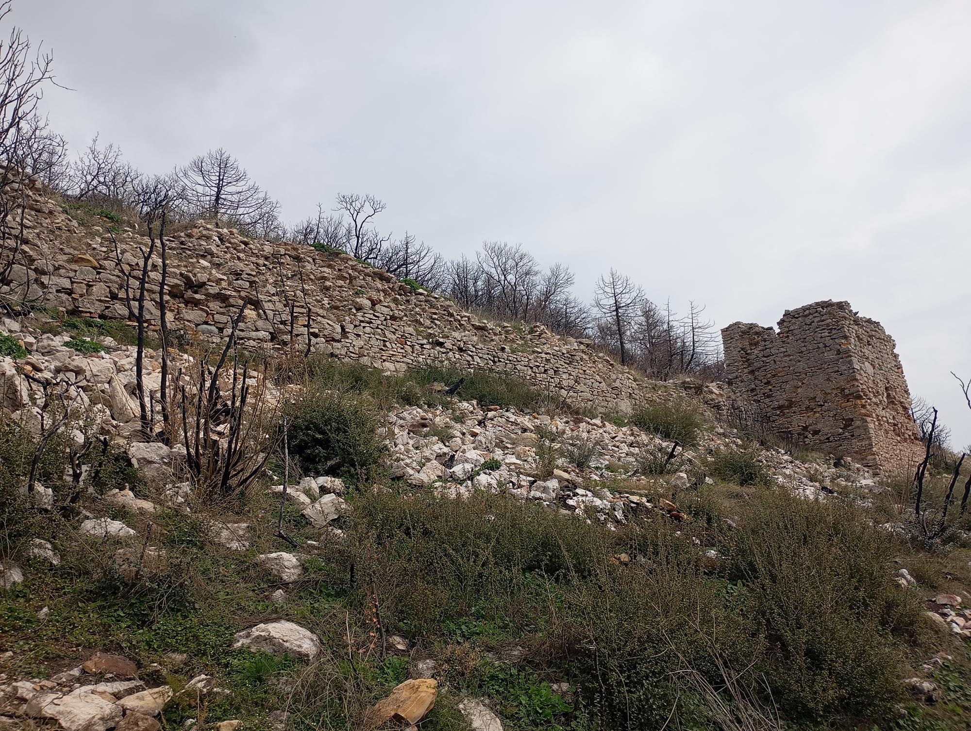
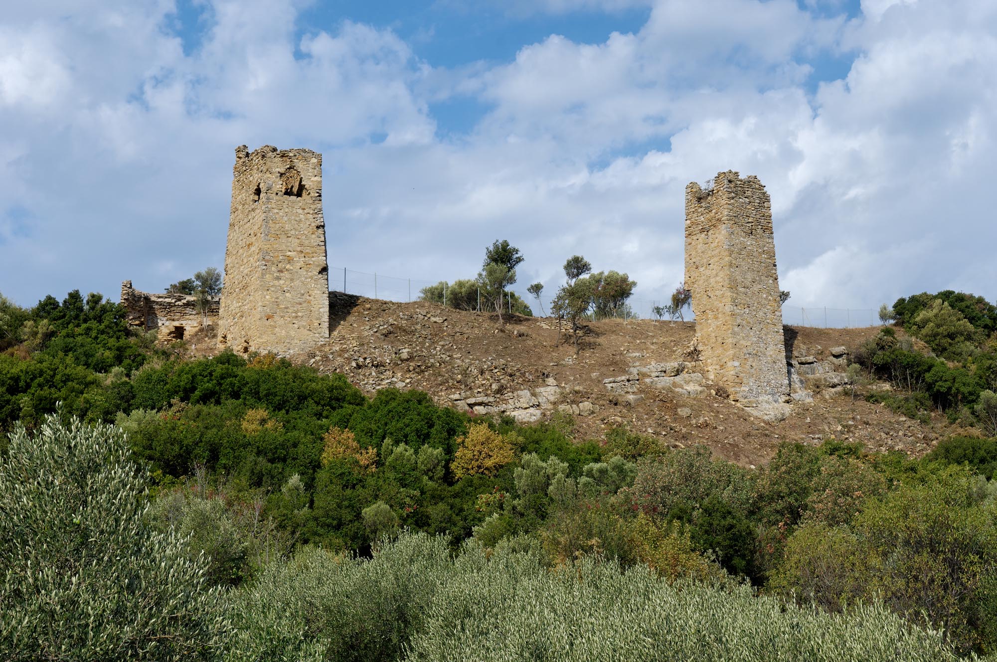
The first castle stands on the steep Boz-Tepe Hill just north of Avantas. It is a non-rectangular parallelogram shape and encloses an area of just under a hectare. Its enceinte is reinforced by four-sided towers, four of which are visible today.
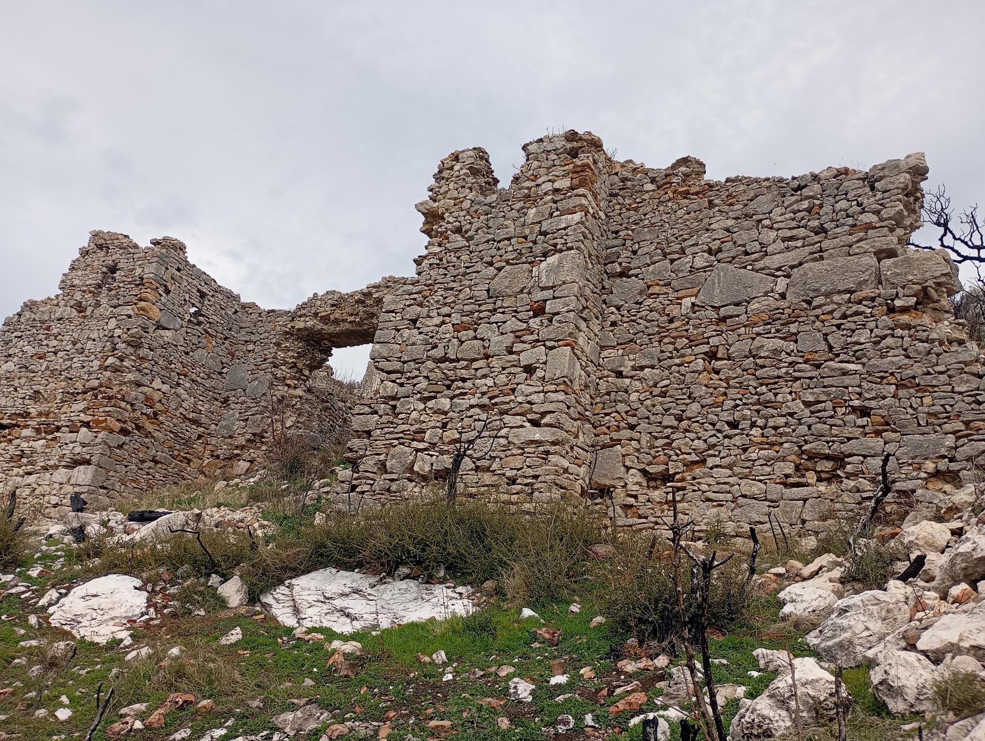
The second castle, known as the Castle of Potamos, is located south of Avantas, on the long, low, rocky hill near the Potamos railway station on the Komotini–Alexandoupolis line, close to the abandoned village of Potamos (Bulgarian Badoma), which was inhabited by Bulgarians before the region’s incorporation into the Greek State in 1920. The Alexandoupolis–Avantas provincial road passes west of the castle. The castle has a perimeter about 600 m long and encloses an area of no more than 8,000 m2. It has two fortified enclosures: the smaller, triangular inner one, with an area of about 1,000 m2, is in the north part of the castle, higher up the rocky hill. The castle’s defences are reinforced at intervals by strong towers, four-sided except for one which is trapezoidal. The castle gate, on the south side of the outer enclosure, is protected by two towers, one quadrilateral and one heptagonal. The largest tower, on the west side of the inner enclosure, may be the castle keep due to its position and size.
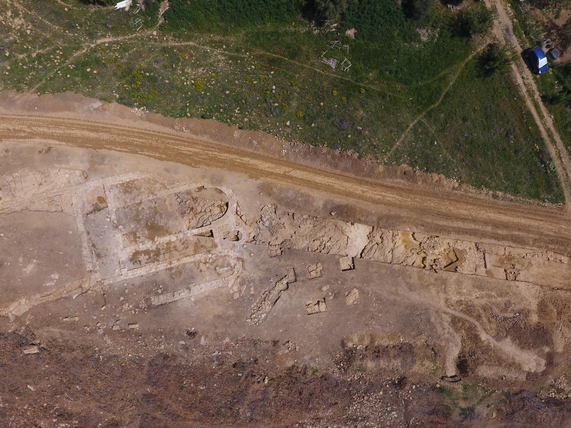
The lack of inscriptions or written references to the two castles prevents us from determining the year of their foundation or whether they were built at the same time. At least two building phases can be identified in the Castle of Potamos. Based on the features of the two castles, it has been suggested that they date from the 14th century, before the Ottoman conquest of the region; the conquest of Thrace was completed in 1373, after their victory against the Serbs at the Battle of Marica (1371). The few pottery sherds recovered from the two castles belong to the late 13th and the 14th century.
It has been suggested that the Castle of Potamos may be the Güvercinlik (meaning “dovecote” in Turkish) mentioned in the epic of Umur, the Emir of Aydın. If this is true, then it may be identified with the Castle of Peristeria (meaning “dovecote” in Greek), mentioned by Byzantine sources a short distance west of Bera (present-day Feres). The castle seems to have already been abandoned by the 15th century, according to the Burgundian traveller Bertrandon de la Broquière, who visited it during his voyage in 1432-1433. In the 17th century it remained deserted and ruined, “the only visitors being the local sheep and goats”, according to the account of the Ottoman traveller Evliya Çelebi, who visited the nearby village of Güvercinlik in the late 1670s.


