Servia
Servia, the “Mystras” of Macedonia
In the small town of Servia, one of the largest in the Regional Unit of Kozani, is one of the best-preserved examples of a fortified Byzantine settlement in Northern Greece, likened by some researchers to the famous fortified town of Mystras in the Peloponnese. The Byzantine castle-city is built on the easternmost of the twin rocky hills that rise on the southwest side of the modern town. The hill, in the western foothills of the Pierian Mountains, is a natural stronghold, surrounded by the deep gorges of Agios Georgios and Chouni, rendering the castle inaccessible to enemies. Byzantine writers such as Kekaumenos and George Kedrenos refer admiringly to the strong defensive walls of Servia.
Below the hill and to the west extends the large valley of the middle course of the Haliacmon, which flows through the area and then, via the passes of the Pierian Mountains, into the Thermaic Gulf. Much of the valley, which provides a rich hinterland for the inhabitants to this day, is occupied by the long artificial Lake Polyphytos, which was created in 1974. At the level of Servia, the opposite banks of the lake are connected by the “High Bridge of Servia”, the second-longest bridge in Greece at 1,372 m long and one of the most popular attractions in the area.
The site of Servia controlled one of the two natural exits of the Sarantaporo Pass, which has always connected the wider region of Western Macedonia with Thessaly and Southern Greece. Two major roads passed through Servia. The first connected the town with Larissa via Sarantaporo. The second, even more important road started from Kastoria and, following the course of the Haliacmon, reached Thessaloniki, branching off to Veria and the cities of Pieria. Another road starting from Servia crossed the Eordaia Plateau north of Kozani and, after bypassing the marshes of Sari-Giol (in the present-day Regional Unit of Ptolemaida), led to the Byzantine castle of Soskos (in what is now the Regional Unit of Kozani) and to Ostrovo (present-day Arnissa). At the level of Servia was one of the crossings of the Haliacmon, which was passable in the summer mainly via fords known as “pores” (whence the name Sarantaporo, “Forty Pores”), which were directly connected to the roads of the area. In some cases, as at the site of Paliohano, near the village of Sparto just west of Servia, they had hans for travellers.
History
esearch in the wider environs of Servia has brought to light a large number of archaeological sites belonging to all periods of the prehistoric and historical eras, with the first traces of habitation dating from the Palaeolithic period (30000-10000 BC). Intensive occupation is observed from the Neolithic period (c. 6500-3000 BC) onwards and throughout prehistoric times, while there are a significant number of sites of the Archaic, Classical, Hellenistic and Roman periods (700 BC-300 AD). There are also many settlements and cemeteries ranging in date from Byzantine to modern times. Most of the sites are located on elevated riparian plateaux or hillocks in the Haliacmon basin, very often in areas on or near natural passes and fords.
Genaral topographical plan of the castle: 1.External wall’s gate. 2.Church of St John the Baptist (Prodromos). 3. Church of SS Theodores. 4.Episcopal basilica. 5.Middle Wall’s Gate & chapel. 6.Citadel. 7.possible bathhouse. 8.Church of SS Anargyroi. 9.Church of SS Constantine & Helen. 10.Bridge 11.Cave chapel of St George Kremastos.
Scholars place the founding of Servia between the 6th and 7th centuries, since the episcopal see of Servia, subject to the metropolitan see of Thessaloniki, is attested in the sources from the end of the 9th century. In the late 10th century, the town was conquered by the Bulgarian Tsar Samuel (997-1014), who, with Ohrid as the administrative seat of his state, attempted to create a large hegemony, extending his authority southwards as far as the Gulf of Corinth. Over the course of several campaigns, Emperor Basil II Boulgaroktonos (the Bulgar-Slayer) (976-1025) gradually managed to recapture the fortresses taken by the Bulgarians and achieve the complete submission of Tsar Samuel. He retook Servia in 1018, when, like other castles in the region, he ordered its walls to be demolished in order to prevent the Bulgarians from using it against him again.
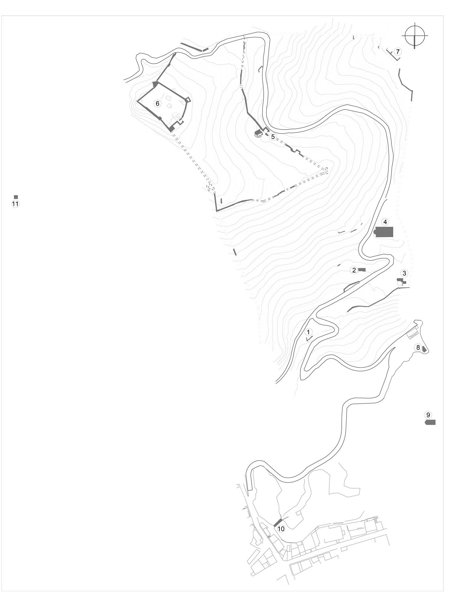
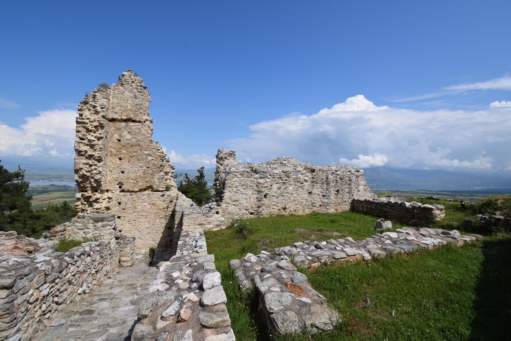
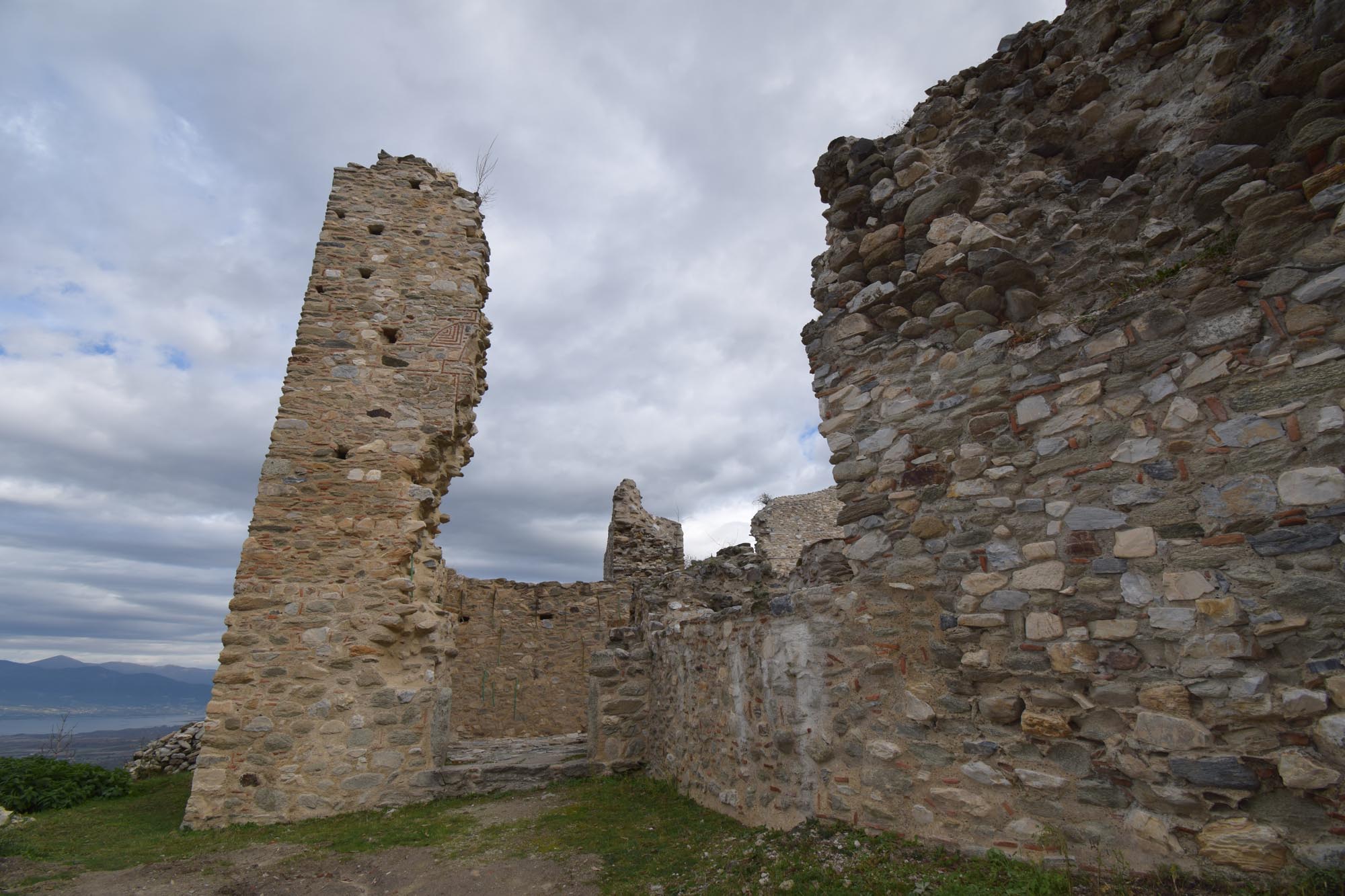
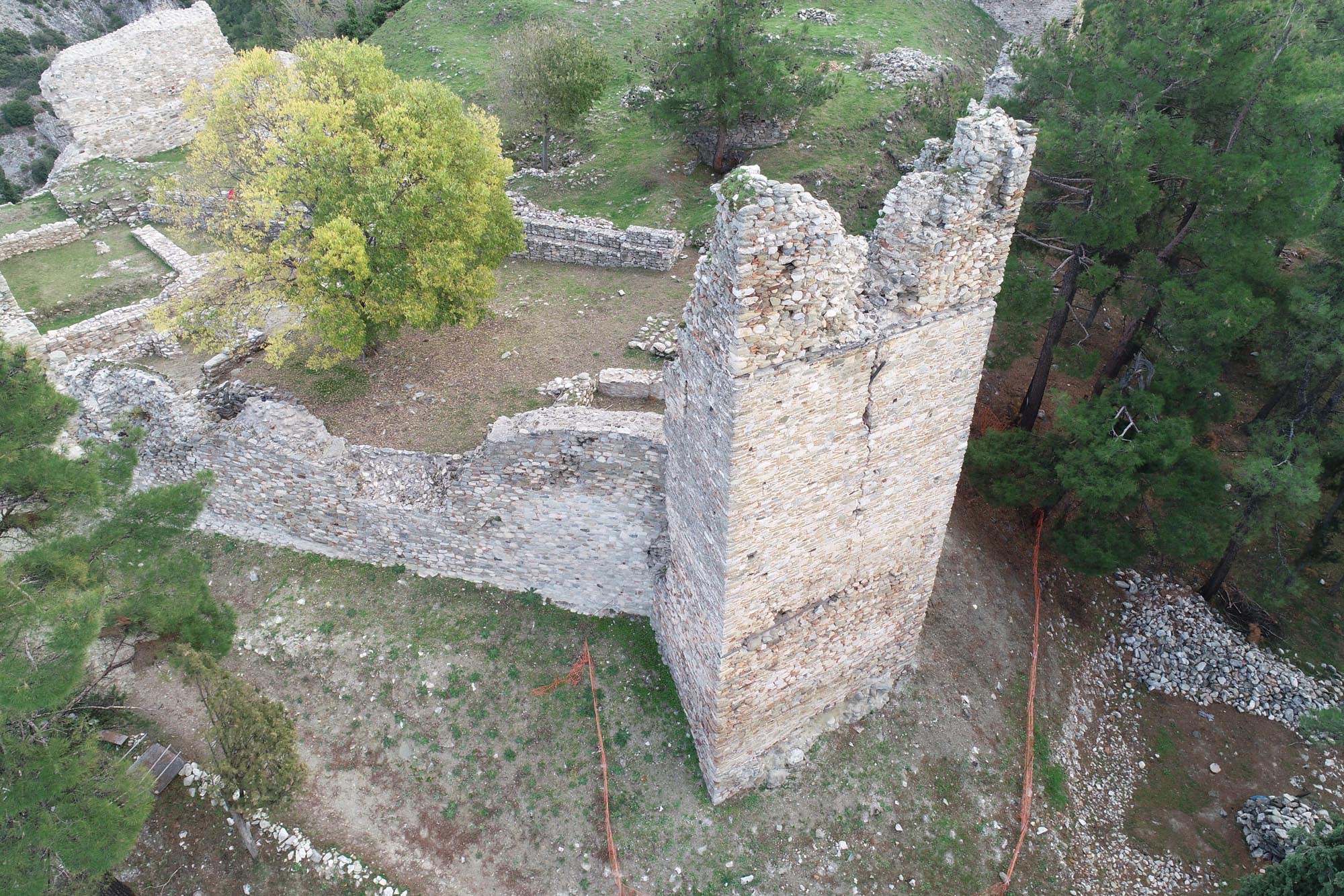
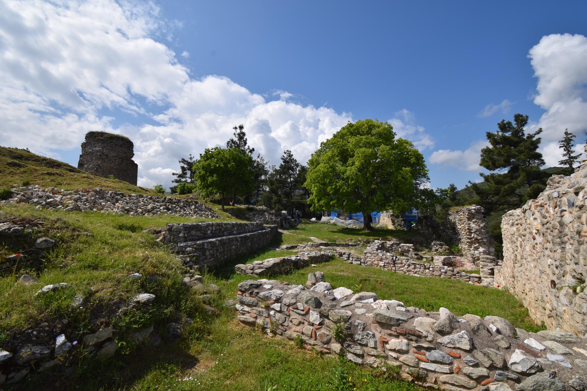
In 1204, with the fall of the Byzantine Empire to the forces of the Fourth Crusade, Servia was captured and suffered significant destruction at the hands of Boniface of Montferrat, the leader of the newly established Latin Kingdom of Thessalonica (1204-1224). It was then, along with other areas of Western Macedonia, incorporated into the Despotate of Epirus, when repairs were made to the city walls. After the Battle of Pelagonia (1259), the entire region of Western Macedonia was incorporated into the Empire of Nicaea, and on the Reconquest of Constantinople (1261) it became part of the restored Byzantine Empire.
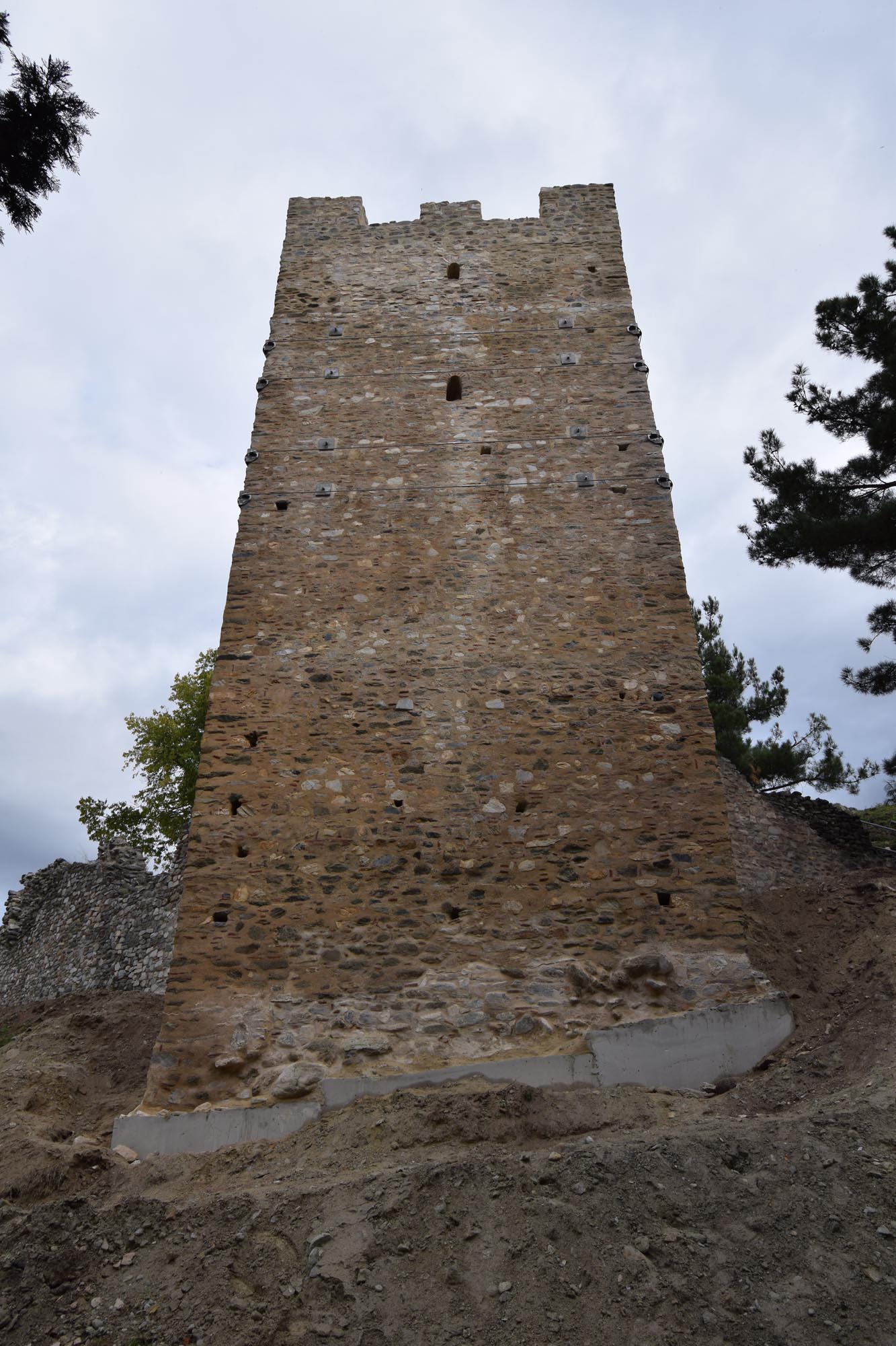
In the 14th century, between 1342 and 1344, the powerful Serbian ruler Stefan Uroš IV Dušan, taking advantage of the civil war between the Kantakouzenoi and the Palaiologoi, conquered the whole of Western Macedonia. The Emperor of Constantinople, John VI Kantakouzenos, sought to expel the Serbs in the summer of 1350. After capturing a number of castles (Veria, Edessa, etc.), he attempted to besiege Servia. The Serbian garrison of the city put up a strong resistance, forcing him to abandon his attempt, but he subsequently signed a treaty with Dušan under which Servia passed into Byzantine hands. In his historical work, Kantakouzenos provides an admiring and fairly detailed description of the powerful castle-city which he failed to capture by force of arms.
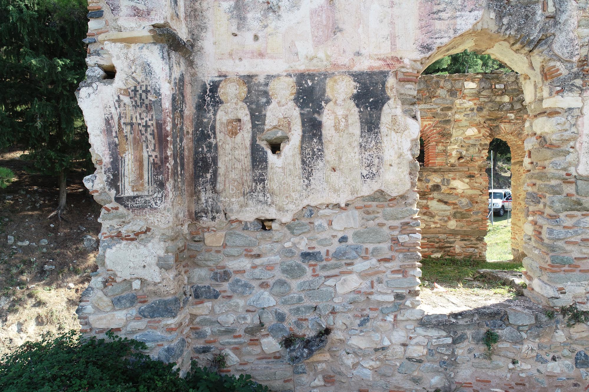
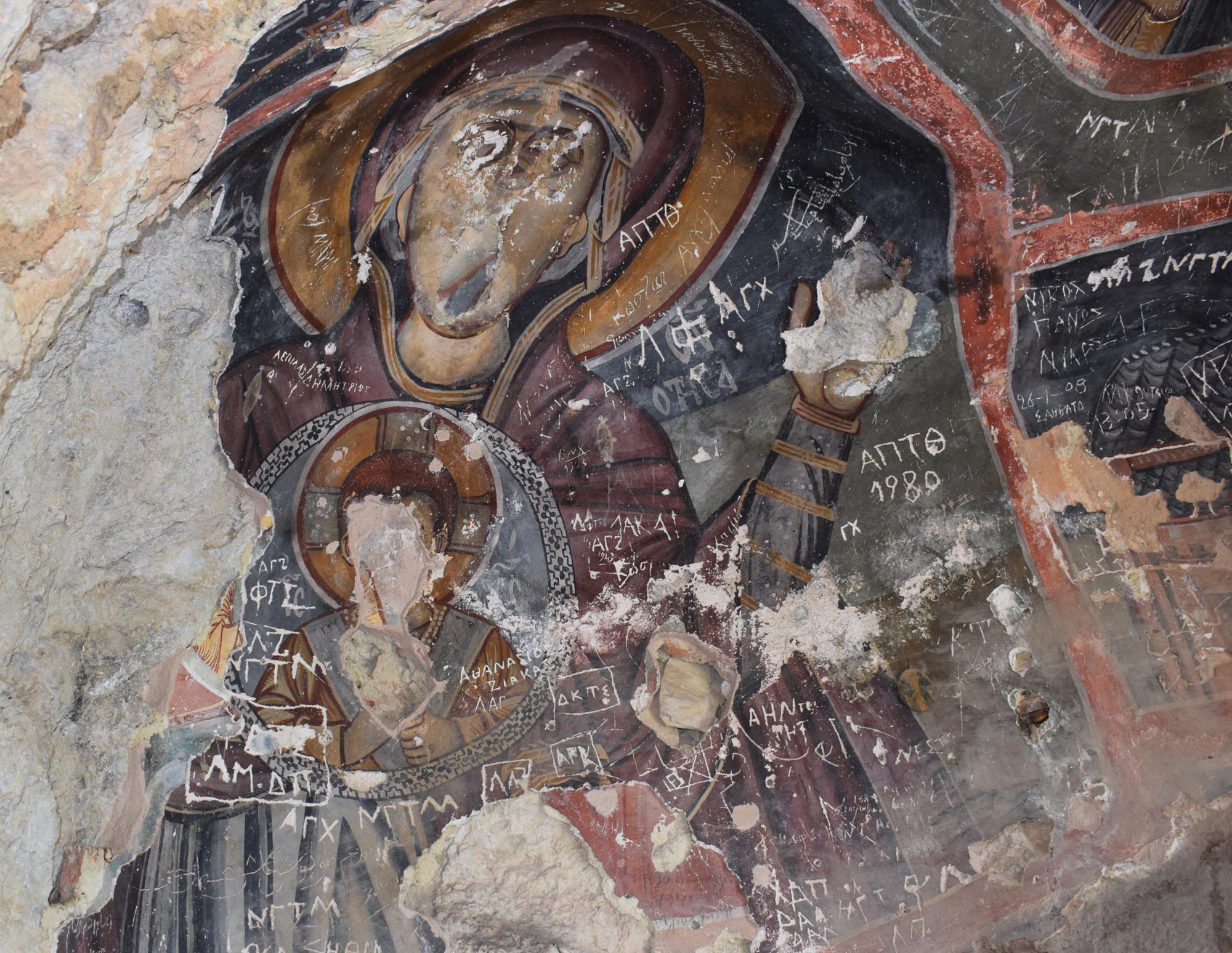
Servia is thought to have surrendered to the Ottomans in 1393, although according to one view it was only definitively conquered later, under Sultan Murad II (1421-1444 and 1446-1451). The area was initially included in the kaza of neighbouring Veria, while in the early 16th century it was elevated to the Kaza of Servia (kaza-i Serfice), which extended as far as the Eordaia Plateau, north of Kozani. In the first decades following the Ottoman conquest, an Ottoman garrison was established in the castle and the population was boosted by new Muslim settlers, although Christians outnumbered Muslims until the 17th century. The Ottoman traveller Evliya Çelebi, who visited Servia in 1660-1661 and 1667, reports that there were 1,800 houses divided into six Muslim, eight Christian and one Jewish quarter. Within the castle – which had lost its defensive role, as it had not been modernised – there were a hundred houses of poor Christians, while the town, which had expanded outside the castle walls, had six mosques, six small mescits, a tekke (dervish house), two schools, a hammam, a han and 100 shops. Çelebi called Servia “Little Bursa” (Bursa being a major silk-production centre) because it had many mulberry trees and produced considerable quantities of silk.
From the 17th century onwards, the jurisdiction of the Kaza of Servia was limited northwards, only extending as far as the Haliacmon. The rise of Kozani as an important economic centre of the region from the second half of the 17th century onwards contributed greatly to the decline of Servia. In 1745, the episcopal see of Servia was renamed the see of “Servia and Kozani” and its seat was transferred to Kozani.
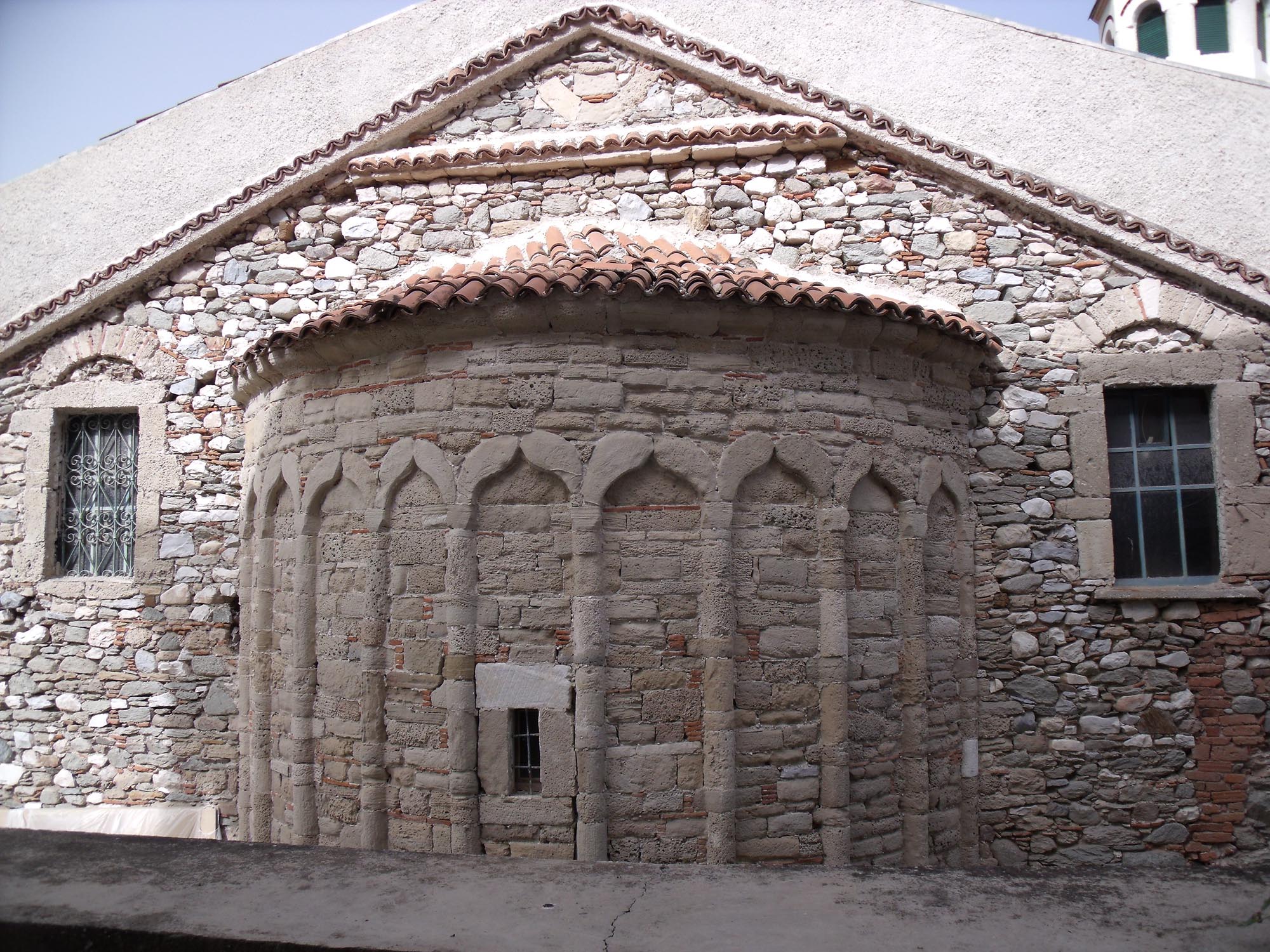
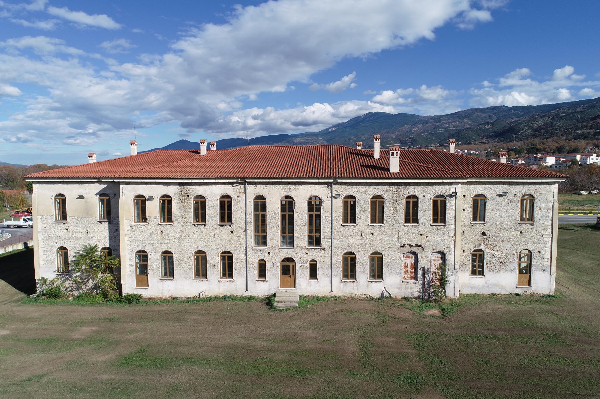
At the end of the 19th century, after the annexation of neighbouring Thessaly to the Greek State (1881), the administrative and military role of Servia was enhanced. The Sancak of Servia was founded, subject to the Eyâlet of Monastir, which included the Kazas of Servia, Kozani, Elassona and Grevena. Notable public buildings were constructed, such as the large clock tower in the town centre and the Ottoman Government House, although the only building which survives today is the Ottoman School. The governor of the region, Halil Pasha, a scholar of Greek, played a key part in the urban and architectural development of the town. The Greek State attempted to respond to the new, enhanced role of the town by establishing a Greek consulate there in 1882 and upgrading the episcopal see of Servia and Kozani to a metropolitan see.
In 1912, Ottoman rule in Servia came to an end following the victory of the Greek Army at the Battle of Sarantaporo (9-11 October), one of the most decisive battles of the First Balkan War, which signalled the subsequent victorious advance of the Greek Army in Macedonia. On 6 March 1943, during the German Occupation, Servia was completely destroyed by the Italian forces, who executed many of the inhabitants and burned down almost all the houses and public buildings of the town.
Monuments
Castle
The castle has an irregular shape, following the contours of the steep rock on which it is built. Three successive fortified enclosures divide the castle into three parts: the citadel on the hilltop (0.25 hectares), the Upper City (2 hectares) and the Lower City at the foot of the hill (7.5 hectares). The tripartite layout of the castle ensured maximum protection for the inhabitants: it allowed them, in the event of the Lower City being occupied, to take refuge behind the middle wall, and, if this was also captured, to mount a defence in the citadel, the last point of resistance. At the same time, according to Byzantine sources, the arrangement of the city in three successive zones reflected its social stratification: the Lower City, which was more populous, was inhabited by peasants and labourers, the less densely populated Upper City was home to merchants and officials, while the citadel was the seat of the city’s military governor. Part of the population also resided outside the castle, seeking refuge there in the event of a siege.
The outer enclosure of the Lower City is not preserved for its entire length and its course is restored on the basis of its preserved sections and the contours of the hill. It was reinforced with towers at intervals. A rectangular tower is preserved on the east side of the wall, while traces of a second one are seen on the west side. The main gate of the castle is in the north wall.
The inner enclosure (middle wall) separating the Lower and Upper Cities, and the smaller enclosure which defines the area of the citadel, are in better condition. The polygonal middle wall is reinforced by rectangular and round towers. A now-restored square tower with internal dimensions of 4 x 4 m, preserved to a height of over 4 m, served as the entrance from the Lower to the Upper City, via two gates in its north and west sides.
The citadel enclosure is an irregular pentagonal shape, reinforced by a series of towers of different periods and shapes. The ruins of three towers are still preserved today: the one on the south side probably dates from the 11th century and has a circular base and pentagonal superstructure. The two four-sided towers in the northwest part of the citadel, facing the Upper City, are built in the same style and date from the mid-14th century; they are associated with the activities of either Stefan Dušan or John Kantakouzenos. Of these two towers, the north one, which originally had three storeys, was the gateway to the citadel. It measures 7 m on a side and is preserved to a height of 12 m. The west tower, measuring 7 x 7 m, was also three storeys high and survives to a height of 17 m.
Of the buildings that once stood inside the castle, three important Byzantine churches, the episcopal basilica and the churches of St John the Baptist (Prodromos) and the Saints Theodore, are preserved today within the boundaries of the Lower City. Two further churches with notable frescoes, those of the SS Anargyroi (Holy Unmercenaries) and SS Constantine and Helen, are preserved outside the fortified Byzantine settlement. The remains of numerous buildings are scattered across the whole surface of the citadel: the architectural remains of five more small single-nave churches stand out. A cistern is preserved in good condition near the church of St John the Baptist, while on the west side of the Lower City are the remains of a rectangular building with a tripartite layout, probably a bathhouse. In the area of the citadel, the excavation has brought to light, among other things, the remains of six single-storey buildings which may have been used as military quarters, storerooms or stables.
Episcopal basilica
The ruins of the basilica lie at the northwest end of the Lower City. It is thought to have served as the city’s episcopal church and is known as the “Basilica of the Catechumens” or “Saranta Portes” (Forty Doors). According to tradition, the church is dedicated to St Nicholas, although it has also been suggested that it was dedicated to St Demetrios, based on the large painting of the saint on the south wall of the nave, where a dedicatory inscription of Bishop Michael of Servia survives.
The church is a three-aisled basilica with a narthex and a raised central nave. The nave had a saddleback roof, while the two side aisles and the narthex had a separate lower, single-pitched roof. The aisles were separated by two long walls, each pierced with four arched openings. The church terminated on the east in a large semicircular apse which has now collapsed.
The church is dated c. 1000 AD, but it underwent successive phases of modifications between the 12th and 16th centuries, most notably in the 14th century, when the south aisle was converted into a portico.
The basilica contains three layers of frescoes. The first is considered contemporary with the construction of the church and is covered by the second layer, which was painted in the 13th century during the term of office of Bishop Michael. The frescoes of the second layer, covering the nave, the narthex and part of the north aisle, have suffered considerable damage as they were exposed to the elements for many years due to the collapse of the church roof. The full-length figures of saints in the lower zone of the nave are in better condition. The third layer of frescoes, which dates from the 15th-16th centuries, comprises only a few fragments that were uncovered during the excavation work carried out for the purposes of a study for the restoration of the church in 1995-2000.
Church of St John the Baptist (Prodromos)
The church lies northeast of the episcopal basilica, near the north outer wall of the Lower City. It is a small, single-nave church with a timber saddleback roof. Its original form has been altered by later additions and more recent interventions. On the east side, where the low semicircular sanctuary apse protrudes, there is fragmentary decorative brickwork of successive courses of horizontal bricks. On the west side is a narthex which was added at a later date, probably replacing an older, smaller one. The interior of the church was fully frescoed, but the decoration had already suffered considerable damage by the time Professor Andreas Xyngopoulos studied the monument in 1957. Today, very few traces of frescoes are preserved in the sanctuary. Based on its construction, the church is dated to the 14th century.
Church of the Saints Theodore
Built on a small hill at the edge of the outer city wall, north of the episcopal basilica, is a tiny single-nave church measuring 4.10 x 2.42 m on the inside. It has a timber saddleback roof and terminates in a high semicircular conch on the east. The church stands out for its rich decorative brickwork, forming letters or simple geometric shapes. Dentil courses of bricks are also preserved. On the basis of its morphological characteristics, the church is dated to the second half of the 11th century.
The church has been identified, albeit with reservations by some researchers mainly due to its small size, as the katholikon of the female monastery of the Saints Theodore, also known as the monastery “of Sideris”, or “Kalogries” (Nuns). It is a stavropegic monastery (i.e. directly subject to the Ecumenical Patriarchate of Constantinople) that appears in written sources as early as the 13th century, while in Ottoman times, at least, it was a dependency of the male monastery of the Saints Theodore of Kastania, Servia. Part of the monastery complex and a vaulted cistern survive today.
Inside the monument and on its western outer wall are preserved remarkable frescoes, albeit quite badly damaged. According to a written inscription, they were painted in 1512 with the assistance of many of the faithful (the names of at least six families and a priest and his wife are mentioned). However, in the literature to date they are held to have been painted in 1497, based on the earlier proposal of Professor Andreas Xyngopoulos. The frescoes of the church are associated on the basis of their stylistic and iconographic characteristics with groups of wall paintings attributed to the “Kastoria workshop”.
Church of the SS Anargyroi (Holy Unmercenaries)
The church is built on a small rock outside the northwest part of the castle, near the north gate of the outer enclosure of the Lower City. It is a small, single-nave church dating from the second half of the 11th century. It has a timber saddleback roof and terminates on the east side in a small rectangular apse with a decorative herringbone brickwork pattern. The door and window arches also have brick frames.
Inside the church are preserved two layers of frescoes. Fragments of the first layer, dated between the 11th and 13th centuries, are visible under the second layer in the sanctuary. The slightly damaged frescoes of the second layer extend across all four walls of the church and were executed by two painters. Like the frescoes of the church of the Saints Theodore, they are closely related to the wall paintings attributed to the “Kastoria workshop”. The surviving written inscription informs us that the church was decorated during the term of office of Bishop Gerontios, unattested elsewhere, with the assistance of the “Orthodox Christians” of Servia, meaning that this was a collective donation. Researchers have proposed different hypotheses on the dating of the second layer of the frescoes, depending on the completion of the indistinct date recorded in the inscription. However, according to the prevailing view, the frescoes were painted in 1510, a date consistent with their iconographic and stylistic characteristics.
Church of SS Constantine and Helen
Standing just south of the church of the SS Anargyroi, this is a single-nave church with a timber saddleback roof. It has undergone later repairs and interventions, but the original pseudo-cloisonné masonry is visible in the lower walls. The three-sided apse, which protrudes on the east side of the church and bears rich brickwork decoration, also belongs to the original phase. The church dates from the 13th century and has been attributed to a construction crew familiar with the ecclesiastical architecture of the Despotate of Epirus.
Two layers of paintings are partially preserved inside the church. The first layer consists of only a few fragments of floral decoration at the entrance, dating from the 13th-14th centuries. The second layer is found on the east wall of the church and in the conch of the sanctuary. Despite the extensive damage, it forms a remarkable group of wall paintings dating from the late 15th century.
Various buildings, Lower City
The castle of Servia includes the remains of a significant number of buildings that have not yet been excavated. Among them are the remains of a rectangular building on the west side of the Lower City, which is likely to have been used as a bathhouse.
Cave Church of St Georgios Kremastos
The church is set into the almost inaccessible vertical face of the Gorge of Agios Georgios, which descends from Mount Kastania and flanks the Byzantine castle of Servia on the east. Two layers of frescoes are preserved inside the church. Only a small part of the first layer is visible below the later painting of the Theotokos of Blachernae in the conch of the sanctuary. It is dated to the end of the 13th century and, according to the fragmentary inscription on the south wall of the cave, was executed at the expense of the “most noble” Theodore Komnenos Livadares. The founder of the church has been identified with the founder of a monastery of the Theotokos (Our Lady) in Constantinople, to whom the poet Manuel Philes (c. 1275 – c. 1345) dedicated a poem. The frescoes of the second layer of the cave church are placed, on the basis of iconographic and stylistic criteria, in the second half of the 15th century and belong to the group of frescoes of Servia influenced by the “Kastoria workshop”.
Bridge of Servia
The bridge, spanning the Gorge of Agios Georgios, is located at the beginning of the road connecting the modern town of Servia with the Byzantine castle. It is a stone bridge with a single semicircular arch with a span of 7.70 m, constructed in the 19th century.
Metropolitan Church of St Kyriaki
The church, in the type of a three-aisled basilica, was built in 1879 on the site of an older church (1679), which had been destroyed by fire twice (in 1756 and 1878). In 1943 the church was burned down again by the Italian occupation troops. Of particular interest is the semicircular apse of the church, which bears nine shallow decorative arches.
Museum
Servia Folk Museum (Karpou Konstantinou St.)
The Museum, in the house of Dr Aristides Christakis, displays representative examples of local folk culture.


