Asprovalta
Asprovalta, in the bight of the Strymonic Gulf
The small town of Asprovalta, one of the largest tourist resorts in Macedonia today, lies in the bight of the Strymonic Gulf, in the long, narrow plain that extends northeast of Lake Volvi, immediately after the Rentina Pass, which is known as the “Macedonian Tempi”. This narrow, low-lying strip of land, which Herodotus calls the “plain of Syleus”, surrounds the Strymonic Gulf like a wreath and is described by the geographer Michael Chrysochoos as a “broad crescent-shaped plain”. In antiquity, at least from the 4th century BC onwards, it was part of the territory of Mygdonia. In this extremely fertile area, with its abundant water and dense vegetation, archaeologists have identified numerous sites dating from the prehistoric to the Ottoman period, including the remains of settlements and cemeteries, farmhouses, fortresses and towers.
The area has been of special strategic interest since ancient times: it was, as it still is today, the only pass between Macedonia and Thrace. The Via Egnatia once ran through here. Like the modern Egnatia Motorway, immediately after Amphipolis it followed the eastern foothills of the Kerdyllian range, instead of running further south along the coast of the Strymonic Gulf, in order to avoid the sandy expanses there. After crossing the Rentina Pass, the Via Egnatia continued its course towards Apollonia and Thessaloniki.
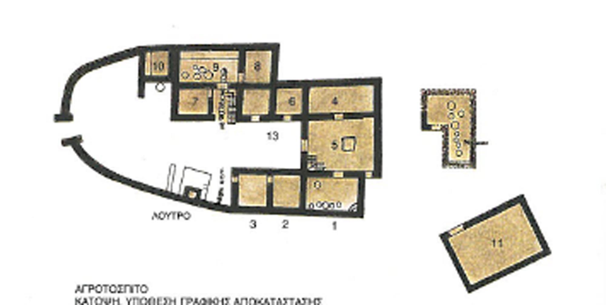
Somewhere in the area of Asprovalta was the changing station (mutatio) of the Via Egnatia known as Pennana, which, according to the Itinerarium Burdigalense, lay midway between the station (mansio) of Amphipolis and the changing station (mutation) of Peripides, 10 Roman miles from each (the latter is placed at the western entrance of the Rentina Pass). The mutatio Pennana may be identified with the remains of a Roman farmhouse complex (mid-4th to mid-6th c. AD) that has been excavated at Km 87 of the Thessaloniki–Kavala highway. This view is supported by the layout and use of the rooms of the complex (spacious courtyard, large food preparation area, stables, sanitary facilities, baths), which indicate that, besides being used for agricultural activities, it could have functioned as a reception and service area for travellers, as a hostelry of the time. This view, however, is not widely accepted, as the site of the farmhouse, on a high, secluded saddle, overlooks the wider area while ensuring the safety and protection of the complex, but does not lie on the axis of the Via Egnatia. According to the researcher Moschos Otatzis, the Pennana station may be located at Akrogiali, between Asprovalta and the village of New Kerdyllia of Serres, where four inscribed milestones were found: they were made in Amphipolis and refer to repairs of the ancient road between 138 and 225 AD (see Amphipolis).
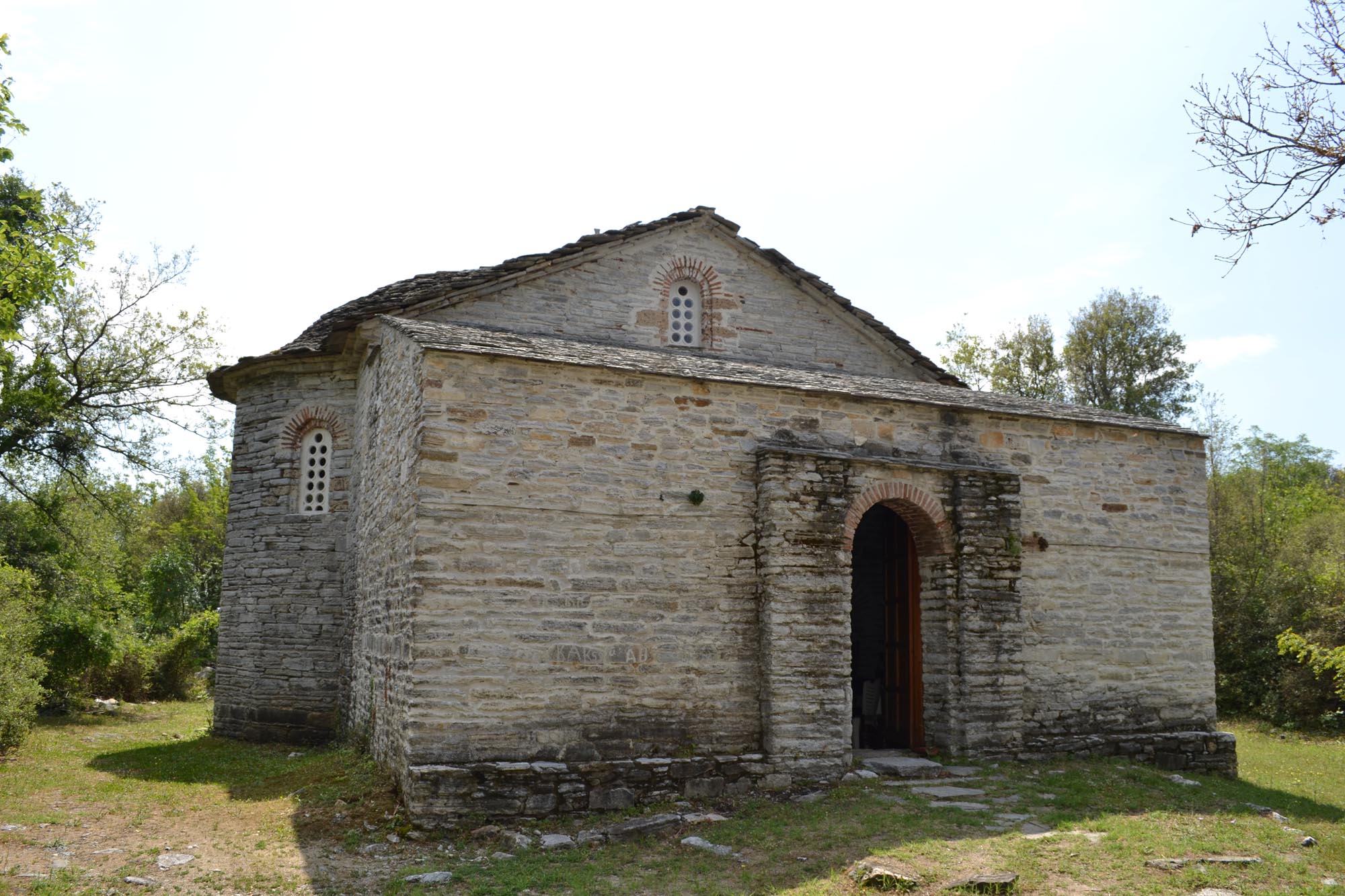
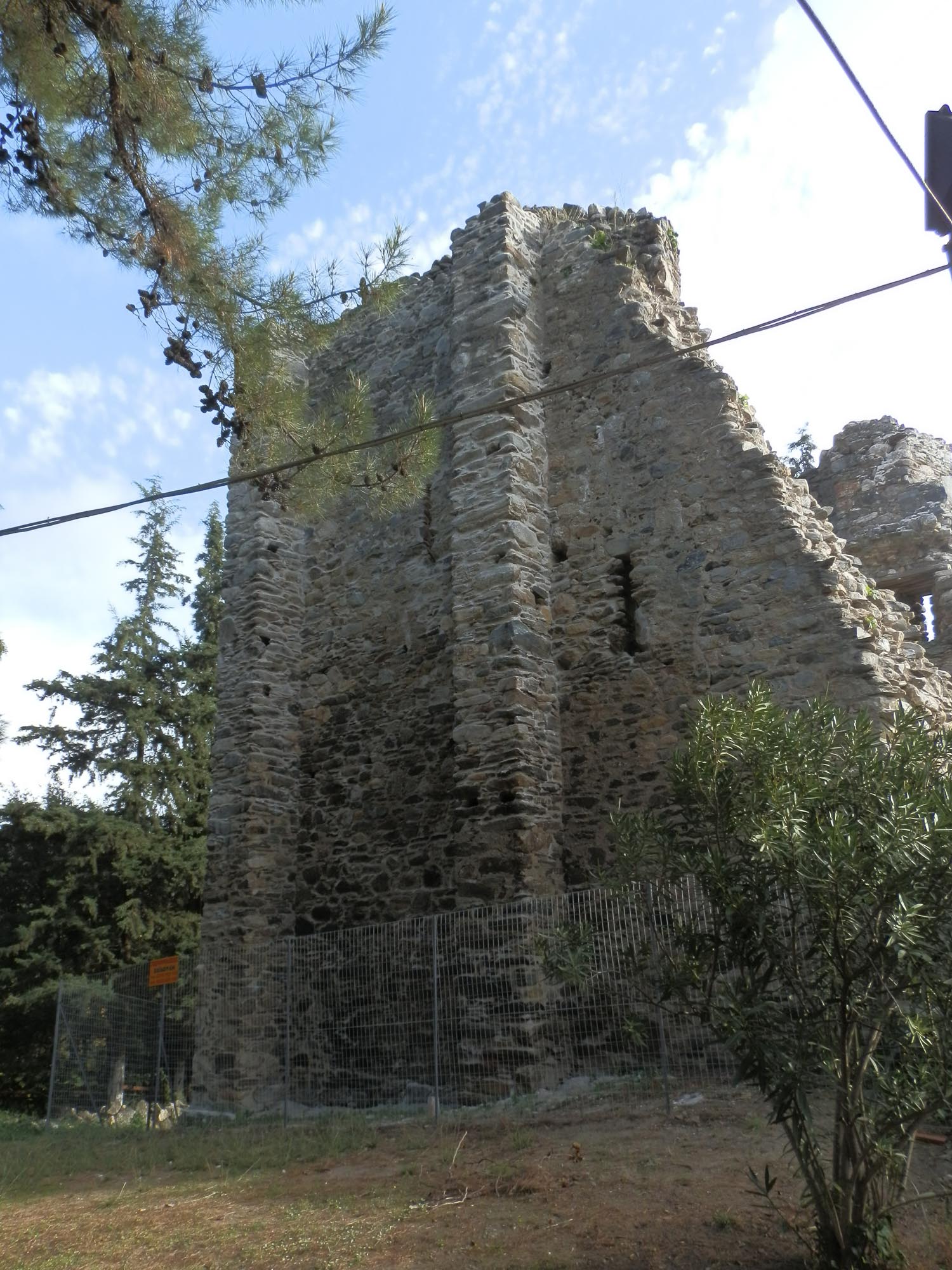
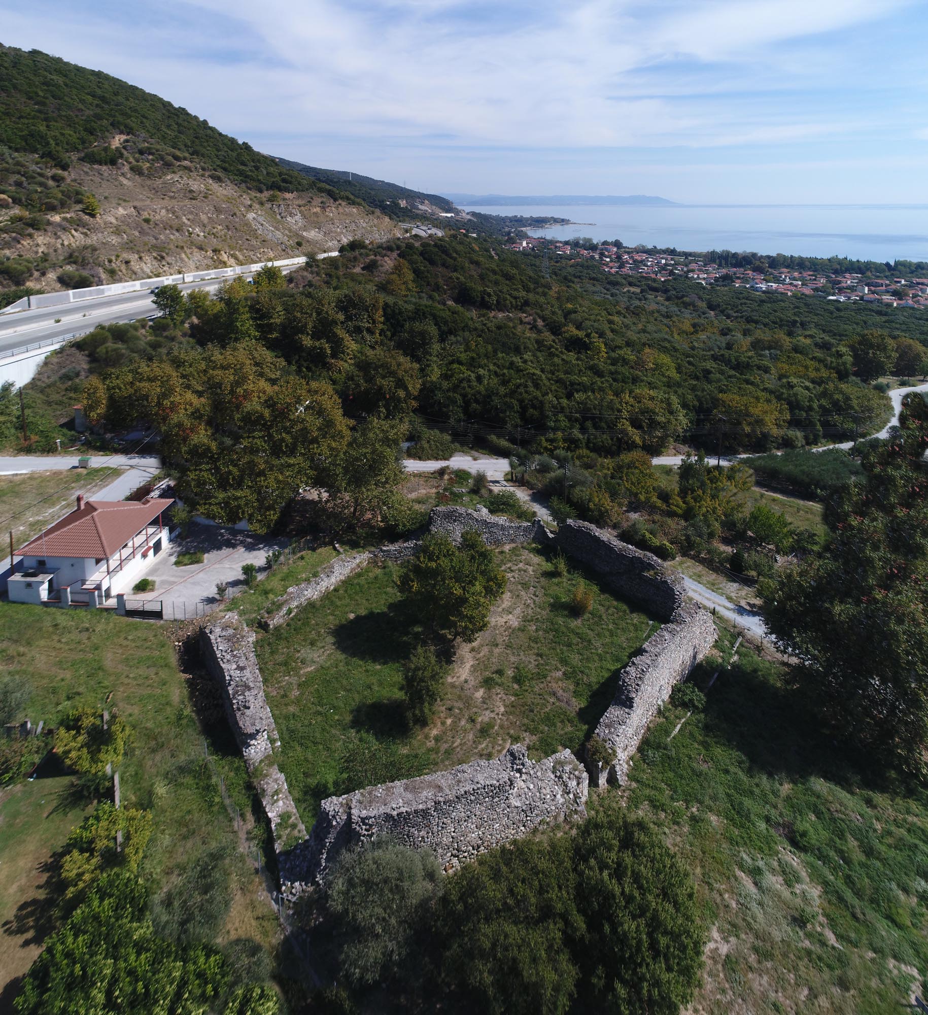
The small castle at Kaledes or Kaliades, east of Asprovalta, in the southeast foothills of the Kerdyllian Mountains, lies on the route of the Via Egnatia through the area. It was founded in Middle Byzantine times and remained in use until the Early Ottoman period. The small size of the castle, together with its location, which ensured the supervision of the coastal plain and the possibility of rapid escape to the adjacent wooded mountain, indicate that it was a fortified station of the Via Egnatia, intended to control the road as well as providing safe accommodation and passage to travellers and troops. The dating of the castle in the Middle Byzantine period rules out its identification as the station of Pennana, as has been argued.
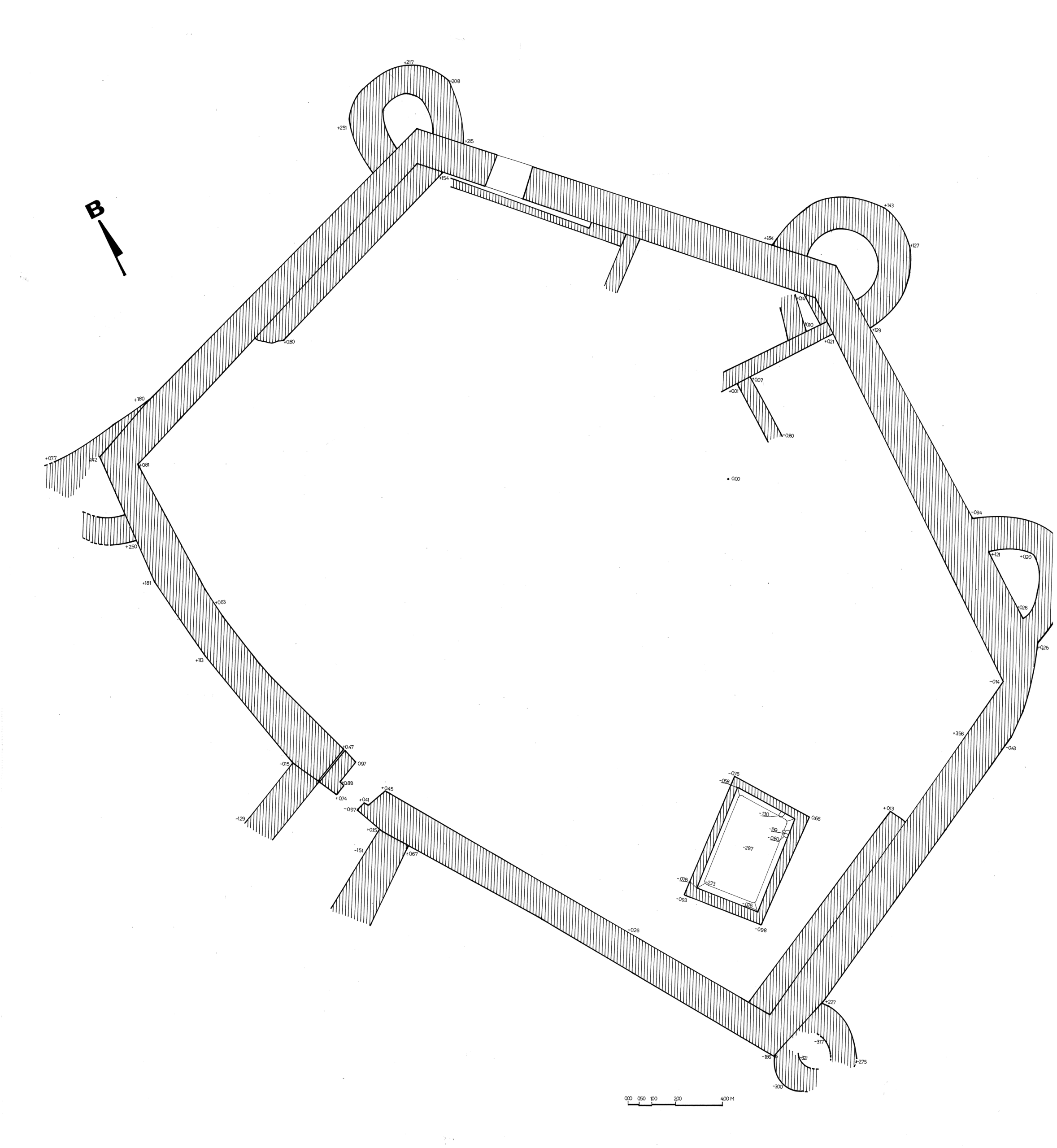
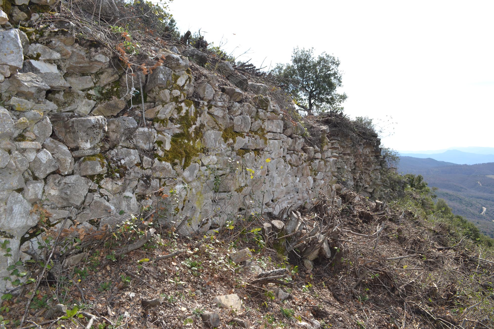
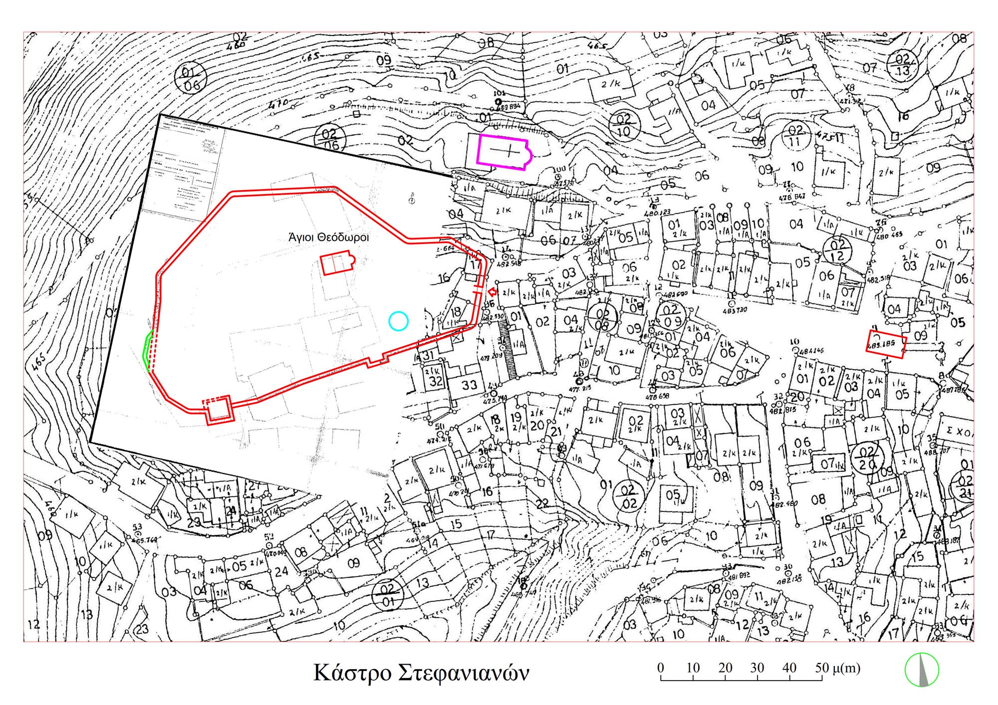
Important information on the topography of the region during the Middle Byzantine period is provided by the Typikon of the Monastery of the Theotokos Petritzonissa in Bačkovo, Bulgaria (1083). According to this, the village of Priloggio in the archonteia of Stefanina was granted to the monastery, along with the “old castles”, the agridia (farmhouses) and the hostelries of the area. At least two hostelries were located in the village of Priloggio, whose identification has been a matter of dispute. The archonteia were administrative regions of the Byzantine Empire which included guarded passes of strategic importance. That of Stefanina, centred on the important Byzantine settlement in the Stefanina area northeast of Lake Volvi, may have been established as early as the 9th century, if not earlier, for the purpose of guarding the Rentina Pass.
Palaia (Old) Asprovalta
The original settlement of Asprovalta was founded in the 16th century, about 2 km north-northwest of today’s seaside town, in order to deal with the bandit gangs roaming the area. According to a document from the Monastery of Simonos Petra on Mount Athos, the area where the settlement of Asprovalta was established was cleared of trees, as the dense forest provided an ideal refuge for robber bands.
In the 17th and 18th century, Asprovalta was a Muslim village, one of the charcoal-burners’ villages, which were obliged to deliver a certain quantity of coal to the Ottoman authorities each year. In 1844, the Muslim inhabitants of Asprovalta claimed from the Christian inhabitants of Stefanina the exploitation of the dense forest that still covered the area and which travellers mentioned in admiring terms. The kadi (judge) of Thessaloniki, however, ruled in favour of the inhabitants of Stefanina. According to Major Nikolaos Schinas, who travelled around Macedonia in the mid-1880s, Asprovalta was inhabited by 50 Turkish families and was a wintering-place for a few families of Vlach shepherds. On 23 October 1907, during the Macedonian Struggle, the Battle of Asprovalta took place here, in which Lieutenant Kosmopoulos and his guerrilla corps defeated the opposing Bulgarian forces accompanied by Turkish gendarmes.
In Late Ottoman times, travellers from Macedonia to Thrace still passed through the region. The strategic value of the location is attested by the fact that a gendarmerie unit was stationed in Asprovalta. The remains of a large 19th- or early-20th-century han (inn) were discovered near Palaia Asprovalta during the construction of the Egnatia Motorway. The building was surrounded by an irregular enclosure, in the southeast corner of which there was a small four-sided room which served as a lookout point.
Modern Asprovalta
After the liberation of the area from the Ottomans in 1912, Palaia Asprovalta was gradually abandoned by the Muslim population, while a few Greeks settled on the coast, on the site of the modern village. The population of Asprovalta increased in 1922 after the arrival of refugees, most of whom came from Renkioi (Erenköy) in Asia Minor.
Monuments - Antiquities of Asprovalta
Roman Farmhouses
A series of farmhouses dating from the Late Classical and Early Hellenistic period to Early Christiantimes were discovered in the wider area of Asprovalta during the construction of the Egnatia Motorway. These are large building complexes covering 2,000-4,000 m2. The farmhouses produced and traded agricultural goods such as olive oil and cereals, and had enough space to store them. They were also fortified and monitored the surrounding area, while providing a high level of security both for their occupants and for the agricultural products stored there.
Farmhouse-station of the Via Egnatia (?), Km 87, Thessaloniki–Kavala highway
The complex, which had a long life (mid-4th – mid 6th c. AD), took shape following successive additions and individual repairs. In its final form it had a large enclosed courtyard with an arched end, in which the various rooms of the farmhouse were arranged in a square-U-shaped plan. A large room with a central hearth for food preparation stands out. One of the rectangular rooms southwest of the farmhouse is thought to be a space for fermenting wine must, as it had a floor of hydraulic cement and a drainage pipe. In the courtyard was a small independent bathhouse. A well-designed drainage system with pipes led the water out of the complex. Outside the enclosure, a semi-open-air storage shed with ten holes cut in the ground for placing large storage jars was uncovered, as well as an isolated rectangular building that probably served as a stable or a livery stable.
The complex, despite its importance, could not be preserved, because most of it was located directly on the route of the Egnatia Motorway, which could not be moved due to the terrain.
Farmhouse at the Liotopi tou Rouchtseli site, Km 85, Thessaloniki–Kavala highway
The archaeological site of the farmhouse, which is open to the public, is located about 2 km east of Asprovalta. The total area of the complex is over 3,500 m2. Three main building phases are identified a short time apart. The farmhouse was founded in the reign of Philip II (359-336 BC) and abandoned around 240-230 BC, during the period of the Gaulish invasions of Macedonia.
The complex has a square plan and measures 28 x 28.5 m. It consists of four wings around the centre, three of which, except the southern one, are two-storey buildings. In the centre of the farmhouse stands a two-storey tower building. On the north and east sides of the complex are two large open courtyards, probably for livestock breeding and stabling. During the third building phase, a row of auxiliary rooms was added on the south side of the complex, one of which was used as an optanion (kitchen), as evidenced by the central hearth excavated there. Two other rooms of the same extension were used as workshops, as is evident from the many metalworking scraps. Workshop activity was also attested 50 m outside the complex, where three large kilns were uncovered near a long retaining wall that has been excavated to a length of 30 m.
Byzantine castle at Kaledes or Kaliades
This is a five-sided fortress with five semicircular towers, enclosing an area of 800 m2. The enceinte is preserved to a maximum height of 6.20m The main double gate of the castle is set in the middle of the south side, with a second entrance at the north end of the east side, next to the east tower. Inside the south and north sides of the enceinte are staircases leading to the wall-walk. A large cistern was discovered next to the south staircase.
The castle dates from the Middle Byzantine period, but it may have been founded on the site of an earlier castle. It underwent extensive repairs during the Late Byzantine period and remained in use into Early Ottoman times.
Han, Palaia Asprovalta
The remains of the han (inn),discovered near Palaia Asprovalta during the construction of the Egnatia Motorway, have an L-shaped floor plan. The north wing consists of five rooms of equal size, while the west wing consists of two larger rooms. The two wings faced an open courtyard.
Monuments - Antiquities in other settlements of the area
Stefanina
Built on the site of the fortified settlement of the same name (Stefaniana) dating from the Middle and Late Byzantine period, this was the seat of the archonteia of Stefaniana from at least the 11th century onwards. From the 14th century it was the seat of the homonymous katepanikion (a province comprising a fortified town and its surroundings) which included the area of Asprovalta. Today, a large part of the castle that once surrounded the settlement is preserved, known as “Pirgos Stefaninon” (Tower of Stafanina). However, newer houses built within its perimeter have altered its original form. Today, numerous antiquities are preserved in the wider environs of Stefanina.
Monastery of St George, Mount Kerdyllion
The monastery stands on a mountain plateau known as the Plaka tou Agiou Georgiou (Plateau of St George), in the foothills of the Kerdyllia range, northeast of Stefanina. The katholikon of the monastery dates from the mid-16th century and is of the Athonite architectural type (a four-columned cross-in-square church with the lateral arms of the cross ending in choirs). The frescoes of the sanctuary and the prothesis are all that survives today of the once richly decorated church.
Vrasna
A short distance west of Asprovalta is the traditional village of Vrasna, which in Byzantine sources appears as Vrasta, a name it retained until the beginning of the 20th century. It has been argued that this is the settlement mentioned in Athonite documents of the Late Byzantine period as a dependency of the Monastery of Esphigmenos. Inside the village, next to the church of St George, stands a large four-sided tower dating from the first quarter of the 14th century. The walls of the tower were externally reinforced by pilasters, an architectural element common in the towers of Mount Athos. The tower is one of those built by the monasteries of Mount Athos in the area of Lake Volvi, where they maintained a large number of dependencies.
At the site of “Trypimeni Petra” in Vrasna, an impressive fortified complex covering approximately 4,000 m2 has been discovered. It ensured the protection of its inhabitants and was also used for the production and storage of agricultural goods. It dates from the time of Philip II (359-336 BC) and remained in use until the Roman conquest of the region in 168 BC. The complex has a pentagonal plan. Its rooms, which included an olive press, grain processing areas and storage rooms, were arranged around a central courtyard. Its strategic location, overlooking the surrounding area, its monumental dimensions and its strong enclosure wall reinforced with rectangular towers suggest that it was an official or public building.


