Apollonia
Apollonia, a lakeside station of the Via Egnatia
South of Lake Volvi, at the Bountroumia site, in the countryside between the modern villages of Apollonia, Nea Apollonia and Kokkalou, are the remains of ancient Apollonia, one of the most important cities of the Macedonian hinterland, lying within the geographical boundaries of ancient Mygdonia.
According to the Roman itineraries, Apollonia was a station (mansio) of the Via Egnatia, located 36 or 38 Roman miles from Thessaloniki and 30 or 33 miles from Amphipolis. This means that the ancient road ran along the south shore of Lake Volvi, unlike the modern Egnatia Motorway, which follows the north side of the lake. 19th-century travellers also followed the route to the north of the lake, because the south side had a tendency to flood. Near the modern village of Apollonia, Professor Nikolaos Moutsopoulos has found traces of a cobbled road that are probably associated with the ancient road.
History
The wider area of Apollonia has been inhabited since prehistoric times. At least three sites dating from the end of the Late Neolithic period to the Late Bronze Age have been identified (“Apollonia A”, “Nea Apollonia B Tumulus” or “Tsair Tumulus”, and “Nea Apollonia C” or “Mese Alani Mesopotamou”).
The precise location of the ancient city of Apollonia has occupied scholars for decades, as the written sources refer to the place-name Apollonia in widely different ways. The site of the ancient city at Bountroumia, near Lake Volvi, was identified in the 1980s by Professor Nikolaos Moutsopoulos, who combined surface surveys with information from written sources and travellers. The question of the location of ancient Apollonia was resolved once and for all when a Latin inscription with a letter of the Emperor Hadrian (117-138 AD) was found, mentioning the name of the city.
The ancient writers who refer to the Mygdonian Apollonia include Pseudo-Scylax (before 360 BC), Pliny (1st c. AD) and Claudius Ptolemy (2nd c. AD). The earliest reference to the city, however, is found in the Hellenica of the Athenian historian Xenophon. Referring to the historical events of 382 BC, he mentions Apollonia and Acanthus as the most important cities in the area of Olynthus on the Chalcidice peninsula. The two cities sent ambassadors to Sparta to seek aid against the territorial ambitions of the Chalcidian League, the political union of the cities of Chalcidice led by Olynthus. This was the period when the ambitious Chalcidians drove out the Macedonian king and even advanced south of Pella.
The founding of the city is dated a little earlier than Xenophon’s first mention of it. According to the historian Thucydides, Apollonia is believed to have been founded by Chalcidians who had settled on the south coast of Chalcidice in 432 BC, when King Perdiccas II of Macedon (448-413 BC) persuaded the inhabitants of many coastal towns of Chalcidice to defect from the Delian League and come to live near Olynthus and Lake Volvi. Those who left their homes would be given land “in Mygdonia, near Lake Volvi” to cultivate as long as the war against the Athenians lasted.
Apollonia appears as an independent city in the inscription from the Asklepieion of Epidaurus of 360/59 BC, which lists the names of the theorodokoi who undertook to welcome and host the theoroi of Epidaurus, the official representatives of the ancient sanctuary, in Northern Greece. The city lost its independence during the reign of King Philip II of Macedon (359-336 BC), when it became part of the Macedonian Kingdom.
Strabo states that Apollonia was one of the cities that came together to found Thessaloniki in 316/5 BC. Apollonia is where the Roman general Lucius Aemilius Paullus and Perseus, the last Macedonian king, met after the Battle of Pydna (148 BC), which decided the ultimate subjection of Macedonia to the Romans. According to the historian Livy, Perseus came to Apollonia from Amphipolis, a day’s journey away.
We know from inscriptions that there was a temple of Dionysus in Apollonia, while Zeus, Hermes and Hercules were also worshipped there. The excavation revealed a temple-shaped building against the south part of the walls and a solid, almost life-size terracotta head of a figure.
Α two-chambered Macedonian tomb (late 4th or early 3rd c. BC) was discovered in the south cemetery of the city. In the antechamber was a marble cist with a cover, a rare find, as the only known similar one comes from the supposed tomb of Philip II in Aigai. The tomb was found looted, but its few movable finds included leaves from gold wreaths of olive and oak leaves, and two gold earrings, one depicting a winged Eros (Cupid) and the other a lion’s head.
During Roman times, the fact that the Via Egnatia passed by the city contributed to the latter’s development. A Latin inscription of an unknown emperor mentions the construction of a hostelry (stabulum) for travellers, while another inscription attests to the city’s well-designed water supply system. According to the Acts of the Apostles, St Paul passed through Apollonia with his companion St Silas on his way from Amphipolis to Thessaloniki (49/50 AD).
In the Early Christian period, Apollonia is listed among the cities of Macedonia in the Synecdemus of Hierocles (written before 535 AD). It was probably an episcopal see subject to the metropolis of Thessaloniki, based on the reference to a bishop of the city in an ecclesiastical taktikon, an official document of the Patriarchate of Constantinople, dated 739, during the reign of Emperor Leo III (717-741 AD). The establishment of Christianity in the city is confirmed by Professor Moutsopoulos’s discovery of building remains and architectural elements belonging to an Early Christian basilica.
The excavations carried out in the city of Apollonia by the Archaeological Service between 1991 and 2010 brought to light a large part of the circuit walls of the ancient city. The city is estimated to have covered an area of 33 hectares, making it one of the largest in ancient Macedonia. The excavations also uncovered many graves in its necropoleis, which extended outside the city walls, occupying almost twice its area. The cemetery of the Late Classical and Hellenistic periods extends south of the city, while that of the Late Hellenistic, Roman and Early Christian periods extends along the north wall. Two earlier pottery kilns of the Archaic and Early Classical periods (6th-5th c. BC) were discovered in the area of the south cemetery. They were probably used to make terracotta figurines, as a clay mould for the head of a figurine was found nearby.
To the rich movable finds of the excavations are added the chance finds, mostly inscriptions, which are occasionally handed in to the Archaeological Service. Some of these finds are particularly impressive: the most striking examples are the rare gold wreath of ivy leaves dating from the 3rd quarter of the 4th century BC, and the marble statue of Nike (Victory) of the 2nd half of the 2nd century BC, which would have been the acroterion (pedimental ornament) of a public building or perhaps part of a votive monument.
Monuments - Antiquities
Ancient fortifications
The ancient circuit wall of the city is estimated to have been 3,100 m long, of which 834 m have come to light. It is preserved up to the first course of blocks and is 2.20 m thick. It is reinforced every 35 m with a semicircular or circular tower 7 m in diameter. The wall, which dates from the 5th century BC, is built of limestone trapezoidal blocks, between which smaller slabs are interspersed (“Egyptianising” masonry). Its western arm, which survives to a slightly greater height, is less thick (1.80 m) and was built in pseudo-isodomic masonry with squared blocks in alternating wide and narrow layers. It is probably bulwark or a section of wall rebuilt in later times, perhaps during the Hellenistic period.
Tumulus of Apollonia
The burial mound is in the shape of a truncated cone with a small flat top. It is one of the largest in Macedonia, 19 m high and 100 m in diameter. The excavation revealed a stone retaining wall/enclosure of rubble masonry 36 m long, 1 m wide and 0.5 m high that runs around the tumulus. In the south part of the tumulus was discovered a two-chamber barrel-vaulted Macedonian tomb, probably dating from the second half of the 3rd century BC. It measures 7 x 4 m and was constructed of roughly dressed travertine blocks in the isodomic system (with courses of equal height). The tomb had already been looted several times since antiquity.
Modern village of Apollonia
The modern lakeside village of Apollonia is mentioned in Ottoman registers as Pazar-i Cedid as early as the 16th century. Up to the beginning of the 20th century it was known by its former name, Pazarouda or Pazargia (Pazargah) and Yeni Pazar (“New Market”). In Ottoman times it was the most important administrative centre of the region, as the seat of the nahiye of Pazargah. It also became a major commercial centre of the region. A great bazaar was held here every Friday; according to the Ottoman traveller Evliya Çelebi, who visited the area in the late 1670s, it attracted 5,000-10,000 people. Gabriele Cavazza, the secretary of the Venetian bailie Lorenzo Bernardo in Constantinople, also refers to the commercial traffic and bazaar of Pazarouda in his description of their journey from Thessaloniki to Rentina in 1591.
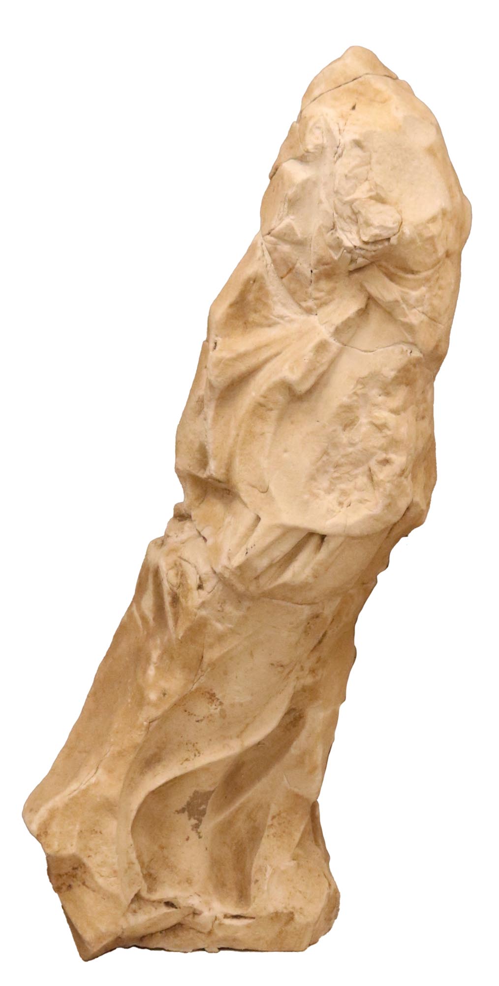
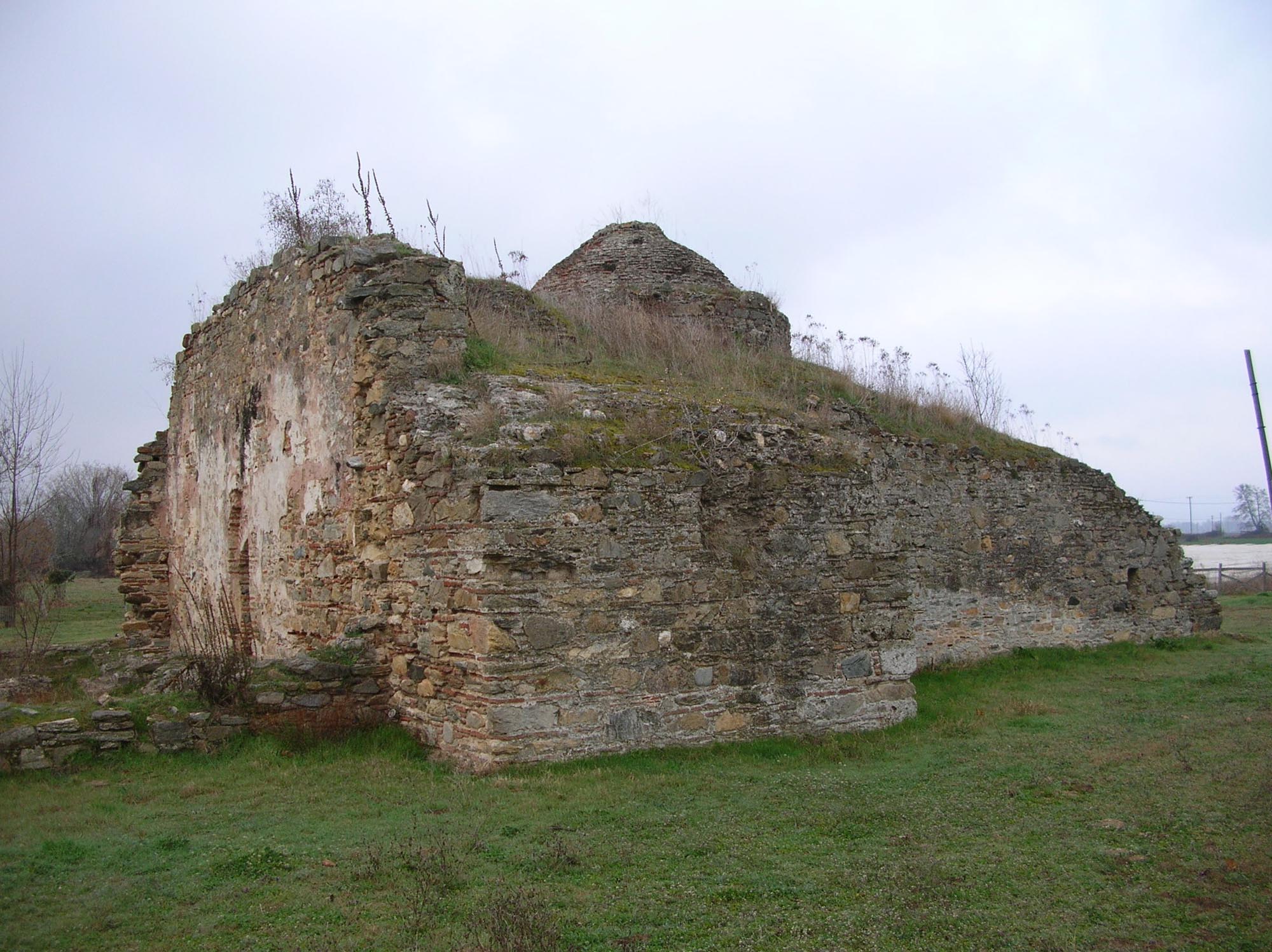
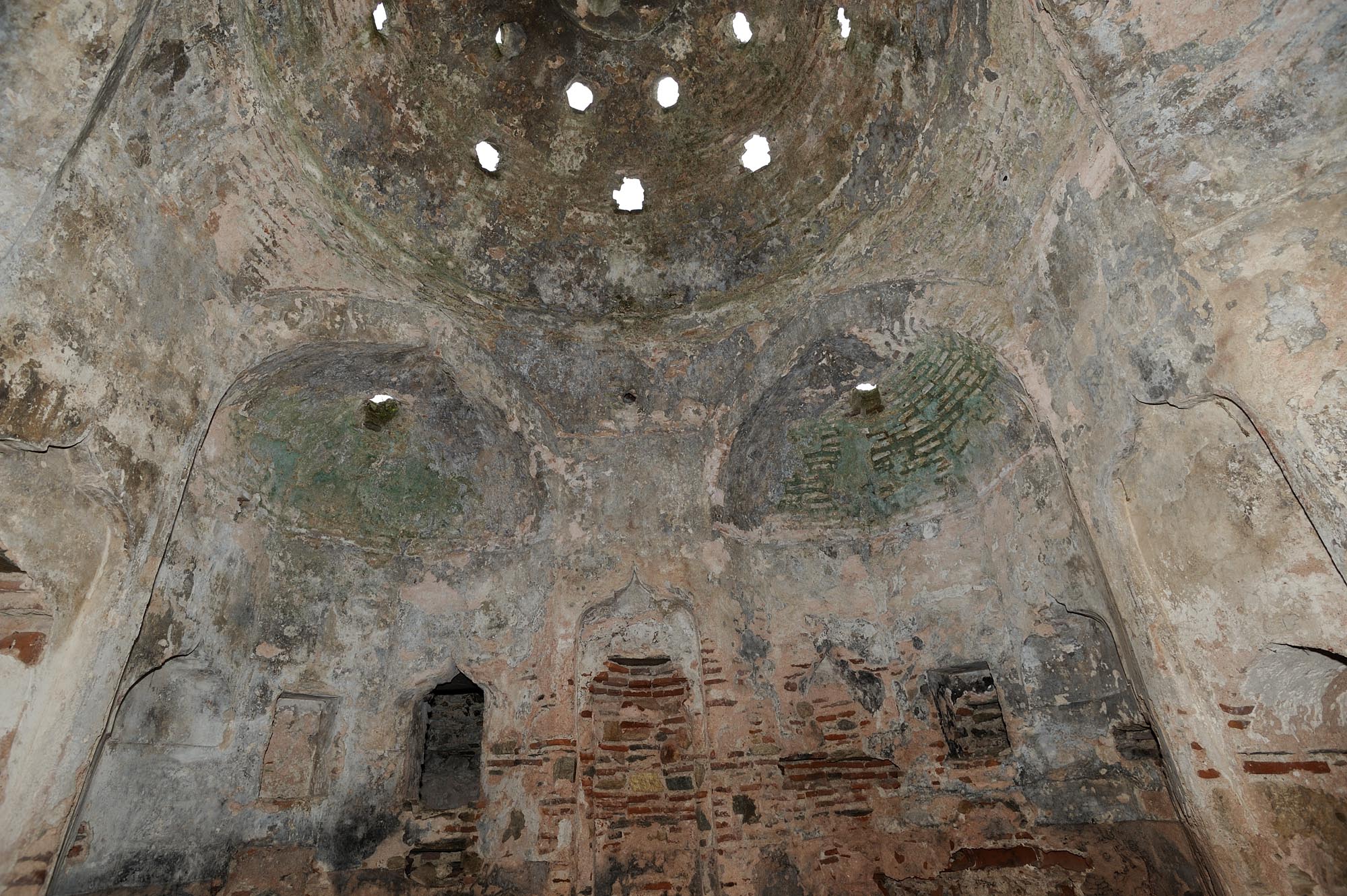
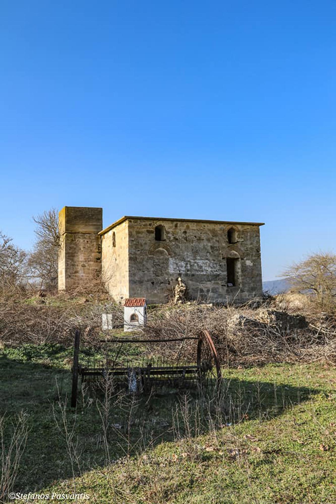
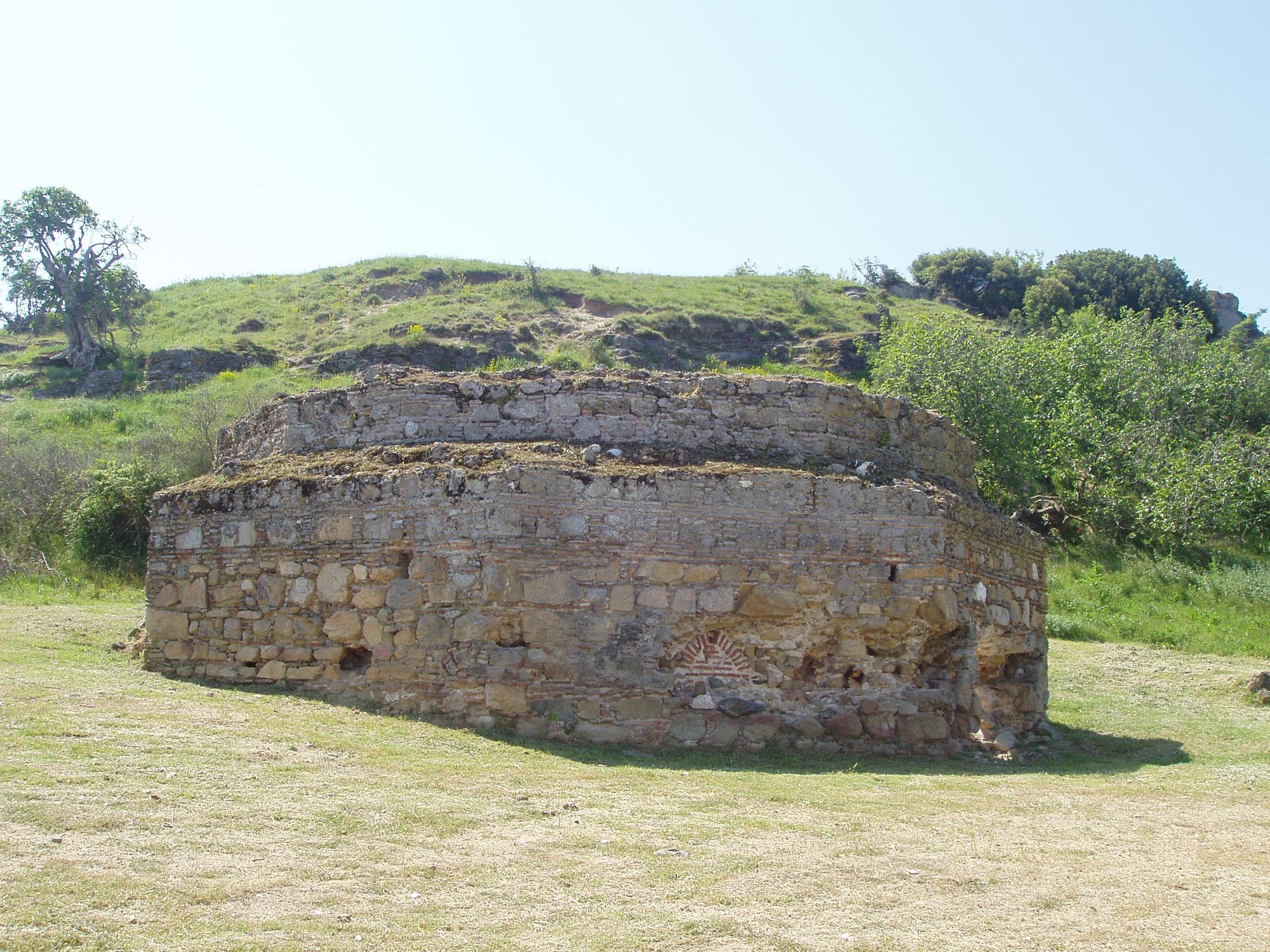
The commercial traffic of Pazarouda was served by the charitable building complex consisting of a mosque, a han and a hammam, which is preserved today in the village of Apollonia. The complex was built during the reign of Sultan Selim II (1566-1574) at the expense of Grand Vizier Şokolli Muhammad Pasha, who, as noted in a register of 1568, bought the village, which had previously been arable land, incorporating it into his a vakıf. According to Evliya Çelebi, he also erected other religious and public buildings on the town,such as charitable houses, a teaching house, a school, a tekke (dervish house) and an imâret(poorhouse). . These buildings, as Evliya Çelebi notes, contributed to the growth of the settlement from “a prosperous, beautiful and well-built town (kasaba)” into a “real city… that is becoming ever more prosperous”. The existence of infrastructure in Pazarouda for serving travellers is, it has been argued, linked to the fact that the “left arm” (Sol Kol) of the Via Egnatia, which ran across southern Macedonia, passed through the town, at least in the 16th century.
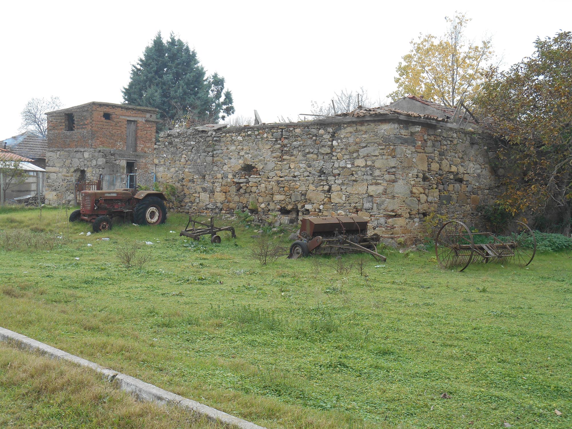
In the following centuries, Pazarouda was a charcoal-burners’ village, whose inhabitants were obliged to deliver a certain quantity of coal to the Ottoman authorities each year. In the late 17th and early 18th century, the inhabitants of the settlement were recorded as hânekeşan, meaning that they paid extraordinary taxes. The inhabitants were required to deliver a quantity of saltpetre to the Ottoman authorities each year for use in the state-owned gunpowder factory. During the Greek Revolution of 1821, the settlement was ravaged by the troops of Bayram Pasha.
Complex of Şokolli Muhammad Pasha
The mosque and han of the complex are located within the settlement, while the hammam is relatively isolated, on the outskirts of the town.
The mosque has a square plan, 10.30 m on a side, which is extended by the addition of a spacious portico on the west side. In the northwest corner is the minaret, of which only the base is preserved today. The monument was originally roofed with a dome, which has been replaced today by a reinforced concrete slab. It is built in pseudo-isodomic masonry.
The han, a long building measuring 47 x 20.4 m, is the worst preserved of the three monuments of the complex. Only the outer walls of the building survive in a fragmentary state and to a low height, while the west wall has been incorporated into the masonry of a modern house. There was a gallery on the north side, probably for stabling pack animals.
The hammam is a long building with external dimensions of 28 x 8.7 m. The functional spaces are arranged on a north-south axis and follow the typical sequence of bathhouse rooms. On the north is the cold room, now in ruins. Next comes the warm room and finally the hot room. At the north end of the building is the water tank and the furnace for heating the water. Two main building phases can be identified, not far removed from each other.
It has been argued that architectural design of the complex may be linked to the work of the imperial architect Sinan.
Podium of St Paul the Apostle
The hammam of the complex of Şokolli Muhammad Pasha is located within a wider archaeological site which includes the so-called Podium of St Paul the Apostle, the rock from which, according to tradition, the Apostle preached on his way from Amphipolis to Thessaloniki. On the rock grows a large plane tree which has been a listed natural monument since 1985. In the same year, the archaeological site of Apollonia was declared a listed historical monument. It includes the remains of a Roman/Early Christian wall and an old paved road, a little further away than the Podium of St Paul the Apostle, which may have been part of the Via Egnatia.
Nea Apollonia
Nea Apollonia was founded in the Ottoman period, being mentioned in sources as early as the 16th century as Eğribucak-Gaina and Eğribucak. The village was inhabited by Yörüks, Turkish nomadic populations who were moved by the Ottoman authorities for reasons of political expediency to areas abandoned by their Christian inhabitants, from the late 14th to the late 16th century. Like Apollonia (Pazarouda), in the 17th-18th centuries it was a charcoal-burners’ village.
Loutra (settlement)
On the south shore of Lake Volvi is the village of Loutra, an important centre of spa tourism today, thanks to the thermal springs that rise in the area. Evliya Çelebi praises the “very hot spring” of Lake Volvi, emphasising its therapeutic properties for those suffering from leprosy and syphilis. The Ottoman bathhouse that is still preserved today between the villages of Apollonia and Loutra, near the south shore of Lake Volvi, is associated with the local springs.
Bathhouse between Apollonia and Loutra
The bath has an octagonal plan and is roofed with a hemispherical dome, most of which has collapsed. It dates to the 16th century and it is built in cloisonné masonry of stone blocks enclosed by bricks.


