Acropolis of Kastritsa
Fortified hill of Kastritsa, an “archaeological palimpsest” in the Ioannina basin
The archaeological site, open to the public, on the hill of Kastritsa, just west of the modern community of the same name and about 12 km from Ioannina, dominates the Ioannina basin, southeast of Lake Pamvotis (Lake of Ioannina). The naturally defensible craggy hill, rising 250 m above the surface of the lake, is an “archaeological palimpsest”, where human presence is recorded from prehistoric times to the modern era. On the north part of the hilltop, the remains of one of the largest fortified ancient cities of Epirus, covering an area of 34.5 hectares, are preserved to a considerable extent and height. The identification of the city remains problematic. Professor Sotirios Dakaris, who carried out the first excavations on the hill of Kastritsa in the 1950s, as well as other scholars, have suggested it is the city of Tecmon mentioned in ancient sources, but different views have also been expressed, for example that it is ancient Eurymenae.
The fortified city was built here due to the key strategic location of the hill, which overlooks the southern half of the Ioannina basin while controlling the ancient roads to and from Epirus to the north, Macedonia to the northwest, the Ambracian Gulf to the south, Thesprotia to the west and Thessaly to the east through the passes of Mount Driskos. It is also in visual contact with the ancient fortified city of Megalo Gardiki on the Kastri hill, northwest of Lake Pamvotis, which similarly controls the northwestern part of the Ioannina basin.
History
Human presence on the hill of Kastritsa is documented from prehistoric times. The topography of the area was quite different then: due to the fluctuating water level of Lake Pamvotis, the hill formed a small peninsula projecting into the lake. At the western foot of the hill is the Palaeolithic cave, one of the earliest sites in the Ioannina basin, where the first traces of habitation date from the Upper Palaeolithic Age (22000 BC). The next phase of occupation of the hill is during the Neolithic (5500-3200 BC), based on the excavation finds discovered in a drainage ditch at the foot of the hill and in a small cave at its north edge, now blocked by landslides.
At the eastern foot of the hill, excavations have also brought to light burials and the remains of an unfortified settlement, which was continuously inhabited from the Late Bronze Age (1600 BC) up to at least the Classical period (4th c. BC). This was when the Greek-speaking Molossians had already appeared in Epirus and settled in komai, agropastoral settlements whose remains have been discovered at various sites in the wider area. Movable finds of the same period have also been uncovered on the hilltop. However, according to the latest excavation data, the settlement there only became a strongly fortified city in the early 3rd century BC, during the reign of King Pyrrhus, a time when an extensive network of citadels was established in the Ioannina basin, serving as places of refuge for the people living in the scattered lowland komai. Various views have been put forward on the date of the city’s founding, linking it, for example, to the reforms of the Molossian King Tharrhypas (423-404 BC).
The fortified city of Kastritsa flourished especially after the middle of the 3rd century BC, when Apeiros or the Epirote Alliance (c. 329/5-233/2 BC), followed by the Epirote League (233/2-168 BC), allied federations of the city-states of Epirus, were formed. In 167 BC it was destroyed by the Romans as punishment for the assistance the Epirotes provided to Perseus, the last king of Macedon, during the Third Macedonian War. The city continued, however, to be inhabited in later Roman and Early Christian times, at least until the end of the 6th century. A late 4th- or early 5th-century stathmion (coin-weight) of copper alloy with silver inlay, bearing the images of two emperors, was found during the excavation of a large Early Christian edifice, probably a public building, on the hill of Kastritsa. It attests to the importance of the city in the Early Christian period, since its discovery presupposes the existence of a central administration – stathmia were officially certified measuring weights mainly used for weighing gold coins and precious metals.
In the 11th or 12th century, the Monastery of St John the Baptist was founded on a plateau on the west hillside, within the ancient walls. The monastery flourished during the Ottoman period. The church of St Athanasios on the southeast hillside was also built in Ottoman times. It was demolished during the Balkan Wars and rebuilt on the same site by the inhabitants of the modern village of Kastritsa after the incorporation of Ioannina into the Greek State (1913). In the first decades of the 20th century, the hill of Kastritsa, due to its key importance for the defence of the city of Ioannina, was incorporated in the Ottoman defences. These were organised in 1909-1912 by the German military mission under General Colmar von der Goltz and included the reinforcement of the defences of other fortified positions in the wider Ioannina basin. A series of fortification works were constructed on the hill of Kastritsa, including gun emplacements, trenches, ammunition depots, water cisterns and barracks.
Monuments
Fortifications
The wall of the Hellenistic city of Kastritsa, about 3 km long, has an elongated plan oriented north-south. It follows the contours of the hill, running around its north end, while on the west it descends the hillside almost to the level of the plain. It is preserved to a height of 2.5-5 m and has an average width of approximately 3.25 m. It consists of two stone faces with a filling of earth and rough stones or rubble. As is often the case with the ancient fortifications of Western Greece, the masonry is polygonal, being constructed of large dressed blocks of stone with more than four sides. Another distinctive feature is that the stone blocks are placed transversely at intervals (headers), to increase the stability of the wall. The masonry varies in places, following the isodomic or pseudo-isodomic system of regular courses, indicating different building phases; these are, however, difficult to date on the basis of the available excavation data. The repairs observed in some parts of the fortification, with extensive use of rough stones and mortar, date from the Byzantine and Ottoman periods.
The wall is reinforced with strong quadrilateral towers and angles along the south and southwest sides of the hill, where the slopes are less steep and therefore more vulnerable. The six gates at key points of the wall in naturally fortified positions, three on the east, one on the north and two on the southwest side, are also protected by towers and angles. The six gates are of monumental construction, with large stone blocks in the corners. The monumental tower at the eastern end of the south side stands out. It was originally rectangular but was reinforced in a later building phase with the addition of a triangular point, acquiring a five-sided plan with a spear-shaped point rarely seen in fortifications, with a total internal length of 24 m and a maximum thickness of 9 m at the base of the triangle. The modification and strengthening of the tower dates from the Roman invasion of Epirus in 167 BC, as the excavation revealed a destruction layer (“battle layer”) of that period outside the tower, with large concentrations of iron arrows, iron spearheads and stone balls used as siege engine projectiles.
Settlement
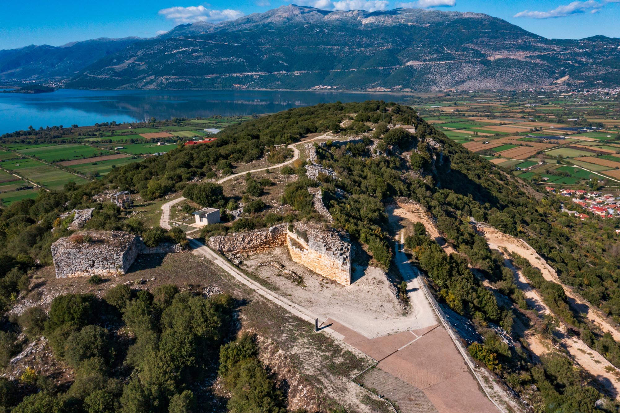
The excavation, which is limited to the south and southwest side of the citadel, covering an area of about 6 hectares, shows that the citadel was densely built up, with a free urban plan adapted to the sloping terrain and the rocky outcrops. The building insulae, in some cases supported by retaining walls, all face the same direction and are delimited by wide or narrow streets ranging from 1 to 4.5 m wide.
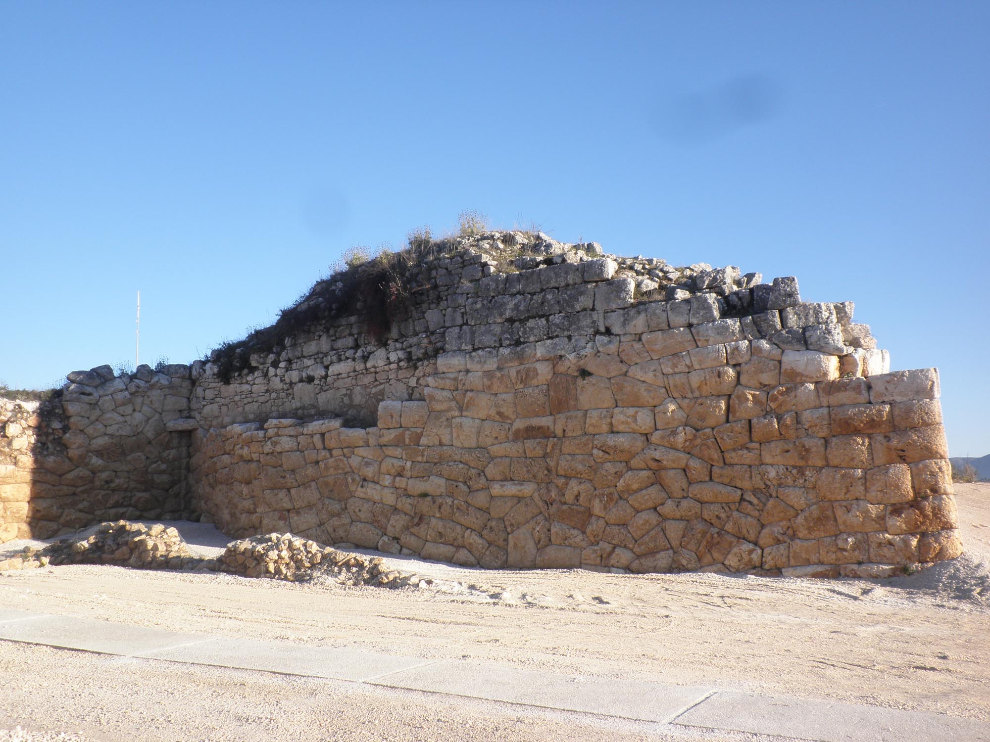
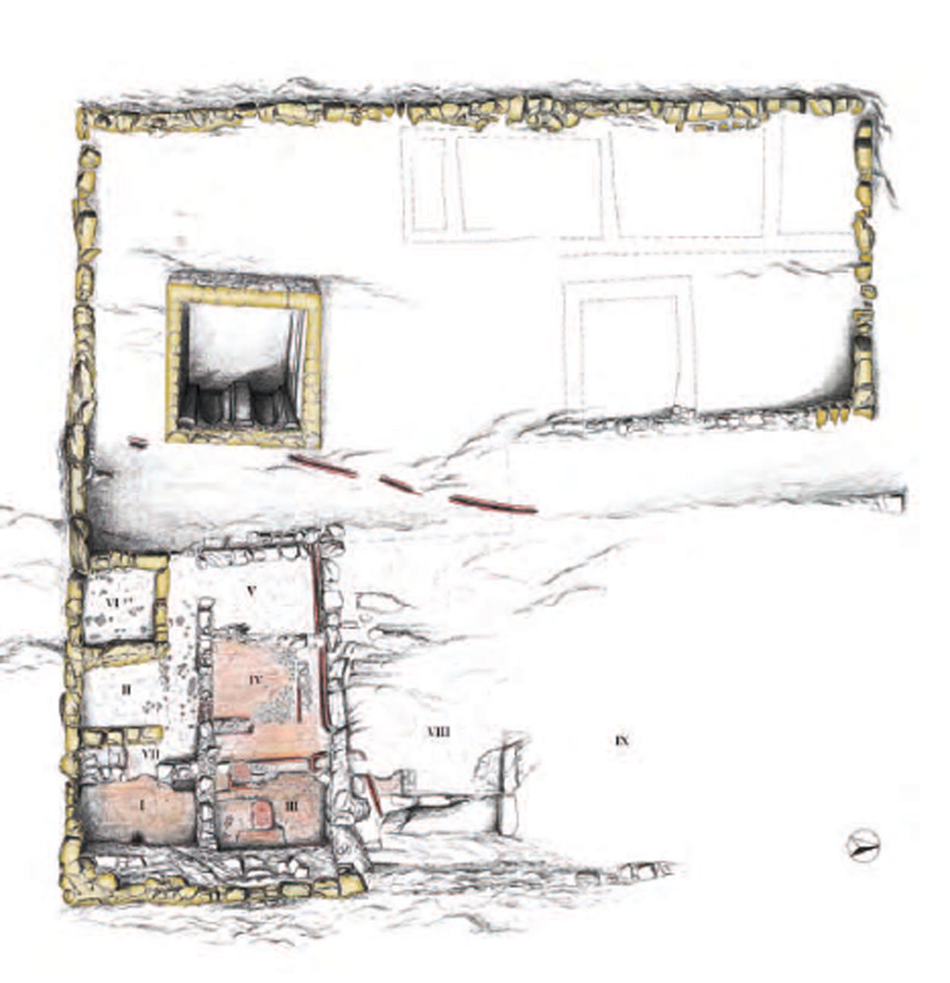
Particularly important excavation finds are the remains of four large building complexes, in continuous use from the early 3rd century BC to the late 6th century AD. During their long period of use, their external dimensions remained the same but extensive changes were made to their interior layout. The buildings are roughly square in plan, varying in size from 120 to 255 m2, and are built in polygonal masonry of large limestone blocks. Their internal layout features rooms symmetrically arranged on either side of a central corridor. They had tiled roofs.
Of the four building complexes, that conventionally named Complex E, with a total area of 1,024 m2, is delimited by main city roads. It was probably two storeys in height and had mosaic floors and ornamental brickwork, parts of which were uncovered during the excavation. The complex included an impressive cistern with a capacity of 85 cubic metres, and rooms with floors and walls lined with waterproof mortar, indicating the existence of bathing facilities. Some of the rooms were also used as workshops, as we see from the remains of a kiln and various other clay structures. The complex was supplied with water by a network of pipes carefully constructed. Complex Γ-ΣΤ-Ζ-H-Θ has a total area of approximately 1,120 m2. Its most interesting structure is the large Building C, which survives to a height of up to 2 m and features impressive monumental masonry of massive stone blocks.
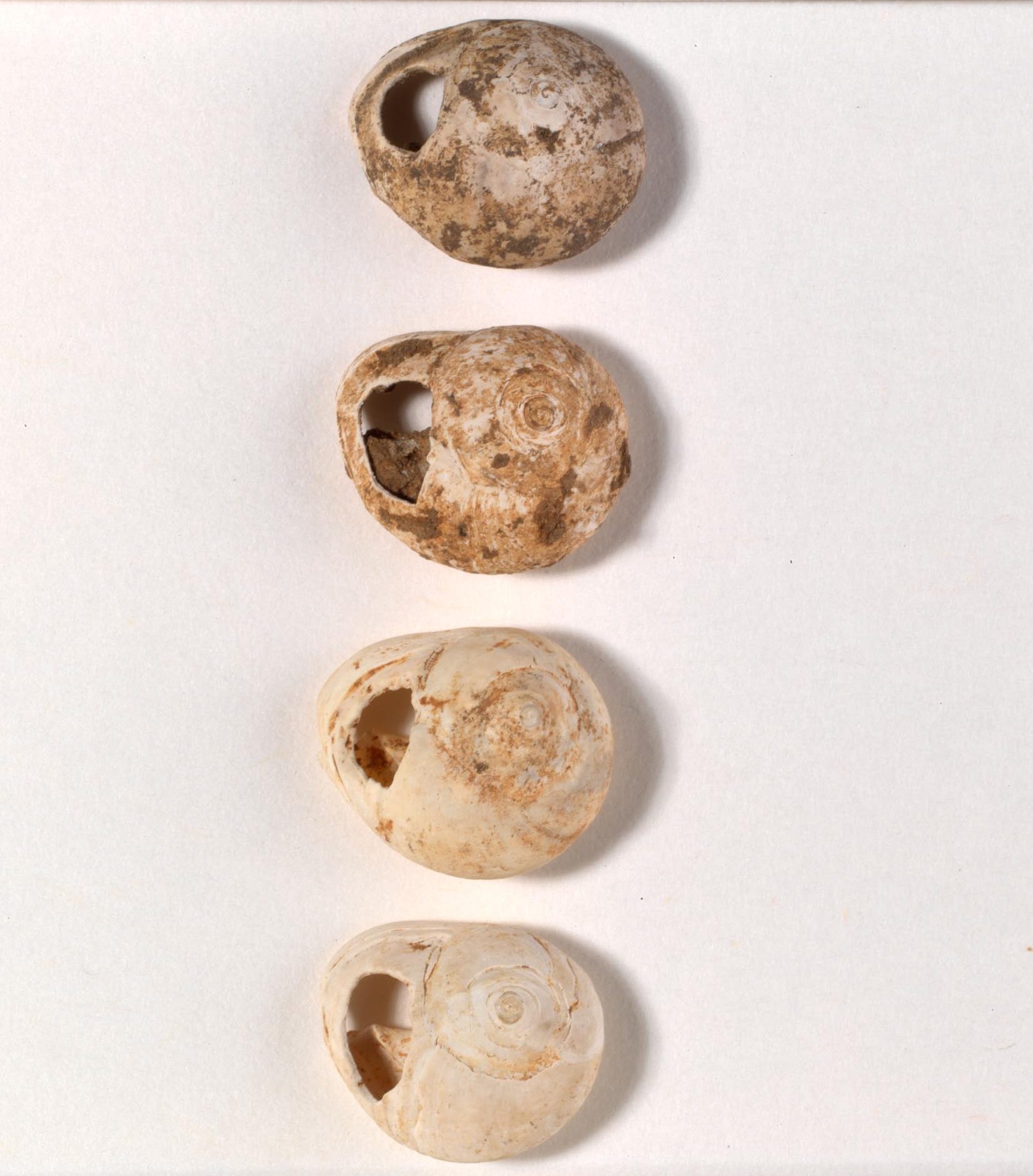
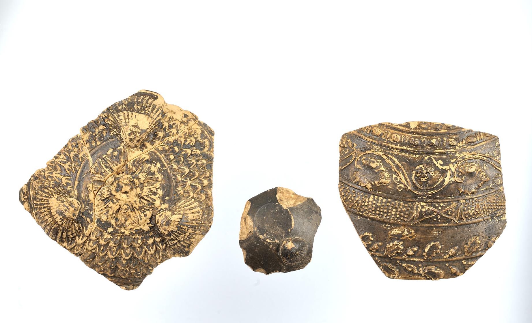
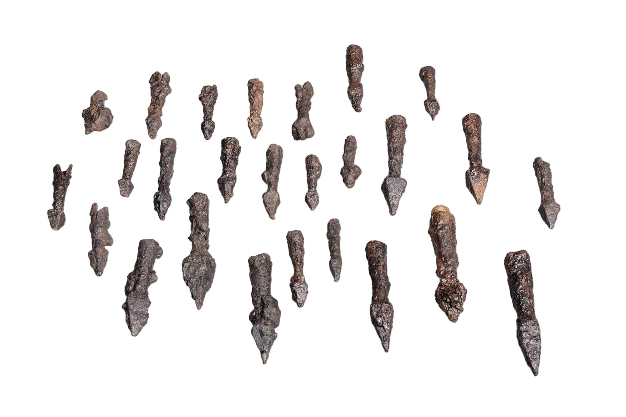
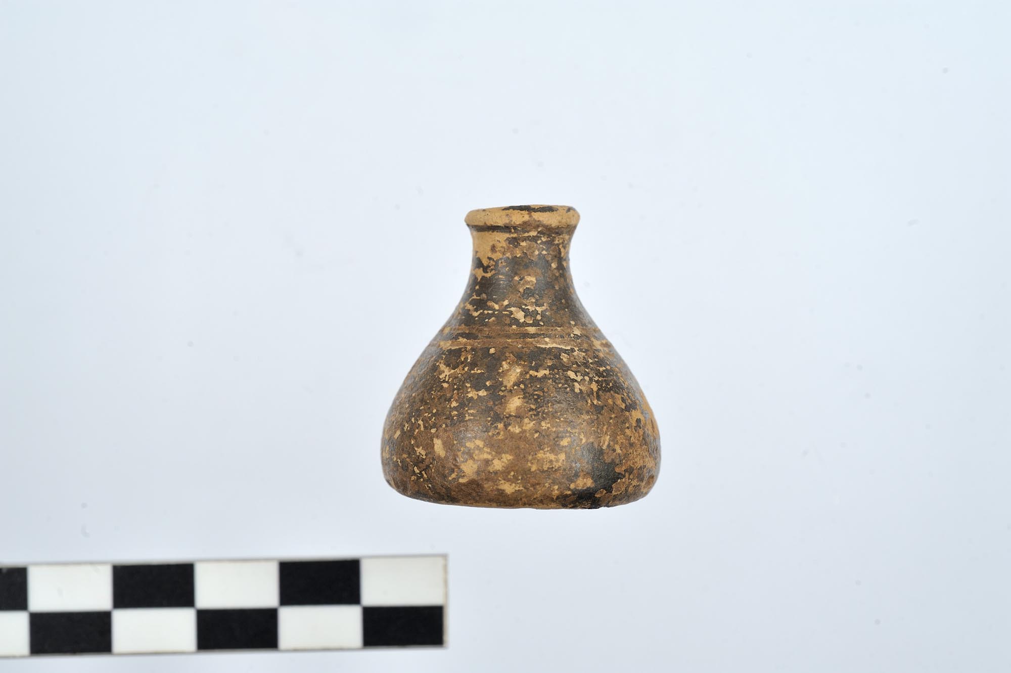
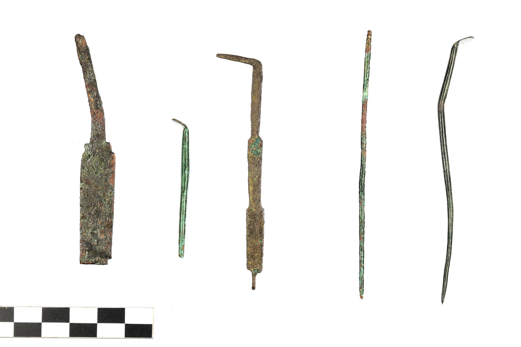
The movable excavation finds, such as the numerous clay loomweights and metal tools now exhibited in the Archaeological Museum of Ioannina, provide us with information on the occupations of the city’s inhabitants. The terracotta figurines are indicative of the practice of domestic worship, while two six-sided clay seals indicate craft activity.
A small number of graves found at the eastern and western foot of the hill indicate the location of the city cemeteries. A rich family tomb dating from the late 4th to the 1st half of the 3rd century BC, containing important grave goods, stands out.
Monastery of St John the Baptist
The monastery complex, on the western slop of the hill, which in its present form is the result of many modifications and extensions, is surrounded by a stone enclosure and includes various modern buildings, such as a church dedicated to the Dormition of the Virgin, a chapel of the Neomartyrs SS George and Philothei, monks’ cells and workshops. The katholikon, the oldest building of the complex (11th-12th c.) is dedicated to the Conception of St John the Baptist. It is a tetraconch church with a dome, containing 17th-century frescoes. A long, vaulted room with a lean-to tiled roof was later added on the west side, after the frescoes had been painted. The masonry includes a large amount of spolia from the hill of Kastritsa. The carved wooden templon features remarkable despotic icons of Christ and the Virgin, signed by the 16th-century Cretan painter Markos Strelitzas Bathas or Markos Vathas.
The monastery, which owned a large estate consisting of vineyards, mills, fields and pastures during the Ottoman period, was used as a military camp by the Ottomans in 1854 and the Greeks in 1913. It was converted into an orphanage in 1916. In 1932, Abbot Dorotheos was murdered by bandits and the monastery was abandoned until 1972, when it was reopened as a convent.
Palaeolithic Cave
This is one of the most important Palaeolithic sites in Greece, continuously occupied from the 22nd to the 16th or 13th millennium BC, a period when anatomically modern humans (Homo sapiens sapiens) predominated. The excavation of the deposits in the cave, which were up to 9 m thick, yielded rich finds including numerous stone and bone artefacts. Other interesting finds are shell or deer-tooth beads with dotted decoration, interpreted as symbols of social status and distinction.


