Abdera

Abdera, the city of Democritus

Abdera, built on a small peninsula on the Thracian coast, between the mouth of the River Nestos and Porto Lagos, was one of the most important and populous cities of ancient Thrace, a thriving and prosperous commercial centre. Ancient writers emphasise its importance compared to the other Thracian cities and note its favourable geographical location. The breadth of its commercial transactions is revealed by the wide circulation of its high-denomination coins bearing the griffin emblem, which have been found not only in the neighbouring cities of Macedonia and Thrace but also in distant lands such as Egypt, Syria and Mesopotamia. The rich movable finds from the excavations attest to the existence of notable local workshops and the high quality of Abderan art. The city’s intellectual influence was great and continuous; some of the most important figures of antiquity were born and were active here, such as the poets Anacreon and Nicaenetus, the mathematician Bion, the sophist Protagoras and the philosophers Leucippus, Hecataeus and Anaxarchus. The great pre-Socratic philosopher Democritus, considered the founder of modern atomic science, also came from Abdera.

Following the Roman conquest, from the 2nd century BC onwards, the once-glorious city gradually began to shrink. As in the case of other ancient coastal cities of Thrace, such as Zone and Maroneia, its decline was largely due to the construction and operation of the Via Egnatia, which reinforced land communications in the region, shifting the lucrative trade routes from the coast to the interior of Thrace.

History

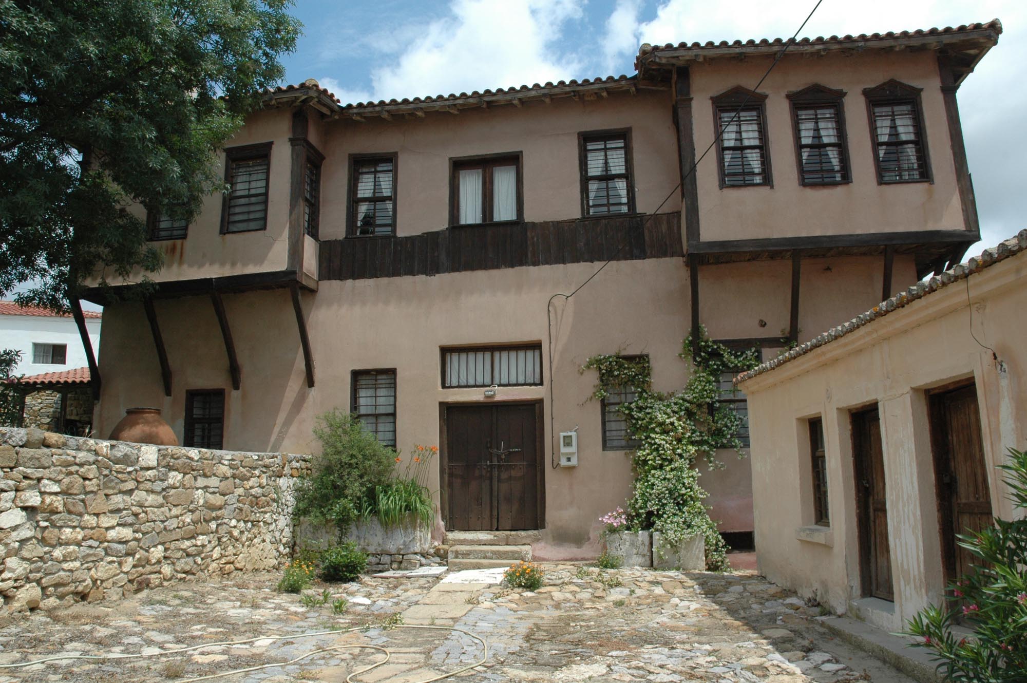
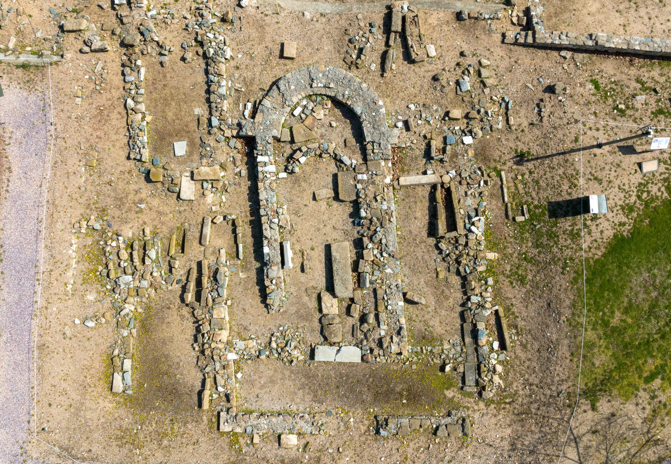
Legend has it that the founding of the city of Abdera is connected with the eighth labour of Hercules, the capture of the mares of Diomedes, the king of Thrace. The mythological tradition states that the city was founded by the hero himself, in honour of his companion Abderus, who was devoured by the man-eating horses of Diomedes. According to the literary evidence, the first settlement in the area was founded in 654 BC, during the Second Greek Colonisation, by Ionian settlers from Clazomenae in Asia Minor. This first venture of the Clazomenaeans, although successful in establishing a colony, was not consolidated, mainly due to attacks by local Thracian tribes. Around a century later, in 545 BC, there followed a second wave of Ionian colonists, this time from Teos, a city neighbouring Clazomenae. The Teian colonists settled in the sparsely populated fortified city founded by the Clazomenaeans and quickly established themselves, making their city the dominant power in the region. It is telling that in 491 BC, when the Persian general Mardonius conquered the Greek cities in the area, the port of Abdera served as a Persian base. King Xerxes was hosted here twice, in 480 and 479 BC, leaving a golden sword and a gilt tiara as counter-gifts.

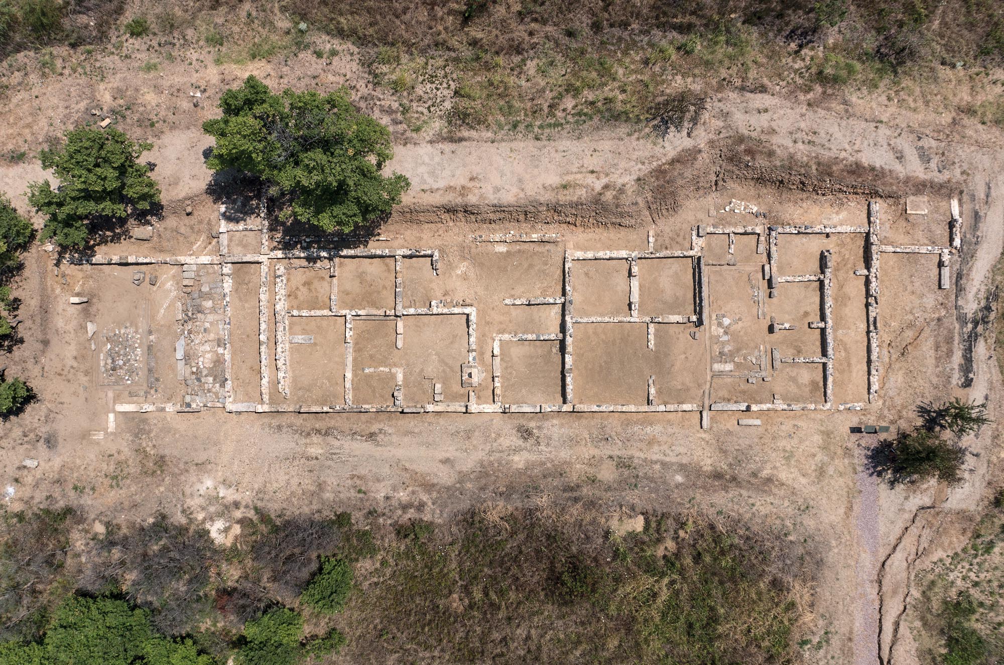
During the Classical period (5th-4th c. BC), after the Persian Wars, Abdera, now within the sphere of influence of the Athenians and a member of the First Athenian League, experienced a period of great prosperity and cultural flourishing. The city’s strength is attested by the high tax it was obliged to pay to the Athenian League. Key to its prosperity was the wide expanse of the Abderitis chora, the zone of rich arable land controlled by the city in the hinterland of Thrace, roughly corresponding to the southern part of the modern Regional Unit of Xanthi.

Νεκροταφείο των τύμβων, γυάλινο αλάβαστρο, τέλη 6ου-αρχές 5ου αι. π.Χ., ΕΦΑ Ξάνθης / Burial tumuli, Glass alabastron, late 6th- early 5th c., Ephorate of Antiquities of Xanthi
Σφραγιδόλιθος από καρνεόλη με παράσταση Απόλλωνα, από οικία του νότιου περιβόλου, ρωμαϊκή περίοδος, ΕΦΑ Ξάνθης / South Enclosure, insula of residencies. Carnelian seal-stone depicting Apollo, Roman period, Ephorate of Antiquities of Xanthi

Probably in 347/6 BC, Abdera, along with other cities of the Thracian coast, came definitively under the control of King Philip II of Macedon. During this period, the geophysical changes caused by the silting of the River Nestos forced the inhabitants to move the city of Abdera further south. The city was rebuilt from the start following a cohesive building programme, according to the Hippodamian Plan. With its two ports, it continued to prosper thanks to its commercial power.

In 170 BC, during the Third Macedonian War between the Macedonians and the Romans, Abdera was besieged by the Roman general Lucius Hortensius, who, together with the troops of Eumenes II of Pergamon, sacked the city. In 168 BC, after the Battle of Pydna and the Roman victory over the Macedonians, Abdera came under Roman rule, while retaining the privileged status of a “free city” (civitas libera). From then on, the city began to lose its former glory and shrink in size.

Later, in the first half of the 4th century AD, the population moved to the coastal hill of the acropolis. The shrinking of the city was due not only to historical circumstances but also to natural factors, particularly the formation of marshes and the rising ground level caused by the repeated flooding of the River Nestos. The elevated position of the acropolis was probably one of the reasons for choosing this part of the ancient city for the establishment of the Early Christian and the later Byzantine settlement.

In the 6th century AD, the city is mentioned in the Synecdemus of Hierocles (written before 535 AD) under its new name of Polystylon (“Abdera, now called Polystylon”). The sources then remain silent until 879 AD, when the city, under its new name, appears in the minutes of the Council of Constantinople as an episcopal see. From the 10th to the 12th century, Polystylon was listed as an episcopal see subject to the metropolitan see of Philippi. The change of name, it has been suggested, is probably due to the many columns (styloi) standing in the vast ruins of the ancient city.

During the Byzantine period, Polystylon developed into an important castle-city of the region, but not a particularly large one, being termed a “fortress” or “coastal town” in the sources. Its key geographical location played an important part in the development of the town during the Byzantine period, as it was the only port between Christopolis (present-day Kavala) and Poroi (present-day Porto Lagos), where two roads from the interior, one from Xantheia and one from Peritheorion (Anastasiopolis), ended.

In the 14th century, the city came to the forefront of the clashes and civil wars that shook Byzantium, following a similar course to neighbouring Peritheorion. In 1342, the city was rebuilt by John Kantakouzenos, to whom it remained a grateful ally during the Byzantine Civil War of 1341-1347, taking a stand against the Palaiologans. In the same year Apokaukos, a political rival of Kantakouzenos, captured Polystylon and reinforced the supporters of the Palaiologans there. It was around this time that his political rival, Emperor Andronikos III Palaiologos (1328-1341), rebuilt Peritheorion. In 1343, Umur Pasha, the Emir of Aydın and Smyrna, sent 15 ships to the port of Polystylon to aid Kantakouzenos. Three of the ships were destroyed in an attack on the city by the Bulgarian warlord Momchil. As in the case of Peritheorion, the civil wars and the continuous raids by Serbs, Bulgars and Ottomans led to the gradual decline of the city. In the late 1360s, the city, like the entire region of Xanthi, came under Serbian rule.

Κοιμητηριακή βασιλική, χάλκινος σταυρός-λειψανοθήκη, 9ος αι., ΕΦΑ Ξάνθης / Funerary basilica, bronze reliquary cross, 9th c., Ephorate of Antiquities of Xanthi

After the completion of the Ottoman conquest of Thrace in the late 14th century, the port of Polystylon seems to have remained in use, at least until the 16th century, as it is mentioned among the coastal settlements of Thrace in contemporary portolan charts. During the Ottoman period, the settlement of Polystylon was gradually abandoned, probably due to pirate raids, and its inhabitants founded the modern village of Abdera, about 7 km north of the coast. The date of foundation of the new settlement is unknown, but it should be placed before the early 18th century, when the oldest written testimony, an inscription of 1726 formerly set into the fountain in the village square, is dated. The name Bulustra, a corruption of the name Polystylon, was gradually applied to the new village; today, Bulustra is the name of the cape on which the ancient acropolis is built, in the archaeological site of Abdera. The new village quickly expanded, becoming a thriving settlement of the region by the mid-19th century. The majority of the population remained Christian. It acquired its present name, Abdera, after the incorporation of the region of Xanthi into the Greek State on 4 October 1919.

Πόρτο Λάγος, αρχαιολογικός χώρος Πόρων, φωτ. ΕΦΑ Ξάνθης / Porto Lagos, archaeological site of Poroi (phot. Ephorate of Antiquities of Xanthi)

MONUMENTS AND ANTIQUITIES

Archaeological site of Abdera

In recent centuries, only the walls of the Byzantine city remained visible in the archaeological site of Abdera. In 1887, the Austrian archaeologist Wilhelm Regel identified the ancient ruins as the ancient city of Abdera. The systematic excavations which began in 1950 and continue to this day have brought to light a large part of the ancient and Byzantine city, which was not always located in the same place during its long existence, nor was it the same size.

The archaeological site today includes the older North Enclosure, which surrounded the city in the Archaic and Classical periods (mid-7th to mid-4th c. BC), and the South Enclosure, which was built when the city was essentially re-founded in the mid-4th century BC south of the former, due to the silting up of the bay by sediments carried by the River Nestos. In the southwest part of the South Enclosure, at Cape Bulustra, rises the hill of the ancient acropolis, where the Byzantine Polystylon later developed. The cemeteries of the city, dating from the Archaic to the Hellenistic period, extend north of the archaeological site across a wide area of about 300 hectares.

The Νorth Εnclosure contains an area of 1,075 m2. Within the North Enclosure parts of the wall of the Clazomenaean colony (7th c. BC) and parts of the Teian wall (late 6th-early 5th c. BC) have come to light. There is also a shipshed of the same period, which stood at the northeast end of the harbour before the area became landlocked due to the silting of the River Nestos, and the remains of the sanctuary of Demeter and Kore (late 6th-late 4th c. BC).

The South Enclosure is quadrilateral and covers an area of approximately 1,125 m2. The excavation has revealed a large part the streets and houses of the town, which was built according to the Hippodamian Plan, as well as the remains of its two harbour facilities.

This part of the ancient city, which has so far been excavated more extensively than the rest, is the main archaeological site open to the public today. A large section of the ancient city walls has been uncovered here, including the impressive West Gate framed by two strong four-sided towers. The excavations have also brought to light a luxurious Roman bathhouse, a Roman funerary monument, a building identified as a store or shop for selling amphorae (since amphorae with pointed toes were found inside it), as well as shops and a workshop for the manufacture of clay figurines. Within the South Enclosure, a series of impressive residences have also been uncovered, including residences with paved courts and the so-called “House of the dolphins”, which bears an impressive mosaic floor with dolphins.

Πήλινο ειδώλιο κωμικού ηθοποιού, α΄ μισό 4ου αι. π.Χ., Αρχ. Μουσείο Αβδήρων / Τerracotta figurine of a comic actor, first half of the 4th c. BC., Archaeological Museum of Abdera

The remains of the ancient theatre of the city have been discovered on a hillside between the North and South Enclosure. The date of its construction is uncertain.

The excavation has brought to light numerous buildings of the Byzantine era, associated with the religious and public life of the castle-city, which developed on the site of the acropolis of the ancient city. The trapezoidal enceinte of the Byzantine castle-city that arose on the site of the ancient acropolis is preserved along almost its entire perimeter, which is about 800 m long. Most of the fortifications date from the Late Byzantine period and are associated with the building work carried out by John Kantakouzenos (1347-1354). However, earlier building phases of the Middle Byzantine period have also been identified.

The most important building of the excavation is considered to be the episcopal church, which was uncovered in the central part of the fortified city (late 10th-early 11th century). It is of the three-aisled basilica type and was built on the ruins of a three-aisled Early Christian basilica, which had an octagonal baptistery. Among the buildings uncovered within the walls are a single-nave church of the 12th century, and a 4th- or 5th-century bathhouse. Outside the city walls, near the western gate of the ancient city, a funerary basilica dated prior to the 9th century has been excavated; it was built in successive phases. Αn extensive cemetery arose around it, which was in use until the 11th to 12th century.

The village largely retains its old layout of narrow streets and houses with courtyards, forming closed blocks. It has two neighbourhoods, each with its own parish church, only one of which survives today (Church of St Paraskeve).

Nαός Αγίας Παρασκευής, ΕΦΑ Ξάνθης / Church of St Paraskeve, Ephorate of Antiquities of Xanthi

The church was built in 1845 and is a typical three-aisled timber-roofed basilica of the period. It is one of the few churches of this period that are preserved in the region, outside the city of Xanthi.


Το αρχοντικό Παμουκτσόγλου, ΕΦΑ Ξάνθης / The Pamouktsoglou mansion, Ephorate of Antiquities of Xanthi

The two-storey mansion, built around 1870 by the tobacco merchant Panagiotis Pamοuktsoglou, originally from Constantinople, is a typical example of the rich residences constructed in the village in the mid-19th century. The mansion, which has has been exemplarily restored, operates as a cultural center and it is used for educational purposes.

Museums

Archaeological Museum of Abdera
Νεκροταφείο τύμβων, χρυσό σκουλαρίκι με μορφή Νίκης, 3ος αι. π.Χ., Αρχ. Μουσείο Αβδήρων/Tumuli cemetery, gold earring in the form of Nike, 3rd c. BC, Archaeological Museum of Abdera

The Museum presents the development of the nearby ancient city through rich movable finds covering a wide chronological range, from its founding in the mid-7th century BC to its transformation into a Byzantine castle-city. The exhibits, representative of the daily life of an ancient Greek city, bear witness to the role that Abdera played in the region of Thrace and the ancient Greek world as whole.

The Museum is housed in the old Primary School of the modern village of Abdera, built in 1860. Objects related to the villagers’ traditional way of rural life are exhibited on the two floors.

Other stops in the Regional Unit of Xanthi

error: