Souli
Souli (Tetrachori), the historical homeland of the “unenslaved” and “unbowed” Souliotes
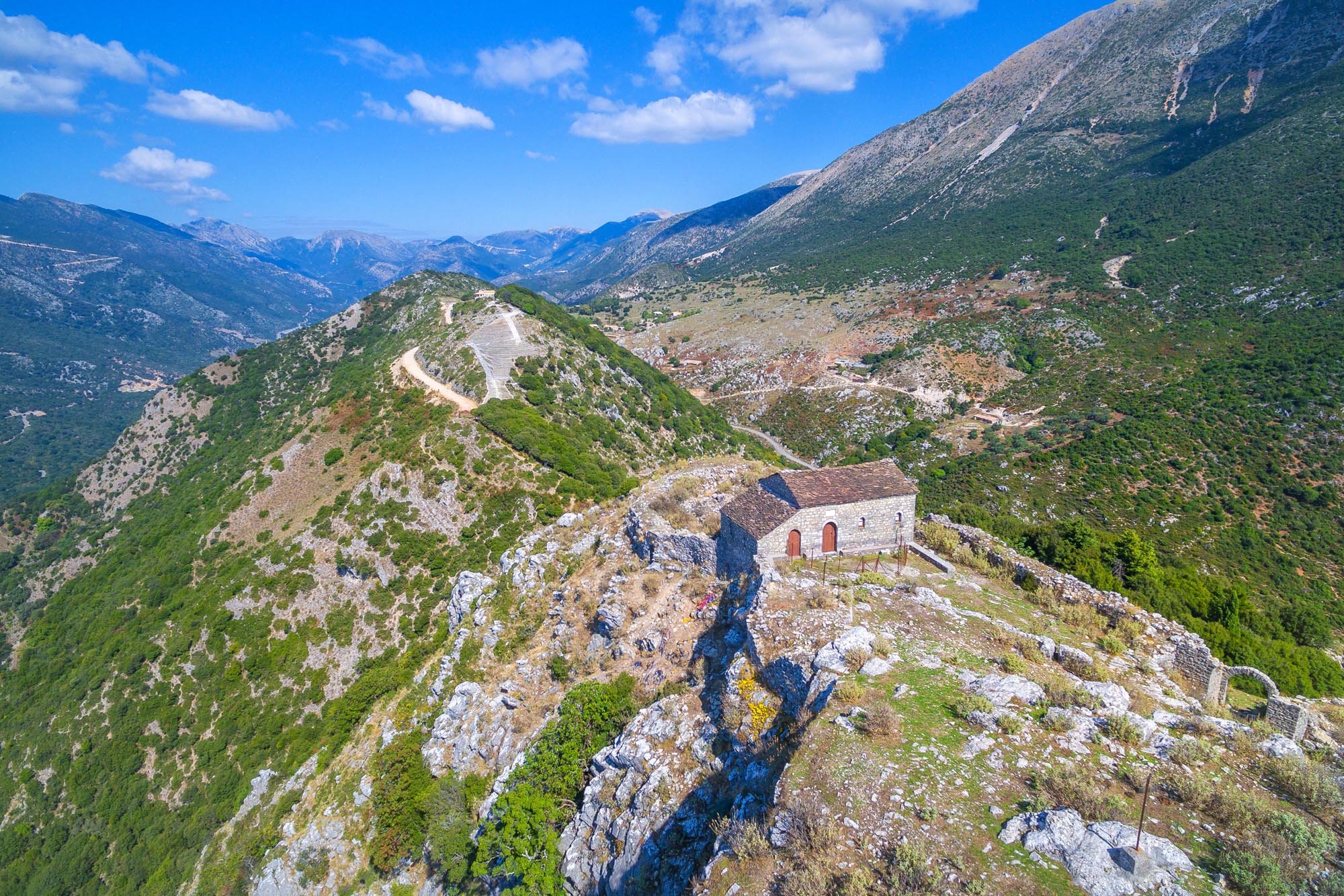
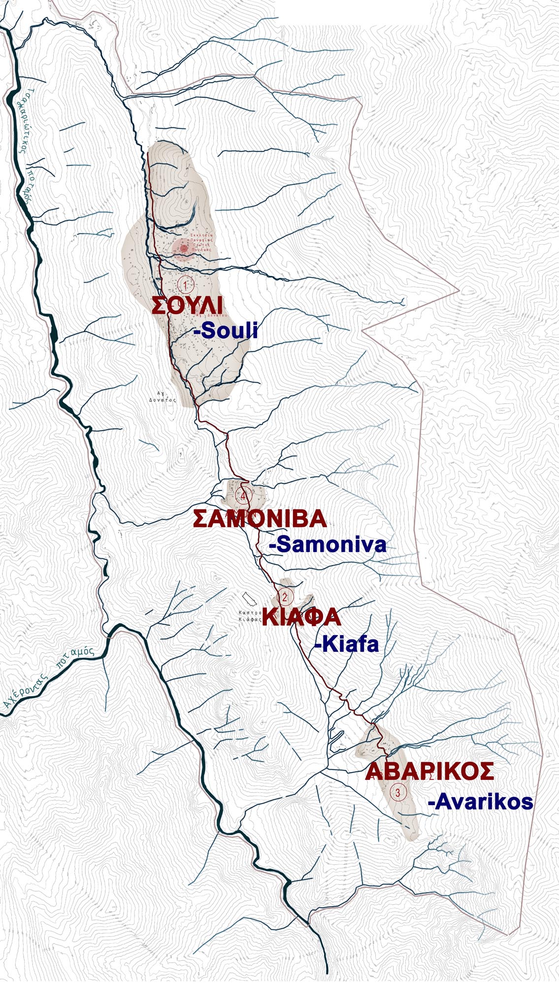
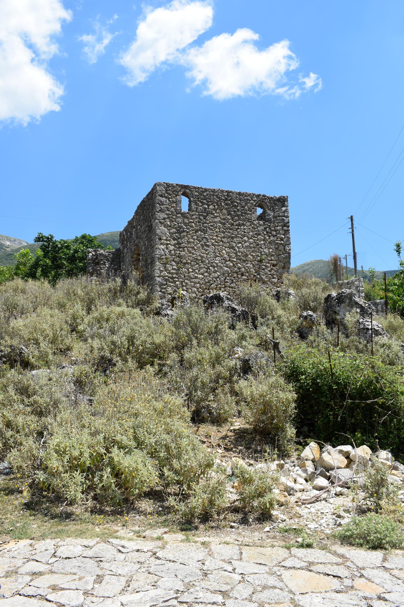
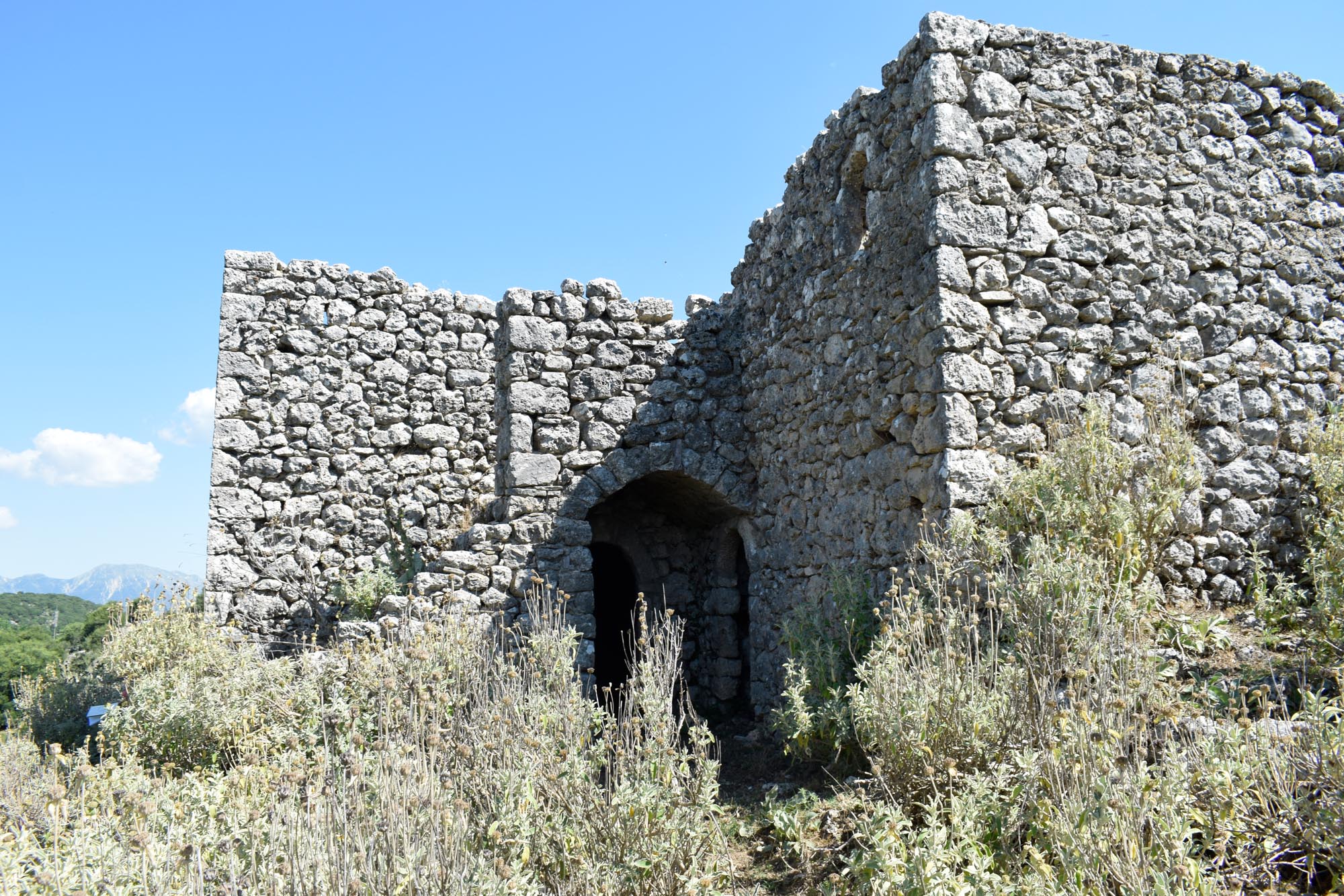
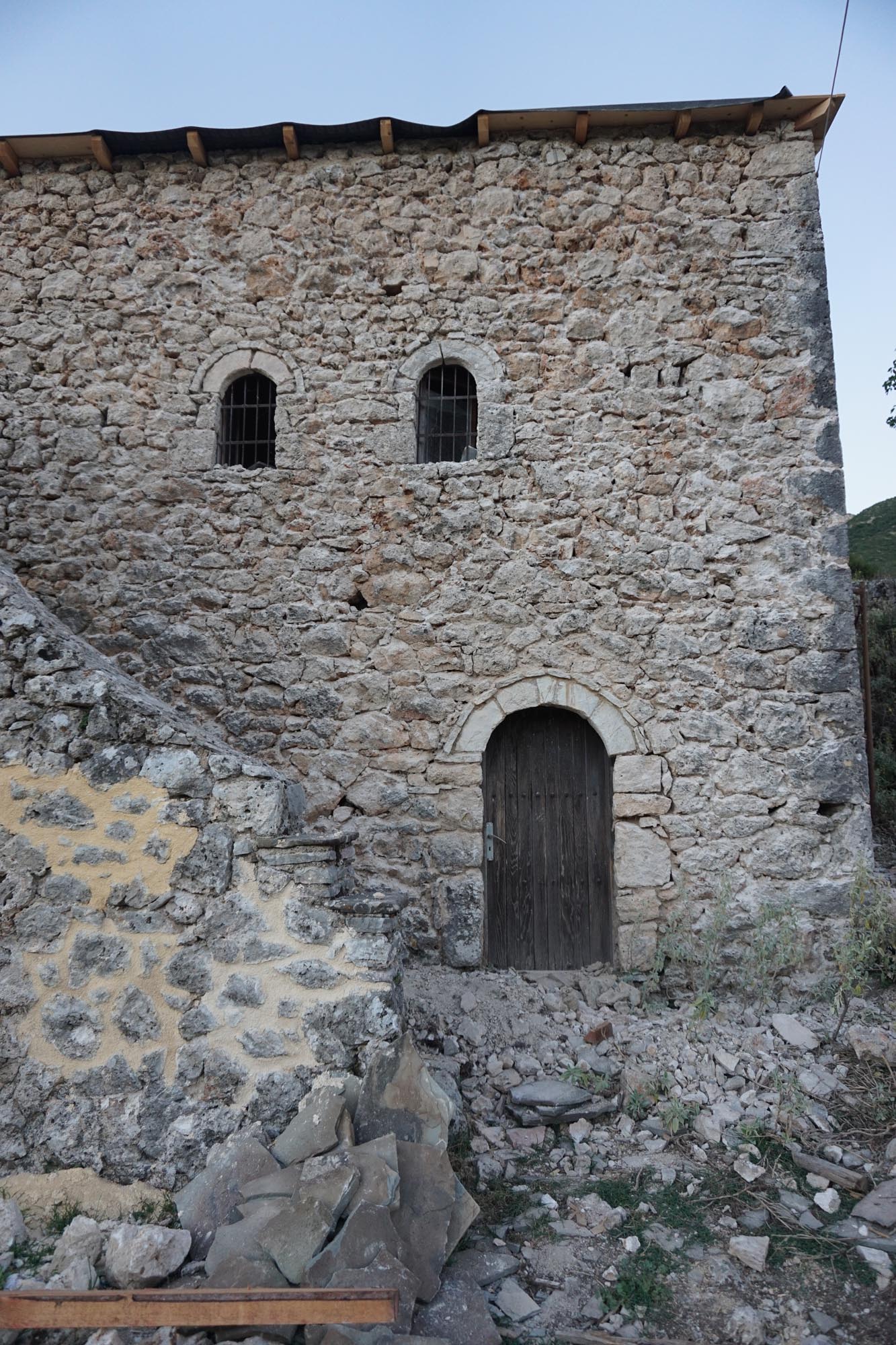
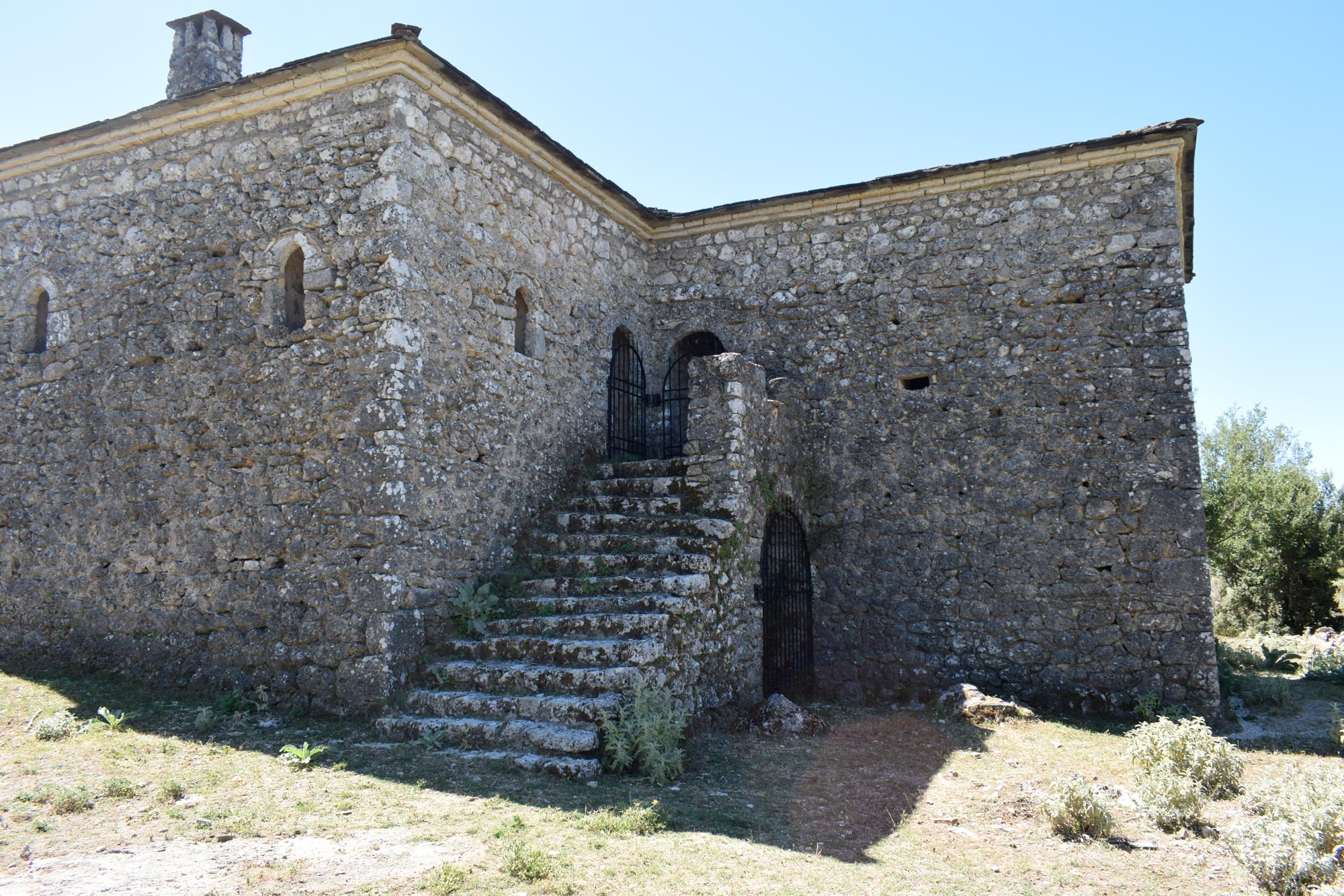
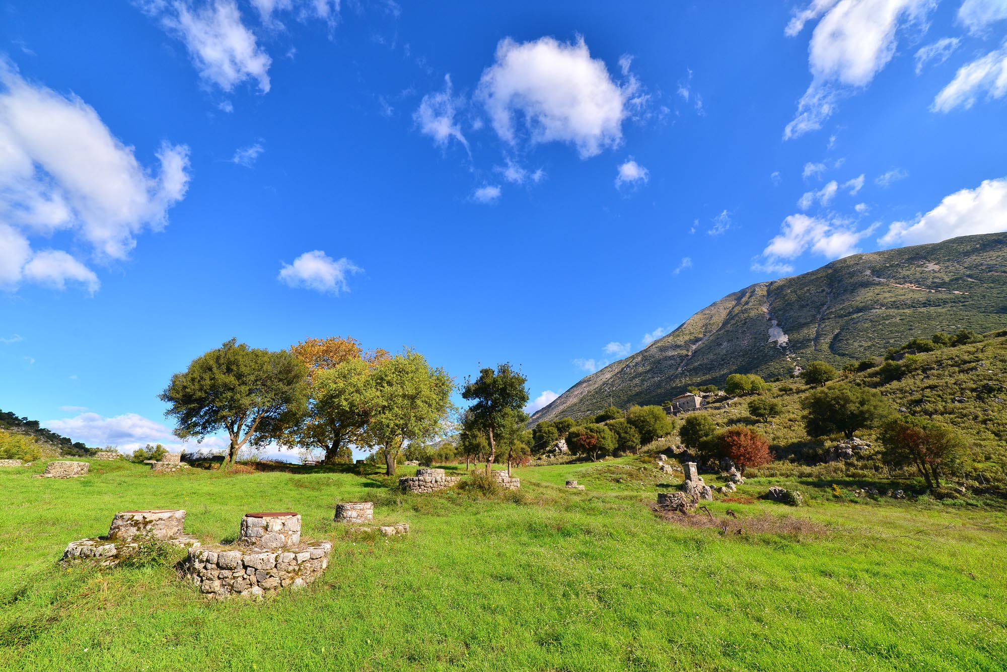
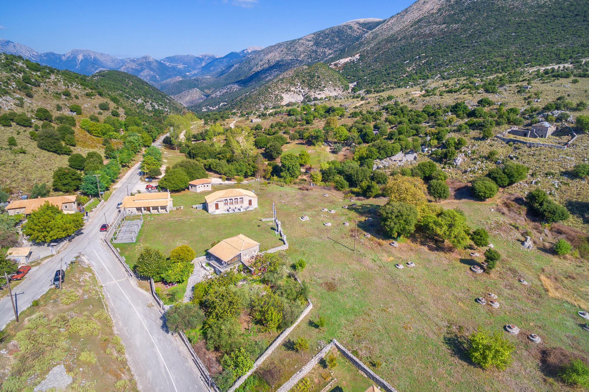
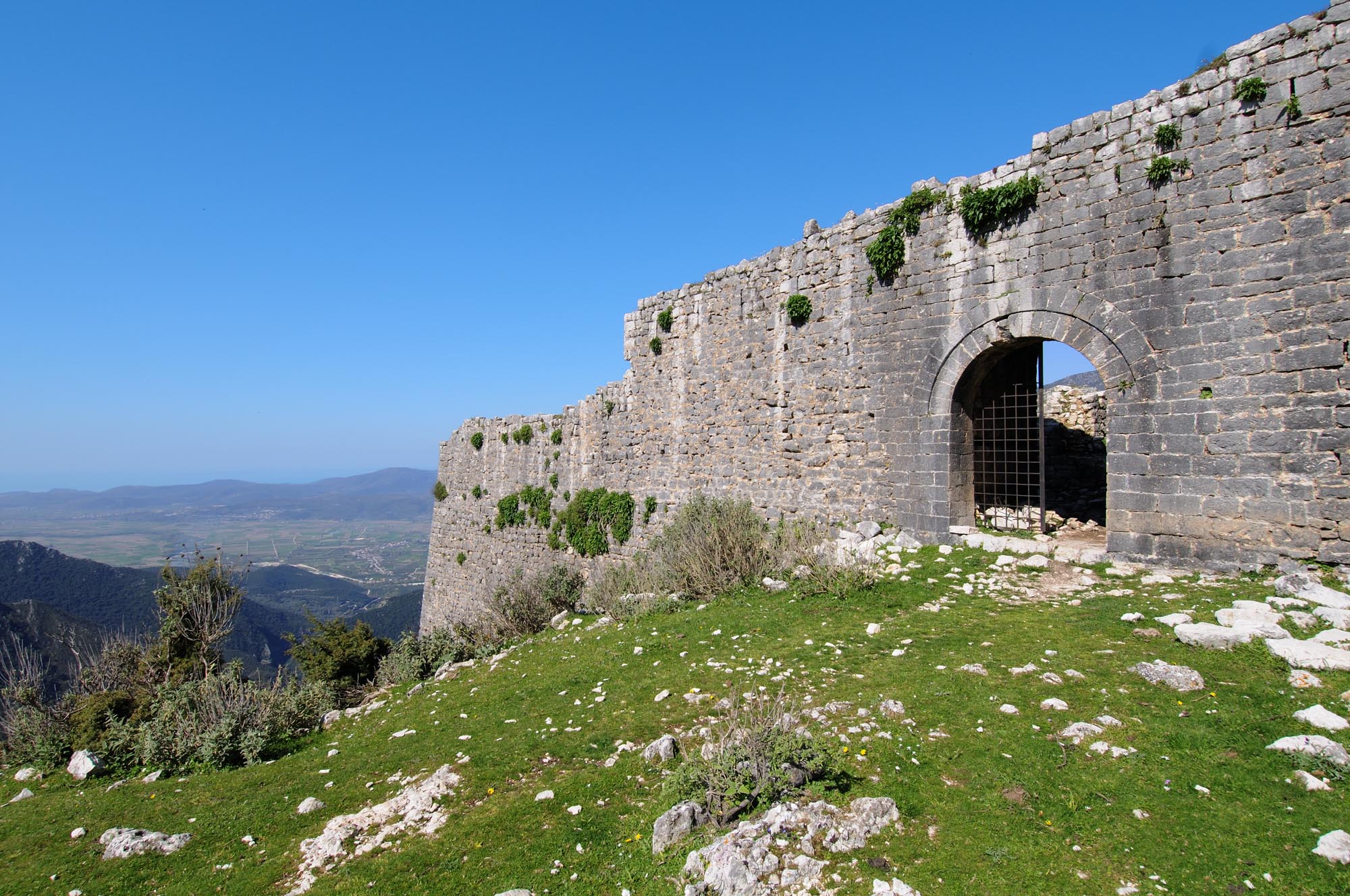
Souli, one of the most historically charged places of remembrance in Greece, identified in the Greek consciousness with the struggle for freedom from the Ottoman yoke and with timeless, universal values such as heroism and self-sacrifice, is a geographical unit consisting of four villages, collectively known as Tetrachori (literally “Four Villages”). The largest and oldest of these, where the most famous Souliote fares (clans) lived, is believed to be Souli, also known as Kakosouli, Megasouli, Paliochori or Pigadia. The name also gradually came to be applied to the other three villages of Tetrachori: Samoniva, Kiafa and Avarikos. The four villages lie along a north-south axis, at roughly the same altitude (600 m), on the rocky western slopes of the Souli Mountains, half an hour to an hour from each other on foot. Today, Kiafa and Avarikos are almost completely deserted, while in Souli and Samoniva, now designated the historic seat of the Municipality of Souli, there are only a few inhabitants, mainly shepherds. Over the years, lack of space led the Souliotes to establish seven more villages lower down the mountain; these are called Eptachori (“Seven Villages”).
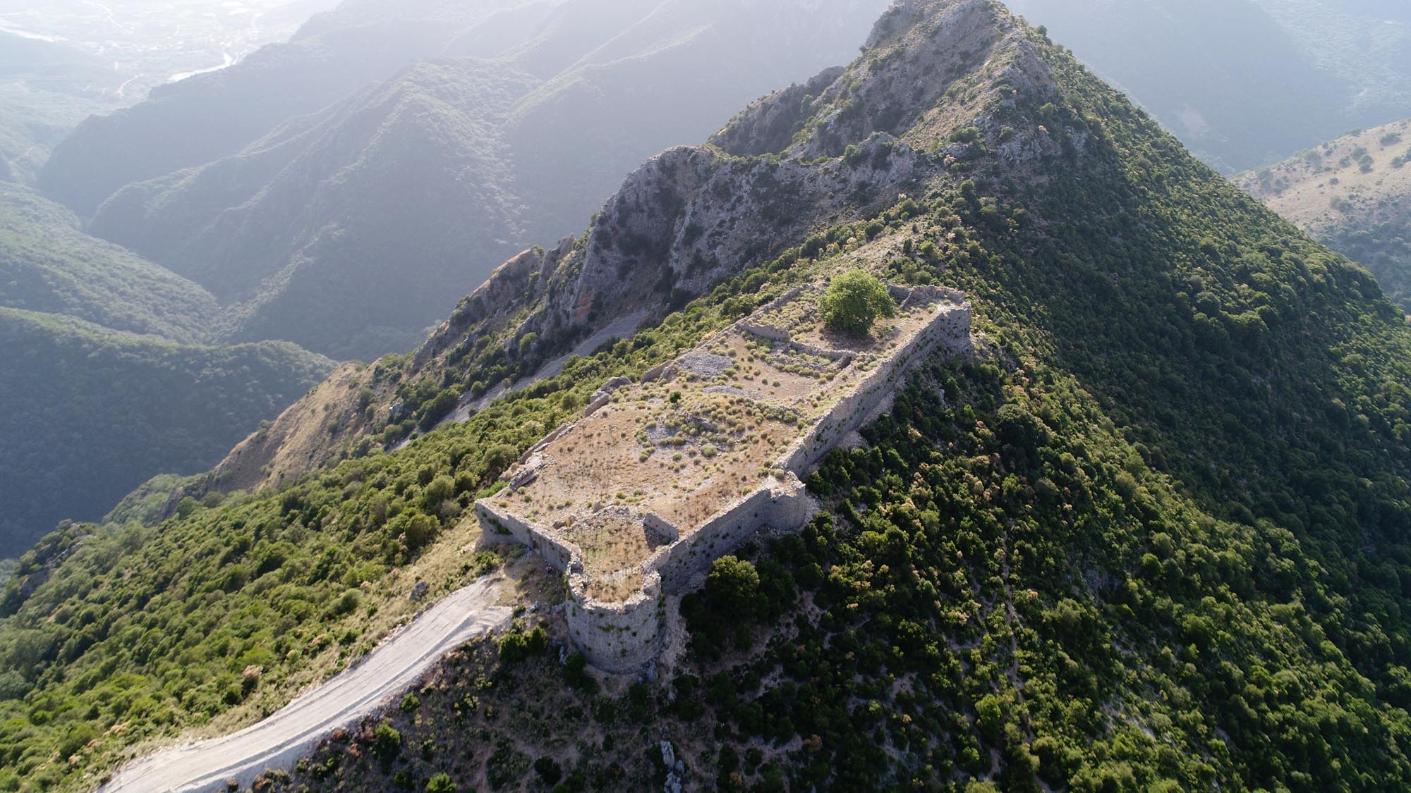
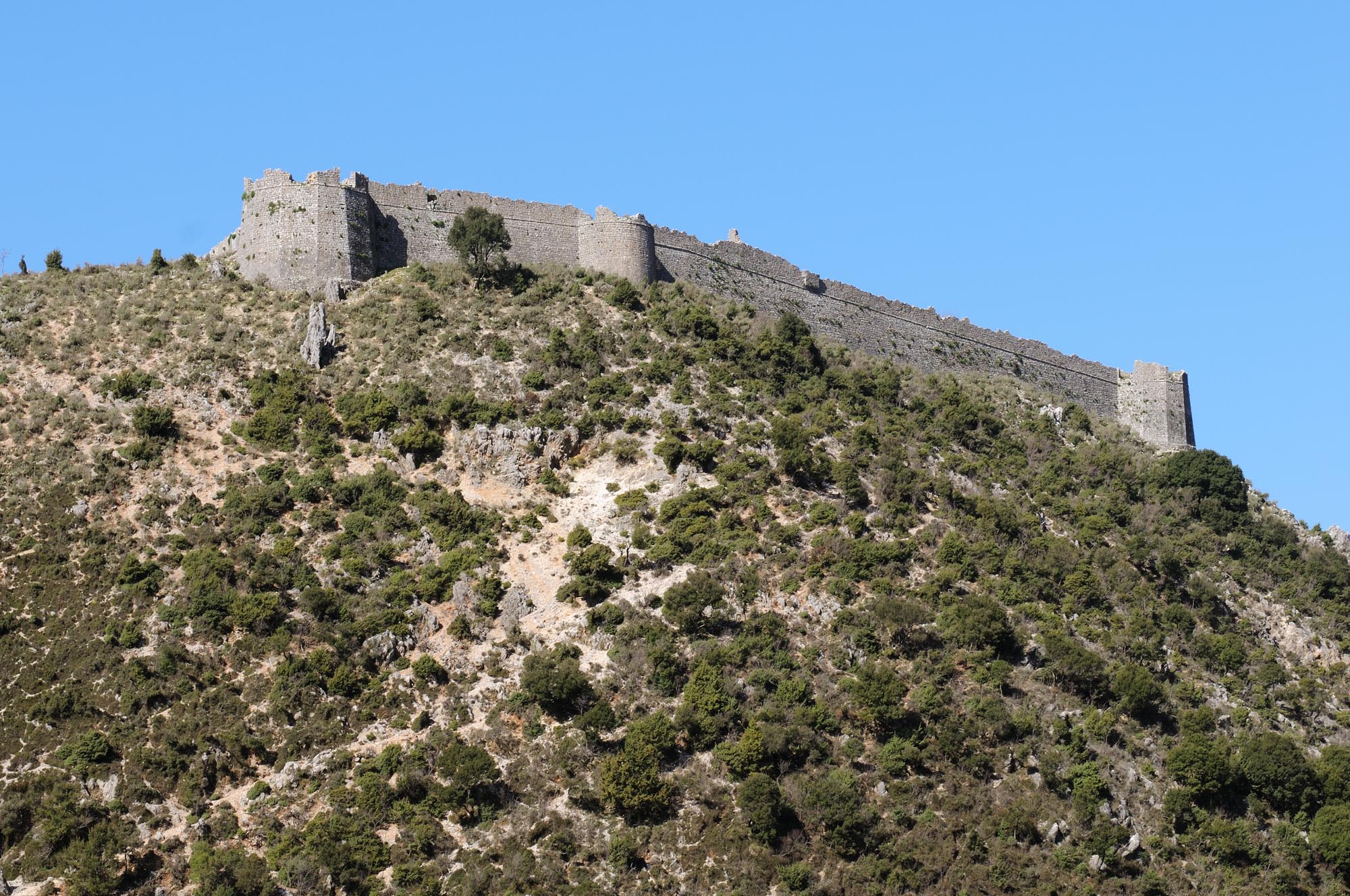
The region of Tetrachori is naturally inaccessible, as the Souli Mountains join the Paramythia Mountains to the north, forming a horseshoe shape and leaving only a single opening in the southwest, where the River Acheron flows down through the Acheron Straits, a gorge of outstanding natural beauty, emerging near the community of Glyki and the Fanari Plain. The villages of Tetrachori, surrounded by massive mountain ranges, lay far from the main road networks of Epirus. Even today, access by road via a highway with many hairpin bends, starting from the community of Glyki, is not easy. Communication between the inhabitants and the surrounding areas was formerly only possible along a series of steep, rough paths. One of the paths to the west, known as the Skala tis Tzavelainas (Tzavelaina’s Stairs), descended to the banks of the Acheron, Glyki and the Fanari valley, and from there to Paramythia or Parga – the villages of Souli were eight hours’ walk from both towns. To the east, a path between the high peaks of Voutsi and Mourga connected Souli, after a five-hour hike, with the Lakka Souliou, the fertile plain to the east of the Souli Mountains, and from there with the city of Ioannina, 14 hours’ walk from the villages of Souli. Today, part of the Skala tis Tzavelainas has been repaired and, together with other paths in the area, is used as a hiking trail.
Studies have found that, beyond the historical anthropogenic environment, the unique identity of Souli is composed of a palimpsest of multidimensional and diverse historical and cultural factors. Souliote society, consisting of warlike shepherds famed for their military prowess, was a bearer of oral culture, leaving few written documents. Thus questions such as the exact date when the Souliotes settled in the area, their place of origin, the nature of their military conflict with the Ottomans, and even the etymology of their name have long occupied historians, often giving rise to conflicting views.
History
Research has shown that the villages of Souli were established in the early or mid-17th century, if not earlier, by migrant pastoral groups of Albanian- and Greek-speaking Christians, who took to the inaccessible mountains of the region in order to escape Ottoman oppression and violence, as well as rivalries with the neighbouring pastoral populations. At the same time, the mountains of Souli provided pasturage for sheep farming, their main occupation. Souliote social organisation was based on the fares or clans, large organised kin groups. Each fara took the name of its founder and leader, who was chosen for his courage, prestige and wisdom. The inhabitants of Tetrachori constituted an autonomous privileged state, known to historians as the Souliote Confederacy. Public affairs were governed by customary law, which was exercised by council of elders (plekesia) composed of the heads of the clans.
The Souliotes were famed for their toughness, their indefatigability, their military prowess, their ability to fight in the dark and their self-sacrifice for the members of their clan. Skilled warriors, they ensured the protection of their villages and flocks, but also raided neighbouring populations, stealing sheep and agricultural produce. Around the middle of the 18th century, the oppressions of the Ottoman landowners led the Christians of the surrounding region to seek protection from the Souliotes in return for an annual payment in cash or in kind (agaliki). By the end of the century, the protection provided by the Souliotes had expanded to cover a large number of villages, many of which were wrested by the Souliotes by force of arms from the Ottoman ağas of Margariti, Paramythia and Ioannina. The historian Christoforos Perraivos, who was the first to publish the history of Souli in 1803, states that 66 villages, known as Parasoulia, had been conquered by the Souliotes in a wide radius of 10 to 40 km around the mountains of Souli, reaching as far as the Ioannina basin. The four villages of Skapeta (known as Skapetochoria) north of Tetrachori – Avlotopos (formerly Glavitsa), Koukoulioi (Kouklioi), Tsagari and Frosyni (formerly Koristiani) – were among the first to submit to Souliote authority, as did the villages of the Lakka Souliou.
The first military attempts of the Ottoman authorities to take Souli were made as early as 1731-1733, but these efforts, like those that followed, were doomed to failure. Ali Pasha of Ioannina, wishing to limit the power of the Souliotes, launched a series of military operations against them; the first was in 1789, just two years after he became Pasha of Ioannina. After two further unsuccessful attempts in 1792 and 1800, he decided to encircle and besiege Tetrachori. After several years of isolation, during which the Souliotes found themselves in dire straits, Veli Pasha, the son of Ali Pasha, led a fresh assault against them in August 1803. After fierce fighting, the Souliotes signed a treaty of surrender (12 December 1803).
The last defender of Souli was the hieromonk Samuel, who set the seal on the heroic resistance of the Souliotes by blowing up the powder magazine in the church of St Paraskeve on Kougi Hill, south of the village of Souli (16 December 1803). Most of the Souliotes fled to Parga and the Ionian Islands, but some clans agreed to settle in the territories under Ali Pasha’s jurisdiction. That same year, however, Ali Pasha broke his agreement and unleashed his troops against them. Word of the battles that followed and the self-sacrifice of the “invincible heroes and fervent defenders of freedom”, in the words of Adamantios Korais, at Zalongo and at the Tower of Dimoulas in Riniasa (modern Riza) in Preveza, as well as at the Monastery of the Dormition of the Virgin of Seltsos in Arta, quickly spread through the philhellenic circles of Europe and became a symbol of the struggle for freedom, defining not only Greek history and the national consciousness of the Greeks, but also modern Western thought.
After the departure of the Souliotes, Ali Pasha settled about 200 families of Muslim Labs (an Albanian tribal group) in Souli and built a series of fortresses and other fortifications, of which only the Castle of Kiafa is preserved today.
In July 1820, when the Sultan declared Ali Pasha guilty of high treason, many of the Souliotes who had fled to the Ionian Islands returned to Epirus to fight alongside the Sultan’s troops. The commander-in-chief of the Sultan’s forces, however, did not respect the terms of their agreement, forcing the Souliotes to ally themselves with their former persecutor Ali Pasha, who promised to restore Souli to them. The Souliotes returned to their beloved mountains in December of the same year, but their stay proved short-lived. In 1822, after the definitive defeat of Ali Pasha, Souli was besieged by the Sultan’s troops. The Souliotes were forced to capitulate and leave their homeland for good, dispersing to the Ionian Islands and then to Central Greece and the Peloponnese, where they actively participated in the Greek Revolution.
Monuments
After the final departure of the Souliotes in 1822, the only new buildings in the once-prosperous and populous four villages of Tetrachori were constructed for the limited needs of the few farmers who settled there, who built or renovated a small number of houses and stables. Thus today, the four villages, located in a unique and remote landscape, unmarked by modern interventions, largely retain their traditional layout and have been declared an archaeological site. The buildings are mainly houses and churches, most of which are now in ruins. It was formerly claimed that some of the buildings in the centre of the village of Souli were public (council house, courthouse, school and prison), but this view is not widely accepted today. The buildings of the four villages date from the late 18th or early 19th century, although some of them may be considerably older.
Houses
The houses of the four villages are not arranged according to a residential plan but are freely and quite widely scattered. Their distribution indicates that the various districts of the villages were established according to clan. The houses are of similar form and construction, always oriented in the same direction, with the longer part along the east-west axis. Perfectly blending into the rocky, arid landscape, they are made of local materials, with walls of simple rubble masonry. Meeting their occupants’ needs in a rudimentary manner, they are plain buildings, with a simple rectangular plan and unadorned fronts. Most are single-storey dwellings or have a partial upper storey, while two-storey buildings or those with more complex layouts are less common. A few of the two-storey houses have a square plan, following the architectural type of the towers and tower-houses (koulies) common in this period.
The defining characteristic of Souliote houses is their defensive aspect: they are provided with gun-loops and other fortification features, such as the wall with embrasures protecting the staircases leading to the upper storey (lotzes). The defensive nature of the houses is also served by the few openings and the high placement of the windows. It has been pointed out that the defences of the houses, and often the churches, too, were primarily intended to deal with internal rather external enemies, during conflicts between the warring Souliote clans, who practised the custom of blood vengeance (vendetta).
The restored houses of Lambros Tzavellas and Panos Bousis stand out among those in the village of Souli. The former, belonging to the famed family of Souliote chieftains, is occasionally used as a private exhibition space for the display of heirlooms of the Tzavellas family and that of Kitsos Botsaris.
Churches
The churches of Tetrachori, like the houses, are of simple architectural form. They are small or moderately-sized single-nave buildings, with a vaulted or timber roof, built in simple rubble masonry. The large parish churches which appear in the villages of the wider region during this period are absent from Souli. The sole exception is the ruined church of St Donatus on the northeast outskirts of Souli village, which was converted into a mosque by Ali Pasha and is relatively large (19.30 x 9.55 m).
Only a few of the churches of Tetrachori have been repaired or rebuilt from the ground up, to serve the devotional requirements of the few inhabitants of the area or as part of efforts to promote local history. These include the church of the Annunciation of the Virgin in Samoniva, the church of St Donatus south of Souli village (not the ruined church of the same name on the outskirts of the village), and the church of St Paraskeve on Kougi Hill, which was blown up in 1803.
Wells
A distinctive feature of Souliote architecture are the wells which supplied the villages with water, as the region is arid and lacks natural springs. Each family is thought to have had its own well. In the centre of Souli village 111 wells have been identified, all concentrated in the same area, of which 32 are still in operation today. They date from before 1772 and have a characteristic stone mouth consisting of two rings, a larger one at the base with a second, smaller one set on it.
Castle of Kiafa
The only surviving fortress of Ali Pasha’s extensive fortifications in the wider area of Souli was constructed in 1803 on the ridge of the hill above the village of Kiafa, overlooking the whole Souli plateau and the Acheron valley. It has a rectangular plan and measures approximately 150 x 50 m. Adapted to the terrain, its long sides are oriented northwest-southeast, parallel to the ridge. The fortified enclosure is tapered from the base to the crown, forming a sloping outer face. A rectangular cordon runs around the wall at the point where the sloping scarp joins the parapet with its cannon embrasures. The main castle gate is on the southeast narrow side, at the end of the path leading up from the village of Kiafa. There is a second gate in the thickness of the northwest narrow side, the upper part of which has collapsed. The two long sides of the fortification have an inner wall-walk. That on the northeast long side, facing the less steep hillside, is wider and higher than that on the southwest. The northeast wall is reinforced with two polygonal and one semicircular bastion with embrasures. The southwest long wall, facing the cliff, has only a single rectangular tower. The inner wall-walk on this side has a row of 23 vaulted, rectangular underground spaces which were probably used as storerooms, living quarters and shelters. Two transverse walls divide the inside of the fortress into three sections; Ali Pasha built a saray (palace) in the middle section. Today, apart from a few ruins, none of the buildings inside the castle survive.
Watermills
Along the banks of the Tsagariotikos (or Dala) stream, which runs west of the villages of Tetrachori, between the Paramythia Mountains and the Souli Mountains, stood seven watermills which were used until the 1970s to grind the grain of the inhabitants of the surrounding villages. The best preserved is the two-storey Mill of Soulis, in a landscape of outstanding natural beauty. The Dala watermill, which is in a dilapidated state, is interesting for the many gun-loops in its walls. The stone arched Dala Bridge once stood near the watermill, but it has collapsed in recent decades.
Church of St Kyriaki, Avlopotamos
In Avlopotamos, one of the Skapetochoria of Souli, where important antiquities have been found, is preserved the cross-vaulted church of St Kyriaki. The church, dating from the early 17th century, has a later narthex on the west and a hayat (open portico) along its south side. Late-17th-century frescoes are preserved in the sanctuary. The frescoes in the rest of the church were painted in 1915 by the painter Pavlos Giannoulis from Konitsa.


