Igoumenitsa
Igoumenitsa, the starting-point of the modern Egnatia Motorway
Κτισμένη στον μυχό του ομώνυμου κόλπου, η Ηγουμενίτσα, έδρα σήμερα του ομώνυμου Δήμου και πρωτεύουσα της Π.Ε. Θεσπρωτίας, αποτελεί το μεγαλύτερο οικονομικό και διοικητικό κέντρο της περιοχής. Πρόκειται για μία σχετικά καινούρια πόλη, που ανοικοδομήθηκε μετά την ενσωμάτωση της περιοχής στο Ελληνικό κράτος (1913). Τις τελευταίες δεκαετίες, η πόλη, με πληθυσμό 10.000 περίπου κατοίκους, έχει επεκταθεί προς όλες τις κατευθύνσεις, συμπεριλαμβάνοντας σε ενιαίο οικιστικό σύνολο τα τοπικά διαμερίσματα των Αμπελιών, της Νέας Σελεύκειας, της Εθνικής Αντιστάσεως στα βόρεια, του Λαδοχωρίου στα νότια και του Γραικοχωρίου στα δυτικά. Η προνομιακή γεωγραφική θέση της πόλης, η οποία συνδέεται ακτοπλοϊκά με την Κέρκυρα και τα μεγάλα λιμάνια της Ιταλίας, σε συνδυασμό με τα μεγάλα έργα των τελευταίων δεκαετιών για την επέκταση και τον εκσυγχρονισμό των λιμενικών της εγκαταστάσεων, την καθιστούν σήμερα το δεύτερο σε επιβατική κίνηση λιμάνι της χώρας μετά τον Πειραιά. Η κατασκευή της Εγνατίας οδού, η αφετηρία (ή ο τερματισμός) της οποίας βρίσκεται στα νότια του Λαδοχωρίου, έχει μειώσει σημαντικά τον χρόνο ταξιδιού μεταξύ της Ηγουμενίτσας και των Ιωαννίνων από σχεδόν δύο ώρες σε 40 λεπτά, συμβάλλοντας αποφασιστικά στην ανάδειξη της πόλης σε έναν από τους σημαντικότερους διαμετακομιστικούς κόμβους της Ηπείρου και σε βασική πύλη εισόδου στη δυτική Ελλάδα.
History
It has been argued that Sybota, the site of the naval battle between the Corcyraeans and the Corinthians in 433 BC, shortly before the beginning of the Peloponnesian War, should be placed on Igoumenitsa Bay (and not on the more closed bay of the modern community of Syvota, about 24 km south of Igoumenitsa). Sybota is known from ancient and Byzantine sources. Thucydides, who vividly describes the naval battle, refers to the islets and the “desert harbour” of Sybota. Igoumenitsa Bay is also the site of the Corcyraean Peraia (a Corcyraean colony on the coast of Thesprotia opposite Corfu), to which, according to the same historian, the oligarchic Corcyraeans fled after their defeat by the democratic faction in 427 BC, during the devastating Corcyraean civil war that broke out during the Peloponnesian War.
Igoumenitsa Bay became more densely inhabited after the Roman conquest of Epirus (167 BC) and especially from the late 2nd century BC onwards, with the extensive settlement of Roman colonists, the “Synepirotae”, in Epirus. One of the earliest rural villas of Thesprotia of this period has been excavated on a low hilltop at the site of Troube in Nea Seleukeia, on the north side of the bay.
Sybota mentioned in the sources, has been excavated near the modern village of Ladochori in recent decades. Based on the excavation data, the settlement was founded in the late 1st century BC, when numerous settlements arose along the coast of Epirus thanks to the favourable conditions created by the Pax Romana following the victory of Octavian Augustus at the Battle of Actium in 31 BC.
The settlement flourished until the 6th century, probably serving as the seaport of Photike. It then fell into decline, probably due to the ravages caused by the Ostrogoth raids in 551. The Ostrogoth fleet, according to the historian Procopius, landed at Corfu and launched raids from there on the islands of Sybota and the coast of Epirus opposite. The settlement’s prosperity was largely due, apart from its rich lowland hinterland and the key location of its port, to its proximity to the branch of the ancient Via Egnatia leading from Dyrrachium to Nicopolis.
The building remains brought to light by the excavations in Ladochori, under difficult conditions, as they are below the water table and subject to seawater flooding, provide a revealing picture of the layout of the ancient settlement. It appears to have covered an area of about 5 hectares and developed freely, lacking a strict urban plan. Most of the remains uncovered belong to houses with successive building phases. They were built along the small or larger paved streets of the settlement and have a rectangular or, more rarely, trapezoidal plan. They are spacious buildings with many rooms, in some cases arranged around a central room or courtyard. An upper storey is not uncommon. The walls are preserved to a relatively low height and are made of simple rubble masonry with interspersed fragments of brick, bound with earth or mortar. The superstructure of the houses may have been made of low-quality materials which do not survive today. The most luxurious houses had mosaic floors with geometric decoration, while the walls were coated in mortar and coloured plaster. A triclinium (formal dining room) was discovered in one of the houses.
The architectural remains of the ancient settlement of Ladochori include luxurious bathing facilities, as well as buildings that, based on their cisterns, pipes, floors finished with lime plaster and other features, are identified as workshops and shops. Of the other buildings of the settlement, the most interesting is a long, large building complex. The excavated part comprises at least 20 rooms, four of them featuring mosaic floors with geometric decoration dated to the late 4th-early 5th century. These floors were made by a local workshop of mosaicists whose work is also seen in other buildings of the settlement, as well as in the neighbouring cities of Onchesmos or Anchiasmos (modern Agioi Saranda) and Nicopolis.
The Ladochori settlement had an extensive drainage and water supply system, of which a dense network of pipes and several wells, probably communal, have come to light. The excavations have also revealed a large stone arch with a span of over 95 m, probably part of the aqueduct that supplied the settlement with water. The harbour of the settlement had a large built breakwater, in which were found 32 logs of spruce from Rhodope and maple wood.
During the Early Christian period, probably in the 6th century, a large, probably five-aisled basilica was erected, of which a small part has been uncovered. Its elaborate construction is attested by the mosaic floors, preserved in a fragmentary condition, and the few marble architectural elements, elegantly carved. Tile-graves without grave goods were found in the area around the basilica, and a well-built cist grave in the northwest annexes.
The extensive cemetery of the late 3rd and early 4th century, found near the northern entrance to Igoumenitsa during the excavations preceding the construction of the Archaeological Museum, is probably associated with the ancient settlement of Ladochori. Individual or clustered tombs have also been excavated in many places in the village of Ladochori, while there is also what is probably a mausoleum (burial chamber), in the style of Roman funerary architecture.
The movable excavation finds, including numerous coins, a large quantity of amphorae and imported luxury terra sigillata pottery, attest to the monetised economy and significant commercial activity of the port of the Ladochori settlement. One of the most important movable finds is a terracotta mould depicting Christ the Good Shepherd carrying a ram on his shoulders, a popular symbol during the Early Christian period.
The dense habitation of the area of Igoumenitsa during Roman times is further revealed by two villae rusticae (rural villas) which have come to light, one during the construction of the regional road of Igoumenitsa, on the outskirts of the village of Ladochori, and the second at the site of Zavali, Ladochori. The area around the two villae rusticae had been used for burials, with a funerary mausoleum found near the second villa.
From the late 3rd century onwards, with the end of the Pax Romana and the first barbarian raids by the Goths in the territories of the Empire (267), there was intense fortification-building activity in Thesprotia. According to the prevailing view, it was then that the first castle of Igoumenitsa was constructed, to protect the inhabitants of the Ladochori settlement.
There is no evidence of habitation in the area during the Byzantine period, apart from the remains of a building complex of the 7th or 8th century, consisting of a small single-nave church, probably dedicated to St Nicholas, and a small annexe, on the uninhabited rocky islet of Prasoudi in the mouth of Igoumenitsa Bay. The Ladochori settlement may not have been definitively abandoned in the 6th century; part of it may have continued to be inhabited in the Middle Byzantine period, based on the discovery of a gold coin of Alexios I Komnenos (1081-1118) during the excavation of the basilica. The port of Igoumenitsa seems to have been in use in the mid-12th century, as a portolan chart from Pisa gives the place-name in its current form for the first time, as “portum Gomitisso”. After the 13th century it appears on maps as “Gouenica” and “Gomenitsa”. In 1361, when the region of Epirus was under Serbian rule, “Igoumenitsa” is mentioned in the chrysobull issued by the Serbian ruler Simeon Uroš Palaiologos, confirming the extensive possessions of Grand Constable John Tzaphas (Tsaphas) Orsini in the area of Rogoi, in what is now Preveza.
From the 15th century onwards, the coast of Epirus was a major theatre of operations in the wars between the Venetians and the Ottomans, who had taken control of most of Epirus after the fall of Arta in 1449. The port of Igoumenitsa, called Porto delle Gomenizze, remained under Venetian control, along with other trading posts on the coast of Epirus. The castle preserved today was constructed during this period.
In 1479, after the end of the First Ottoman-Venetian War (1463-1479), the region of Igoumenitsa came under Ottoman rule and was incorporated into the new Ottoman Sancak of Arvanitia. The port of Igoumenitsa was then occupied alternately by both rivals for short periods of time, until the final victory of the Ottomans at the end of the Third Ottoman-Venetian War (1537-1540).
In 1685, during the Sixth Ottoman-Venetian War (1684-1699), also known as the Morean War (Guerra della Morea), the Venetian fleet commanded by Admiral Francesco Morosini blew up the Castle of Igoumenitsa. In the late 18th century, Ali Pasha of Ioannina occupied the region and attempted to repair the half-ruined castle of Igoumenitsa as part of his renovation of a series of coastal forts of Epirus; he installed garrisons and used them as trading posts. He erected a tower in the area of Graikochori, west of Igoumenitsa, which served as a headquarters for directing the defence of the castle.
At the end of the 19th century, the port of Igoumenitsa was just a small fishing village where the local caiques unloaded the goods transported via Corfu. The only buildings were a customs house, a health station and a grocery store. In 1910, shortly before the outbreak of the First Balkan War (1912-1913), Igoumenitsa was designated the seat of the newly established Sancak of Reşadiye, named in honour of Sultan Mehmed V Reşâd. It was also known as the Sancak of Igoumenitsa or Çamuria, as the area was called due to the large population of Chams (an Albanian tribal group). This political and economic elevation of Igoumenitsa was due not only to the advantages of its geographical location, but also to the efforts of the Ottoman authorities to downgrade Preveza, the sole port of Ioannina, and to develop a new port city with a purely Muslim population, far from the Greek-Turkish border. In 1909, the imposing Government House, which now houses the offices of the Regional Unit of Thesprotia, was erected to house the city’s administration. However, the Ottoman authorities’ attempt to create a new large city on the site of Igoumenitsa was never completed, as the victorious Greek Army entered the region in February 1913. A few years later, in the 1920 census, the community of Igoumenitsa numbered just 649 inhabitants in three separate villages: Igoumenitsa, the Port and the more populous Grava (modern Vounospilia, now merged with the neighbouring village of Nea Seleukeia). After the Asia Minor Catastrophe in 1922, the population of Igoumenitsa increased significantly with the settlement of refugees.
In 1936, when Igoumenitsa became the capital of the newly established Prefecture of Thesprotia, it underwent extensive construction, which was halted by the outbreak of the Second World War and the destruction of the city by German troops. In 1955, the ferry line between Igoumenitsa and Corfu was inaugurated, while from the late 1950s onwards, in the framework of the country’s economic recovery and tourist development, the port facilities were modernised with the construction of a large pier, a customs house and a tourist pavilion. The Xenia Motel was built in 1959: designed by the pioneering architect Aris Konstantinidis, it now houses the schools of the Igoumenitsa branch of the former Technological Educational Institute of Epirus. A ferry link to Italy was established in the 1960s.
In the following decades, the rapid growth of the city and the consequent increase in population, combined with the lack of a timely land use and urban planning policy, resulted in the destruction of many of the city’s prewar buildings. Today, notable examples of architecture, despite occasional modifications, are the Forestry Office, the grand Pitoulis Mansion and a few scattered private houses.
Monuments
Castle of Igoumenitsa
The castle in the southwest of the city, standing on a low, pine-clad hill above the port and behind the Regional Unit building, dates from the 15th century. It was built on the site of a late-3rd-century fortress, parts of which can be seen in the lower walls on the south side. The original castle is associated with the Roman and Early Christian settlement of Ladochori, built to provide the inhabitants with a place of refuge in times of danger. During its long lifetime, the Castle of Igoumenitsa underwent successive repairs, additions and modifications, which are evident in the different building methods and materials used. Lime mortar is used as a binding material, while brick fragments are randomly inserted between the joints of the masonry. The castle was systematically repaired by Ali Pasha of Ioannina. Its present fragmentary state of preservation is largely due to the destruction caused by Morosini’s fleet in 1685. The north part of the castle and most of the citadel were destroyed shortly after the Second World War to make room for a cistern for the city’s water supply.
The castle has a trapezoidal layout and covers an area of about 6,300 m2. The fortified enceinte, with a total perimeter length of 412 m, is preserved in sections up to a height of approximately 6 m and has an average thickness of 2 m. It is reinforced with rectangular towers at the corners and at intervals along the curtain wall. The castle gate in the middle of the east wall is protected by a rectangular tower on either side. Around the whole perimeter of the wall, especially along the better-preserved south side, are arched gun ports with large vaulted casemates. Each gun port faces in a different direction, covering the whole Bay of Igoumenitsa. The northeast part of the castle was closed off by a wall, forming an inner citadel. The buildings that stood inside the castle and the citadel, including a church and a mosque, are depicted in old engravings. Today, however, with the exception of a rectangular cistern in the northwest part of the castle and the timber-roofed building, probably a powder magazine, near the north tower, only a few ruins survive.
Ladochori, Zavali site, Roman villa and mausoleum
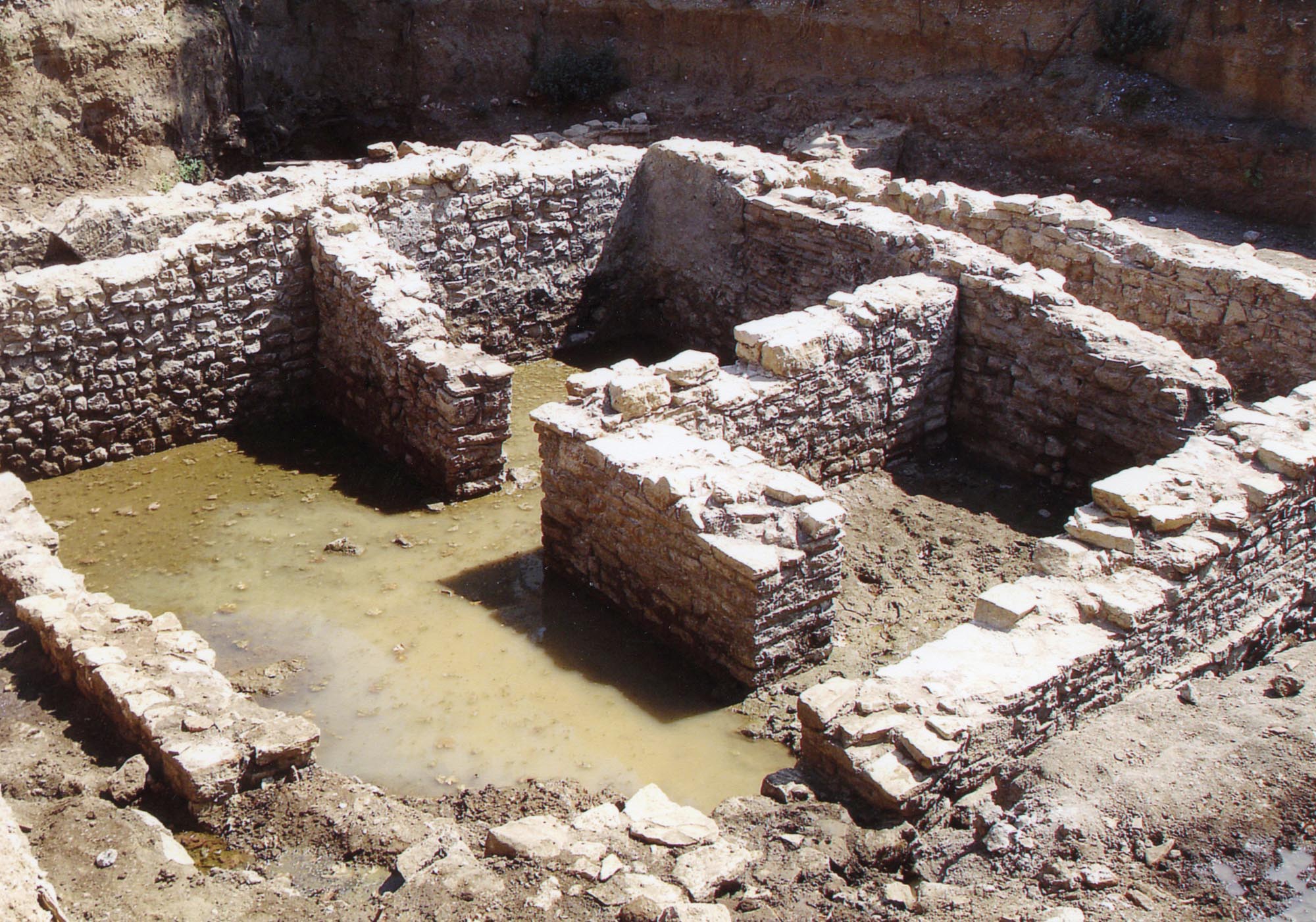
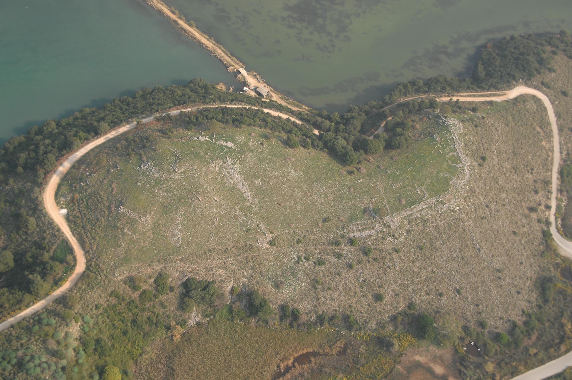
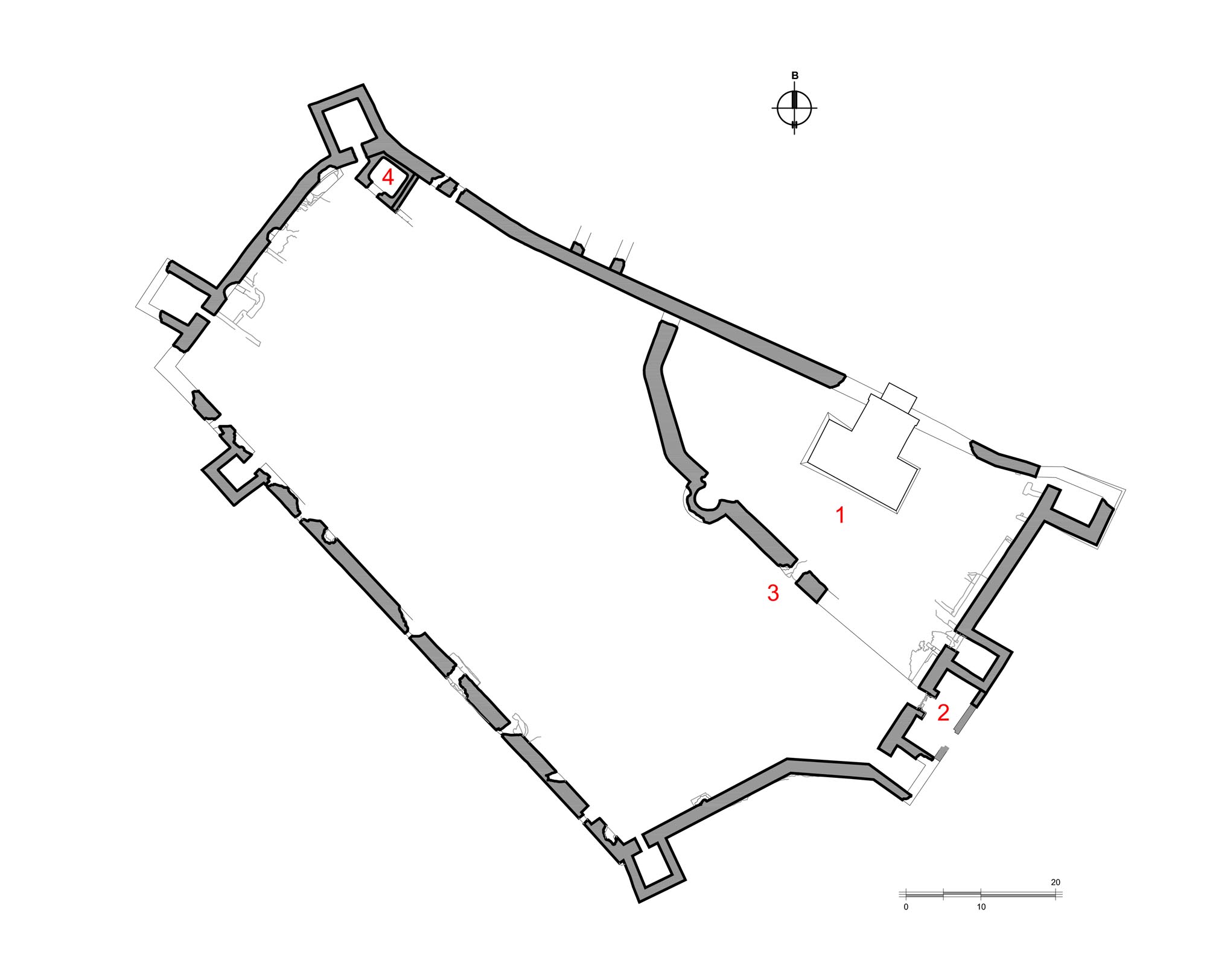
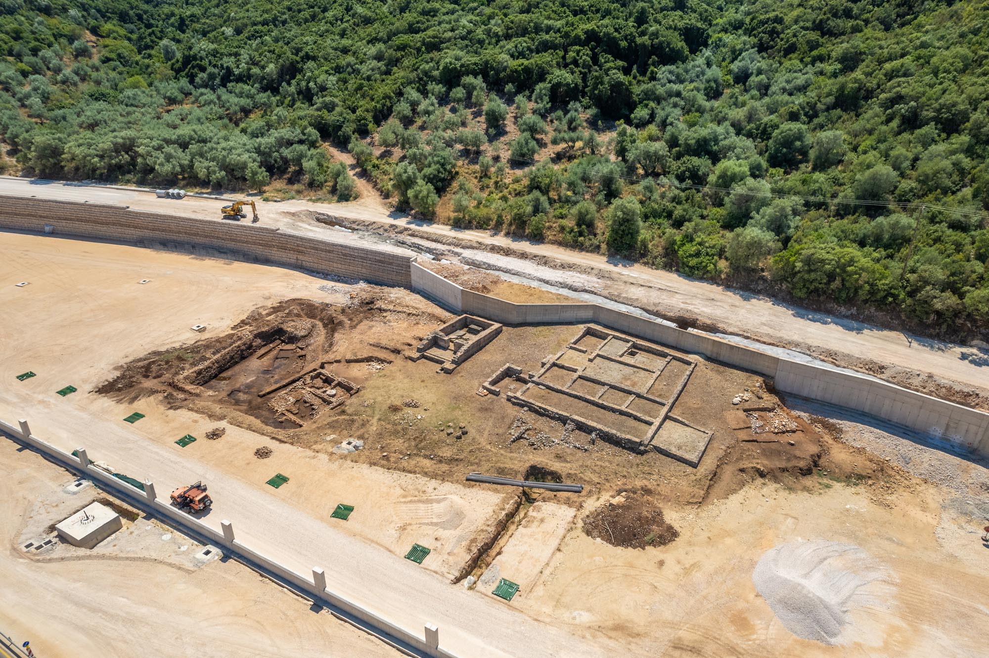
The rural villa, part of which has collapsed into the sea, has come to light in an olive grove expropriated by the Greek State, 3 km southwest of Igoumenitsa, alongside the Igoumenitsa–Preveza national highway. It is a rectangular building with maximum dimensions of 29 x 20 m, most of it preserved up to foundation level. The walls are made of simple rubble masonry, while in the highest surviving are visible sections of irregular opus quasi reticulatum, Roman-period masonry consisting of cubes arranged in a net-like pattern, joined with poured material. The building’s foundations are constructed using the poured masonry technique (opus caementicium).
The rural villa was in use for a long period of time (early 2nd-mid 4th c.), during which it underwent extensive repairs. It consists of 13 rooms and, in terms of its architectural form, is a typical example of a Roman rural villa, with a rectangular semi-outdoor space in the centre, around which were arranged what were probably two-storey wings. The north wing was the residential area; some of the rooms were apparently decorated with mosaic floors, as the discovery of scattered tesserae during the excavations indicates. One of the rooms of this wing is probably a bath. The south wing, where two wine-presses and storage jars were found, consisted of areas for the production and storage of agricultural goods.
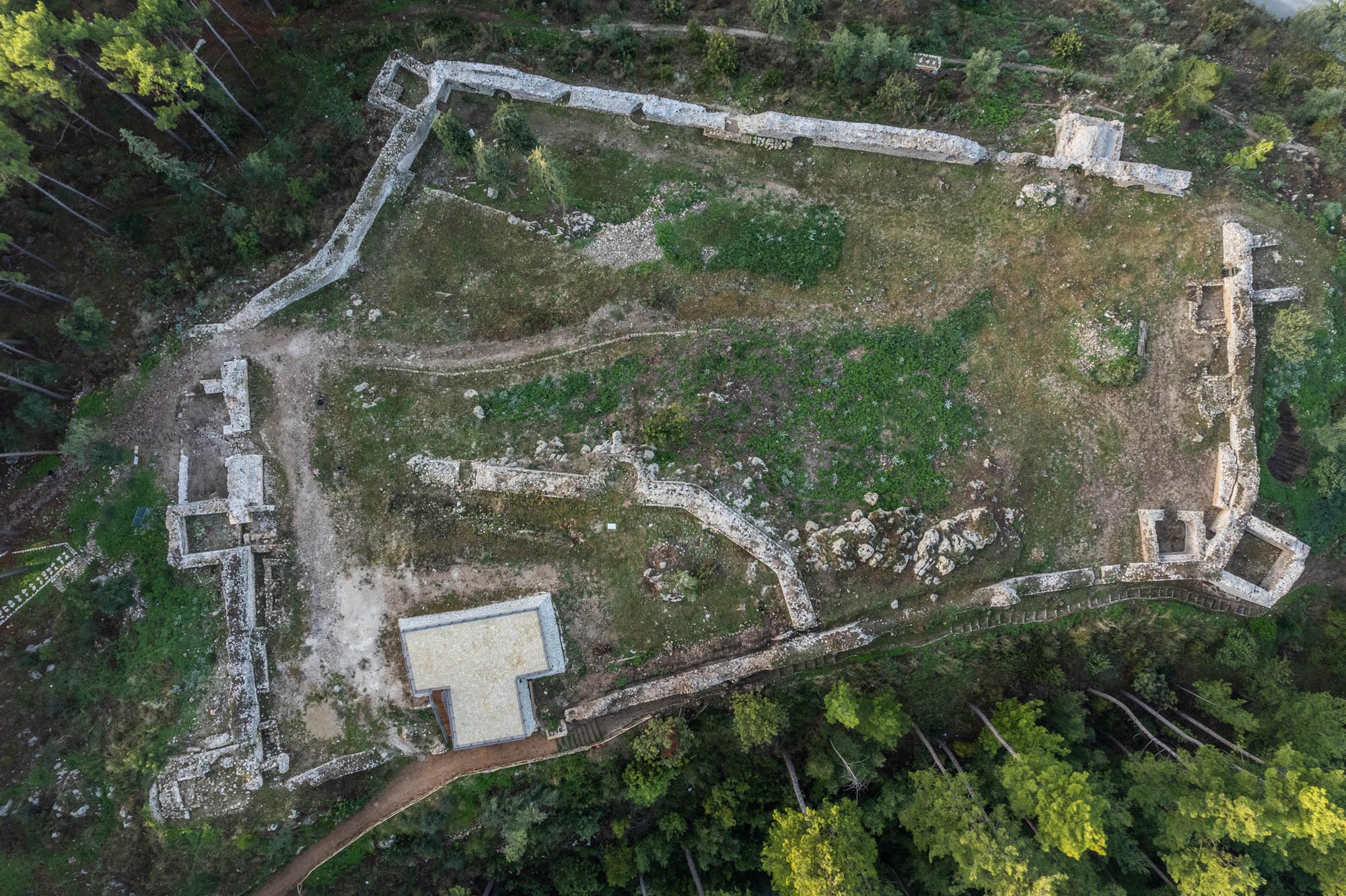
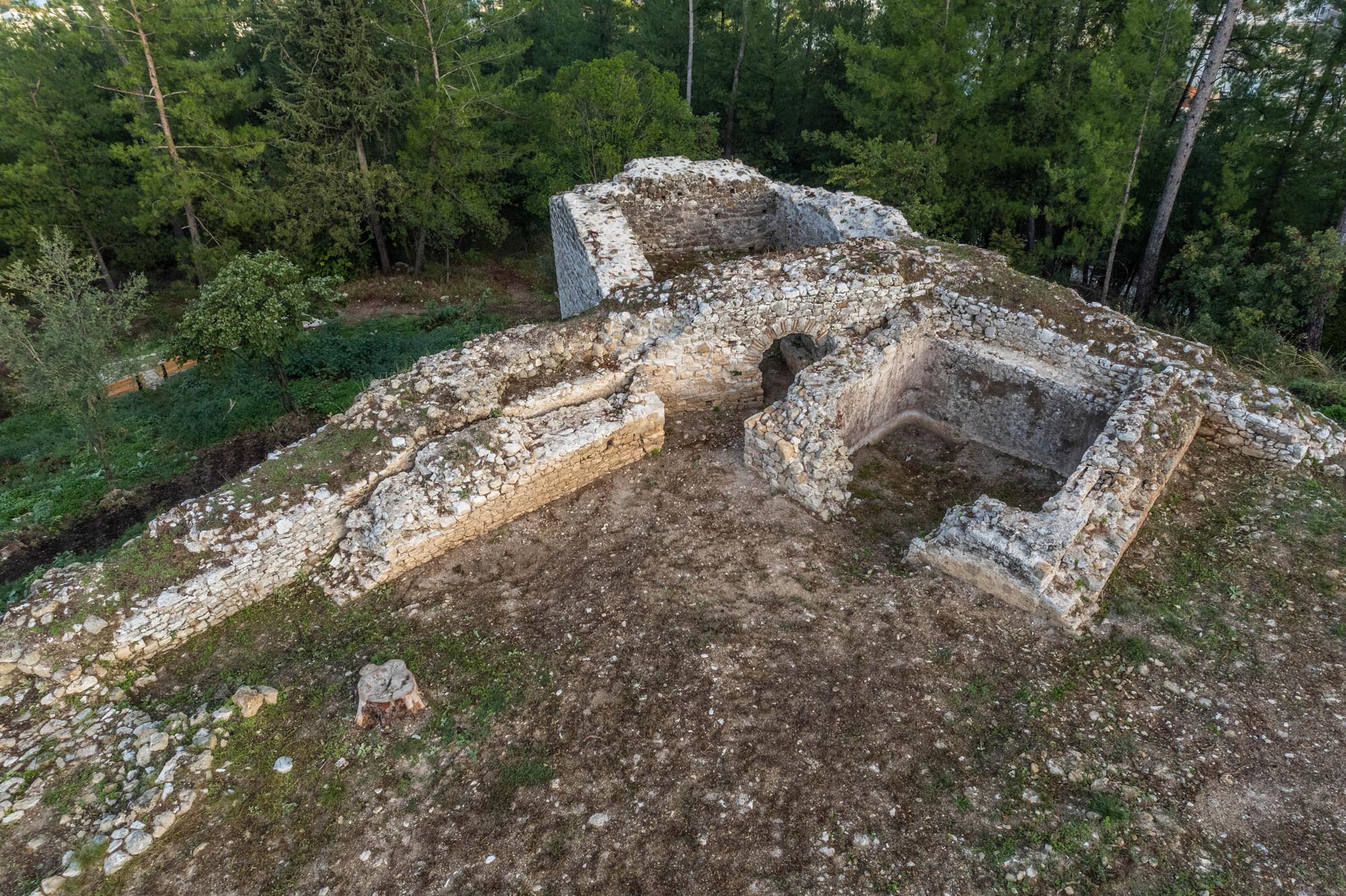
Just east of the rural villa, a temple-like mausoleum was discovered. Constructed in the common style of Roman funerary architecture, this is a rectangular building measuring 10.60 x 7.5 m, consisting of a main chamber and an antechamber, open at the front. Its walls are preserved to a low height and are constructed in opus mixtum (rectangular blocks alternating with courses of bricks), while its foundations are constructed using the poured masonry technique (opus caementicium). The roof of the mausoleum, which does not survive, is thought to have been vaulted.
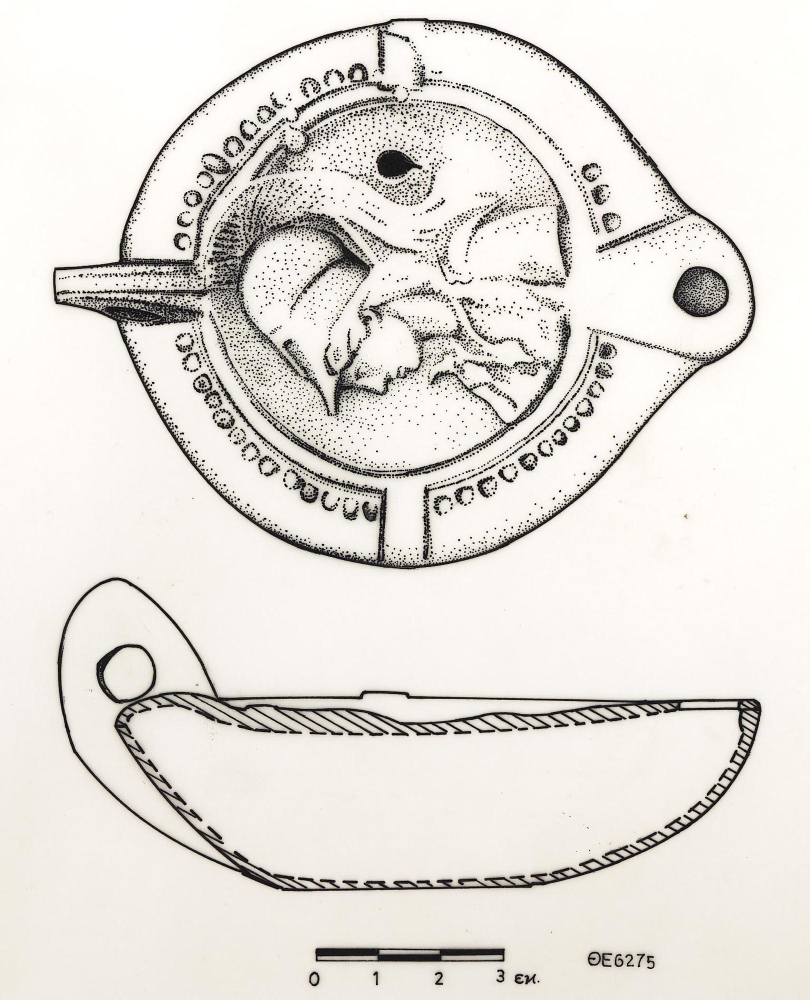
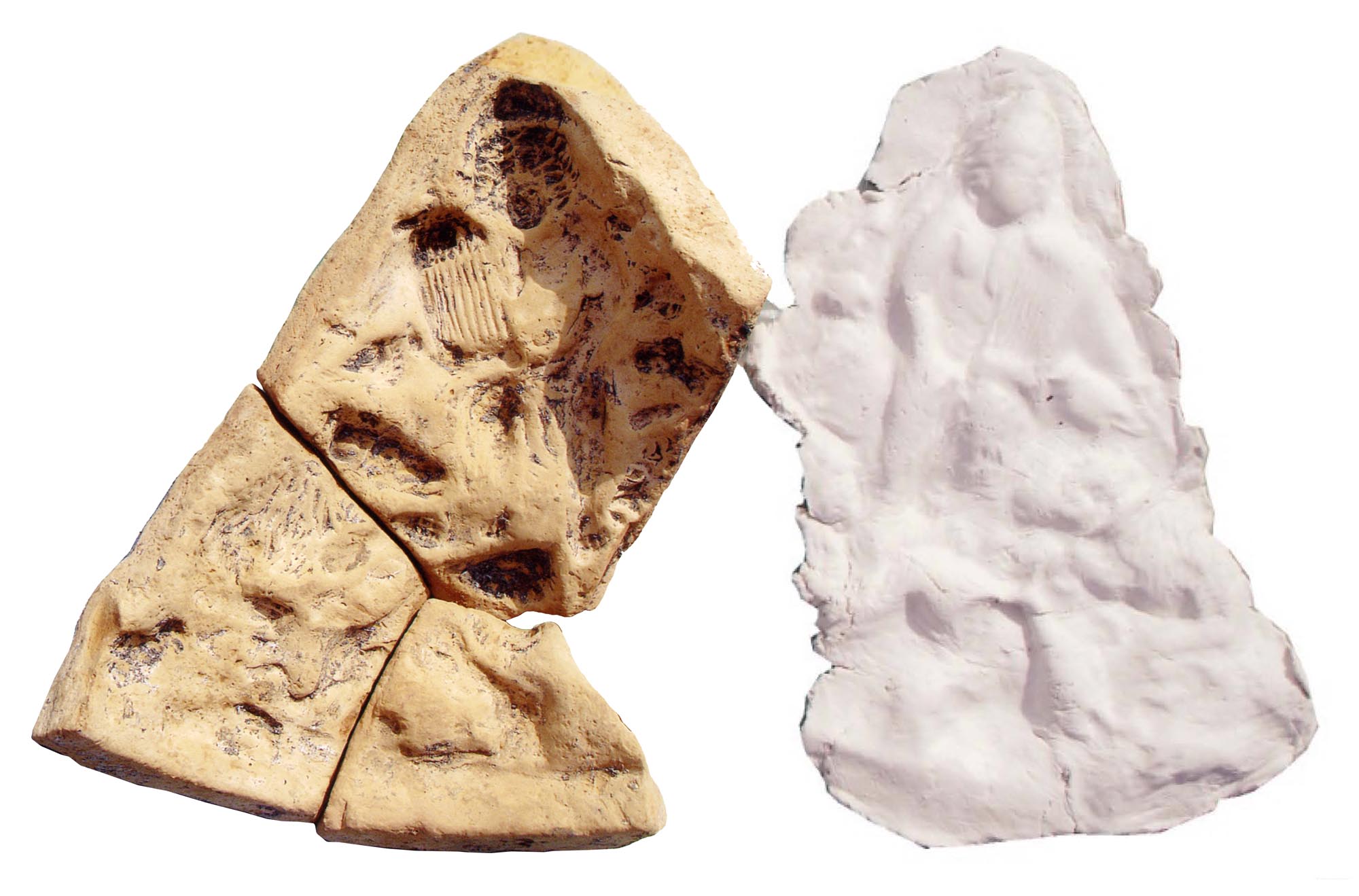
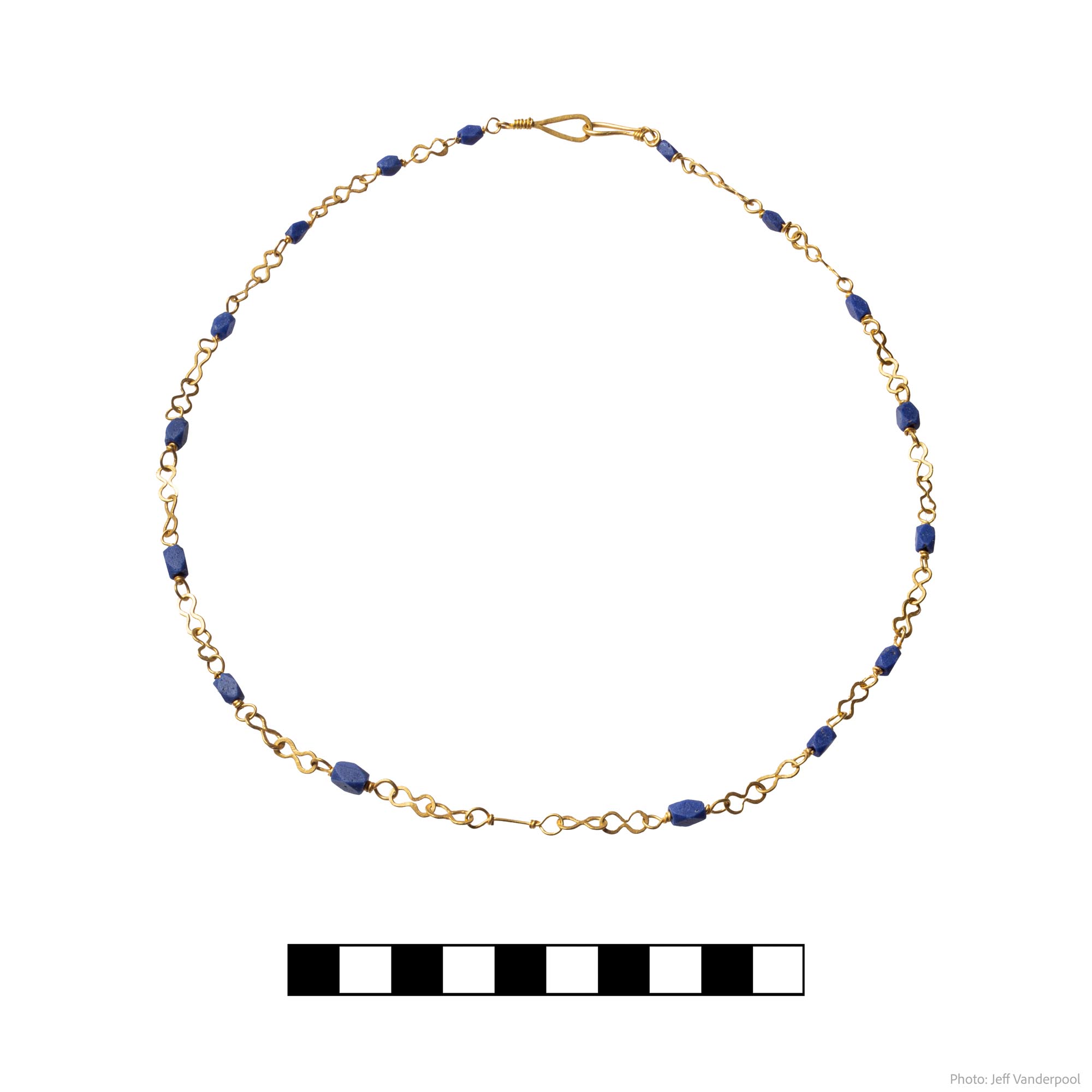
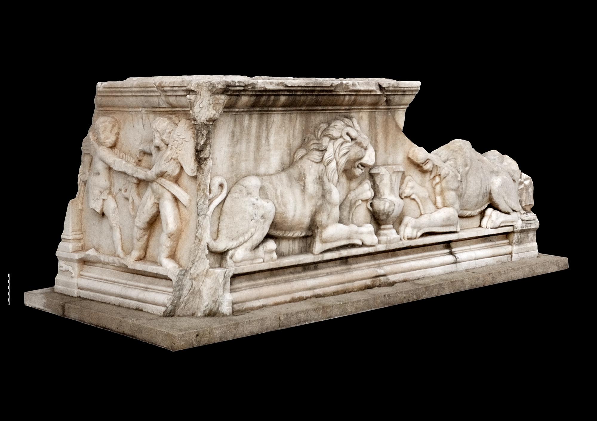
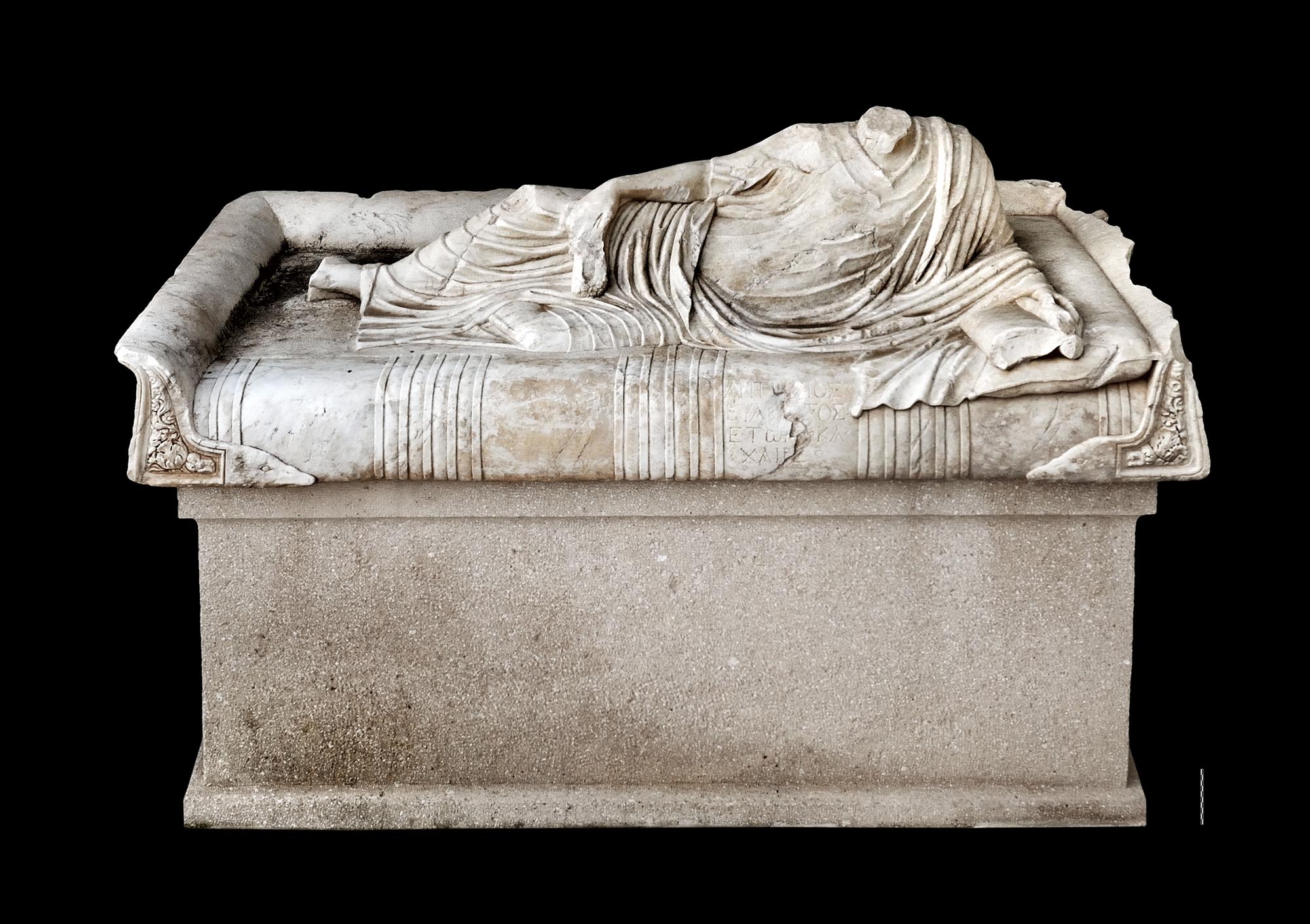
A small rectangular built structure 2 m from the front of the monument is probably an altar. Inside the main chamber, which was already looted in antiquity, were three built bases for sarcophagi of Pentelic marble, parts of which are exhibited in the Archaeological Museums of Ioannina and Igoumenitsa. They bear sculptural decoration of exceptional artistry, attributed to an Attic workshop of the early 2nd-early 3rd century. The area both inside and around the mausoleum was used for burials over a long period of time (2nd-4th c.). The mausoleum is thought to have been intended for the owner of the rural villa and his family members, who were probably Greek, based on the Greek inscription preserved on one of the sarcophagi.
The architectural remains of the villa and the mausoleum are to be incorporated into the facilities of the Port of Igoumenitsa as an archaeological site open to visitors.
Ancient fortified settlement of Lygia
The archaeological site of Lygia extends over three fortified hills (Castles A, B and C or Lygia A, B and C) on the eastern half of the Lygia Peninsula on the north side of Igoumenitsa Bay, about 8 km northwest of the city of Igoumenitsa. The location is of key geographical importance, as it allows direct control of both the coast and the adjacent lagoon formed by the delta of the River Kalamas. The enceintes of the three hills are mostly built in pseudo-isodomic masonry, with regular courses of large trapezoidal and, more rarely, rectangular ashlars. The differences seen in individual sections of the masonry are due to occasional repairs and modifications to the three fortifications. The walls are reinforced with large rectangular or semicircular towers up to 10 m in diameter, as well as with angles (slight displacements of the axis of the enceinte). Our information on the layout and function of the building remains visible inside the three fortifications is limited.
The site of Lygia was formerly identified as Torone, a Corcyraean colony on the coast of Epirus opposite Corfu, and the construction of the three fortresses was placed before the Corcyraean civil war (427-425 BC), when, according to Thucydides, the defeated oligarchic faction fled here. According to the latest research, however, the initial construction phase of the three fortifications should be dated after the beginning of the 4th century BC. The ancient settlement of Lygia survived the Roman conquest (167 BC), remaining in use until its final abandonment in the Early Christian period.
Archaeological site of the Tower of Ragio
On a low hilltop in the middle of the Ragio–Kestrini plain, near the archaeological site of Lygia, is the archaeological site of the Tower of Ragio, which owes its name to the imposing Ottoman tower that dominates the area. The excavations have brought to light movable finds ranging from prehistoric times to the period of Ottoman rule, confirming the habitation of the site through the ages.
The small fortress, with an area of just 3,000 m2, is surrounded by a strong wall in isodomic masonry of regular courses preserved in particularly good condition, to a height of over 4 m in places. Its defences include rectangular towers and angles. The fortress, based on current research, was constructed in the 5th century BC and is associated with Corcyraean activity on the coast of Thesprotia opposite Corfu. The polygonal masonry visible in a small section of the west wall is thought to be a repair of the Late Classical or Hellenistic period. The fortress was of a purely military nature, a fact confirmed by the lack of any buildings inside it indicating permanent habitation. In roughly the centre of the enceinte is an impressively large rainwater collection cistern cut entirely into the rock, with a diameter of 13 m and a depth of over 5 m.
The site was inhabited more systematically during the Ottoman period, to which the majority of the drystone building remains within the fortifications belong. The imposing Ottoman tower was erected over the north tower of the ancient fortress in the mid-19th century by Haci Grava, Ağa of Igoumenitsa. It belongs to the architectural type of the kulia (fortified residence) widespread in Greece and the Balkans, and served as an observation post housing the local garrison. It has an L-shaped ground plan and three floors. For defensive purposes, there are no doors or other openings on the ground floor of the tower; the only entrance is on the first floor, protected by a murder hole. It was accessed via a staircase or a wooden drawbridge. For the same reason, the upper floors have gun-loops and only small square or arched windows.
The archaeological site of the Tower of Ragio has now been enhanced and the restored tower has been converted into an exhibition space.
Museums
Archaeological Museum of Igoumenitsa (2, 28th October St.)
More than 1,600 exhibits and a wealth of accompanying visual material tell the story of the most important milestones of the archaeological past of Thesprotia, focusing mainly on the Hellenistic period, a time when the region flourished.
Folklore Museum “Rena’s House, Memories – Tradition – Culture” (6 Renas Kotsiou St. - formerly 6 Olympou Passage)
The museum, founded by Elias and Eleftheria Kotsiou in memory of their daughter Rena, has a rich collection of traditional costumes, textiles, folk embroidery and many objects of everyday life from Igoumenitsa and the wider region of Epirus.


