Elea – Photike – Paramythia
Elea – Photike – Paramythia, three large residential centres of Thesprotia
After Ioannina, the Egnatia Motorway continues west across the Regional Unit of Thesprotia to Igoumenitsa. Together with the construction of the Ionian Motorway, it has significantly improved the connection of the formerly isolated border region with Ioannina and the other major urban centres of mainland Greece. The first major centre of Thesprotia, close to the Egnatia Motorway, is Paramythia, now the capital of the Municipality of Souli, approximately 32 km from Igoumenitsa and 53 km from Ioannina. Paramythia, the largest town of Thesprotia, is laid out amphitheatrically on a hill at an altitude of about 300 m above sea level, on the western slopes of Gorilla (Gorila, Koryla), the highest peak of the Paramythia Mountains. To the east rise the Souli Mountains, while further north is Mount Chionistra (Spata or Labanitsa Mountains). One of the few passes between these three mountain ranges is the Skala tis Paramythias (Kakia Skala), a steep, narrow gorge ending in an open plateau near the abandoned village of Eleftherochori. The pass, known as the Eleftherochori Pass, has been used since antiquity, and even today the Egnatia Motorway passes through here. Southwest of Paramythia lies the long, narrow valley of the River Kokytos or Cocytus (Mavros), a tributary of the Acheron. The Acheron, the Kokytos and the Pyriphlegethon, the other tributary of the Acheron, were the three rivers of Hades in antiquity. At the confluence of the three rivers, near ancient Ephyra, at the present-day village of Mesopotamo in Preveza, was the famous Necromanteion or Necyomanteion (oracle of the dead) of Acheron and the now-drained Acherusian Lake, where the dead descended to Hades. The Kokytos valley has been continuously inhabited since prehistoric times and contains a large number of archaeological sites of all periods. Due to the chthonic nature of the Kokytos, the “river of lamentation” in mythology, the whole valley was used as a necropolis, with many individual graves and burial monuments dating from Hellenistic to Early Christian times. The rugged terrain of the wider area of Paramythia, with its high mountains, deep, steep ravines and dense river system, forms a rich natural environment. Thanks to its environmental and ecological importance, much of it is included in the Natura 2000 European ecological network. The riverbeds of the Acheron and its tributaries have also been declared historical sites and areas of outstanding natural beauty. Two of the most important urban centres of Thesprotia were founded in the region of Paramythia: Elea, the first political centre of ancient Thesprotia, and Photike, a Roman colony, initially with a purely Latin-speaking population. Paramythia itself was the most important administrative and economic centre of the region during the Late Byzantine and Ottoman periods. Rich movable finds from the excavations around Paramythia can be admired today in the Archaeological Museum of Igoumenitsa.
History
The earliest traces of habitation of the wider area of Paramythia date from the Palaeolithic period (100,000-10,000 before present), when Neanderthals (Homo neanderthalensis) and anatomically modern humans (Homo sapiens) led a nomadic life here, hunting and gathering fruit and nuts. Besides the Kokytos valley, a number of sites of this period have been discovered in the north of Paramythia during construction work on the Egnatia Motorway (Mesovouni and Grika Tunnels, Krystallopigi Bridge, Krystallopigi–Psilorachi, Eleftherochori Pass). Finds of the Mesolithic (10000-9000 BC) and Neolithic periods (9000-2800 BC) have also been identified in the Kokytos valley and in the labyrinthine cave of Psaka, above the community of Grika in the northwest of Paramythia.
During the Late Bronze Age, around 2000 BC, the first Greek-speaking tribes are thought to have settled in Epirus. They included the Thesprotians, who, together with the Molossians and the Chaonians, were the three largest tribes of Epirus. Each was divided into numerous smaller clans living in komai, small unwalled settlements of a purely agropastoral nature. The territory of the Thesprotians extended beyond the geographical boundaries of present-day Thesprotia, including the control of the important Oracle of Dodona and the Necromanteion of Acheron. In historical times, Paramythia formed part of ancient Eleatis, the territory of the Eleatai, one of the most important Thesprotian tribes. The remains of a small settlement of the Late Bronze Age have been uncovered at the site of Stenes in Grika. The excavation finds include Mycenaean vases (1400-1100 BC), evidence of Mycenaean presence in the area.
During the Geometric (1100-730/700 BC) and Archaic (730/700-500/480 BC) periods, the time of the Second Greek Colonisation, numerous colonies were established along the coasts of Epirus by the Eleatai, the Corinthians and the Corcyraeans. Archaeological sites of both periods have been excavated in the Kokytos valley, the most important being that of Mavromantilia, and also between the communities of Neochori and Grika in the northwest of Paramythia. The excavation finds, which include imported pottery and coins from Southern and Central Greece, highlight the region’s importance in the trade in products to both the West and the hinterland.
In the late 5th-early 4th century BC, a time of increasing rivalry among the Epirote tribes, the Molossians seized a large piece of Thesprotian territory, annexing the sanctuary of Dodona and Cassopaea near Zalongo in Preveza, the home of the Thesprotian tribe of the Cassopaeans. The Thesprotians were forced to cross the River Kalamas and expand northward. The following period (2nd half of the 4th c. BC) is considered a milestone in the history of Thesprotia, and indeed the whole of Epirus, as from then on and for about two centuries, until the middle of the 2nd century BC, the region experienced great population, residential and economic growth. The Thesprotians, like the other Epirote tribes, gradually began to abandon their nomadic way of life, laying the foundations for their urbanisation by gathering in the hitherto-unwalled towns and founding heavily fortified cities. This was also the period of the establishment of the Thesprotian League, a federation of Thesprotian tribes initially based in Elea and later in Gitana (Gitane), an important Thesprotian city north of the Kalamas. Against this background, the Thesprotians adopted a series of innovations, including minting their first coins. Subsequently, unable to compete with the Molossians, they were forced to join Apeiros or the Epirote Alliance (c. 329/5-233/2 BC) under the king of the Molossians, and later the Epirote League (233/2-168 BC). At the beginning of the 3rd century BC, as part of the strategy of the Molossian king Pyrrhus (293-272 BC), the most powerful ruler of Epirus during this period, new settlements were founded in Thesprotia while the existing towns were reinforced.
There are many fortified citadels of the Late Classical and Hellenistic periods in the wider region of Paramythia, built in natural strongholds, where the population sought refuge during enemy raids (castles of St Donatus in Paramythia, St Donatus in Zervochori, Agora near the community of the same name, St Arsenios in Sevastos, etc.). Smaller unfortified settlements were also in use during this period, while individual farmhouses were also built. The discovery of numerous kilns attests to the development of significant industrial activity in the area at this time.
The Roman conquest (167 BC) marked the end of the Thesprotian cities of the Late Classical and Hellenistic periods, including Elea and Gitana, which were gradually abandoned. The invasion of Epirus in 88/7 BC by the Thracian mercenaries of Mithidrates VI Eupator of Pontus, and the civil war between Caesar and Pompey (49-48 BC), accelerated the decline of the Hellenistic cities of Epirus. Shortly afterwards, Octavian Augustus’ victory at Actium in 31 BC and the founding of Nicopolis marked the beginning of the Pax Romana, a period of peace and security in the region.
Many organised settlements still survived in Thesprotia in the Roman period, mainly along the coasts of Epirus. They maintained contacts with the major ports of the time, Nicopolis and Butrint (Bouthroton) in Southern Albania. From the late 2nd century BC, earlier than in the rest of Greece, it seems that individual Roman colonists, members of the Italian aristocracy, had begun to settle in the coastal and lowland parts of Epirus, cultivating the lands they had been granted and breeding the famous Thesprotian cattle. In the region of Paramythia, a considerable number of Roman-era settlements, rural villas and cemeteries have come to light, including a workshop installation at the Gefyrakia site, near the east bank of the Kokytos.
Around the middle of the 1st century BC, in the context of the organised colonial policy of Julius Caesar, a series of colonies with privileged legal status (coloniae Romanae) were founded in Greece, including Photike, northwest of Paramythia. The newly founded colony seems to have been the administrative centre of the region, probably subject to Nicopolis. A second colonisation of the area probably occurred in the reign of Octavian Augustus (27 BC-14 AD). As can be deduced from the surviving Latin inscriptions, the city’s population was originally purely Latin-speaking. From the 3rd century onwards, however, which marks the end of the Roman world in Epirus, the bilingual or Greek inscriptions of Photike attest to the gradual predominance of the Greek over the Latin element.
During the Early Christian period, the largest urban centre of Epirus remained Nicopolis, which was designated the capital of Epirus Vetus (Old Epirus), one of the two large provinces into which Epirus was divided under Diocletian (late 3rd c. AD).
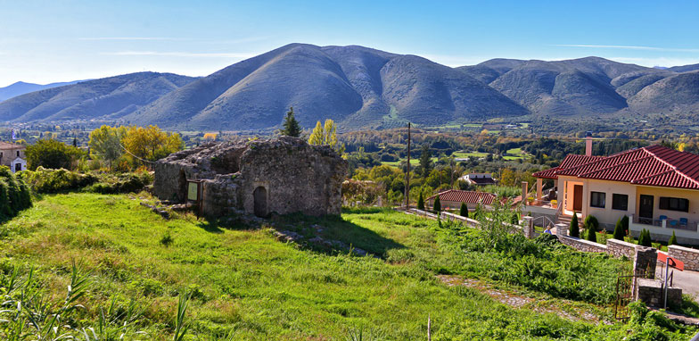
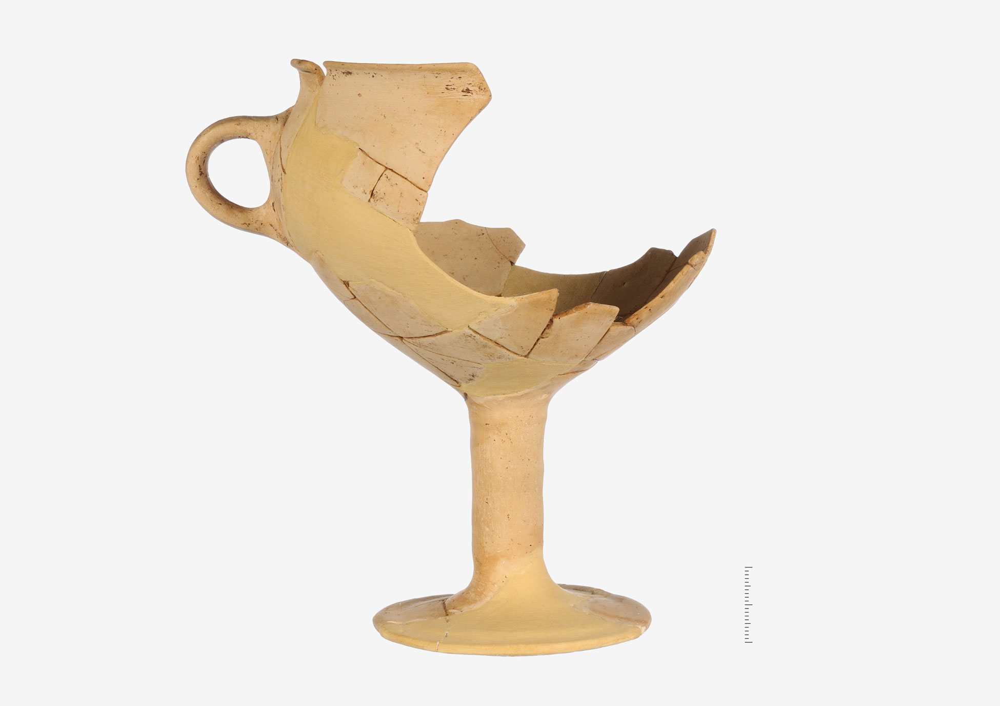
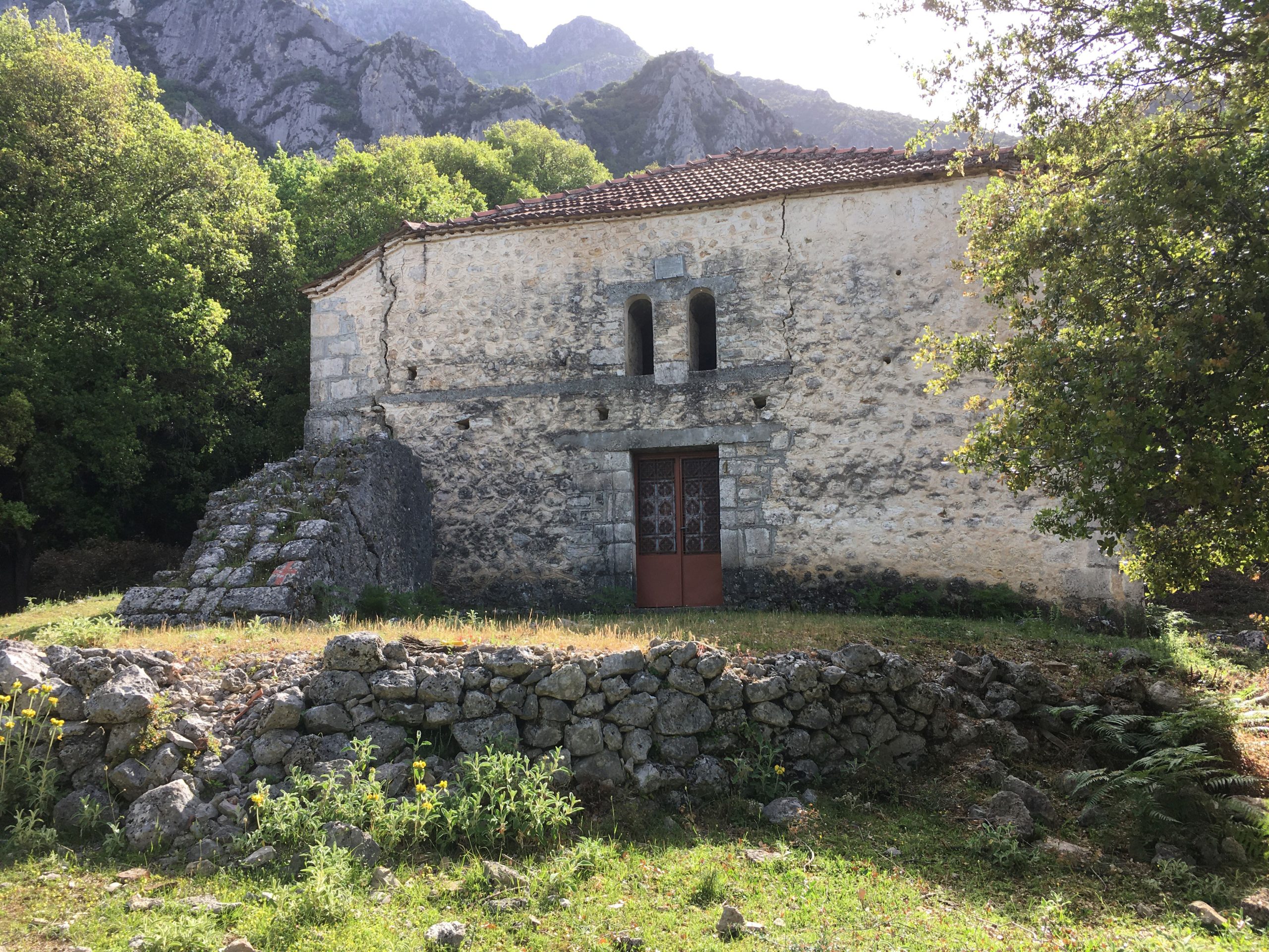
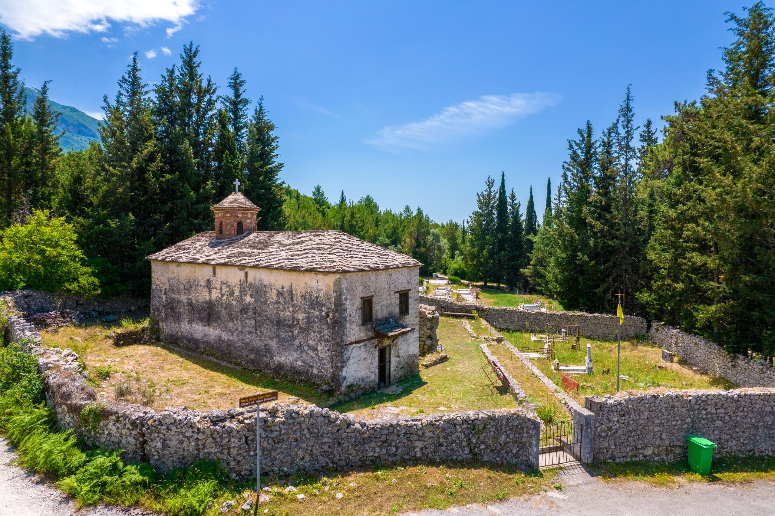
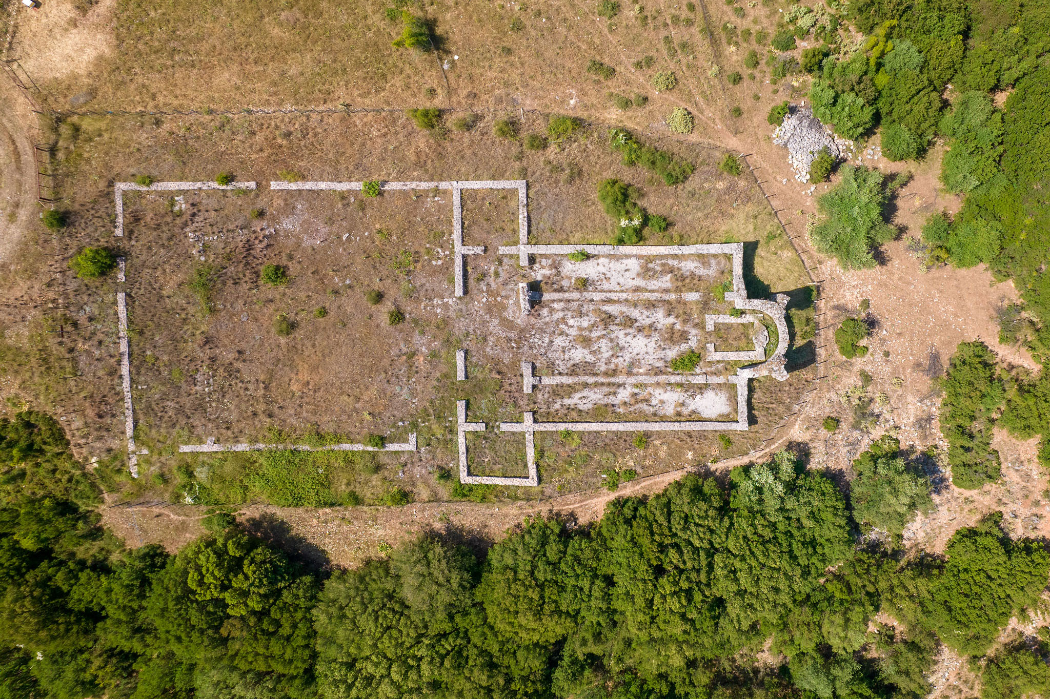
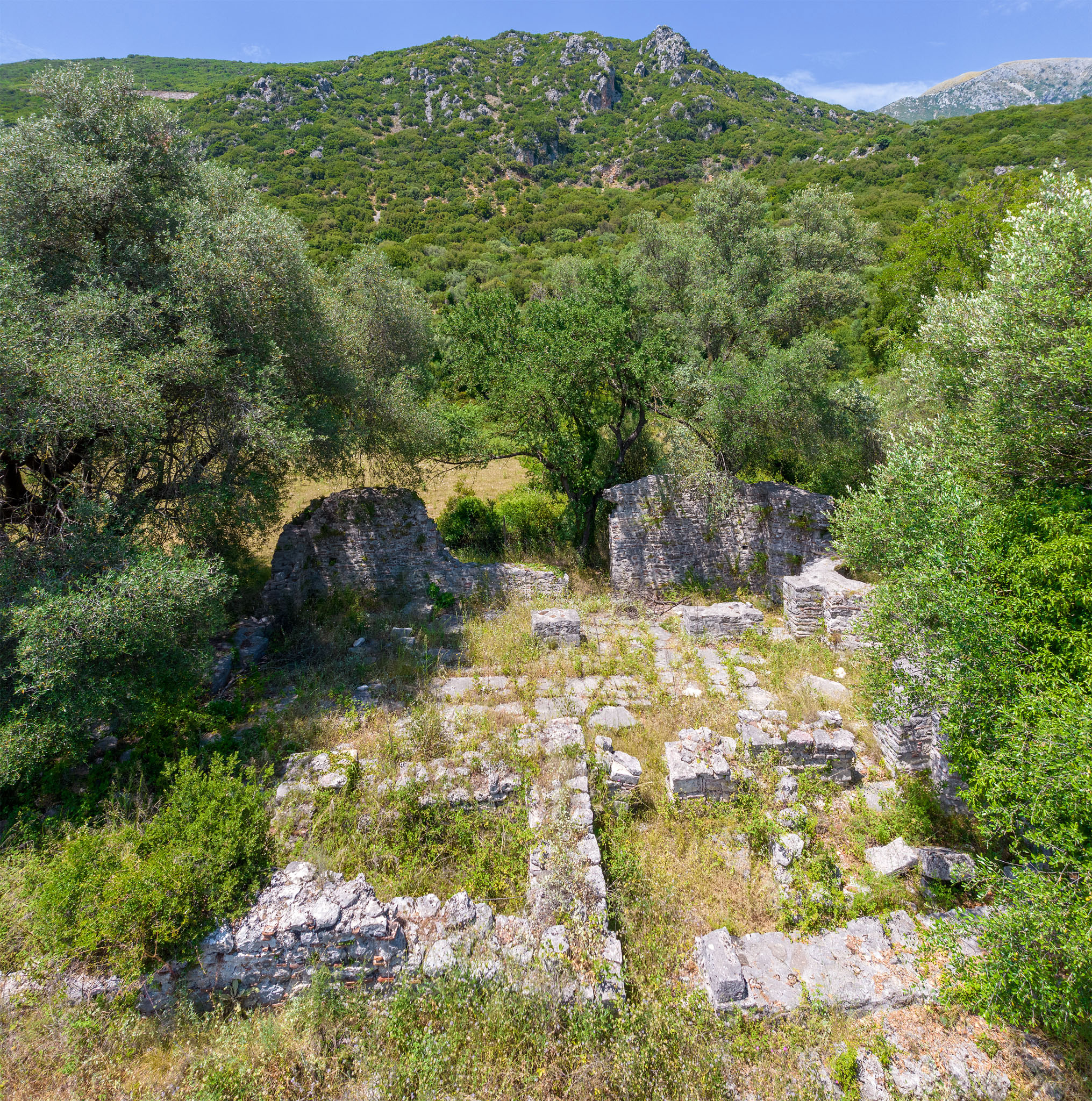
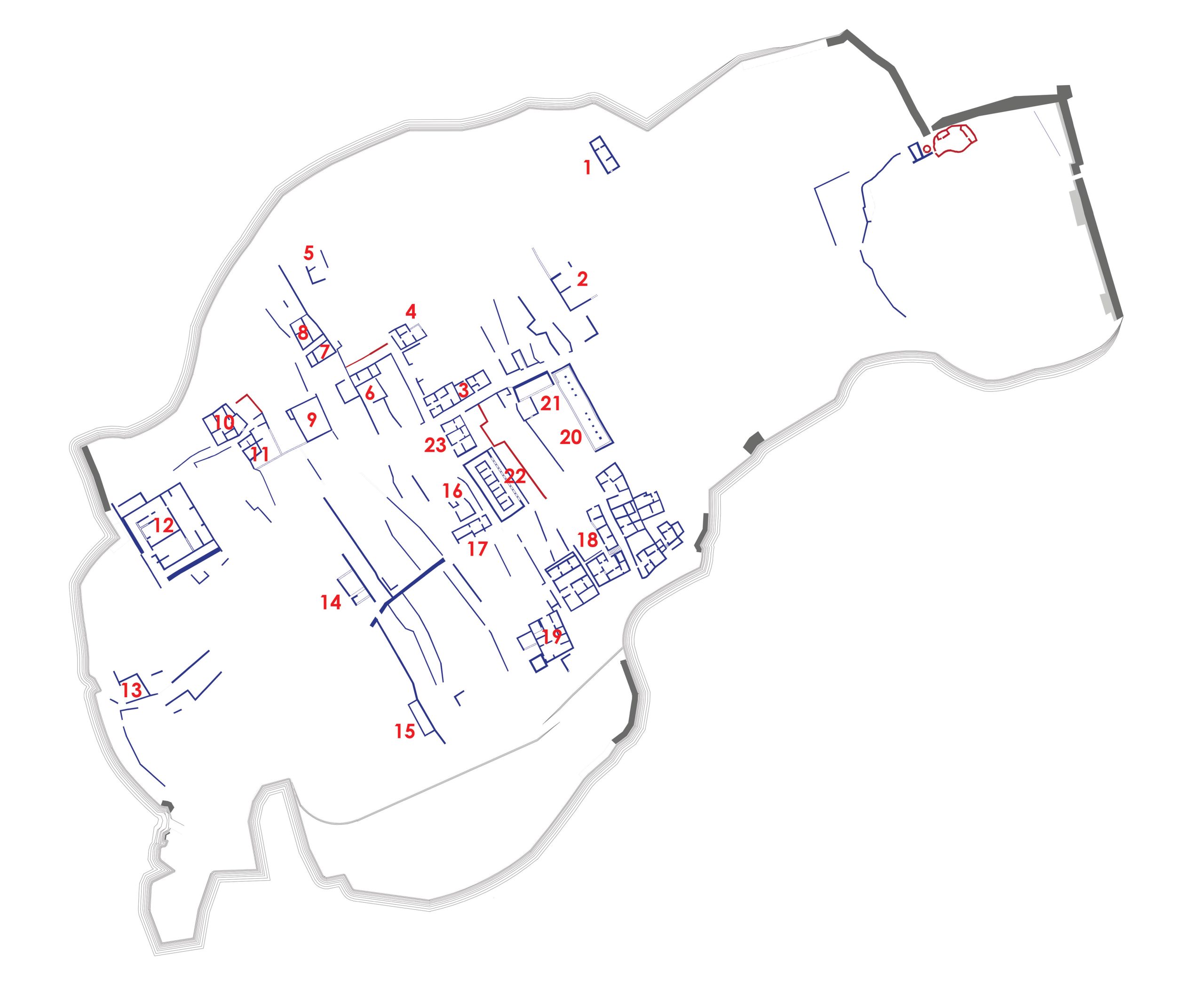
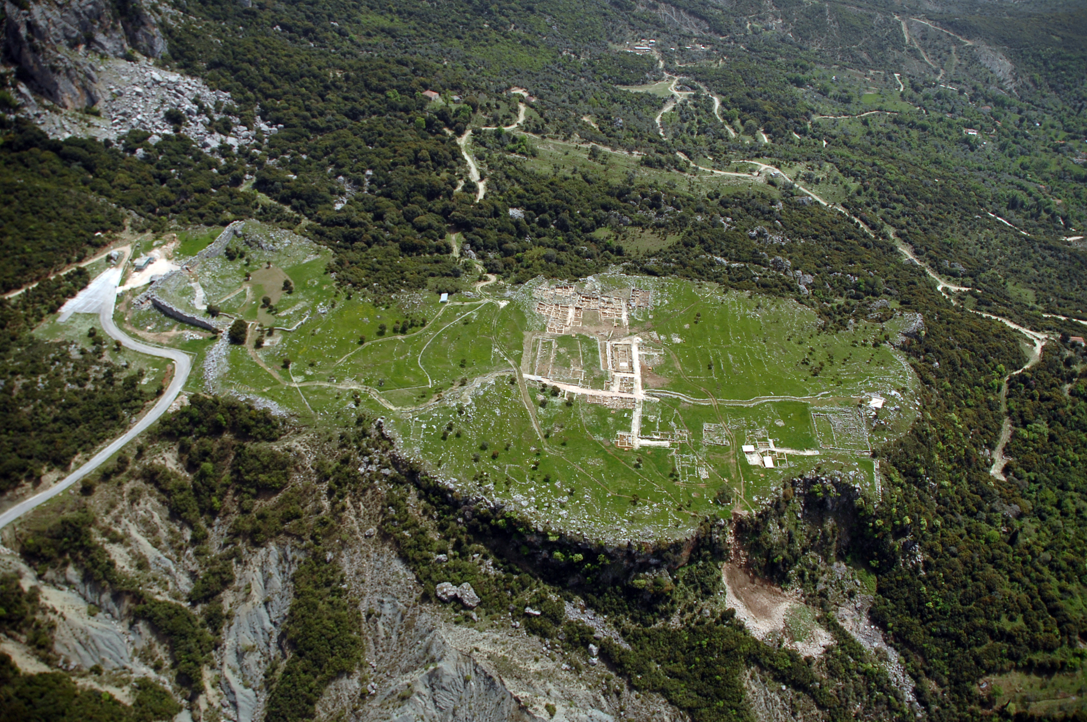
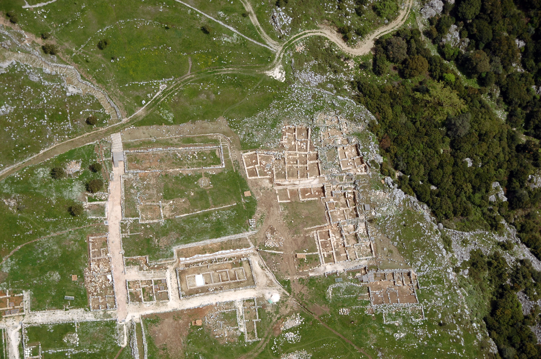
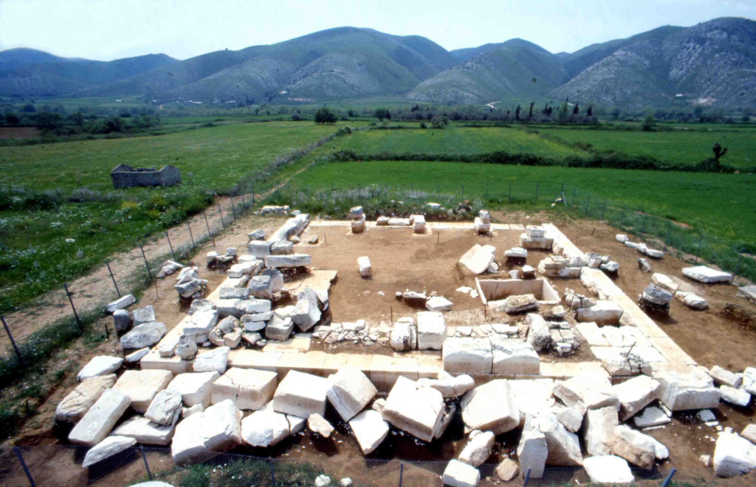
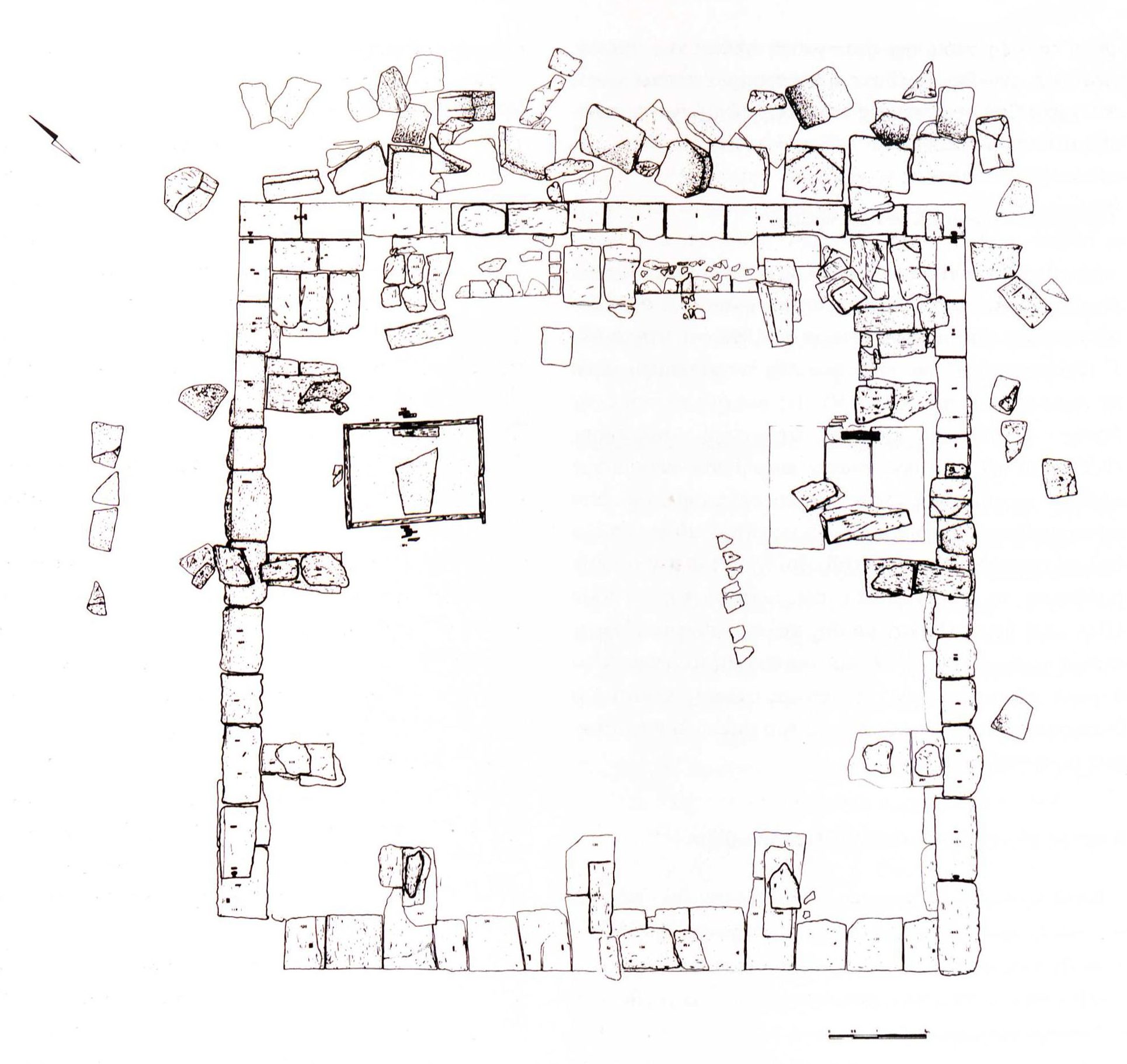
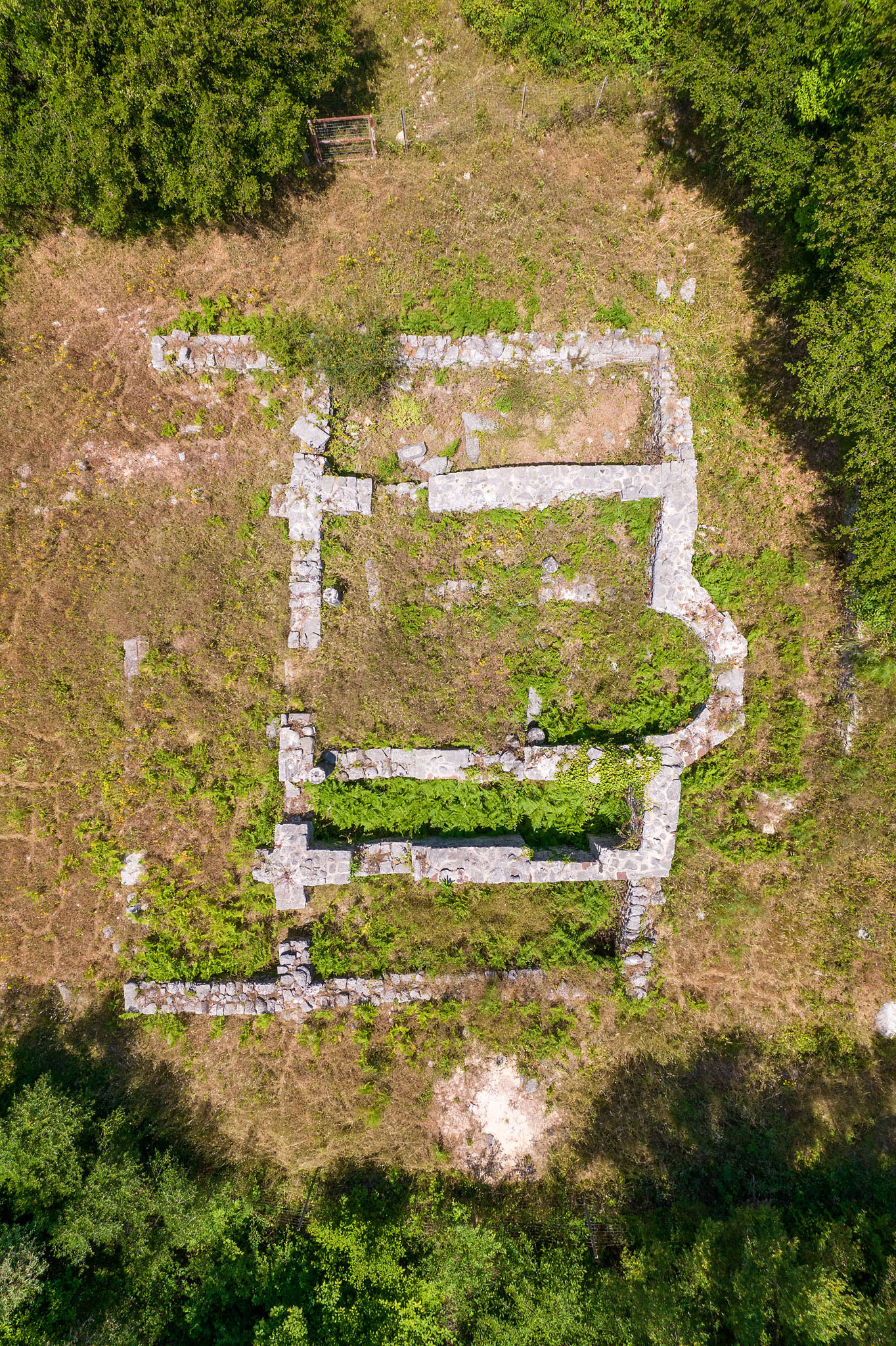
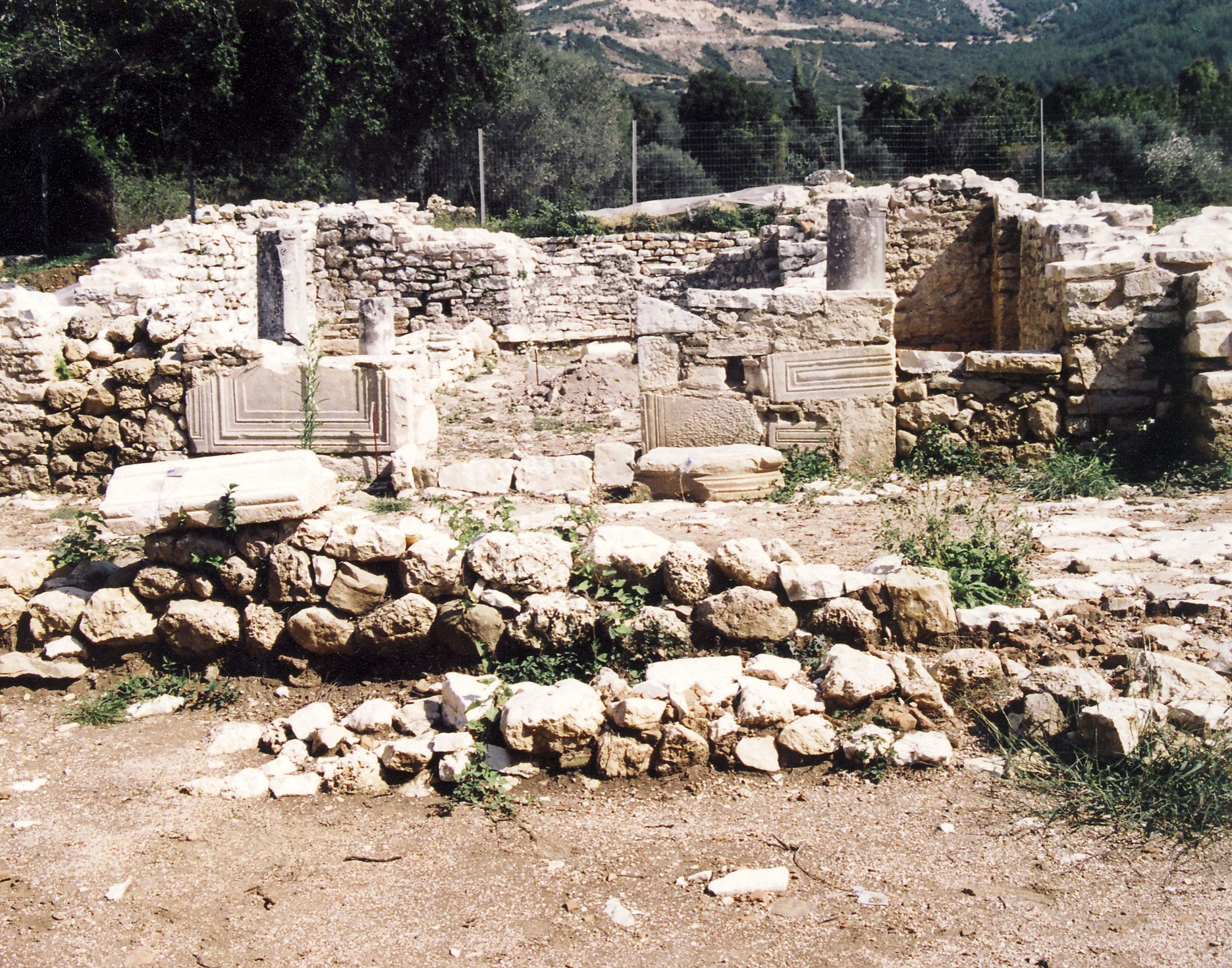
Christianity seems to have spread through Epirus at an early date, based on the tradition that St Paul the Apostle visited Nicopolis in the mid-1st century AD. However, the first episcopal sees of Epirus, Nicopolis and Euroia, are only mentioned from the 4th century onwards. The bishop of Euroia, one of the most important cities of Epirus Vetus, identified by some researchers with the modern village of Glyki south of Paramythia, was St Donatus, a prominent ecclesiastical figure of the time and patron saint of Thesprotia. During the Early Christian era, especially after the mid-5th century AD, there was intensive building activity in Thesprotia despite the constant raids by Visigoths, Ostrogoths and Vandals, with the construction of a considerable number of churches of the new religion. In the Paramythia area, four Early Christian basilicas have been excavated to date (Photike, Chrysavgi, Zervochori and Krystallopigi), in addition to the parts of ecclesiastical buildings of this period that have been discovered in Photike and Glyki under the foundations of later churches. Most of the existing settlements were abandoned during the Early Christian period, except for a few sites, such as the Castle of St Donatus in Zervochori. New, smaller villages were founded on the sites of the abandoned settlements, as were a number of farmhouses (Kokytos valley, Neochori Junction of the Egnatia Motorway, Eleftherochori, etc.).
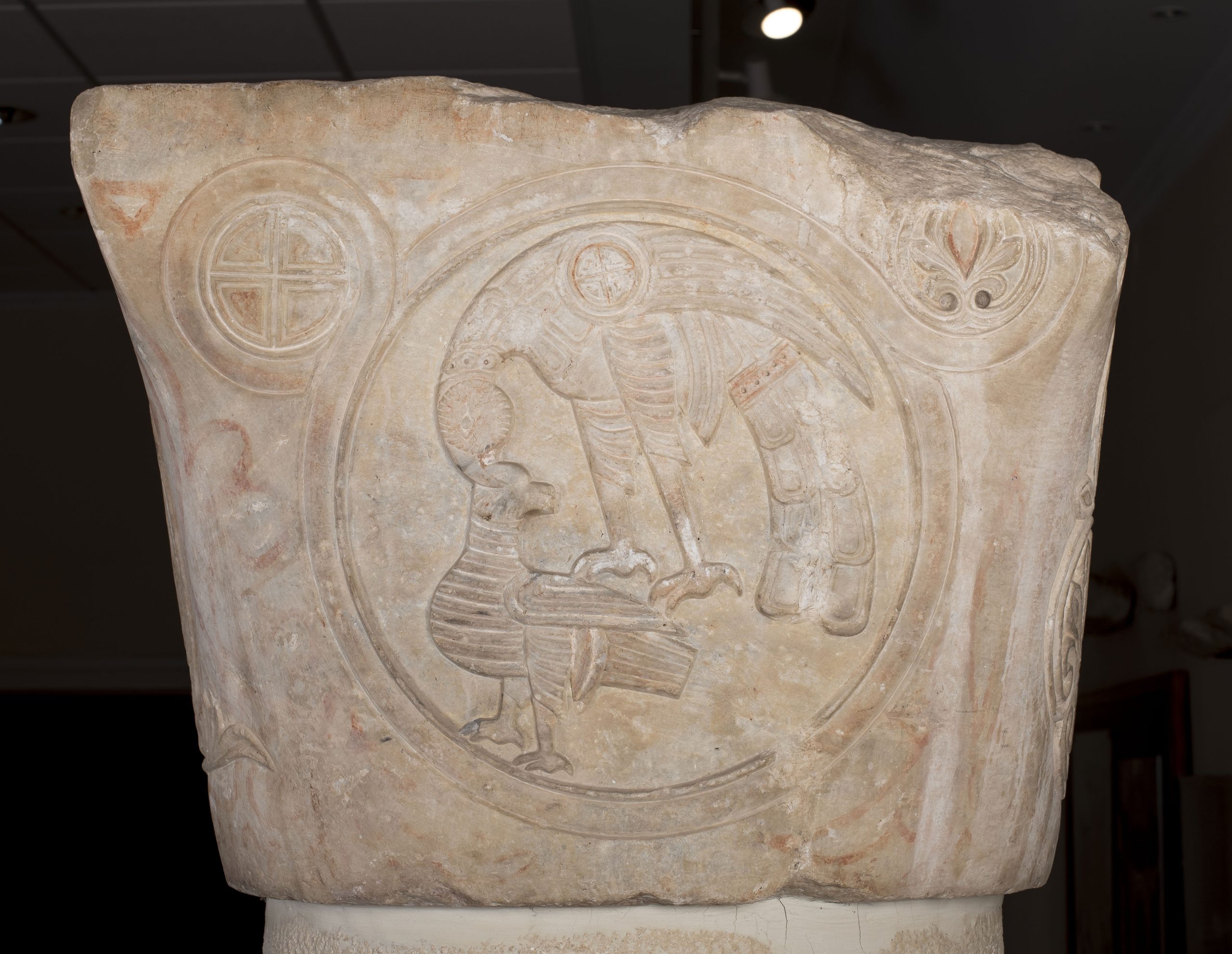
Photike seems to have remained the second most important centre of the region after Nicopolis in the Early Christian era, too. From at least the mid-5th century it was the seat of an episcopal see subject to the metropolis of Nicopolis. One of the city’s bishops was St Diadochos, a prominent fifth-century theologian. In one of his works, he speaks of Photike’s magnificent buildings and its thriving social and intellectual life, and provides an idyllic description of the city, referring to its rich meadows, its trees “with fine twigs” and its “beautiful-flowing” springs.
Our knowledge of the history and topography of Thesprotia in Byzantine times is full of gaps due to the lack of written sources. During the so-called “dark ages” (late 6th-9th c.) there were radical changes in Epirus, when the whole region between Chimara (Himarë) in Southern Albania and Margariti in Thesprotia was occupied by the Slavic tribe of the Baiounitai and called Vagenetia (Vagenitia), a place-name it retained until the Early Ottoman period. At the end of the 9th century, the Theme of Nicopolis was established, including the whole of Epirus and Western Greece, with Nicopolis and then Nafpaktos as its capital. The establishment of the theme marked the definitive restoration of Byzantine central authority in the region, which, however, remained isolated, far removed from events in Constantinople.
On the arrival of the Crusaders in 1204, Epirus found itself at the forefront of political developments in the Balkans, with the establishment of the Despotate of Epirus by Michael I Komnenos Doukas. Thesprotia flourished during the period of the Despotate (1204-1318), as evidenced by numerous settlements and monuments of the period. In 1318, the region of Epirus came under Italian rule until 1348, when the powerful Serbian ruler Stefan Uroš IV Dušan expanded his possessions throughout Epirus and Thessaly. There followed a period of conflict between the Serbs, the Albanians and the rulers of Latin origin who had remained in charge of the individual regions of the fragmented Despotate. In the first half of the 15th century, between the surrender of Ioannina (1430) and the fall of Arta (1449), Thesprotia was conquered by the Ottomans.
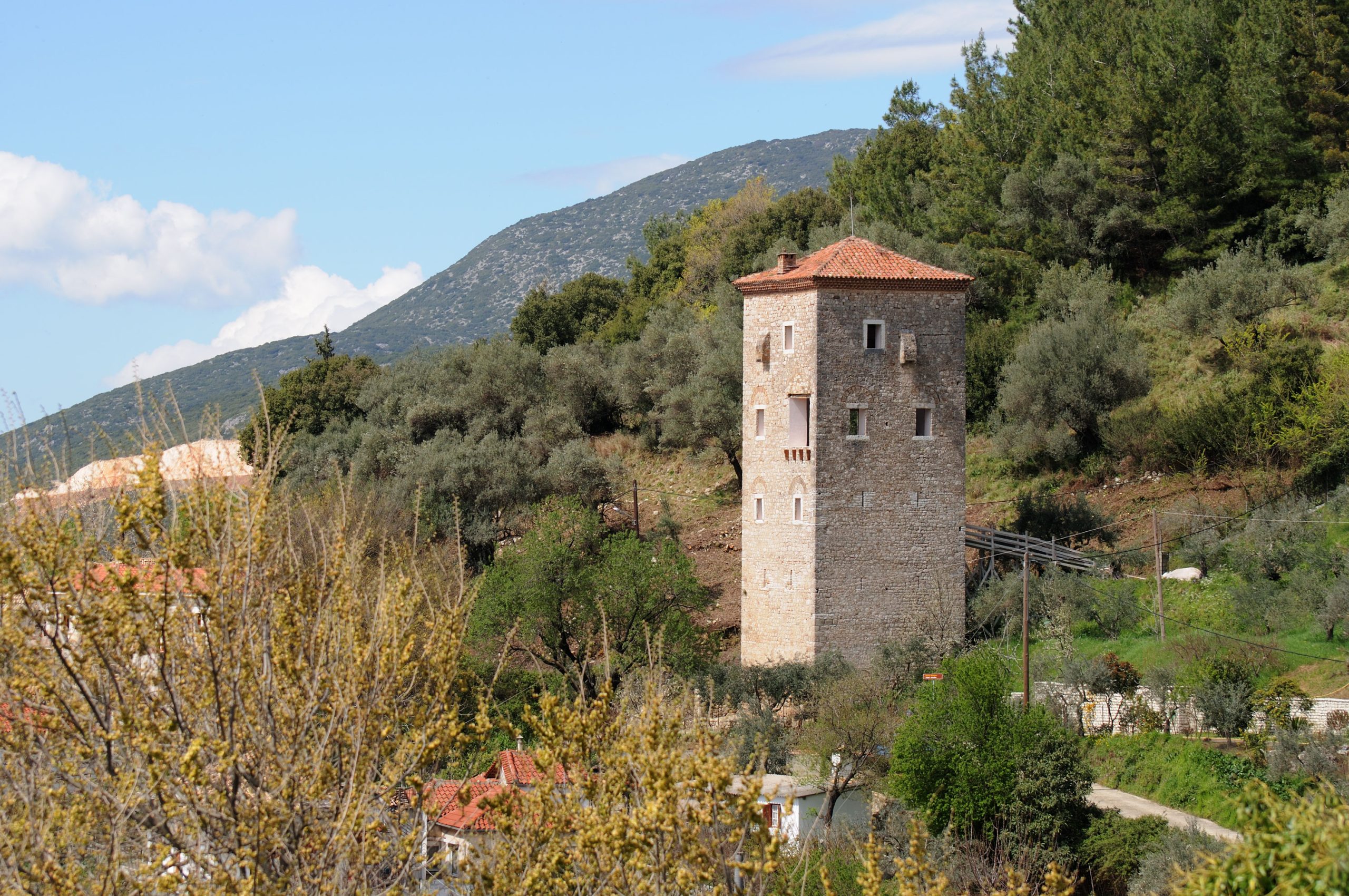
During the Ottoman period, Paramythia was firmly established as the main administrative, military and economic centre of the region, the seat of the kaza of Aydonat Kalesi (Castle of St Donatus), which was originally part of the Sancak of Ioannina and later, after the mid-16th century, part of the Sancak of Delvina, a town in Southern Albania. In 1867, it was incorporated into the newly established Εyâlet of Ioannina. Most of the population of Paramythia remained Christian up to and including the 19th century. The westernmost villages of the kaza were largely inhabited by Albanian-speaking populations, mainly Muslim Chams (an Albanian tribal group), who had settled in the area as early as the mid-14th century, establishing the Albanian-speaking enclave of Çamuria. From the 15th century onwards, Paramythia was the seat of the episcopal see of Buthrotum and Glyki, subject to the Metropolis of Ioannina. It did not become the titular see of Paramythia until the 18th century, while in 1895 it was elevated to a metropolitan see subject to the Patriarchate of Constantinople.
During the Ottoman period, the town’s commercial sector grew rapidly, its merchants supplying mainly agricultural goods to Ioannina and other markets of Epirus and making their mark far from their native land, in the cities of the northern Balkans and Italy. In the late 1670s, when the Ottoman traveller Evliya Çelebi visited the town, Paramythia had about 250 shops. Frankish merchants had settled there due to its importance as a transit centre. This commercial boom led to the establishment of the great annual Lambovos Bazaar, a trade fair that is still held today in Paramythia at the beginning of October. The agricultural production of the area was largely based in the fertile Fanari plain, with its rich crops, mainly rice and maize. Paramythia also produced livestock and other agricultural commodities, mainly cereals, cotton, wine, pulses and walnuts. It was famed for its excellent olive oil, which supplied the Imperial Palace itself in the 17th century.
Monuments - Antiquities of the area of Elea
Archaeological site of Elea
One of the largest ancient cities of Epirus, Elea, the seat of the Thesprotian tribe of the Eleatai and the first capital of the Thesprotians, extends over an area of 10.5 hectares east of the community of Chrysavgi (formerly Velliani), approximately 5 km south of Paramythia. Standing on a naturally fortified plateau at the foot of the Paramythia Mountains, at an average altitude of 480 m above sea level, it is also known as Kastri Vellianis (Castle of Velliani), a place-name believed to echo that of the ancient city. The location is of key geographical importance, as it controls the whole of the surrounding valley while ensuring access to the arable land in the area. Elea was founded shortly before the middle of the 4th century BC, reaching the peak of its prosperity in the Hellenistic period (3rd-1st half of the 2nd c. BC), especially between 360-330 BC, when it issued its own coins. Like other cities of Epirus, it was destroyed by the Romans in 167 BC and abandoned shortly afterwards.
The fortifications of Elea, which are preserved in extremely good condition in places, up to a height of 7 m, date from the founding of the city or a few decades later. They are built in polygonal masonry of large limestone blocks. The sheer cliffs of the plateau on which the city stands made it unnecessary to fortify the whole perimeter. There are two main gates in the wall, one on the east and one on the west side, while there is also a postern on the north side. A massive trapezoidal tower defending the east gate stands in the northeast corner. Another, semicircular tower, only fragmentarily preserved, protected the west gate. The wall is internally reinforced with transverse blocks (headers) to increase stability.
The buildings of the city occupy the western side of the plateau. The northeast side appears to have been left unbuilt, probably for defensive purposes. Stepped terraces supported by large polygonal retaining walls were created to level the slopes. The buildings stand on either side of a main street 3-4 m wide, running southwest to northeast and connecting the two main gates. The urban plan of the city forms a grid of smaller parallel or perpendicular streets. Small sewage and rainwater drains ran the length of the streets.
The foundations and lower walls of the buildings are constructed of rectangular or polygonal stones. The upper walls were made of mudbricks reinforced with timber frames. The floors were mostly cut into the bedrock or made of tamped earth. More elaborate floors are rare. The fragments of tiles found during the excavations indicate that the buildings of the settlement had tile roofs.
The dwellings were mostly single-storey houses with an area of 160-250 m2. Only a few had an upper floor. They usually comprised four or six rooms, with internal open courtyards in some cases. The main entrance is on the adjacent street. The discovery of clay bathtubs also indicates the existence of sanitary facilities.
Directly associated with the political and administrative functions of the city is the Agora complex, which covers an area of 3,000 m2 on the central flat part of the plateau, south of the main street. It was originally an open square laid out on three successive terraces, but during the Hellenistic period (3rd-1st half of the 2nd c. BC), three sides of the Agora were delimited by long, large stoai (porticos). A series of buildings were gradually erected in the area of the Agora to serve the public and commercial functions of the city and to store its public goods. Of the three stoai of the Agora, the one along the west side is the best preserved, with a colonnade of 11 Doric columns on the façade. In its central part are seven rectangular rooms of equal size, interconnected in twos or threes, surrounded by a corridor.
Of the buildings in the rest of the city, the one against the west wall is interesting. Two pottery kilns were found inside, indicating industrial activity. The only temple discovered in Elea to date lies in the scantily built-up northeast part of the city. It a small building consisting of three rooms: pronaos (antechamber), sekos (cella) and adyton (inner sanctum). The deity worshipped in the temple is unknown.
The city cemetery probably extended outside the west gate, along the road leading to the Kokytos valley.
Of the wealth of movable finds from the excavations, the coins are of particular interest. Besides those of the Epirote League, they include issues of major centres of antiquity (Ambracia, Aetolia, Acarnania, Corfu, Corinth, Macedonian kings, etc.), attesting to the wide-ranging economic and commercial contacts of the Eleatai with the rest of the ancient Greek world.
Today, after many years of enhancement work, the archaeological site of Elea is open to visitors.
Monastery of St John the Baptist (Velliani Monastery)
The monastery is located just southeast of Elea, in the western foothills of the Paramythia Mountains. Of the monastic complex, only the katholikon and some of the monks’ cells are preserved today. The katholikon, a three-aisled, barrel-vaulted basilica, assumed its current form due to the work carried out in 1843 by the abbot, hieromonk Leontios. The date of foundation of the monastery is unknown, but the oldest inscription in the katholikon preserves the date 1630.
Early Christian basilica, Chalasmata site or Chrysavgi Airport
The basilica, excavated near the Paramythia–Glyki provincial road, dates from the second half of the 6th century. The sanctuary apse has been incorporated into the small early-20th-century church of Zoodochos Pege (the Virgin Fountain of Life). The basilica has three aisles and a transept terminating in semicircular apses. This type, which is not very common in ecclesiastical architecture, is found in Epirus and in the Early Christian basilica of Dodona. Residential remains have been found around the basilica of Chrysavgi, indicating the presence of an Early Christian settlement.
Funerary monuments in the Kokytos valley
There are many funerary monuments in the valley of the “river of lamentation”. One that stands out is the funerary heroon (cult place of important figures who were worshipped as heroes after their death) of the 3rd century BC, which has been excavated at the Marmara site in the small community of Zervochori, just south of the Paramythia–Glyki provincial road. The almost square building, measuring 15.4 x 15.5 m, is constructed of large limestone ashlars. Inside was discovered a looted cist tomb with a few grave goods that had escaped the looters, including gold nuggets and pieces of gilt foil.
Another distinctive funerary monument in the valley is the cist tomb of a warrior of the 4th century BC which has been excavated in the community of Prodromi, south of Paramythia. It contained impressive finds, including the complete military equipment of the deceased.
Castle of St Donatus, Zervochori
The remains of a small castle of the first half of the 3rd century BC, with an area of around 1.10 hectares, are preserved on a low hilltop on the western slopes of the Paramythia Mountains, about 2 km south of Zervochori. It is named after the small 17th-century church of St Donatus built inside it. The size and location of the castle, at a key point controlling the roads to and from Elea, suggest that it served as a refuge for the people of the Kokytos valley. The castle has a rhomboid plan and its most vulnerable sides, the east and south, are protected by a strong polygonal wall, approximately 215 m long and 1.90-3.40 m thick, which is preserved to a maximum height of 3 m. The main gate, on the northeast, is protected by a rectangular tower. Based on the excavation finds, the castle was in use until the Early Christian period. Inside the castle, excavations have revealed the remains of one of the earliest Roman villas in Thesprotia (late 2nd c. BC-1st c. AD). One its rooms was decorated with superb frescoes in the Second Pompeian Style (50-30 BC).
Early Christian basilica, Paliokklisi, Zervochori
The remains of the large Early Christian basilica, covering an area of 286 m2, with a narthex, baptistery and various other auxiliary buildings, were discovered near the Paramythia–Glyki provincial road. The basilica, dating from the 5th-6th century, served the needs of a settlement whose inhabitants probably sought refuge in the castle of St Donatus in times of danger.
Church of St Demetrios, Zervochori–Kamini area
The funerary church to the east of the communities of Zervochori and Kamini dates from 1747. It is a three-aisled, barrel-vaulted basilica featuring a characteristic small vault with a high cylindrical drum. It incorporates the tripartite sanctuary of an earlier church dating from the time of the Despotate of Epirus (13th c.), built in rough cloisonné masonry.
Church of St Kyriaki, Gardiki
Fountain of Pogas, Choika
In the small community of Choika, west of Paramythia, is preserved a rectangular 16th-century fountain with an elaborate ogee arch on the façade.
Middle Byzantine basilica, Glyki
In the small community of Glyki, near the banks of the Acheron, are preserved the remains of a three-aisled basilica with what was probably a two-storey narthex on the west. The basilica dates from the late 9th-early 10th century or between the 11th and 12th centuries. Its large size, its elaborate masonry, the granite columns of its colonnades and its exceptional sculptural decoration (now in the Byzantine Museum of Ioannina) make this one of the most important Byzantine monuments of Epirus, despite its poor state of preservation. In the foundations of the basilica have been discovered the remains of an Early Christian church, which many researchers believe to be the church built in the late 4th century by St Donatus, Bishop of Euroia, with a grant from Emperor Theodosius the Great.
Monuments - Antiquities of the area of Photike
Archaeological site of Photike
The Egnatia Motorway passes just north of Liboni, about 4 km northwest of Paramythia and close to the modern community of Agios Donatos. There, based on the surviving inscriptions, are located the remains of the Roman colony of Photike, which was founded in the 1st century BC and flourished in Early Christian times. Written sources and archaeological data show that the city survived at least into the Late Byzantine period.
The plain in which the town was founded, with its rich farmland and abundant springs, near the springs of the Kokytos and Chotkova Lake, now drained, is of key strategic importance. The road from the coast of Epirus to Dodona and the Ioannina basin, and the western branch of the Roman Via Egnatia, which followed the coast from Dyrrachium to Nicopolis, both passed through Photike. In fact, Photike may be the Roman station Ad Dianam of this branch of the Via Egnatia, which is mentioned in the Tabula Peutingeriana. Two milestones of the 3rd-early 4th century found near the village of Chrysavgi south of Photike, one of which is set into the wall of the Early Christian basilica at the Chalasmata or Airport site, are associated with this road.
Photike has not been excavated, so its urban plan remains unknown. Its area is estimated at around 30-40 hectares. The archaeological material of the Roman period is limited to chance movable finds, mainly inscriptions. An outstanding group of 14 bronze statuettes of deities and mythical figures of the 1st and 2nd centuries, of exceptional artistry, probably also originates from Photike. Known as the Paramythia Hoard, it was removed from the country in the late 18th century and is now on display in the British Museum in London. Of the preserved buildings of Photike, the remains of a rectangular building of unknown purpose, known as Evraika, at the Chamdi site north of the Liveris torrent, probably date from the Roman period; the building remained in use during the Early Christian era. The rest of the surviving monuments of Photike date from the Early Christian and Byzantine periods.
Church of St Paraskeve (Palioklisi)
On a low hill northwest of Photike lies a large three-aisled basilica with an expanded narthex and an atrium on the west. Known as Palioklisi (“old church”), it dates from the Early Christian period. The east part of the basilica, which is preserved to a height of 4 m, survives in better condition. The other walls are no more than 1 m in height. After the abandonment of the basilica, a small single-nave church was erected on the site of the sanctuary. The church is preserved to a low height, while there is insufficient evidence to date it. Numerous burials have been discovered around the basilica, evidence that the site was used as a cemetery, probably after the abandonment of the basilica.
Church of St Photeine
This three-aisled basilica, now in ruins, was built on a small wooded plateau at the Valsamari site, north of Photike. It has an irregular plan, probably because it was constructed on or near an existing temple or public building of the Roman period, of which part of the mosaic floor and a significant number of sculptures, including two intact stone altars, have come to light. The best-preserved part of the monument is the tripartite sanctuary, whose walls survive to a height of about 2.90 m. Its individual architectural features date it to the Middle Byzantine period. The remains of the elaborate original floor of the church, of limestone slabs surrounded by opus sectile (marble inlay), are interesting. Various later building phases, probably of the Late Byzantine period, are identified in the monument, including the addition of the elongated narthex on the west.
Church of Panagia Lambovithra
This three-aisled basilica with a later narthex on the west is located in the centre of the archaeological site of Photike. The church is dated to the Late Byzantine period. It is built on the site of a basilica dated to the first half of the 6th century, of which a small rectangular room with an exceptional mosaic floor has been uncovered. A large amount of building material from the basilica was reused as spolia in the construction of the church of Panagia. The parapets of the marble pulpit and the colonettes of the marble templon, immured in the west façade of the church, stand out.
Metropolitan church of Photike
Just north of the church of Panagia are building remains and fragments of a mosaic floor, which, according to local tradition, belong to the metropolitan church of Photike.
Early Christian basilica, Krystallopigi
Just a few kilometres west of the archaeological site of Photike is the small community of Krystallopigi, which was established after the abandonment of the village of Selliani. Scattered building remains and pottery have been found in the area. A three-aisled basilica with a baptistery dating from the second half of the 6th century has been excavated on the hill of Rachi Velli, southwest of Krystallopigi and next to the Neraida–Paramythia provincial road. It is built on the site of an earlier building, probably a larger basilica.
Ottoman fountain and “Platanos tou Arapi” plane tree, Krystallopigi
Next to the Neraida–Paramythia provincial road is preserved a rectangular fountain of the 15th or 16th century with an ogee arch on the façade. It is built in elaborate cloisonné masonry and its façade is decorated with a band of bricks in a herringbone pattern. Nearby is an ancient plane tree known as the “Arapis” (“black man”, from the Turkish arap), the hollow trunk of which has been converted into the chapel of Panagia Plataniotissa, the Virgin of the Plane Tree.
Watermill complex, Krystallopigi
Just outside Krystallopigi is the watermill complex of the Lambros Doumas family, which is still in operation today. Also known as the Pyrsinellas or Frangos watermill, it dates from the Late Ottoman period. The complex combines water-powered installations (watermill and fulling mill) with living and storage areas.
Museum
Neochori Folk Museum
The museum is housed in the old stone primary school of the small community of Neochori, a few kilometres northwest of Krystallopigi, where important antiquities came to light during the construction of the Egnatia Motorway. The museum houses a wealth of exhibits on the daily life and occupations of the inhabitants of the area.
Monuments - Antiquities of Paramythia
Castle of St Donatus
The castle, mentioned in numerous written sources from the 13th century onwards, was inhabited until the early 19th century. Built in the Hellenistic period in the rich woodlands above Paramythia, on a naturally fortified rocky plateau of Mount Gorilla overlooking the surrounding area, it is identified by researchers as the castle rebuilt by Emperor Justinian to ensure the safety of the inhabitants of neighbouring Photike. The Hellenistic phase of the monument is easily discernible in the lower parts of the strong fortified enceinte, which are built in polygonal masonry of large ashlars. Two other main building phases can also be seen in the wall, one of the Byzantine and one of the Ottoman period. The castle, covering an area of 3.5-4 hectares, has a polygonal plan and is oriented east-west. The hill on which it stands is protected on the south and north by high cliffs, making it unnecessary to fortify the whole perimeter. The main gate of the castle is located in the south half of its more accessible west side, while there is another gate in the north half of the same side. There are also two gates on the east side of the castle, which is connected to Mount Gorilla by a small saddle. The defences of the wall were reinforced by two rectangular towers, one on the north side and one near the southeast gate.
On the higher northeast side within the enceinte is the relatively small citadel, measuring 24.80 x 46.60 m. It is separated from the rest of the fortress by an inner wall reinforced with rectangular towers. The interior is divided by a transverse wall into two parts, the Upper and Lower citadel. The more vulnerable east side of the citadel is protected by two towers, one circular and one rectangular.
Inside the castle, especially in its better-preserved west part, are the remains of houses and other buildings of the Ottoman period, including a cistern.
Church of Megali Panagia (Dormition of the Virgin)
In the southwest of Paramythia is the church also known as Megali Ekklisia (Great Church) or Megali Panagia (Great Virgin) of Paramythia, one of the most important Byzantine monuments of Epirus. Formerly the katholikon of a monastery, it is now a funerary church. It belongs to the fairly uncommon architectural type of the three-aisled cross-vaulted church with a raised central bay in a transverse barrel vault acting as a dome, with a narthex on the west. It was built in the second half of the 13th century, but its present form is the result of the extensive interventions that it underwent, probably in the 19th century (addition of an exonarthex, ossuary, portico and bell tower).
The monument stands out for its elaborate masonry and its rich moulded decoration, which is very varied and imitates that of the monuments of Arta, the capital of the Despotate of Epirus, where ecclesiastical architecture flourished. An 18th-century fresco depicting the Second Coming of Christ has been uncovered in the narthex. The church houses particularly important relics, including the exquisite gold-embroidered Epitaphios (Bier of Christ) made in 1578 by the embroiderer monk Arsenios of the Monastery of Varlaam in Meteora.
Late Byzantine bathhouse
The small bathhouse, which was probably part of the monastic complex of Megali Panagia, just 100 m away, is believed to date from the Late Byzantine period. Despite its fragmentary state of preservation, the individual parts of the monument (changing room, tepid and hot room), which were once vaulted, can be securely identified. The bathhouse walls are interesting, combining rubble masonry in the lower part with cloisonné masonry in the upper part. A brick dentil band runs around the upper part of the building. Three pieces of graffiti scratched on one of the bathhouse walls, depicting typical ships used between the 13th and 16th centuries, are an unexpected attestation to the building’s operation in the inland town of Paramythia, far from the sea.
Koulia (fortress-house)
Built at the foot of the Castle of St Donatus, in a prominent location in the Proniatika district in the northwest of Paramythia, this is one of the best-preserved examples of an Epirote fortress-house dating from the second half of the 18th to the early 19th century. Also known as the Koulia of Bonolati, it is a tall, square tower with five storeys. Standing 26 m high, it ensured that its owners could keep watch over the surrounding area. It is covered with a vault with a hipped roof. The ground floor of the monument is also covered with a vault, while the other storeys are separated by wooden floors. The entrance to the koulia is on the second storey and was formerly accessed by a retractable wooden ladder. For security, the windows are small and are only found on the upper storeys. The building’s defences are reinforced by gun-loops, the only openings on the ground and first storeys, combined with the murder holes on the fourth storey.
Clock tower
The historic clock, housed in a tall stone tower near the upper Melingoi–Paramythia regional road, was built in 1750 on the initiative of the local Maroutsis family, who lived in Venice. The mechanism was made in Italy and has to be wound up daily.
Rigas Mansion
The listed two-storey mansion of the Rigas family, now a guesthouse, was built in 1872 and has been used for various purposes over time. It combines elements of local traditional and Italian architecture, as the family had close ties with Italy. Its most striking feature is the square cupola atop the hipped tiled roof, typical of the country villas of Trieste and Tuscany.
Voulgaris Primary School
This imposing building was erected in 1937 at the expense of Georgios and Konstantinos Voulgaris, in accordance with the wishes of their father Sotirios Voulgaris, a distinguished silversmith who was highly successful in Italy and laid the foundations of the internationally acclaimed Italian fashion house of Bulgari.
Fountains
Several traditional fountains featuring elaborate masonry are preserved in Paramythia, such as that of Sebey in the Bolotates district and the fountain in the courtyard of the church of Megali Panagia.


