Petres

The Hellenistic-Roman town of Petres. A flourishing ancient town near Lake Petres

The remains of a densely populated town that flourished during the Hellenistic and Roman periods have been discovered on the hill of Gratista (Grantista), about 1.5 km southwest of the modern village of Petres (formerly Petersko), near the southwest shore of Lake Petres in the Municipality of Amyntaio. The small Lake Petres, together with the larger neighbouring Lake Vegoritida and Lakes Zazari and Cheimaditida, form the Amyntaio system of lakes. The four lakes are believed to be remnants of the great ancient Lake Eordaia and are hydrologically connected to each other. They are included in the European Natura 2000 network of protected areas. Despite its degradation, mainly due to overuse of its water resources, Lake Petres forms almost a single dynamic ecosystem with Lake Vegoritida, with particularly rich fauna and flora, the habitat of many bird species. The wider area is of great archaeological interest, with antiquities dating from prehistoric times to the post-Byzantine period.

The steep, trapezoidal hill on which the ancient town is built is bounded by two seasonal streams. Blending into the surrounding hills, it protected the city, while its position allowed the inhabitants to monitor and control the fertile plain to the south and Lakes Petres and Vegoritida to the east. In antiquity, the site formed part of Eordaia, a region between Upper and Lower Macedonia, the two major geomorphological units of ancient Macedonia. People moved from Lower to Upper Macedonia through the Kleidi Pass, also known as Kirli Derven, the narrow natural pass northwest of Petres, through which the modern road still runs today.

The lengthy excavations in the ancient town of Petres, which began in the 1980s and continue to this day, have not brought any inscriptional evidence to light by which to identify the town. Its name, on which various theories have been put forward, is still open to debate. According to some scholars, the ancient town is Cellae (Kelle or Kellion), a station (mansio) of the Via Egnatia, which, according to the Roman Itineraria, was 14 Roman miles from the changing station (mutatio) Ad Duodecimum station and 34 Roman miles from Heraclea Lyncestis or Heraclea in Lyncus. The first station is located east of Petres, near the village of Drosia, roughly 18 km west of Edessa. Heraclea, which, according to the prevailing view, was founded by King Philip II (359-336 BC) in the mid-4th century BC, was an important station on the Via Egnatia and a prominent city of Lyncestis, a region bordering Eordaia on the north. Heraclea Lyncestis has been identified with the remains of the city excavated south of Bitola (formerly Monastir) in North Macedonia.

αρχείο ΔΒΜΑ, φωτ. Κ. Ξενικάκης / archive DBMA, phot. k. Xenikakis

Regardless of the identification of the ancient town of Petres, what is widely accepted by researchers is that the Via Egnatia passed close by, contributing decisively to its development in Roman times. It has been argued that the ancient road passed through the plain, 1.5-2 km southwest of the ancient town, where excavations at the EBGE site have revealed part of an organised cemetery of Early Christian times, while chance surface finds indicate the existence of ancient sanctuaries at the same site. In general, the area of Amyntaio contains important antiquities, one of the most significant being the Roman villa.

Five milestones found in the wider area of Petres are connected to reconstruction or repairs to the Via Egnatia. One, now lost, was found at the beginning of the 20th century set into in the wall of a private house in the modern village of Petres. It probably bore two Greek inscriptions with dedications to the Emperor Hadrian (117-138 AD) and the Second Tetrarchy (305-306 AD). Two more milestones, now in the Archaeological Museum of Florina, were found in a field near the southern exit of the Kleidi Pass. They also bear dedicatory inscriptions in Greek, to the Second Tetrarchy. The fourth milestone, also in the Archaeological Museum of Florina, was found in the plain between Petres and Amyntaio and bears four or five Greek inscriptions, one of which is a dedication to the Second Tetrarchy; of the others, only one can be dated with certainty between 333 and 335 AD, while another inscription is dated between 313 and 333 AD. The dedications to the Second Tetrarchy of the four milestones have been argued to be the work of the same stone-carver. If the ancient town of Petres is indeed Cellae, the four milestones indicate that it had acquired the status of a city (civitas) and assumed responsibility for the maintenance of the Via Egnatia. The exact time, however, when Cellae acquired city status is not known, as it is not mentioned in the Roman itineraries as a civitas but as a station (mansio) on the Via Egnatia. Finally, a fifth milestone, now lost, bearing a Greek inscription also dedicated to the Second Tetrarchy (305-306 AD), was found in the late 19th century in Vegora, just southeast of Petres.

In 2022, a section of the Via Egnatia with a total width of about 7 m was identified at the Grammada–Fountes site, near the village of Petres. It consists of the main roadbed (3 metres) and the curbing (4 metres), while it is edged with upright stones embedded in the ground. Stone-paved sections of the ancient road, 3.30 m wide, are still visible today on the east shore of Lake Vegoritida, near the modern village of Faragi.

Based on the above, the route of the Via Egnatia in the wider area of the Amyntaio basin can be reconstructed as follows: after the Ad Duodecimum station, the ancient road continued west, through the Pass of Arnissa (Sut Burun), a village on the northeast shore of Lake Vegoritida formerly called Ostrovo – which is why the lake is also known as Lake Ostrovo. Ostrovo is described in Middle and Late Byzantine sources as one of the strongest castles in the region. The Via Egnatia then ran along the eastern shore of Lake Vegoritida, which was considerably smaller in antiquity. The ancient road then followed a southwesterly course towards Vegora, afterwards continuing south of Lakes Vegoritida and Petres. Important antiquities and a Roman-era city covering an area of over 10 hectares have been found in Vegora. The Via Egnatia then continued towards the Kleidi Pass (Kirli Derven), where, according to the historians Nicholas Hammond and Miltiades Chatzopoulos, the changing station (mutatio) of Grande was located. From the Kleidi Pass, the ancient road continued its course towards Heraclea Lyncestis, passing through the plain of Florina. Note that the route of the Ottoman road that succeeded the Via Egnatia (Sol Kol) did not pass, like the ancient Via Egnatia, to the south of the two lakes, but to the north, like today’s asphalt road.


History

The earliest occupation of the hill of Gratista dates back to the Iron Age (c. 11th-8th c. BC), based on the discovery of pottery of this period in the fill of the excavation. The next phase of occupation dates from the Late Classical period (second half of the 4th c. BC), when Eordaia was annexed by King Philip II (359-336 BC) to the Kingdom of Macedon in 358 BC, following his victorious campaign against the Illyrians. The first organised residential form of the town, which has been identified only in certain parts of the excavated hill, is believed to be due to Philip’s attempt to ensure the protection of the kingdom’s borders and create organised residential units by unifying and urbanising the local tribal groups of Eordaia, who had been living until then in smaller scattered towns called komai.

The next building phase, with carefully constructed buildings laid out in insulae, is dated in the early 3rd century BC, perhaps in the reign of Antigonus II Gonatas (277-274 and 272-239 BC). This was followed by an extensive building phase in the early 2nd century BC, probably during the reign of Philip V (221-179 BC), when the town assumed the planned layout we see today. During this building phase, which extends over the entire excavated area, the streets of the previous phase were abolished and the urban insulae of the city were reorganised.

From then on, the town of Petres was to experience a period of prosperity that continued into Early Roman times. In 168 BC, after King Perseus’ defeat at the Battle of Pydna, Macedonia was conquered by the Romans and divided into four large administrative regions called merides or regiones. The region of Western Macedonia was included in the fourth and largest meris, with Pelagonia as its capital. In 148 BC the merides were replaced by the Roman Provincia Macedoniae. The region of Western Macedonia was accorded special privileges and freedoms due to the pro-Roman attitude of its inhabitants. The new situation facilitated communication and cultural contacts between the region and the rest of Macedonia.

Μιλιοδείκτης Εγνατίας από την περιοχή των Πετρών, Α. Μ. Φλώρινας / Milestone of the Via Egnatia from the area of Petres, Archaeological Museum of Florina
Επιτύμβια στήλη από τη "Συνοικία της Κρήνης", Α. Μ. Φλώρινας / Funerary stele from the “Fountain Quarter”, Archaeological Museum of Florina

The period of prosperity of the town of Petres coincides with the passage through the area of the Via Egnatia. The ancient road seems to have created favourable conditions for trade between Petres and the other cities of Macedonia, as well as with more distant regions. The pottery found here is proof of close relations with Pella, the capital of the Macedonian state. At the same time, the discovery of coins from Rome, Illyria and Thessaly, and independent issues of the cities of the Macedonian Kingdom, mainly Thessaloniki, Pella and Amphipolis, as well as amphorae from Rhodes, Thasos and Italy, attest to the wide range of both commercial and cultural exchanges. Apart from the development of trade, during this period the agricultural economy of the settlement of Petres was transformed into an agro-industrial one. From the 2nd century BC onwards, flourishing pottery, coroplastic (terracotta figurine), sculpture and metalworking workshops arose in the town, demonstrating its prosperity and the high living standard of its inhabitants. The ancient city of Petres had notable potters: two of their names, Epikouros and Asklepiodoros, are known to us from the signatures on their works. Of the products of the local workshops, two relief kraters are particularly noteworthy, one depicting the retinue of Dionysus (late 2nd/early 1st c. BC) and one with scenes from the Odyssey (shortly before the mid-1st c. BC).

The heyday of the town of Petres was cut short in the middle of the 1st century BC, when it was destroyed, probably by fire, during the Roman civil war between Caesar and Pompey (48 BC), when many of the military operations and clashes of the two rival armies, led by the generals Domitius and Scipio, were conducted on Western Macedonian soil. The losses from the military conflicts caused the depopulation and gradual economic decline of Upper Macedonia, which, according to the Greek geographer Strabo, had become deserted and was now inhabited “in komai”. The thick burnt layer that covered the buildings of the town of Petres has been precisely dated by a coin hoard of 125 denarii, ranging from 105 BC for the earliest to 42 BC for the latest.

After the middle of the 1st century BC, the town of Petres was abandoned. Only limited traces of habitation of the 1st century AD are found on the acropolis, while sporadic movable finds attest to human presence in the same area until the 6th century AD.

The discovery of the remains of a Roman bathhouse and a cemetery in the modern village of Petres indicates that the town was probably moved there during this period.

The rich finds from the settlement of Petres are now exhibited in the Archaeological Museum of Florina, shedding light on various aspects of the daily life and occupations of the inhabitants of the ancient city. The iron agricultural tools, as well as the large quantities of resin used to seal the wine storage vessels and probably also to flavour the wine, are evidence of advanced agriculture and viticulture. The charred grains and legumes attest to the cultivation of these crops and shed light on the dietary habits of the inhabitants.

The archaeological site of Petres has been restored and is now open to the public.

Λίμνη Χειμαδίτιδα (Αρχείο Περιφέρειας Δυτ. Μακεδονίας, φωτ. Π.Μεράκος) / Lake Cheimaditida (archive of Region of Western Macedonia, phot. P. Merakos)
(Αρχείο Περιφέρειας Δυτ. Μακεδονίας, φωτ. Π.Μεράκος) / Lake Cheimaditida (archive of Region of Western Macedonia, phot. P. Merakos)

Monuments - Antiquities

Urban plan

The town of Petres was protected by a strong limestone wall, of which only a small part has come to light, as most of it now lies under cultivated fields. The area enclosed by the wall is about 20 hectares, so this was a relatively small town, with a population of around 5,000 inhabitants. Its cemeteries, which have not yet been excavated, were probably located outside the wall, to the south and east of the town, based on some isolated finds. The excavations to date have been conducted in three areas of the ancient town: a) the “Acropolis”, on the highest plateau of the hill, b) the “Fountain Quarter” on the southeast hillside, and c) the “South Plateau” on the south hillside.

The urban plan of the town is loose, adapted to the terrain of the hill, which is particularly steep except for the flat Αcropolis on the hilltop. The densely built-up insulae (building blocks) are irregular in shape and vary in size according to their location on the hill. In each insula, the houses are arranged in groups of three or four in contact with each other. The insulae were accessed by long roads running parallel to the contours of the hill. Smaller, steeper streets, 0.80 to 1.50 m wide, made it possible to move between the insulae, while ensuring better lighting, ventilation and rainwater drainage from the roofs of the houses. Both the large and the smaller streets featured a well-planned system of built water supply pipes and open drains. There were fountains at various key points in the town.

This is a well-organised district, approximately in the middle of the hillside, facing east to the lake and the plain. Four insulae with rich dwellings and important public and religious buildings have been excavated here. The district was crossed by a 3-metre-wide main road which was also suitable for wheeled vehicles. It was paved with earth mixed with small pieces of tile and shell, covered with fine gravel in many places. Under the roadbed ran a clay water pipe leading to a monumental fountain, which also had a cistern for collecting water.

In the south part of the quarter was discovered a large public building which, according to an inscribed stele, is a sanctuary of Zeus. It is preserved to a height of 2 m and consists of an almost square hall around which five smaller rooms are arranged. In the centre of the square hall is an altar-hearth for burnt offerings. The sanctuary had two entrances, a secondary one on the west and the main entrance, with a monumental stone ramp, on the south.

To the east of the sanctuary a large circular structure and mills for grinding grain have been uncovered, as well as a large underground storage area containing 17 large storage jars. The size and number of the jars, the dimensions of the space in which they were stored and its proximity to the sanctuary of Zeus indicate that this was a public storehouse.

Between the sanctuary of Zeus, the public fountain and the public storehouse was an open square, the commercial centre/agora of the town, with shops along the main street.

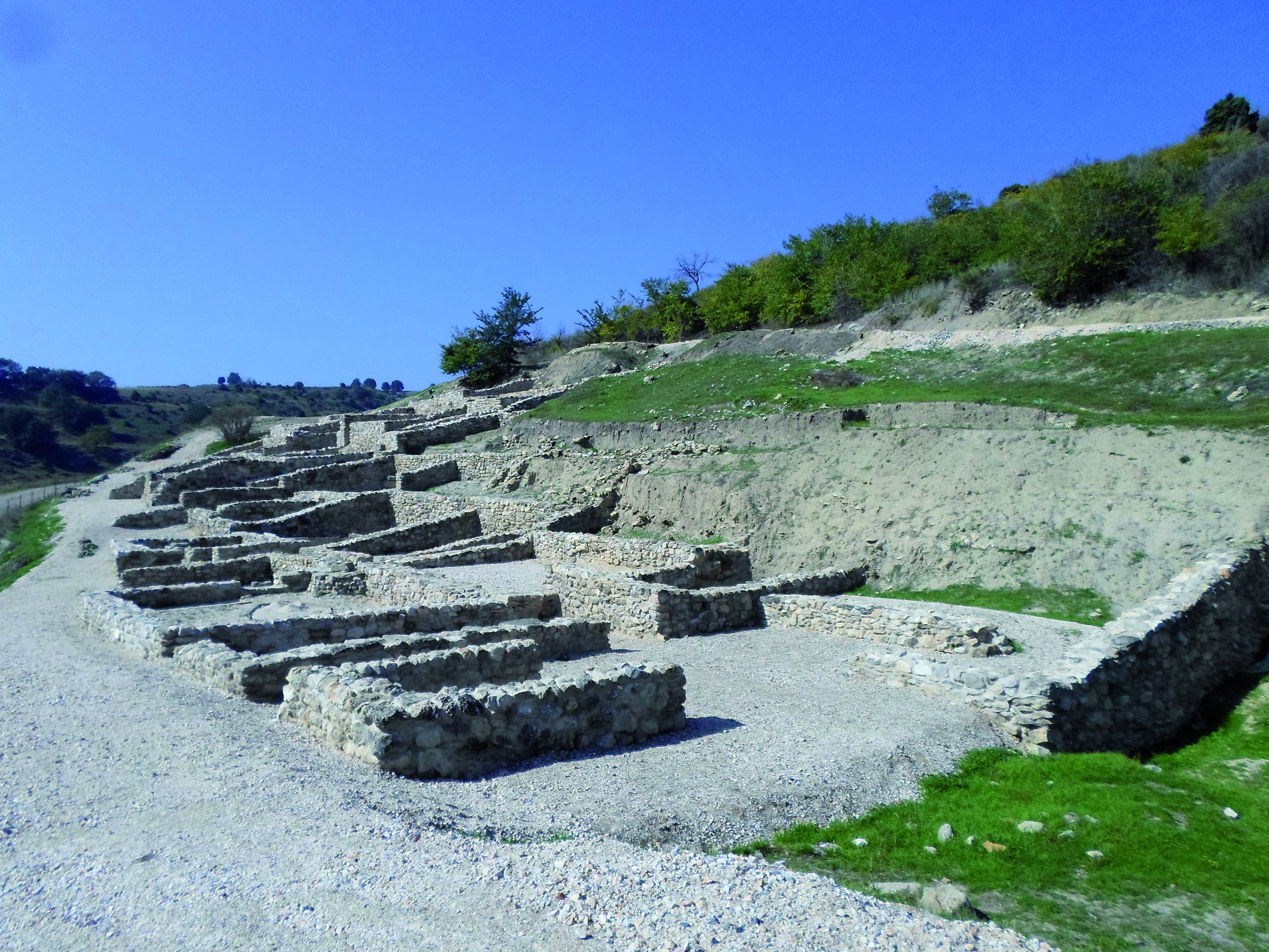
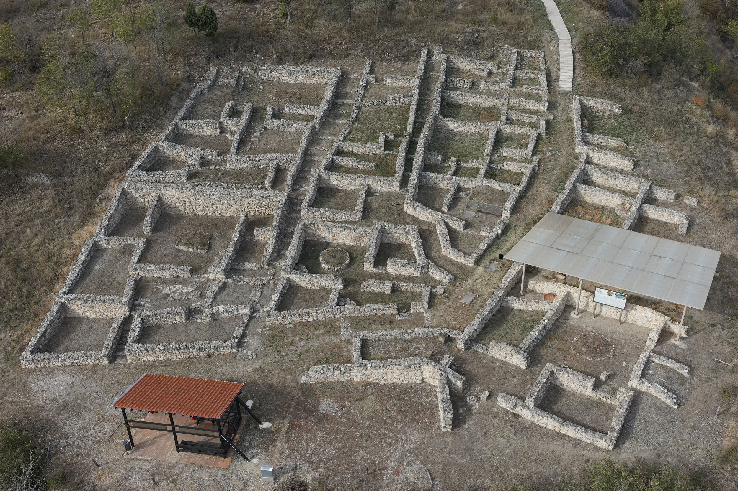
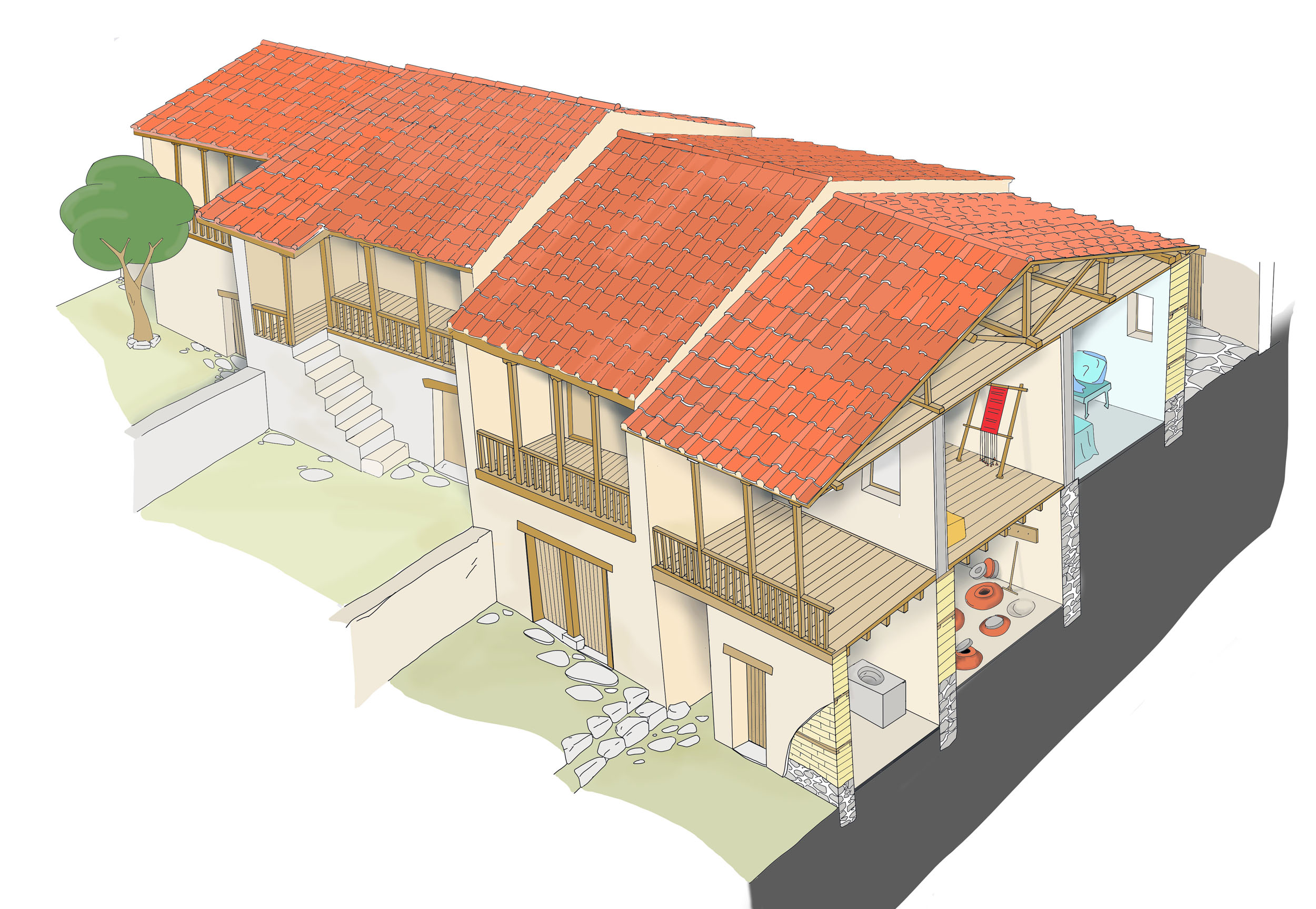
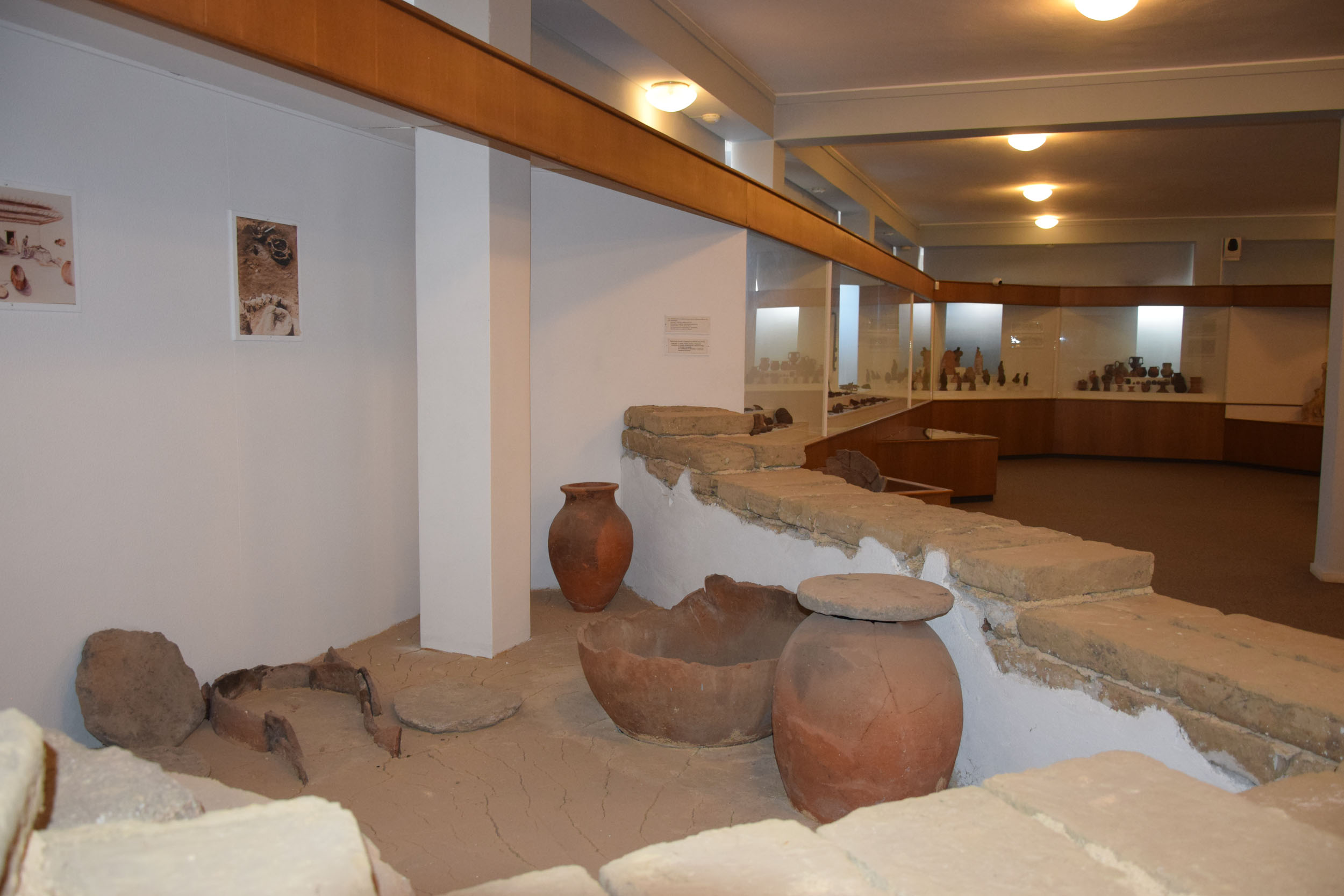
The private houses in the city usually have an area of 180-200 m2 on two floors. The ground floor is built of rough stones joined with mud to a height of about a metre, and mud bricks further up. The floors on the ground floor were usually earthen, or more rarely made of plaster or large pebbles set in plaster. Upstairs, lighter materials such as wood, straw and mud were chosen for structural reasons.

On the ground floors of the houses were the auxiliary rooms, workshops for making various items and storerooms containing jars of different sizes for storing crops. On some of the ground floors, ovens or hearths for food preparation were found, while built mills for grinding grain are common. In several cases, animals were kept on the ground floor.

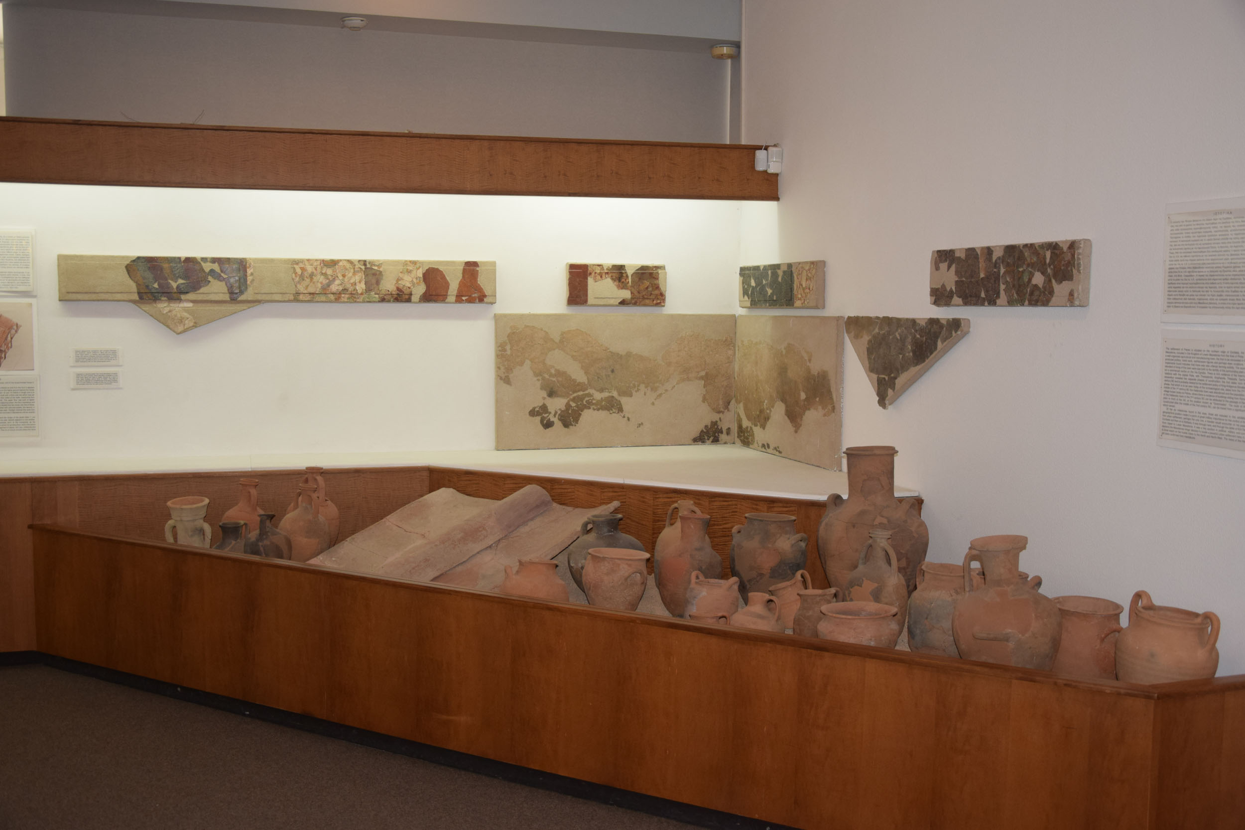
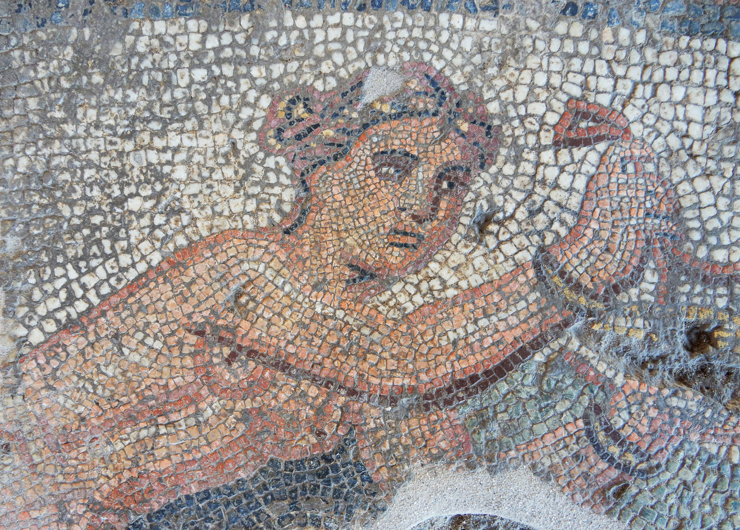
On the upper floor there were usually two rooms for everyday living, the gynaeconitis (women’s quarters) and the andron (men’s quarters). In the excavation layers corresponding to the men’s quarters, skyphoi, kraters, amphorae and other banqueting vessels are usually found. The layers corresponding to the women’s quarters usually contain clay loomweights from the looms used to produce the fabrics for the family’s clothing. The same rooms would also have contained a small shrine, as figurines, mainly of female deities, often come to light there.

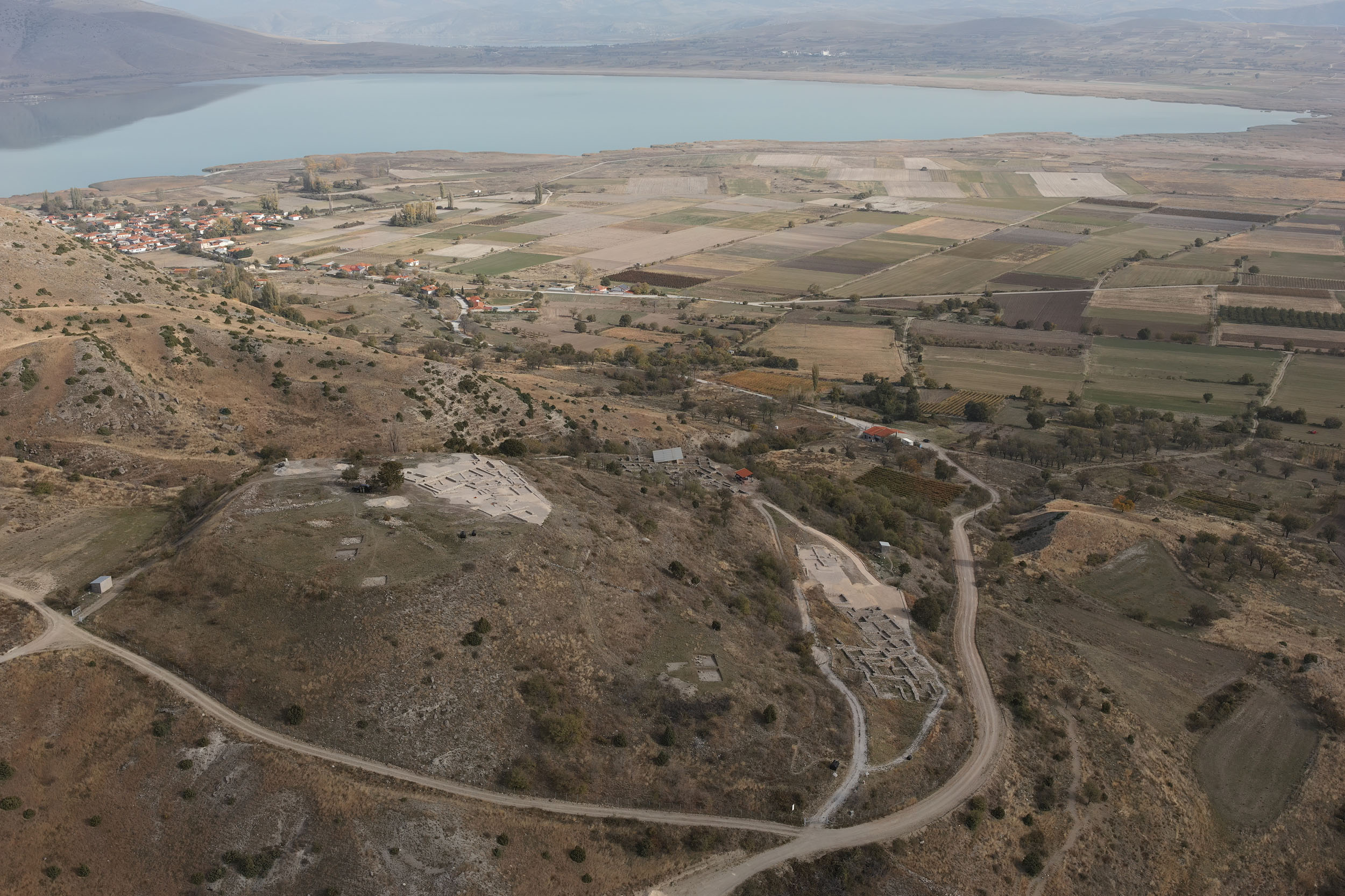
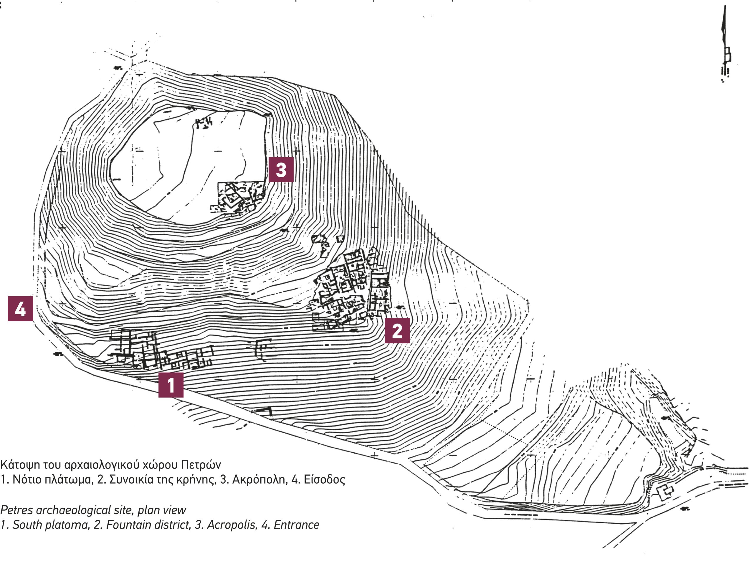
Of particular interest are the private houses that have come to light in the district on the South Plateau, which either have narrow façades, adapted transversely to the hillside, or wide, L-shaped façades. Due to the slope, many of the houses are two-storey on one side and single-storey on the other. On the ground floor, which was directly accessed from the street, was the andron, which was often decorated with fine coloured stucco imitating various types of marble. This type of decoration, known as the First Pompeian Style, is also found in the houses of the Macedonian capital, Pella. In the front part of the upper floor of the houses of the South Plateau were the women’s quarters, which were accessed via an external stone staircase and had a semi-roofed space for lighting, ventilation and taking the air. This resembles the covered balcony (hayat) of the two-storey houses of Macedonian traditional architecture, confirming that this feature predominated for centuries, presumably due to the particular climate and terrain of Northern Greece.

Some of the houses in the Fountain Quarter have a paved inner courtyard in front, while in a few cases the rooms are laid out around a central open space, in the typical layout of ancient Greek houses.

In the particularly fertile Amyntaio basin, where the water element dominates with the presence of four lakes (Vegoritida, Petres, Zazari and Cheimaditida), a dense network of land, riverine and lakeside settlements developed, which covers a time span of at least eight millennia. The earliest of these date back to the Early Neolithic period.

A short distance from the city of Amyntaio, excavations have brought to light an unusually large urban Roman villa of the 2nd century AD, which consists of 96 rooms, including baths, a domestic sanctuary of Zeus and luxurious living spaces. The latter are decorated with frescoes, sculptures and magnifisent mosaic floors, which cover a total area of approximately 360 sq.m., including among other subjects, the Abduction of Europa, Apollo on a griffin and Nereids with seahorses.


Vevi (former Banitsa), located at the west of Lake Petres, is one of the largest and most important settlements of the Regional Unit of Florina. It experienced great development during the Ottoman period due to its particularly fortified location and its proximity to the Via Egnatia and the road axis leading from Thessalonica to Monastir. Today, the church of St Nicholas, one of the most important in the wider area, is surrounded by a cemetery, in which particularly interesting stone crosses of the 19th century are preserved. The church, which was built as a katholikon (monastery church) in 1460, is single-aisled wooden-roofed basilica. Its interior is decorated with interesting frescoes dated to the same year, which bear iconographic and stylistic similarities with the artistic production of Kastoria.

Other stops in the Regional Unit of Florina

error: