Kale castle, Amyntaio

Kale, a small castle on the banks of Lake Petres

The ruins of the fortified enclosure of Kale (pronounced Kále), meaning “Castle”, as the local inhabitants call it, are preserved between the modern villages of Petres and Agios Panteleimon, on the north shore of Lake Petres.

The castle is built on a natural stronghold overlooking the plain of Eordaia which stretches to the south of Lakes Petres and Vegoritida, with a partial view to the southwest of Lyncestis, the region bordering Eordaia on the north. The castle also overlooks the mountain pass of the modern villages of Vevi and Kelli to the northeast. This choice of location has been linked to the control of the Via Egnatia, which passed close by, to the south of Lakes Petres and Vegoritida. The road that succeeded the Via Egnatia in Ottoman times (Sol Kol) did not pass south of the two lakes, but north, like the modern asphalt road.

History

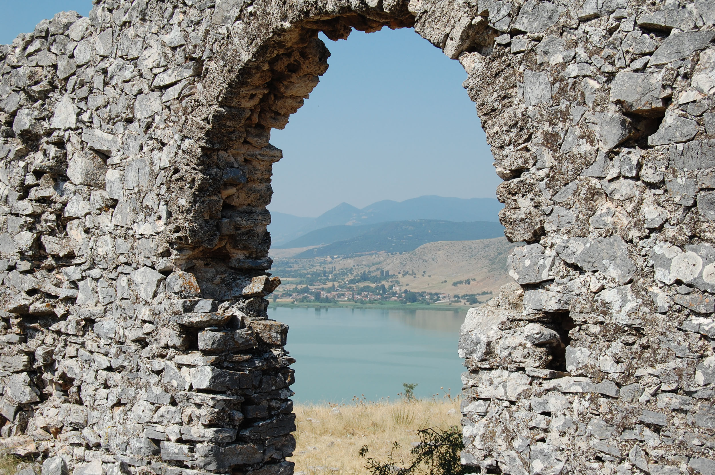
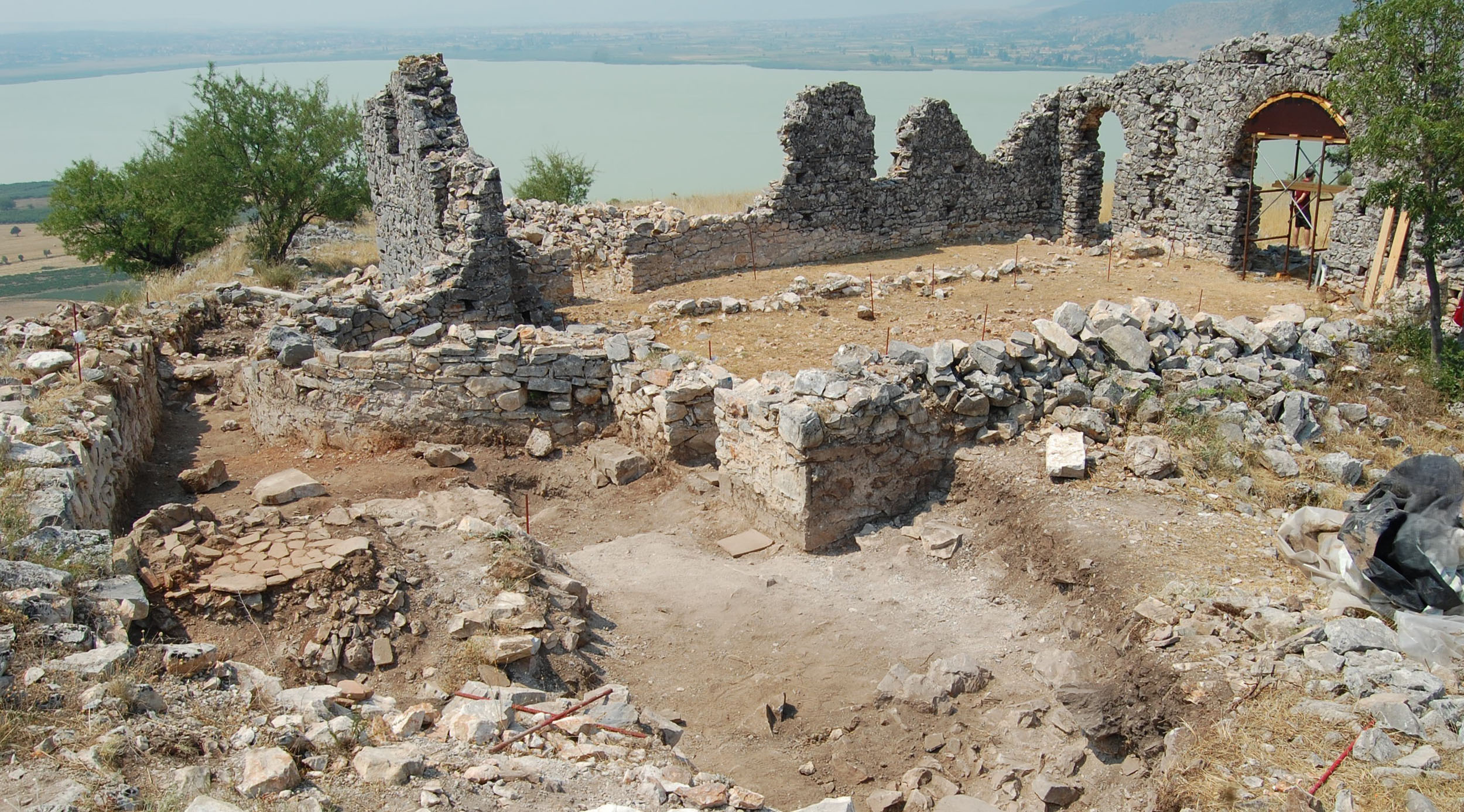
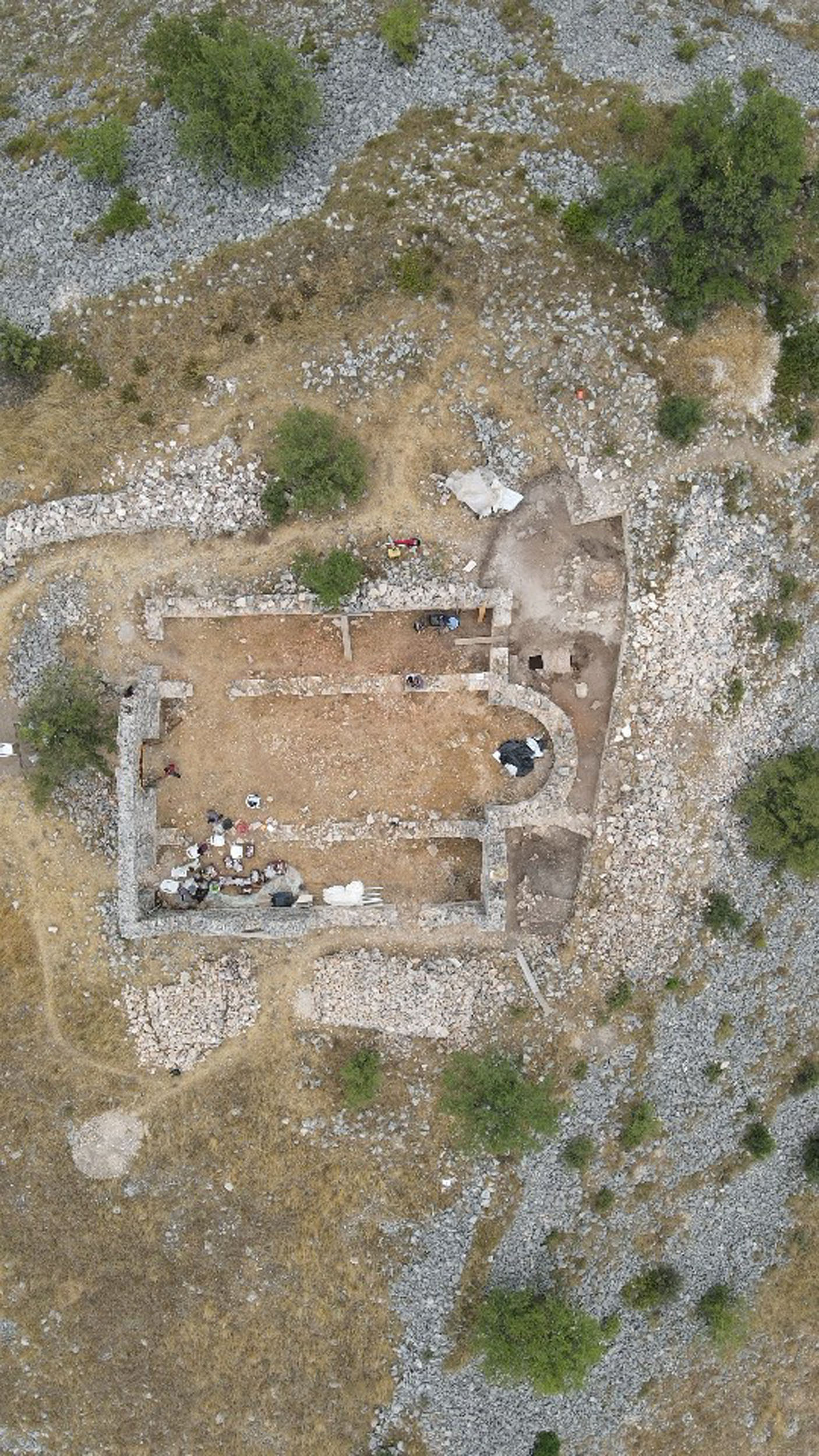
Based on the information available to date, there is insufficient evidence for the identification and dating of the castle. Older research and local tradition place it in the context of the fortification works of Justinian I (527-565), but surface surveys have so far mainly yielded pottery of the Middle Byzantine period, a small quantity of handmade pottery typical of the 7th to 9th centuries, and individual sherds of the 13th century. The church on the plateau of the citadel, the only surviving building of the castle, dates from the 9th century or the 8th at the earliest, based on its morphological and typological characteristics. The archaeological evidence thus supports the dating of Kale Castle to the Middle Byzantine period and its inclusion in the dense network of fortified sites that developed in Western Macedonia in the 9th and 10th centuries, a period of general administrative reorganisation of the provinces of the Byzantine Empire. The same applies to the nearby castles of Ostrovo (present-day Arnissa) and Setina, 6 km northeast of the modern village of Skopos in Florina.

The castle may be connected with the place-name Peteriskó or Peterísko, known from Byzantine sources of the 11th century. This hypothesis is due to its proximity to the modern village of Petres, which was called Pétersko from the 15th century until 1926. The name is attested in Ottoman registers of 1481, which record the village as having about 350-400 inhabitants. The place-name Peteriskó first appears in the work of the historian John Skylitzes, in his account of the military policy of Emperor Basil II Boulgaroktonos (the Bulgar-Slayer) (976-1025) against the Bulgarians. According to Skylitzes, Gavril Radomir, the son of Tsar Samuel, was murdered at Peteriskó in 1015, shortly before the dissolution of the Bulgarian state in Macedonia by Basil II and its reintegration into the Byzantine Empire (1018). The Strategikon of Kekaumenos, an 11th-century text, mentions that during the reign of Constantine X Doukas (1059-1067), probably in 1066, Nikulitzas of Larissa met a Byzantine official, the katepano (captain) of Bulgaria Andronikos Philokales, at Peterísko. The two historical accounts highlight the continuous use of the castle during the 11th century and its great military importance in the context of Byzantine defence policy in the provinces.

Later, in Byzantine sources of the 13th and 14th centuries, the place-name appears as Petra, leaving open the question of whether it should be identified with the Peteriskó/Peterísko of the 11th-century sources. According to the Byzantine historians George Pachymeres and George Akropolites, the castle of Petra was among the fortresses of Western Macedonia seized by the Empire of Nicaea from the Despotate of Epirus in 1259. Later, in the mid-14th century, Petra Castle is recorded among the Macedonian castles that came under the rule of Emperor John Kantakouzenos (1341-1354), first in 1342 and then, for the second time, in 1350.

Kale Castle seems to have been gradually abandoned after the Ottoman conquest of Western Macedonia in the late 14th century, when there was no longer any need for the population to live in protected strongholds. As there is no evidence of destruction, the inhabitants of the fortified settlement probably gradually moved to neighbouring  village Petres. It is likely that this resettlement was due to the fact that life was easier down near the plain, with access to the lake and its resources.

αρχείο ΕΦΑ Φλώρινας / archive Ephorate of Antiquities of Florina

Monuments

Castle

The enceinte, 1,415 m long, forms an irregular triangle, enclosing an area of about 5 hectares. A cross-wall 144 m long divides the castle into two parts: the citadel on the hilltop, and the rest of the castle along the south side of the hill, facing the lake. The cross-wall was intended to reinforce the settlement’s defences, but it may also have served as a retaining wall due to the steep slope. The two vertical arms of the wall run down to the lake, securing the castle’s water supply, and also enclose a cavernous area on the northeast shore which locals call the “Sinkholes”, where the ruins of a watermill are preserved.

The wall is 1.70 m thick and is built exclusively of stones, without bricks, using lime mortar as a binding material. Most of it is preserved to a height of about 1 m, while lower down the hill only its imprint on the bedrock survives. The exception is the southeast side of the castle, where the wall is preserved to a greater height, up to 2.60 m.

The investigations carried out so far have revealed no traces of towers, except for one possible case in the area of the citadel, northeast of the church. Piles of stones are visible throughout the area of the castle; their density and random scattering, combined with their difference in size, suggest that these are the ruins of small houses belonging to a densely built-up settlement, which follows the contours of the hill with intermediate paths.

The church, which is preserved in ruins on the plateau of the citadel, measures 13.5 x 16 m and is a three-aisled basilica without a narthex and with a semicircular apse on the east. The roof of the church has collapsed, while the best-preserved west wall reaches a height of 4.75 m. The three aisles were divided by pillar arcades or pillar walls. The thickness of the walls, ranging from 0.68-0.75 m and reaching 0.90 m in the sanctuary apse, probably indicates that the church was timber-roofed, although the possibility that it was vaulted cannot be ruled out.

The masonry of the church consists exclusively of stones, without bricks, using strong lime mortar as a binding material. In an attempt to imitate the mixed building system, wide bands of rough-hewn stones alternate with narrow single courses of brick-shaped slabs (duzenia). In some places there is attempt to imitate cloisonné masonry, with the insertion of small stones in the thickness of the vertical joints of the larger rough-hewn stones.

The somewhat square plan of the church, the unique wide arch of the sanctuary, and the strongly protruding pilasters on the east and west walls, are archaic elements suggesting that the building dates from the 9th century or the 8th at the earliest.

Other stops in the Regional Unit of Florina