Edessa / Vodena

Edessa / Vodena, the city of the waters

Edessa, the capital of the Regional Unit of Pella, is built on a small plateau in the eastern foothills of Mount Vermio, which is interrupted by a high, vertical cliff, in an area of outstanding natural beauty and flowing waters. The River Edessaios or Vodas runs through the city and, on its exit, forms the famous waterfalls, a striking landmark. The rushing waters of the largest of these waterfalls, named after the mythical hero Caranus, fall from a height of about 70 m.

The city, which lay within the territory of Bottiaia in antiquity, developed on two distinct levels: the Lower City down in the plain now called Longos, and the acropolis or Upper City high up on the cliff, where the modern city now stands. This layout was preserved during the Roman and Early Christian periods, while later, during the Byzantine era, the Lower City was abandoned and habitation was confined to the acropolis, where the castle-city of Vodena stood.

The prosperity of ancient Edessa was largely based on its key geographical position on the natural pass connecting lowland and mountainous Macedonia. The Via Egnatia, of which Edessa was an important station (mansio), also played a decisive role in the city’s development during the Roman period. Edessa remained one of the main stations on the ancient road in Byzantine times, when the invasions of the Slavs, Avars and Bulgars from the end of the 6th century AD onwards caused the Byzantine Empire to lose control over a large part of the Balkan Peninsula. The weakened Empire now controlled only the eastern part of the ancient road, from Constantinople to Edessa.

The Via Egnatia ran from Pella to the Lower City of Edessa, near the Monastery of the Holy Trinity, and then climbed up to the acropolis following the gentle slopes along the east bank of the Edessaios. The ancient road thus passed some distance from the east and north sides of the fortifications of both the Lower City and the acropolis. In the area of the acropolis in particular, the Via Egnatia had to be constructed quite a distance from the north part of the fortifications due to a lake mentioned in later Byzantine sources. The location of the lake, which was later filled in by the silting up of the River Edessaios, has now been identified by archaeological research and a geological study. Outside the walls of the acropolis, near the modern railway station, the Via Egnatia turned west to continue its course towards the Adriatic.

Επιτύμβια στήλη χοίρου θύματος τροχαίου στην Εγνατία (από τον αρχ. χώρο Λόγγου) /Funerary stele of a pig, victim of an accident on the ancient Via Egnatia (found in the archaeological site of Longos

The westwards course of the Via Egnatia after Edessa has been studied by the historians Nicholas Hammond and Miltiades Chatzopoulos. Near the village of Agra, 4 km west of Edessa, they found traces of an ancient road about 4 m wide, which are no longer preserved today. From there, the Via Egnatia continued on, probably through the Edessa Pass, like the railway line and the modern asphalt road. Near the mountain village of Drosia, where ancient material has been found, the two researchers place the changing station (mutatio) ad Duodecimum, which, as its name suggests, lay 12 Roman miles west of Edessa. At the height of the Monastery of the Holy Trinity, on the east bank of the Edessaios, a road about 500 m long branched off the Via Egnatia, leading to the imposing South Gate of the Lower City of Edessa. Ιt is reported that the remains of a Roman bath have been discovered near the junction; it was probably intended to serve the needs of travellers along the Via Egnatia. Another Roman bathhouse of similar purpose was in use until the second half of the 3rd century AD. It formed part of a larger complex, the remains of which were discovered in the modern city of Edessa, near the waterfalls.

Four milestones are associated with the passage of the Via Egnatia through Edessa, attesting to the city’s efforts to maintain the ancient road in good condition. One of them (dating from 314 AD) was found northwest of the village of Rizari and, according to its Greek inscription, was set roughly one Roman mile from Edessa. Its location, together with the remains of the Roman bridge found at the nearby seasonal stream of Aspri Petra, lead to the view that before reaching Edessa, the Via Egnatia followed the northern foothills of Mount Varnous (Nitze) rather than the foothills of Mount Vermio, as the modern highway does.

An excavation in the archaeological site of the Lower City has produced a unique find connected to the passage of the Via Egnatia through the city of Edessa. This is an inscribed marble funerary stele erected over the tomb of a pig in the 2nd or 3rd century AD. According to the surviving Greek inscription, the pig was accompanying its master on his journey along the Via Egnatia from Dyrrachium and Apollonia to Imathia, where he was to attend the phallophoria, a celebration involving a large phallus borne on a chariot, probably part of a procession during the festival of the god Dionysus. The pig’s journey, however, came to an inglorious end at Edessa, where it was killed in a chariot accident. The stele depicts the pig under the wheels of a chariot driven by a man and drawn by four horses, preceded by a four-legged animal, perhaps a dog. The scene probably captures the moment of the accident that claimed the life of the pig, a “friend to everybody”, so that he “lost the light of day”, as the inscription states. It has also been suggested that the stele was not intended for an actual pig but for a slave named Pig (Choiros).

Μιλιοδείκτης της αρχαίας Εγνατίας από την περιοχή Ριζαρίου / Milestone of the ancient Via Egnatia, from the Rizari area ((φωτ. ΕΦΑ Πέλλας / phot. Ephorate of Antiquities of Pella)

History

Habitation in the wider area of Edessa began in prehistoric times and continued uninterrupted until the 6th or 5th century BC, as evidenced by archaeological finds both from the city of Edessa itself and from a series of scattered settlements and cemeteries from Rizari in the east to Drosia west of Edessa.

The urban development of Edessa seems to have taken place mainly during the reign of Philip II (359-336 BC). By the end of the 4th century BC, under King Cassander, this process had been completed and Edessa assumed the form of an organised city protected by strong walls and spread out across the two levels of the acropolis and the Lower City. The city is often mentioned in written sources during the Hellenistic period, during the time of the successors of Alexander the Great. One example is the description of the siege of Edessa in 274 BC by Cleonymus, an ally of King Pyrrhus of Epirus, who, according to the writer Polyaenus, managed to breach the walls. A prominent figure from Edessa was General Chrysogonus, who in 217 BC gathered the Macedonian troops in the city of Edessa before their battle with the Aetolian League (the confederation of the city-states of Aetolia). In 171 BC, Antiphilus of Edessa fought at the head of 3,000 armed peltasts (light infantrymen) in the war declared on Rome by Perseus, the last king of Macedon (179-168 BC).

Following the Roman conquest of Macedonia, Edessa became part of the Third Meris, one of the four administrative regions (regiones) into which Macedonia was divided, with Pella as its capital. Roman citizens, including negotiatores (merchants), settled in the city, as they did in the rest of Macedonia. During the Roman period, Edessa was a prosperous city, favoured by the fact that the Via Egnatia passed through it. One of the nine provincial mints of the Roman Empire in Macedonia operated here; it was inaugurated in the reign of Octavian Augustus (27 BC-14 AD) and continued in operation until the reign of Philip I the Arab (244-249 AD). Inscriptions reveal that the city had a bouleuterion (assembly house) and a gymnasium, as well as several sanctuaries, the most important of which was the sanctuary of the goddess Ma, a deity of eastern origin associated with war but also fertility, as a goddess of nature and vegetation. The site of the sanctuary has not been located, but numerous marble architectural members from the main temple and other outbuildings have been found, indicating that it was a monumental building. The architectural members are covered with manumission inscriptions providing valuable information on the society of Roman Edessa. Apart from the goddess Ma, other deities of eastern origin were also worshipped in Edessa, such as Sabazios, Nemesis Drasteia and Cybele.

Ιερό θεάς Μας, κίονας με απελευθερωτικές επιγραφές δούλων, αρχ. χώρος Λόγγου / Sanctuary of the goddess Ma, column with manumission inscriptions of slaves. Archaeological site of Longos

In the second half of the 3rd century AD, the threat of Gothic raids led to the hasty repair of the city wall using older building material, largely derived from the funerary monuments of the city’s cemeteries.

Edessa continued to develop during the following Early Christian period. In the second half of the 5th century AD, the threat of the Goths reappeared. Edessa, probably because of its key position on the Via Egnatia, served as a base for the military forces of the Byzantine Empire in its struggle against them. According to the historian Malchus, the city was visited in 479 AD by the patrician Adamantius, who had undertaken to come to an understanding with the Goths. Here he met Sabinianus, who was appointed general of Illyricum and subsequently inflicted significant damage on the Goths. In the 6th century AD, Edessa remained a thriving city and is included in the Synecdemus of Hierocles (written before 535 AD), ranking seventh among the 32 cities of the province of Macedonia Prima, an administrative district of Illyricum. The prosperity of the city during the Early Christian period is attested by the extensive residential remains of the time, which have been excavated mainly in the Lower City, in the Longos area. The picture of life in the Early Christian city is illuminated by a series of inscriptions, mainly funerary, which are especially interesting because they mention various professions, such as builders, tanners, drapers, physicians and horse doctors.

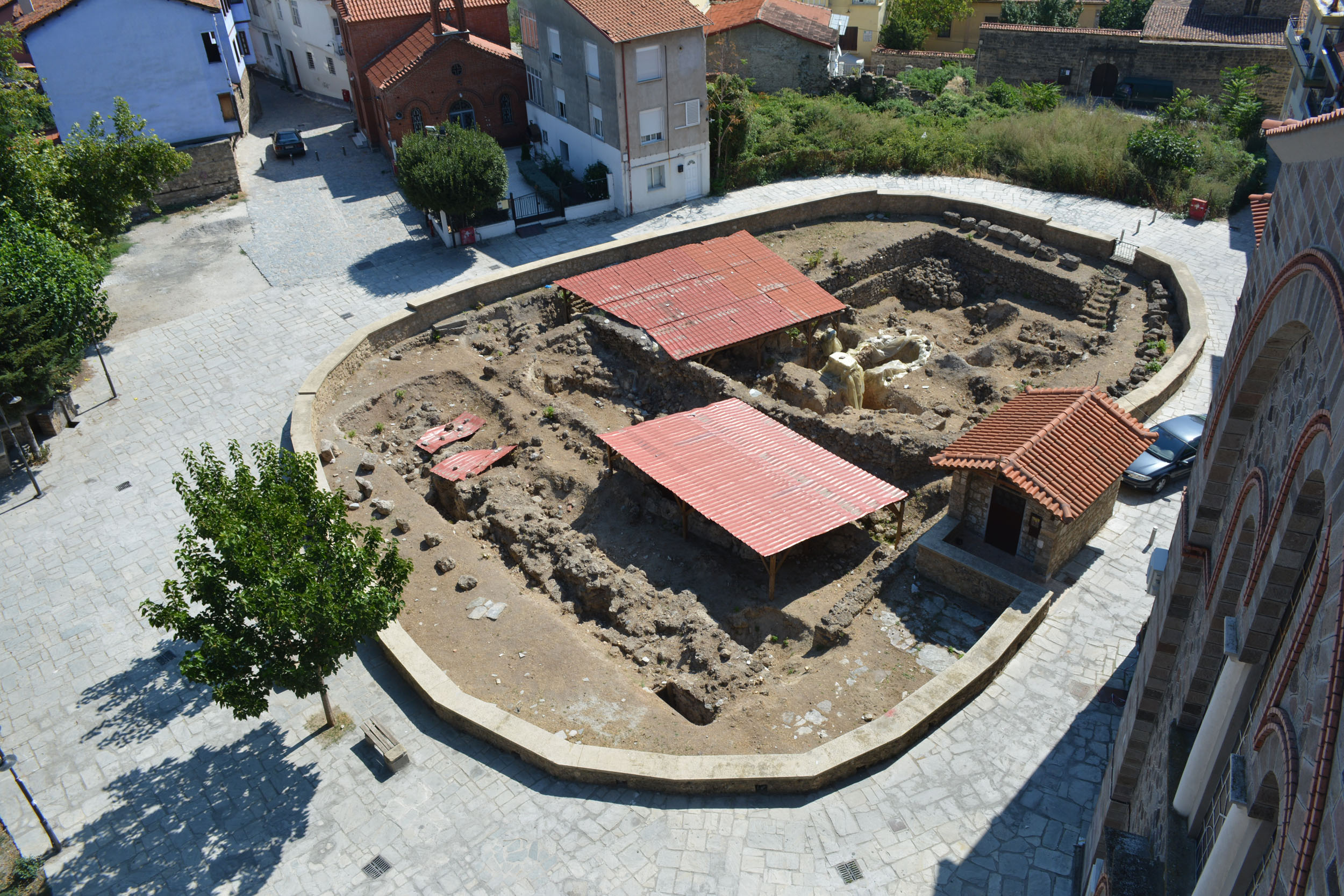
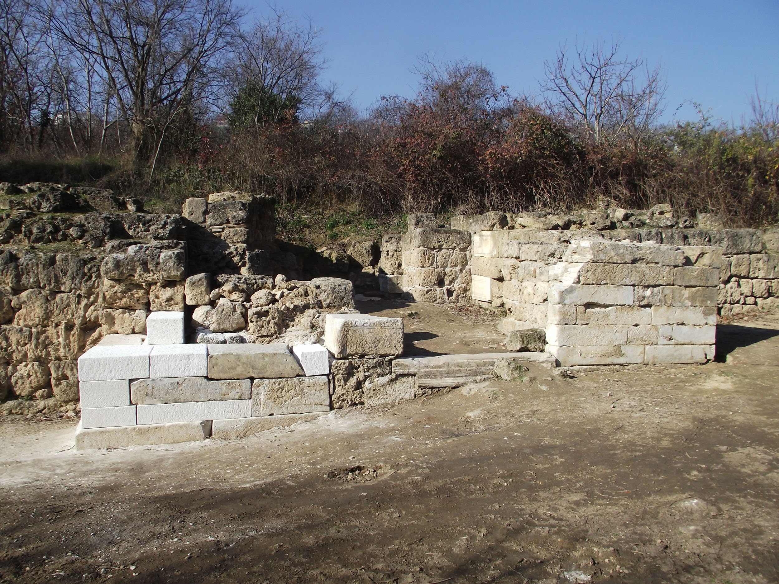
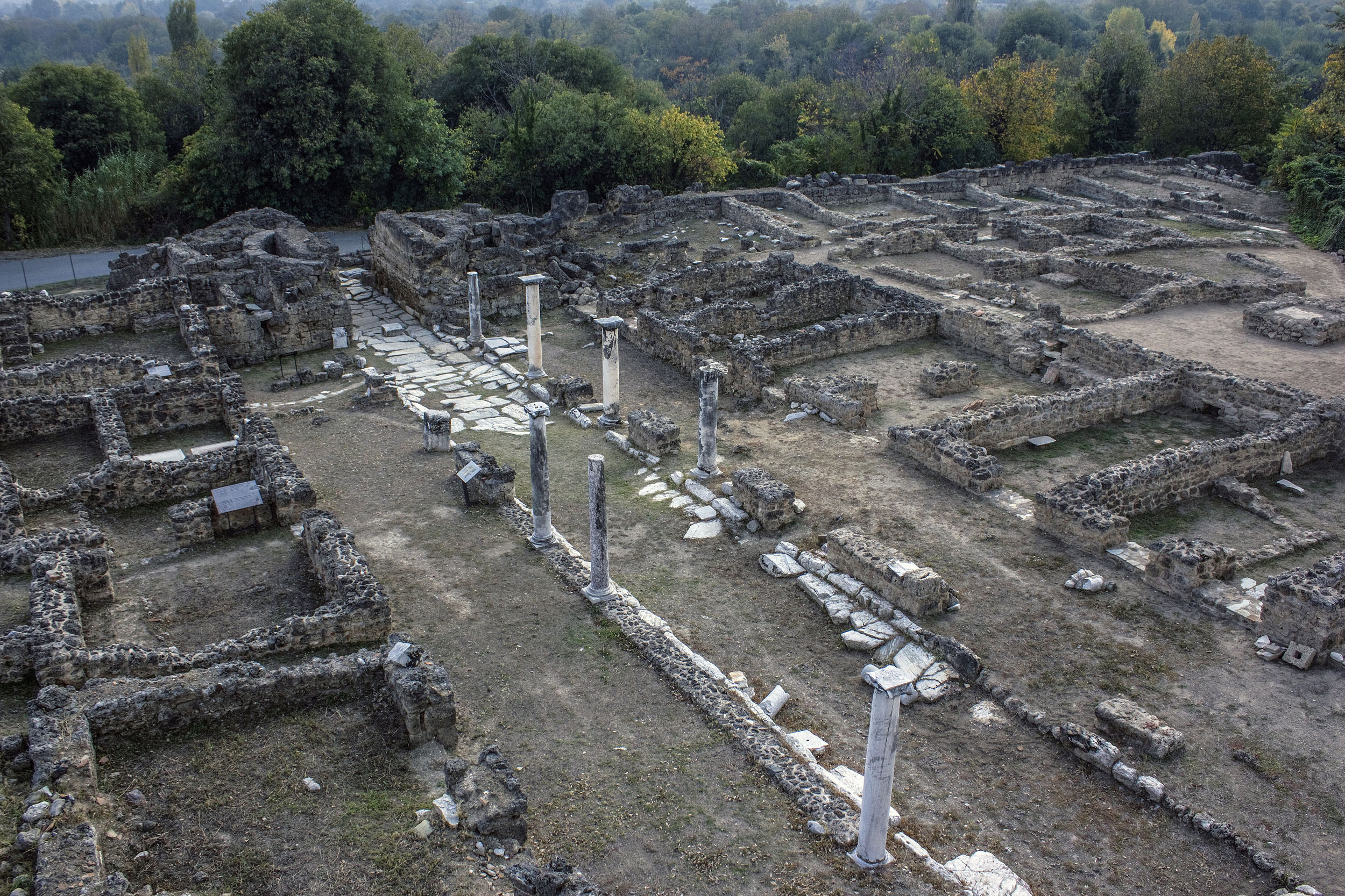
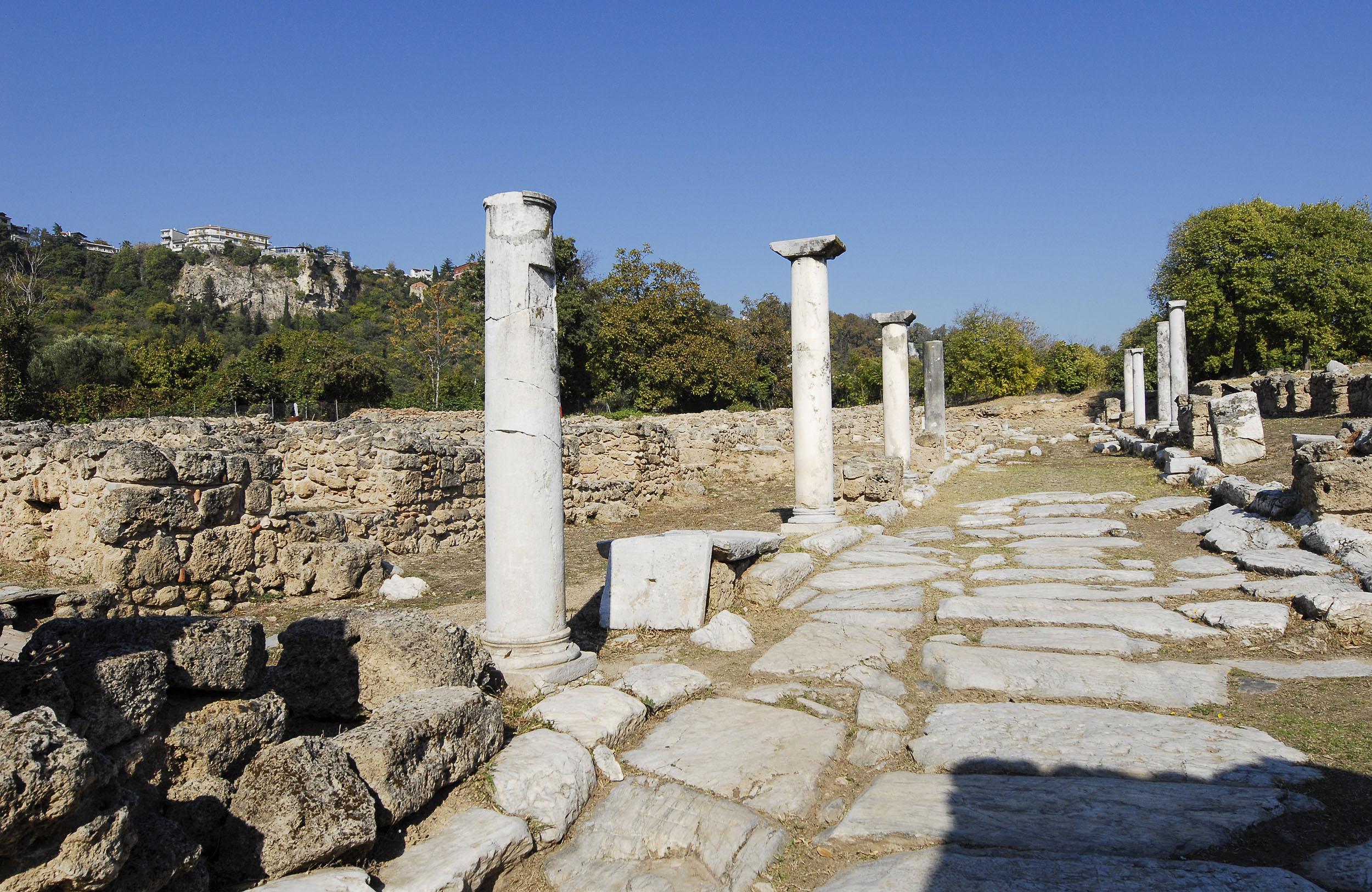
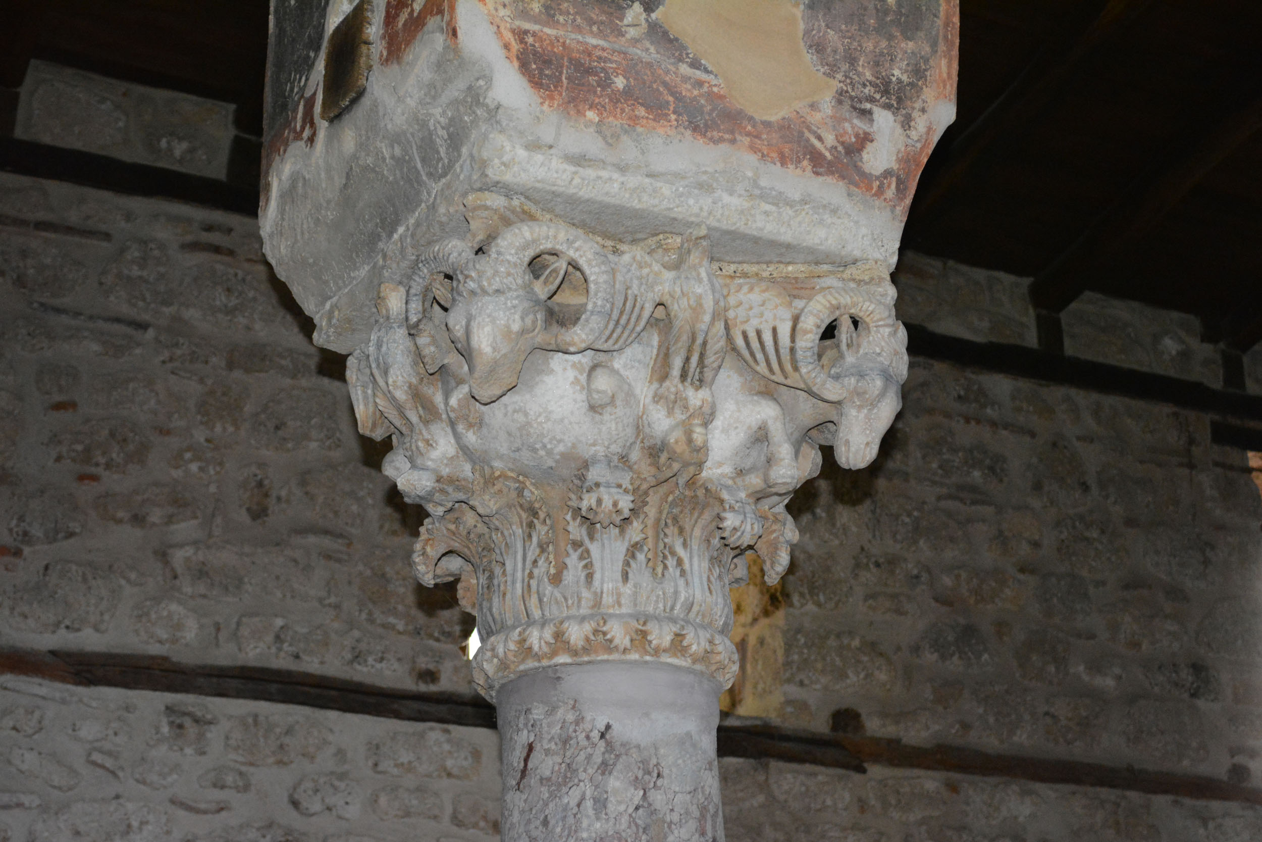
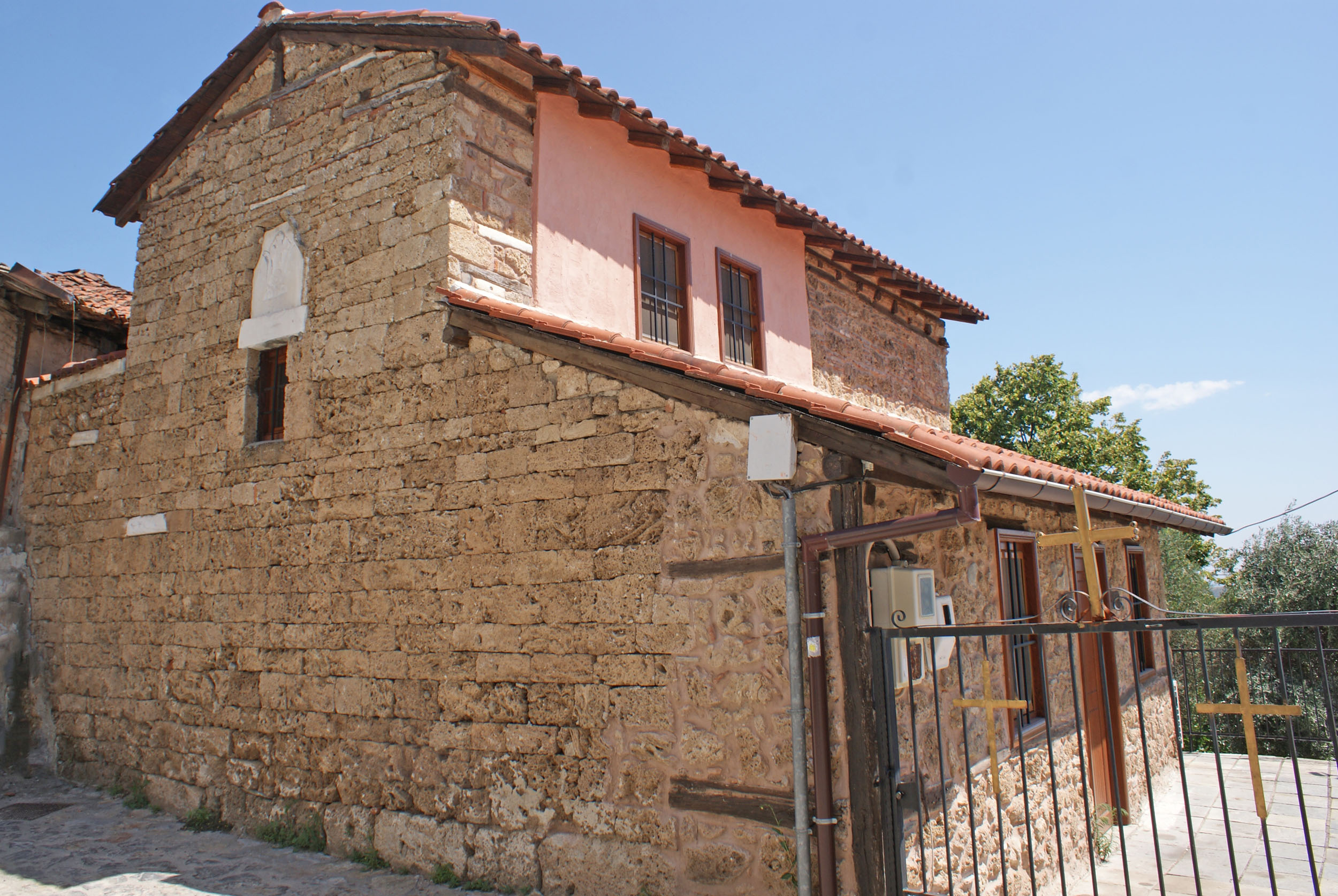
Christianity seems to have become established in Edessa very early on; during the reign of Emperor Decius (249-251 AD), Saints Neonilla and Domnica were martyred in the city, while Saint Bassa and her three sons, Theognis, Agapius and Pistus, were martyred during Maximian’s reign (285-305 AD). The first mention of a bishop of the city only occurs in the 7th century AD. The episcopal see of Edessa, however, seems to have been founded much earlier, from at least the second half of the 5th century AD, when most of the episcopal sees of the province of Macedonia were established. This view is supported by the reference to an anonymous bishop of the city on an inscribed column capital from the Lower City of Edessa, dating from the late 5th to the early 6th century AD. The establishment of Christianity in the city is confirmed by the remains of three Early Christian basilicas. There was also probably a martyrium (a shrine built over the tomb of a martyr) of the Apostles Peter and Paul and an earlier Early Christian monastery on the site of the Monastery of the Holy Trinity, based on inscriptions found during the construction of the latter.

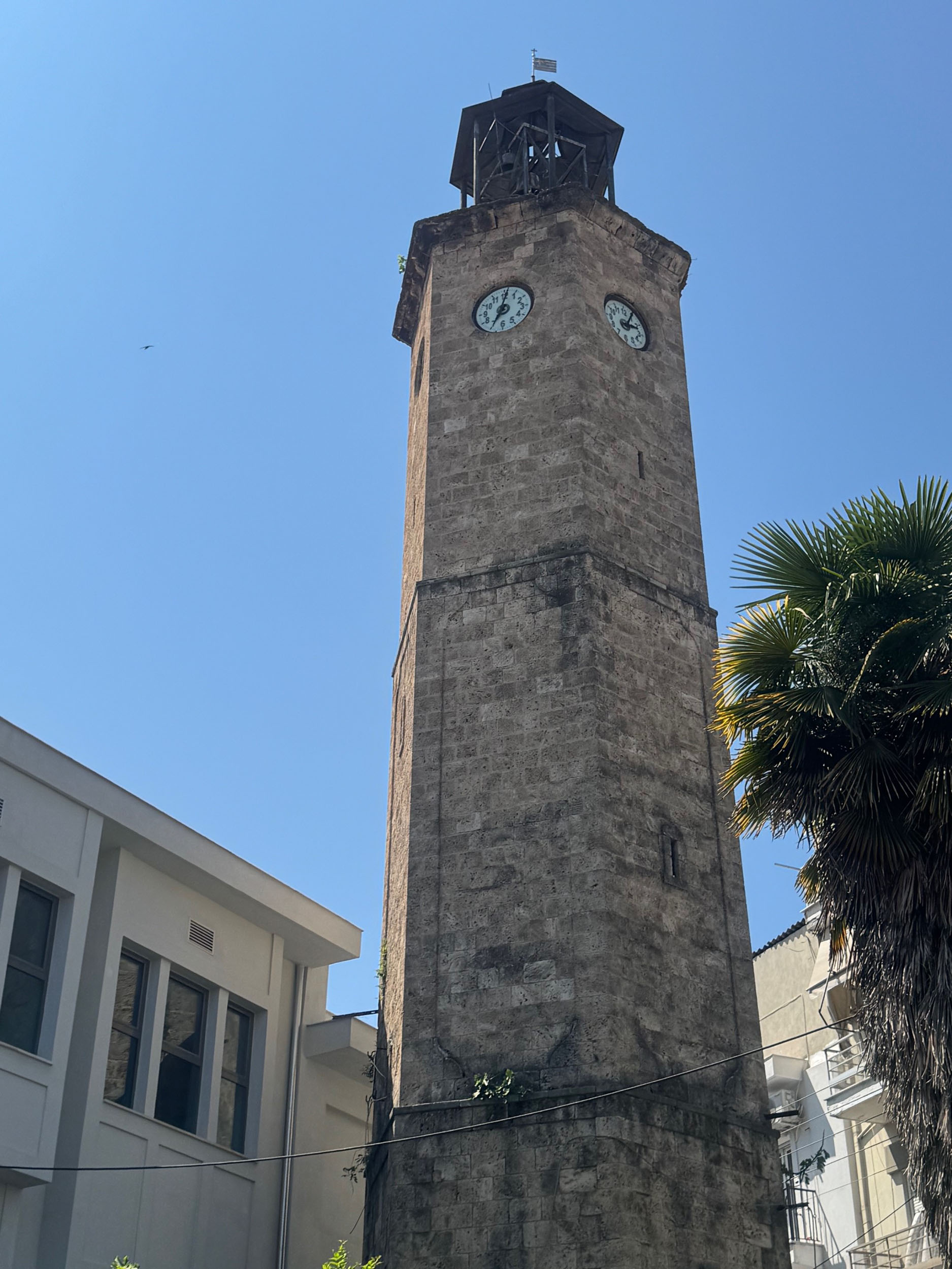
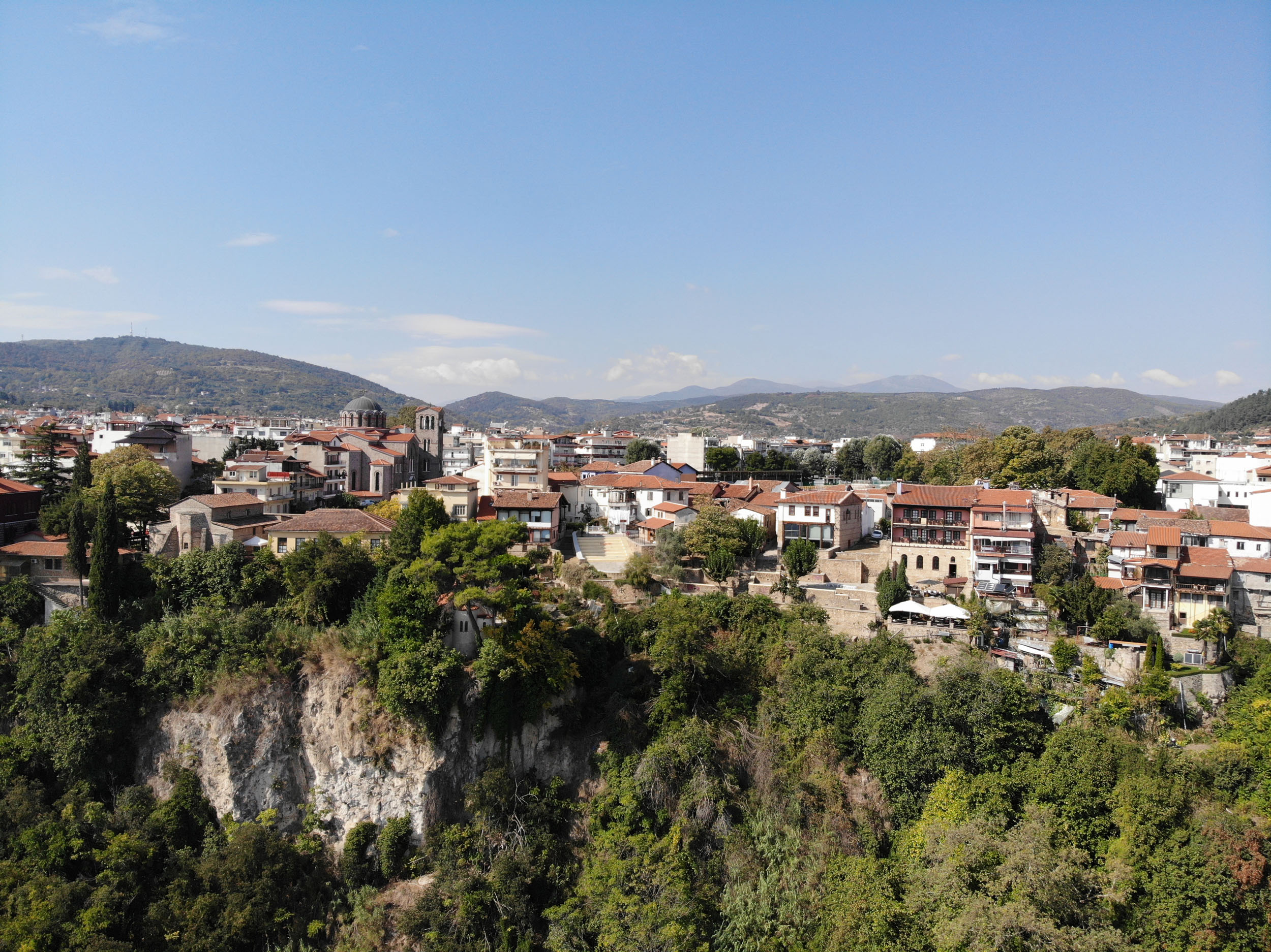
From the late 6th and early 7th century AD, archaeological evidence suggests that the Lower City of Edessa in the Longos valley gradually shrank and was abandoned. The Avaro-Slav raids and the settlement of Slavic tribes, along with natural disasters, are thought to be the main causes of the abandonment of the city in this period, as was the case with other large Early Christian urban centres of Macedonia. From then on, habitation in Edessa was limited to the fortified part of the acropolis, the Upper City, which assumed the typical form of a Byzantine castle-city. From the 11th century onwards, it appears in written sources under the new Slavic name of Vodena or Vodina (the forms Vodeeina and Vodinoi are also found). The strategic position and the naturally fortified site of Vodena contributed to its emergence as an important castle-city of the region, key to the control of Central Macedonia not only by the Byzantines but also by conquerors who briefly held the region, such as the Bulgarians and Serbs, and later by the Ottomans.

In the late 9th century Edessa appears as the seat of an episcopal see subject to the metropolitan see of Thessaloniki. We do not know when the city was first conquered by the Bulgarians and whether it was included among the extensive possessions of the Bulgarian Tsar Simeon (893-927). In the decade between 976 and 986, Edessa, as the city continued to be called until the 10th century, was captured by the ambitious Tsar Samuel, who managed to wrest the entire region of Macedonia west of Thessaloniki from the Byzantines. In 1001 or 1003, Edessa was retaken by Basil II Boulgaroktonos (the Bulgar-Slayer) and after a period of upheaval it definitively returned to Byzantine rule in 1015.

In 1204, with the redistribution of the territories of the Byzantine Empire by the forces of the Fourth Crusade, Vodena seems to have been incorporated into the Latin Kingdom of Thessalonica. The period of Western rule did not last long, however, as by the end of 1219 Vodena had come under the control of the Despotate of Epirus. In 1252 it was conquered by the Emperor of Nicaea, John III Vatatzes and definitively became part of the Empire of Nicaea in 1259. It is indicative of the military importance of Vodena that it was at various times the military base of both John III Vatatzes and the future Emperor Michael VIII Palaiologos (1259-1282). In 1261, Vodena was incorporated into the restored Byzantine Empire.
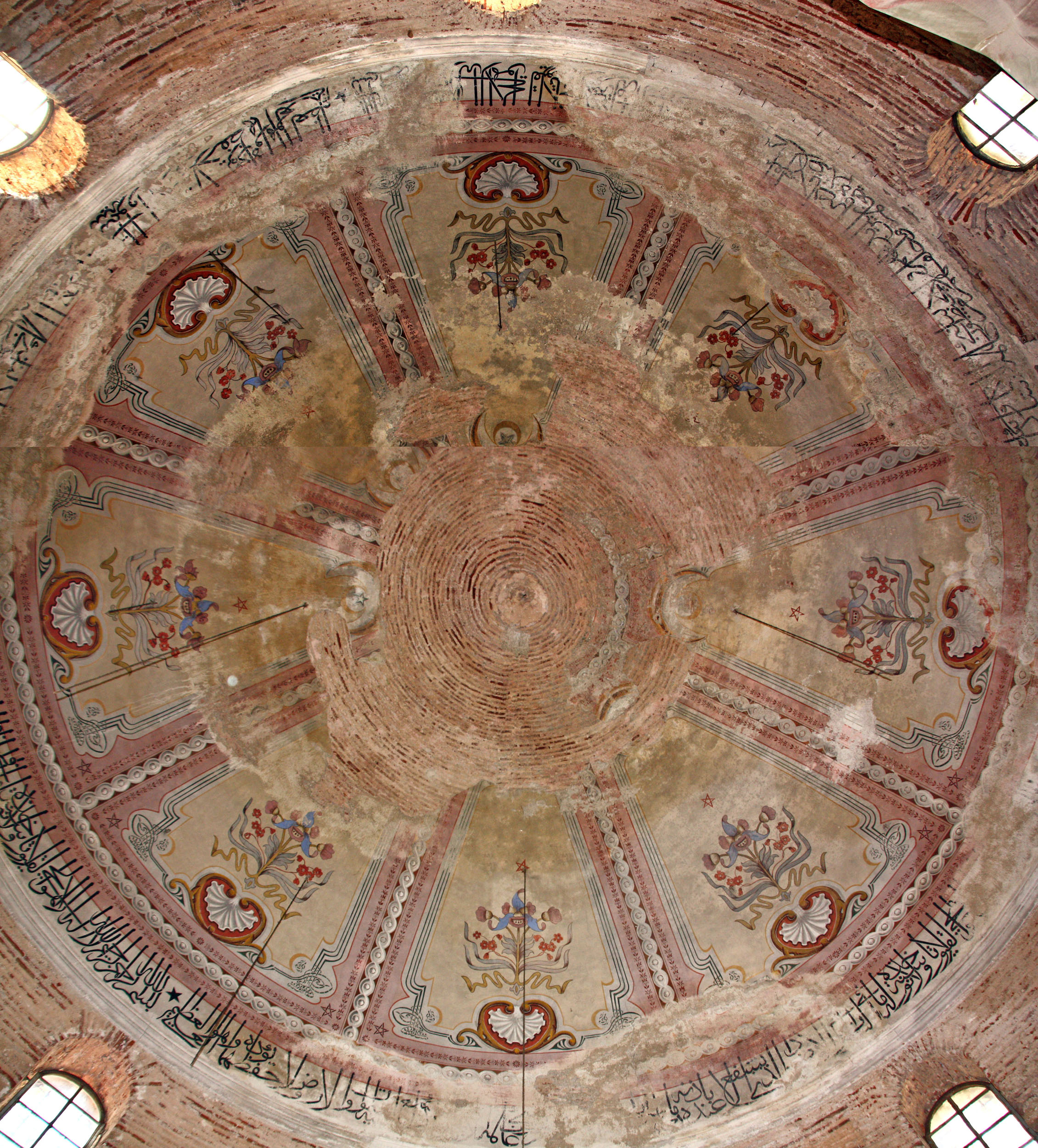
In 1342 the Serbian Kralj (king) Stefan Uroš IV Dušan, taking advantage of the weakness of Byzantium, seized the opportunity to capture Vodena, inaugurating a long period of Serbian dominion over the region. During the period of Serbian rule, important ecclesiastical buildings were founded or renovated in Vodena (church of the Dormition of the Virgin, church of the Apostles Peter and Paul). We know from written sources that the toparch (district ruler) Thomas Preljubović (after 1360-1366/7) built the church of Panagia Gavaliotissa in Vodena, probably the katholikon of a monastery, together with his wife Maria Palaiologina. In 1375 they donated the church to the Monastery of Great Lavra on Mount Athos. The surviving deed of gift mentions the numerous valuables and estates donated by the couple to the church, illustrating how contemporary members of the ruling class endowed the churches they founded.

After the Ottoman conquest (1385 or 1389), Vodena retained its Christian population but was settled by a small number of Muslims. The town expanded outside the walls, which had been demolished by the Ottomans, as the Ottoman traveller Evliya Çelebi informs us in the late 1670s. From the end of the 15th century onwards the Muslim population of the city began to grow, while Muslim mosques and charitable foundations were built. In 1498, Ahmed Bey, the grandson of the conqueror of Macedonia Gazi Evrenos Bey, built an imâret, a mescit, a hammam and shops. From at least the beginning of the 16th century, Vodena constituted the homonymous nahiye of the Kaza of Giannitsa. Later, around 1580, Vodena formed a separate kaza, of which it remained the seat until the end of the Ottoman period. Many religious officials and powerful notables of the Muslim community were established in the city. According to Evliya Çelebi, the city was organised into twelve districts, nine Muslim and three Christian. In 1796, Vodena was conquered by Ali Pasha of Ioannina, who turned nine local villages into çiftliks. On the eve of the Balkan Wars, most of the villages of Edessa were çiftliks, mainly owned by Turkish and Albanian beys.

Καταρράκτες Έδεσσας / The waterfalls of Edessa (Δήμος Έδεσσας / Municipality of Edessa www.edessacity.gr)

During Ottoman times, the city’s economy was largely based on its market, which turned it into a small regional economic centre. Evliya Çelebi reports that there were three hundred shops and a hundred hans in Vodena. In a city with such plentiful water resources, the many watermills were an important source of income. From the middle of the 19th century onwards, the city experienced a major economic boom thanks to the establishment of guilds and the operation of tanneries, small silk mills and larger cotton and woollen mills. In 1892, the Thessaloniki–Monastir railway line was inaugurated, facilitating the movement of these products and boosting the industrialisation of the area.

This was the period when industrial activity rapidly expanded in Northern Greece, centred on four cities: Thessaloniki, Veria, Naoussa and Edessa. The industrialisation of Edessa was spearheaded by entrepreneurs from Naoussa, where the Longos–Kyrtsis–Tourpalis cotton spinning mill had already been established in 1874. Edessa took its first step towards industrialisation in 1895 with the establishment of the Grigorios Tsitsis and Co. cotton mill, which became the largest water-powered manufactory in the Balkans. This was followed by the establishment of five more textile factories whose operation was based on the use of water as the driving force. It is indicative of the great industrial development of the city that in 1920-1921 the total motive power of Edessa’s industries amounted to 2,300 hp, greater than that of Veria and Naoussa.

During the First Balkan War, the Greek Army entered the city on 28 October 1912, and a year later it was incorporated into the Greek State under the Treaty of Bucharest (28 July/10 August 1913), when it was renamed Edessa. As was the case with Giannitsa, the makeup of the city’s population changed significantly with the settlement of a large number of Christian refugees, who had already begun to arrive during the Balkan Wars. An important milestone in Edessa’s history was the firing of the city by the Germans in 1944, burning down many houses in the Varosi district as well as the metropolitan church of the Holy Unmercenaries, on the site of which the church of the Holy Skepe was later built.

Monuments - Antiquities

ANCIENT GREEK, ROMAN AND EARLY CHRISTIAN EDESSA (ARCHAEOLOGICAL SITE OF LONGOS)

In the Hellenistic period, the acropolis or Upper City, on the edge of the cliff of modern Edessa, was shaped like an isosceles triangle enclosing an area of 3-4 hectares, while the Lower City, in the Longos valley, formed an elongated polygon with an area of 20-23 hectares. The city retained this form into the Early Christian period. Our picture of the ancient city on the acropolis remains fragmentary due to its uninterrupted habitation into the modern era. In the Longos valley, however, excavations have brought a large part of the ancient Lower City to light, which, following the restoration works, is open to the public(Longos archaeological site).

Γενικό τοπογραφικό διάγραμμα αρχαιολογικού χώρου / General topographical plan of the archaeological site:  1.Κάτω πόλη/Lower City 2.Νότια πύλη/South Gate 3.Ανατολική Πύλη/East Gate 4.Βόρεια Πύλη/North Gate 5.Άνω Πόλη (αρχαία Ακρόπολη – Βοδενά, Βυζαντινή πόλη-κάστρο)

The Hellenistic wall of the Acropolis, 450 m long, and the wall of the Lower City, 1,200 m long, were constructed in the late 4th to early 3rd century BC as two separate units. The River Edessaios was redirected along the north and south wall of the Lower City as a defence against enemy attack. The walls, both that of the acropolis and that of the Lower City, are 2.20 m wide and built of large stone blocks arranged in the isodomic masonry system, with courses of equal height. In the south part of the Lower City a large part of the wall has been uncovered, one of the best-preserved examples in Macedonia, 4-5 m high and about 190 m long. On its inner side is a circular courtyard inscribed in a large, solid rectangular tower.

In the second half of the 3rd century AD, the city walls were repaired with extensive use of ancient building material. To strengthen the wall, new towers were added in the intervals between the old ones.

In the Early Christian period, as part of the reconstruction work following the Hun and Goth raids in the second half of the 5th century AD, the wall was reinforced with a bulwark 1.80-2.00 m wide, erected 6-7 m from the walls of the acropolis and from at least the northern section of the enceinte of the Lower City.

The paved main street of the ancient city, crossing it from north to south, runs 440 m from the South Gate to the North Gate. It has been uncovered to a length of 85 m and is 4 m wide. In Early Christian times it assumed the form of a processional road, flanked by long arcades (emboloi) 5.20 m wide, their columns, bases and capitals taken from earlier buildings of the city. The first column of the east arcade is particularly important: it comes from the sanctuary of the goddess Ma and is covered with manumission inscriptions. A large, two-metre-high, vaulted sewage and rainwater drainage duct was constructed under the processional road during the same period.

A series of buildings have come to light along the main road and its side streets. They mainly date from the Early Christian period, while parts of Hellenistic or Roman buildings have also been found. Some of the buildings have been identified as shops or workshops (a glassworks and a forge). One of the buildings, over 30 m long, contained storage jars, indicating that it was a state warehouse (horreum).

Another important building, both for its size and for its structural features, is an Early Christian complex in the northeast part of the excavated site which includes a peristyle fountain and an arched hall. The buildings of the complex had opus sectile (marble inlay) floors and luxurious decoration, as evidenced by the traces of coloured plaster on the walls, the plentiful tesserae from mural mosaics found during the excavation, the bricks stamped with a cross and a mullion impost with a relief cross. The finds from the site indicate the building was erected in the late 5th or early 6th century AD and probably served as the bishop’s palace.

Important information on the ancient city of Edessa is provided by the cemeteries extending outside the walls of the Lower City, which were in continuous use from the Hellenistic to the Early Christian period. The best-known cemetery lay north-northeast of the Lower City, on the far side of the River Edessaios, along a road which was later succeeded during the Roman period by the Via Egnatia. Excavations have revealed part of this road with ruts made by cartwheels worn into the rock. There is another cemetery outside the east city wall and yet another to the south, extending as far as the Edessa–Thessaloniki highway.Cemeteries of the ancient city have also been identified outside the walls of the Upper City.

An archaeological excavation has revealed the remains of a small basilica (Basilica I) outside the walls of the Lower City, near the North Gate. Almost square in plan, it was erected at the end of the 5th century and repaired in the first half of the 6th century AD. The floor of the first phase is covered with a mosaic with symbolic figurative and floral decoration. The basilica featured remarkable sculptural decoration, of which the Ionic-style capitals with a high impost stand out.

Another basilica, known as the Basilica of the Holy Trinity, was discovered outside the walls, near the South Gate of the Lower City. Its sculptural decoration dates from the late 5th to the early 6th century AD. It is surrounded by a cemetery, meaning that it was probably a funerary church. A third basilica, of which a small part and various architectural members have been uncovered, has been found inside the city walls, in the area of the small chapel of St Nicholas.

The monastery is located close to the archaeological site of the Lower City of ancient Edessa, in the Longos valley. It was founded in the 19th century, around 1864 or 1865, probably on the site of Early Christian buildings. The katholikon of the monastery is a three-aisled basilica with a raised nave, topped by three small domes. Spolia (reused architectural elements) from the buildings of ancient Edessa are visible in its masonry.

As with the ancient acropolis, the picture we have of the Byzantine castle-city of Vodena that succeeded it is fragmentary. Rescue excavations have brought to light parts of the fortifications of Vodena, from which it appears that part of the city extended to the southeast in Byzantine times. The uncovered section of the north part of the enceinte, which is of particularly solid construction and 3 m wide, bears out the written sources referring to the impregnability of the citadel. At the northwest edge of the modern city, far outside the Byzantine walls, an extensive Middle Byzantine cemetery with 131 graves has been excavated, dating from the 10th-11th centuries. Fifty-one 13th-century graves have also been uncovered set directly against the walls.

φωτ. Δήμος Έδεσσας / phot. Municipality of Edessa (www.edessacity.gr)

Declared a listed architectural ensemble by the Ministry of Culture in 1983, the Varosi district is one of the main tourist attractions of Edessa. It is the first purely Christian quarter of the city, which developed during the Ottoman period in the area formerly occupied by the fortified castle-city of Vodena, which was no longer easily defensible as its fortifications had been demolished by the Ottomans. The district is covering an area of 1.8 hectares as a structured urban unit with closed blocks and a single front of houses built in a row for defensive purposes, the ground-floor façades forming a continuous wall with few openings. The houses are typical examples of Ottoman-era Balkan architecture, with a stone-built ground floor and upper floors constructed with a wooden framework filled with stones or bricks (dolma bulme or bagdadi). Each house has a small courtyard around which the covered balconies known as hayatia are arranged.

One of the most impressive mansions of Varosi is that of the cotton merchant Valasa (1841) on Makedonomachon Street, which, like other houses in Varosi, has a private chapel in the courtyard. The Yusmi Mansion next door has a three-storey silkworm farm. The Tsamis Manion at 44 Archiepiskopou Meletiou Street, the model of which is exhibited in the Folklife and Ethnological Museum in Thessaloniki, is one of the few houses that had an indoor toilet. Another notable building in Varosi is the Girls’ School (1877), which forms a single architectural unit with the Byzantine church of the Dormition of the Virgin. The school is an important testimony to the remarkable educational activity in the city of Edessa during the 19th century, when a series of Greek schools were founded. In the late 1980s, the Polytechnic School of Thessaloniki, under the academic supervision of Professor George Velenis, prepared a redevelopment study for Varosi. In 1990, a special EEC committee awarded the study first prize out of 1,138 studies submitted that year from all over Europe.

φωτ. ΕΦΑ Πέλλας / phot. Ephorate of Antiquities of Pella

In the archaeological site, successive sections of the city’s fortifications (parts of the Hellenistic-Roman fortifications, the Early Christian bulwark and the Late Byzantine fortifications) have come to light. The excavation also revealed the remains of buildings of the Hellenistic period, part of the post-Byzantine church of the Presentation of Christ in the Temple which burnt down in 1823, and the foundations of some traditional buildings of the district.

This church, in the Varosi district, was the old metropolitan church of the city in the Byzantine period and was probably dedicated to Hagia Sophia (Holy Wisdom). The church, which has undergone later interventions and additions, is a three-aisled timber-roofed basilica with a raised nave and a narthex on the west side. The sanctuary apse, which has fewer alterations, stands out for its slender proportions and its blind arches, typical features of the churches of Thessaloniki and its areas of influence. Two layers of frescoes are preserved inside the church, the first of which is dated to circa 1380, thought to be the date of construction of the monument, although certain individual features also seem to indicate the existence of earlier phases. The frescoes of the first layer are only fragmentary but they constitute a remarkable ensemble, apparently associated with the artistic milieu of Thessaloniki and Constantinople. The second layer of paintings dates from the 17th century. Of particular interest is the fact that the arches of the central nave are supported on Early Christian columns, surmounted by fine Theodosian capitals with spiny acanthus leaves, and a double-zone capital with relief rams and eagles dating from the second half of the 5th century AD. The remarkable structural features of the church, combined with its sculptural and fresco decoration, render it a monument of special architectural and artistic value.

This small church, a three-aisled basilica, is also located in the Varosi district. Its frescoes are dated between 1370 and 1385, but there is probably also an earlier building phase. Although fragmentary, the frescoes are of high quality and, like those of the church of the Dormition of the Virgin, are linked to the main artistic trends of Thessaloniki and Constantinople during that period. Large-scale repairs were carried out in 1864, altering the original form of the monument. Three capitals of the Early Christian period (4th-5th c. AD), two Corinthian and one Theodosian, as well as a rare double-zone capital of the Middle Byzantine period with four eagles holding a globe (1st quarter of the 11th c.), have also been reused inside the monument.

The Yeni (New) Mosque is located in the city centre, within the Ottoman quarter that extended across the southwest part of the city. The mosque consists of a square central hall measuring 14.80 x 14.90 m, covered by a dome supported on an octagonal drum. Along the façade on the north side runs a long, open, arched portico of even width, while in the northwest corner rises the imposing minaret, 21.50 m high. Some researchers place the construction of the mosque in the late 19th century, while others argue that it was built between the late 16th and the mid-17th century.

Papageorgiou J. – F. Boubouli (eds.), Ottoman Architecture in Greece, Athens 2023 [2nd edition], fig. in p. 475

Also in the centre of the city is the restored Hünkar (Imperial) Mosque. After the Treaty of Lausanne (1923) and the departure of the Muslim population of the city, the building was granted to the historic “Alexander the Great” Progressive Association, founded in 1922. The association’s use of the mosque as a cinema and cultural events venue, and major building interventions in the 1960s, altered its original form, of which the west wall, part of the east wall and the lower part of the south wall are preserved today. The mosque was erected in the second half of the 15th century. It underwent a second building phase in the 19th century, when it was renovated according to the aesthetic rules of European Baroque, which influenced the modernist Ottoman style of architecture. The form of the mosque at this time is known from early-20th-century photographs.

φωτ. Δήμος Έδεσσας / phot. Municipality of Edessa (www.edessacity.gr)

The tower rises in the heart of the city. It was erected in 1906 by the skilled artisan Konstantinos Zisis, who left his name on the built-in plaque on the north side. It remains today one of the most characteristic monuments of the city.

φωτ. ΕΦΑ Πέλλας / phot. Ephorate of Antiquities of Pella

The stone single-arch bridge across the River Edessaios is located on the west side of Edessa, in an idyllic spot with spreading plane trees. The area is called Kioupri after the Turkish word for “bridge”, köprü. It was built in the Ottoman period, before the traveller Evliya Çelebi visited the city in the late 1670s. He probably refers to the bridge indirectly, as he mentions the “Valley of the Bridge” (Köprü Oνasi), which he describes as an idyllic, verdant location with seats and cookhouses, the most famous place of recreation for the city’s inhabitants, where they enjoyed strolling and taking the air.

Τ

The remains of this monastery of the Late Byzantine period (13th-14th c.) were discovered alongside the old Edessa–Florina highway, at the Psili Vrissi site. Excavations have revealed the katholikon of the monastery, a single-nave church with an ambulatory, various annexes and an extensive cemetery.

Museums

Open-air Water Museum
φωτ. Δήμος Έδεσσας / phot. Municipality of Edessa (www.edessacity.gr)

After the Waterfall Park is the Myloi (Mills) area, which has been laid out as a model open-air park amid lush vegetation. Here, the steep slope and abundant flow of water allowed the operation of a series of water-powered workshops and industrial buildings. Of the many water-powered workshops in the city – Evliya Çelebi mentions 70 watermills for grinding flour and several tanneries – nine are preserved today in the area of the Open-Air Water Museum: one batan (fulling mill), two tanneries, two sesame mills, two flour mills and two sesame/flour mills (i.e. with two grinding mechanisms, one for grain and one for sesame), all dating from the mid- to late 19th century. Of the textile factories established in Edessa after the end of the 19th century, the Ano Estia textile mill, probably founded in 1926, and the Hemp Factory, founded in 1908 by Totskas and Co. and other smaller shareholders, which produced ropes and twine from Indian hemp, are located in the park.

The Museum, in the Varosi district, is housed in an old mansion built in 1932, donated by the Sivenna family. Through a rich collection, it presents the daily life, customs and traditions of the area from the mid-19th century to the early 1950s.

Other stops in the Regional Unit of Pella

error: