Amphipolis

Amphipolis, the glorious city founded by the Athenians on the banks of the River Strymon

Ancient Amphipolis is located proximately 60 km southeast of the city of Serres. The city was founded on the east bank of the Strymon in 437 BC by Athenian colonists led by the Athenian general Hagnon, son of Nicias, the moderate Athenian general and politician during the Peloponnesian War (431-404 BC). According to the historian Thucydides, the city was named Amphipolis (literally “around the city”) because it was flanked on two sides by the Strymon, the once-navigable river that played a key role in communications between the Aegean and the roads leading to the North Balkans.

The strategic location of Amphipolis, at the crossroads of routes that connected Thrace with Macedonia and the sea with the hinterland, as well as its great natural wealth, led to its emergence as an important political and cultural centre of the ancient world. During Roman and later times, the city was a station of the Via Egnatia, which, passing by the city, contributed decisively to its commercial and cultural development.

The course of the Via Egnatia from Amphipolis to Philippi can be roughly reconstructed based on information from the itineraria and the archaeological finds (remains of parts of the ancient road and milestones), and from the examination and interpretation of aerial photographs of the area (photogrammetry). The ancient road probably ran outside the south and east walls of Amphipolis without passing through the city, before heading northeast through the northern foothills of Mount Pangaion towards Philippi.

The course of the Via Egnatia north of Mount Pangaion is confirmed by three inscribed Roman milestones found in the northeast chora or territory of Amphipolis. Two of these, dated to 201 and 217 AD (reigns of Septimius Severus and Caracalla respectively) were found in the village of Palaiokomi, while the third, which preserves three inscriptions — one of which dates to the period of the Second Tetrarchy (305-306 AD), came to light further north, in the village of Mikro Souli. Much later, during Ottoman times, the road ran south of the mountain towards present-day Kavala.

Numerous milestones have been found in the territory of Amphipolis. Four inscribed milestones, made in Amphipolis, were discovered roughly 15 km southwest of the city (at the Akrogiali site, approximately 10 km west of the village of Nea Kerdyllia). They all record repair work on the Via Egnatia in the 2nd and 3rd centuries AD, and it is argued that the place where they were found is probably the site of the Pennana changing station (mutatio) of the Via Egnatia. Another milestone of 217 AD (reign of Caracalla), discovered in fields in the area, was set up 1 Roman mile from Amphipolis according to the surviving inscription. Another milestone of the same date, found reused in the walls of Byzantine Chrysopolis, was originally erected 4 Roman miles from Amphipolis. 

Ευρήματα προϊστορικών χρόνων, Α. Μ. Αμφίπολης / Prehistoric excavation finds, Archaeological Museum of Amphipolis

History

The archaeological finds attest that the area was inhabited long before the founding of the city by the Athenians (437 BC). The earliest traces of habitation range from the Neolithic period (6th millennium BC) to the Early Iron Age (1050-700 BC) and are located on Hill 133, just north of Amphipolis.

Before the arrival of the Greeks, the Thracian tribe of the Edoni lived in the area. The first attempts by Greek settlers to install themselves on either side of the mouth of the Strymon are observed in the mid-7th century BC. They were attracted by the fertile land of the region, its forests that provided timber suitable for ship-building, and its proximity to the rich gold and silver deposits of Mount Pangaion. Around 655 BC, Argilos was founded by colonists from Andros near Amphipolis, on the west bank of the river, while in the 7th century BC other settlers, probably Parians or Thasians, founded Eion at the river mouth. Eion, which was to become a port of Amphipolis in the following centuries, stood on the hill of Profitis Ilias, which rises on the north side of the Kavala–Thessaloniki highway (in antiquity the mouth of the Strymon penetrated further inland to the east).

The Athenians had made repeated attempts to establish themselves in the area since the 6th century BC. Τheir permanent establishment in the region was finally achieved in 437 BC with the founding of Amphipolis, after they had driven the Edoni from the area. Hagnon, a personal friend and associate of Pericles, not only gave the city its name but also ensured that it was fortified with a long wall and provided with public buildings and sanctuaries (Hagnonian buildings). However, the rule of the Athenians, despite their efforts, only lasted 13 years. In 424 BC, at a critical stage of the Peloponnesian War, the Spartan general Brasidas captured Amphipolis, causing the Athenians “great alarm” due to its great strategic and economic importance. The same year or a little later, Amphipolis began to mint its own silver coins, continuing to do so into the Roman period. The coins, bearing the head of Apollo on the obverse and a race torch on the reverse, are among the finest and most remarkable types of antiquity.

Τεφροδόχος υδρία ελληνιστικών χρόνων / Hellenistic funerary hydria (Ephorate of Antiquities of Serres -INTERREG Greece-Bulgaria BORDERLESSCULTURE programme www.borderlessculture.eu)

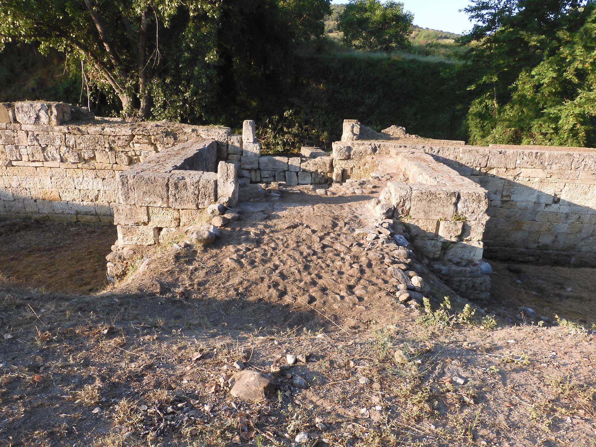
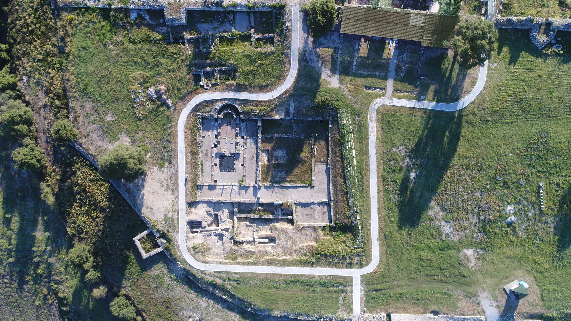
In 422 BC, the Athenian Cleon unsuccessfully attempted to retake the city. In the battle before its walls, described by Thucydides, both leaders of the opposing forces, Cleon and Brasidas, were killed, along with 600 Athenian soldiers and only seven of their opponents. The inhabitants of Amphipolis, who were happy with Brasidas’ regime, arranged for his burial with great honours in the city agora. The Spartan general was thenceforth worshipped with annual sacrifices and athletic competitions as the true oecist (founder) of the city. In 421 BC, under the terms of the Peace of Nicias, which ended the first period of the Peloponnesian War, Amphipolis was restored to the Athenians. The city, however, was reluctant to return to the influence of its metropolis and it seems that it afterwards remained independent until 357 BC, when it was captured by King Philip II of Macedon.

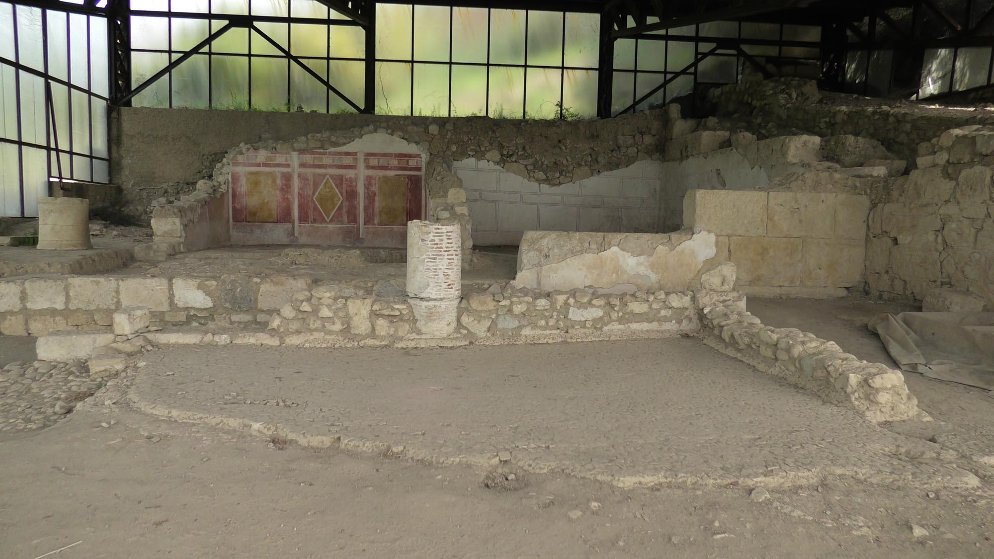
The period of Macedonian rule in Amphipolis marked the end of its autonomy but also its emergence as an important economic and military centre of the Macedonian Kingdom. The city’s population increased significantly with the establishment there of Macedonians and citizens from various other parts of the ancient world (Corinth, Proconnesus, Miletus, etc.), giving Amphipolis a cosmopolitan air. The city became an important commercial centre,  while the exploitation of the mines of Mount Pangaion brought it significant economic prosperity. It was also one of the main royal mints of the Macedonian state.

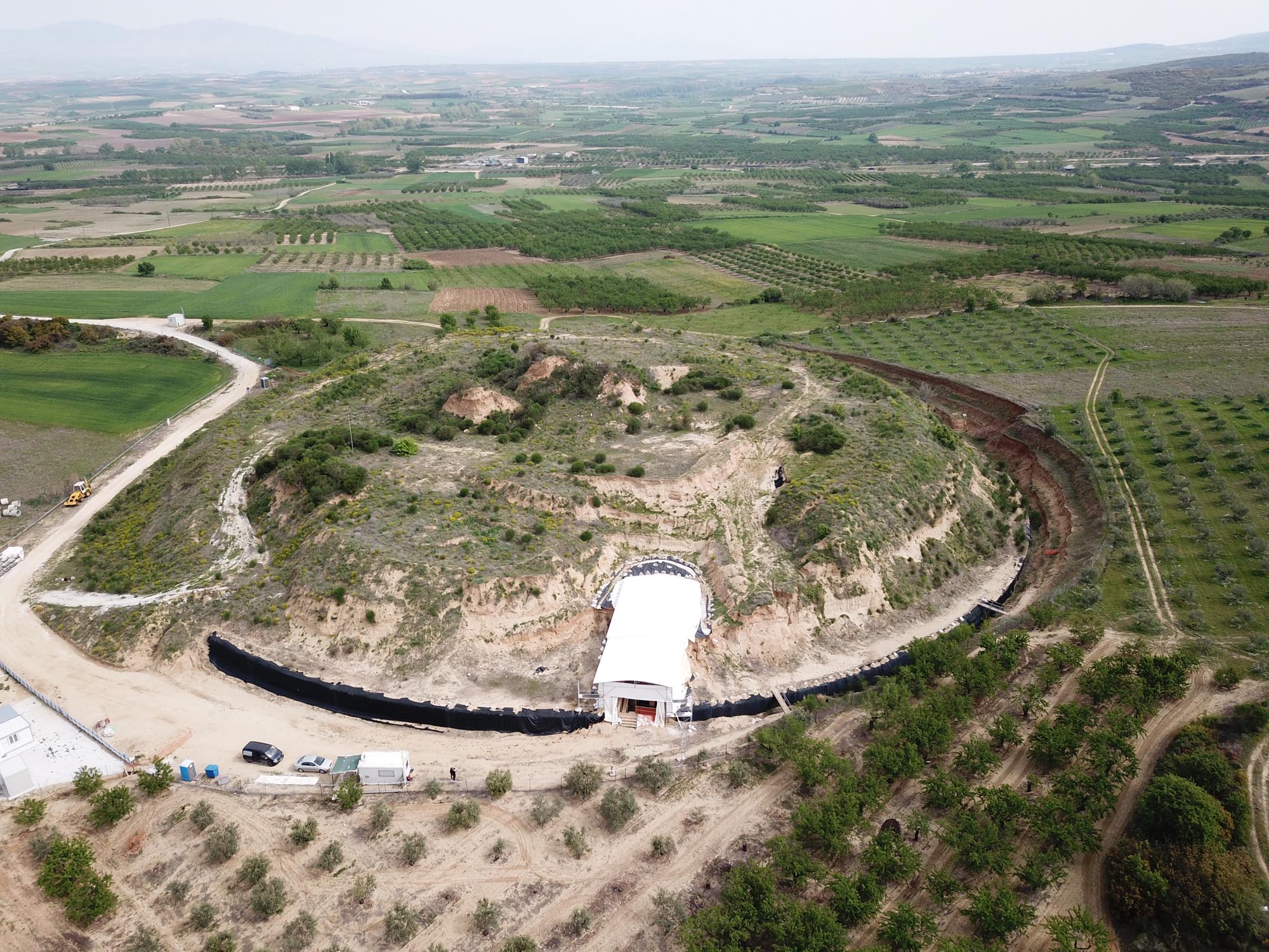
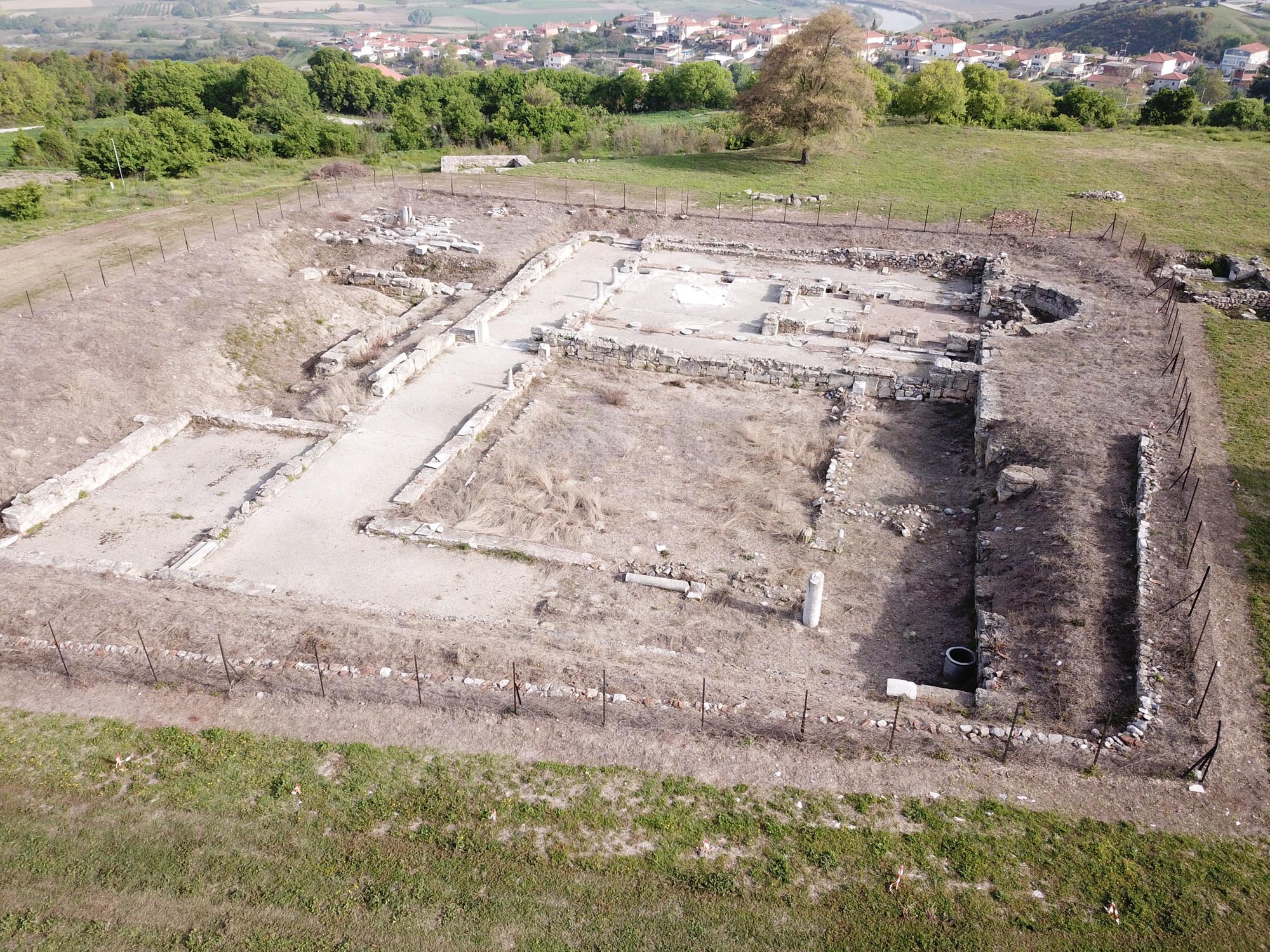
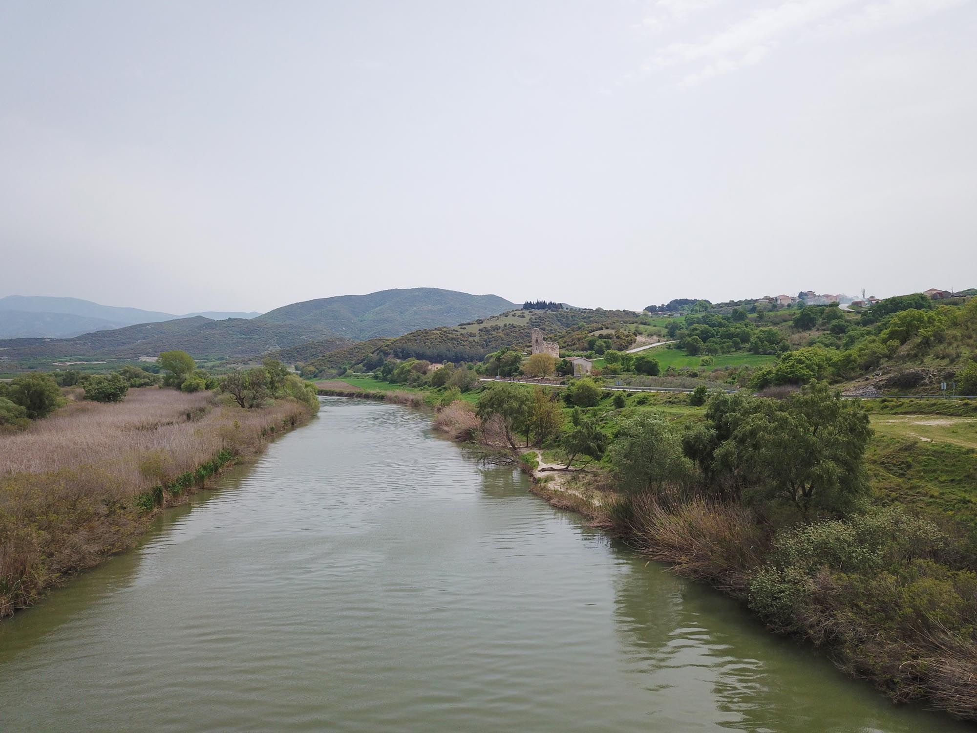
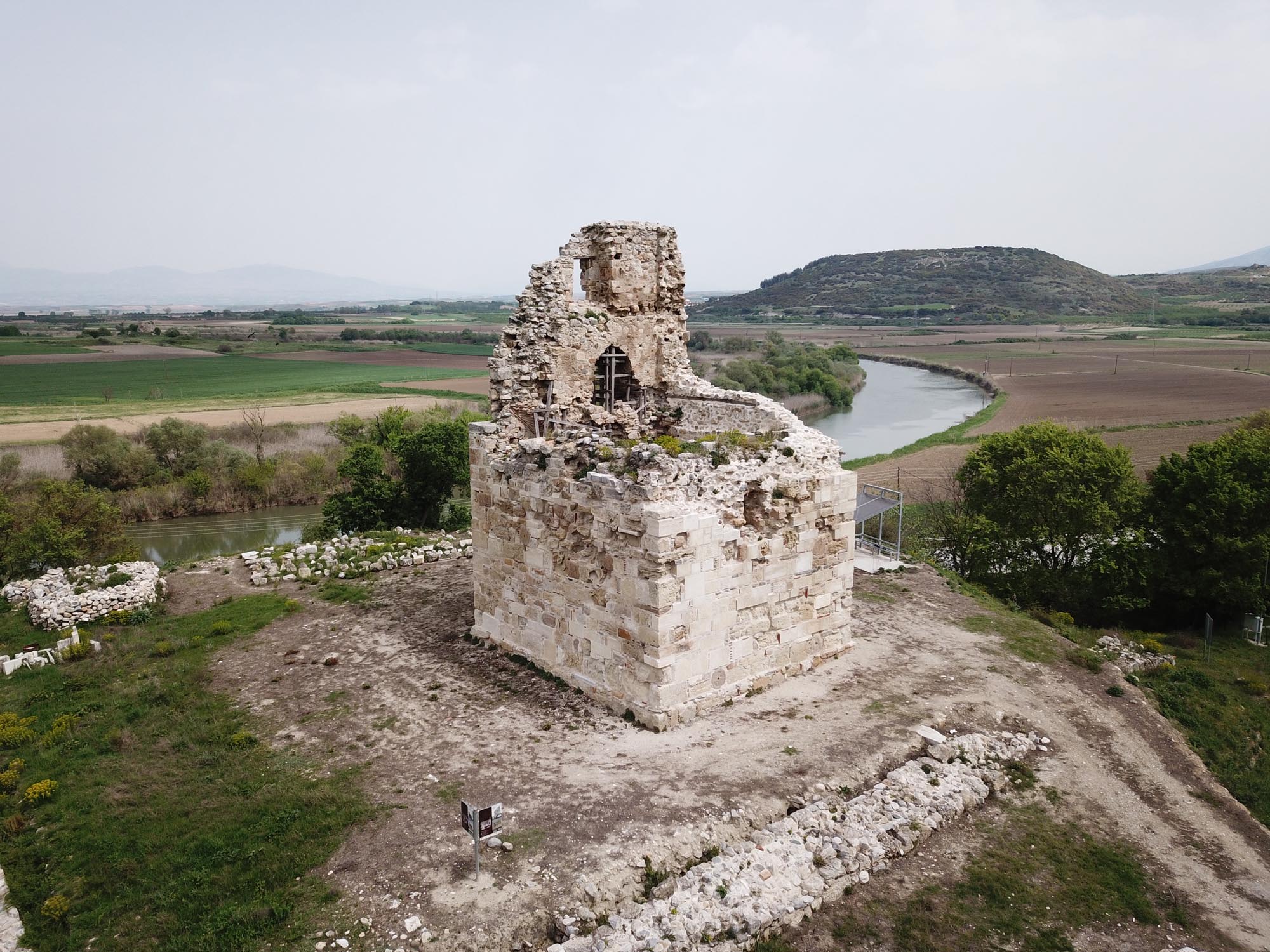
The preparations for Alexander the Great’s campaign for the conquest of Asia in 334 BC are a special moment in the history of the city. It was used by the great commander as a naval base, his sizeable army and large fleet assembling in its harbour and on the navigable Strymon. Before launching his campaign, Alexander the Great named Amphipolis as one of the six cities where a magnificent temple would be built, for which he offered 315 tons of silver.

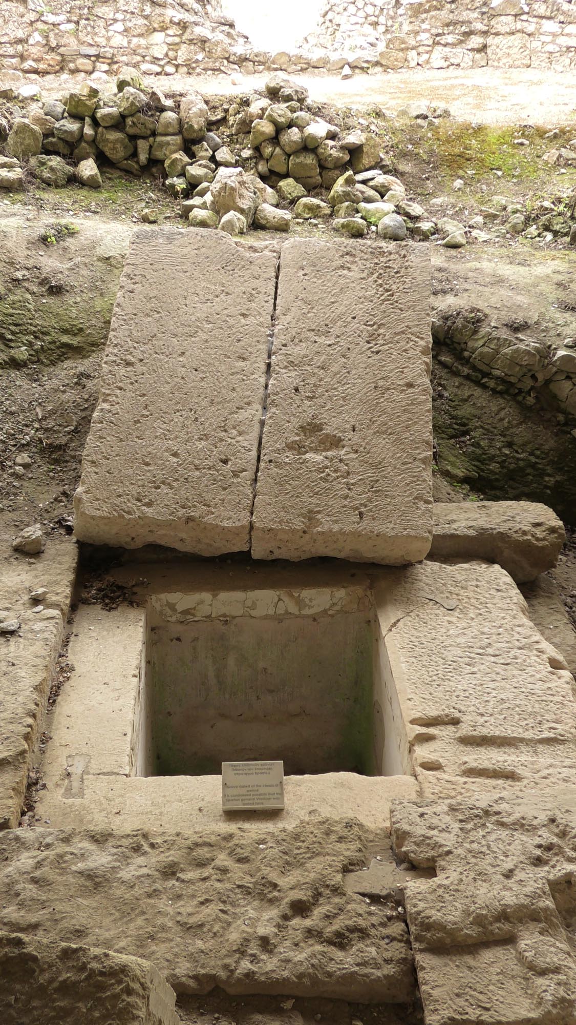
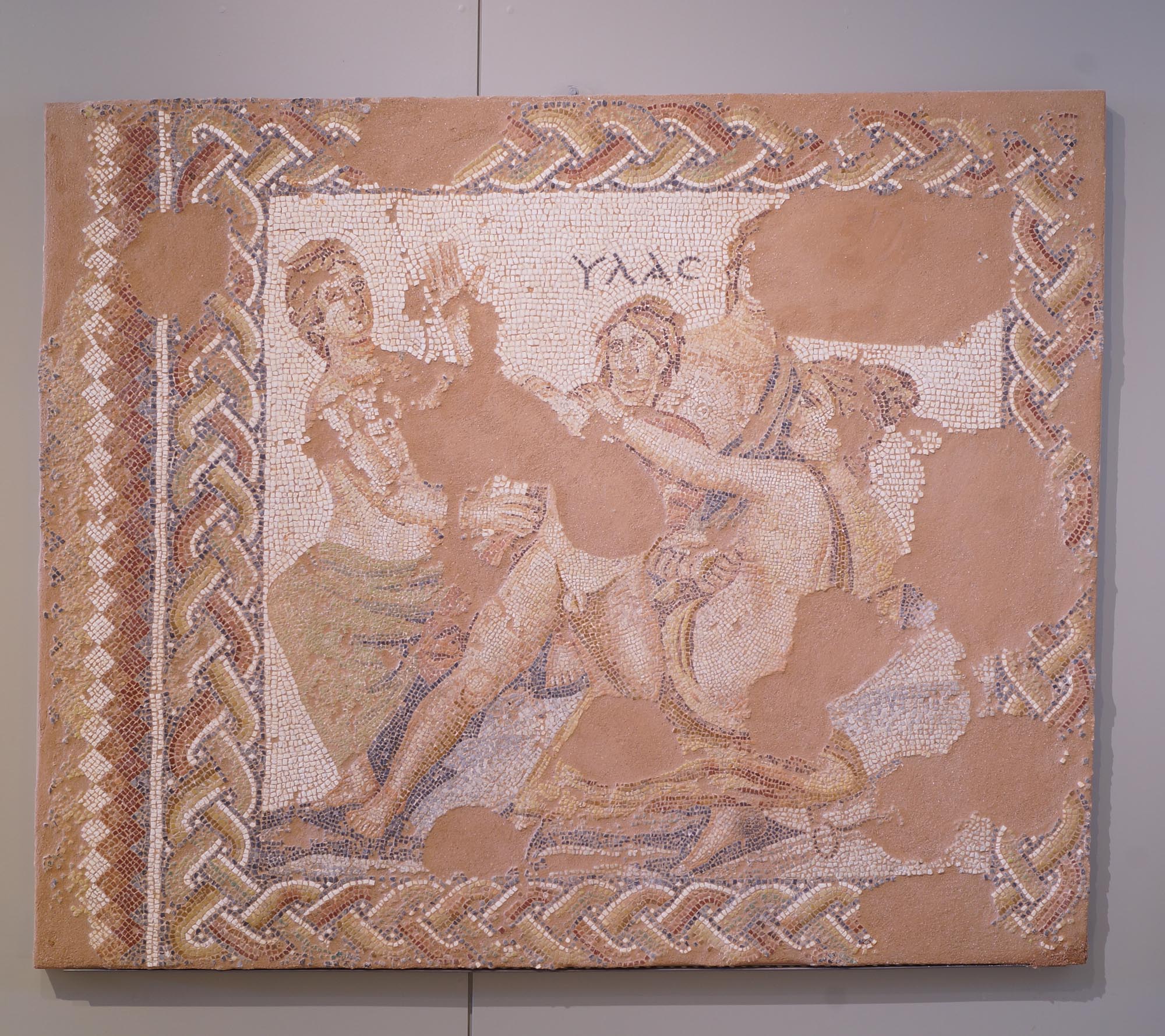
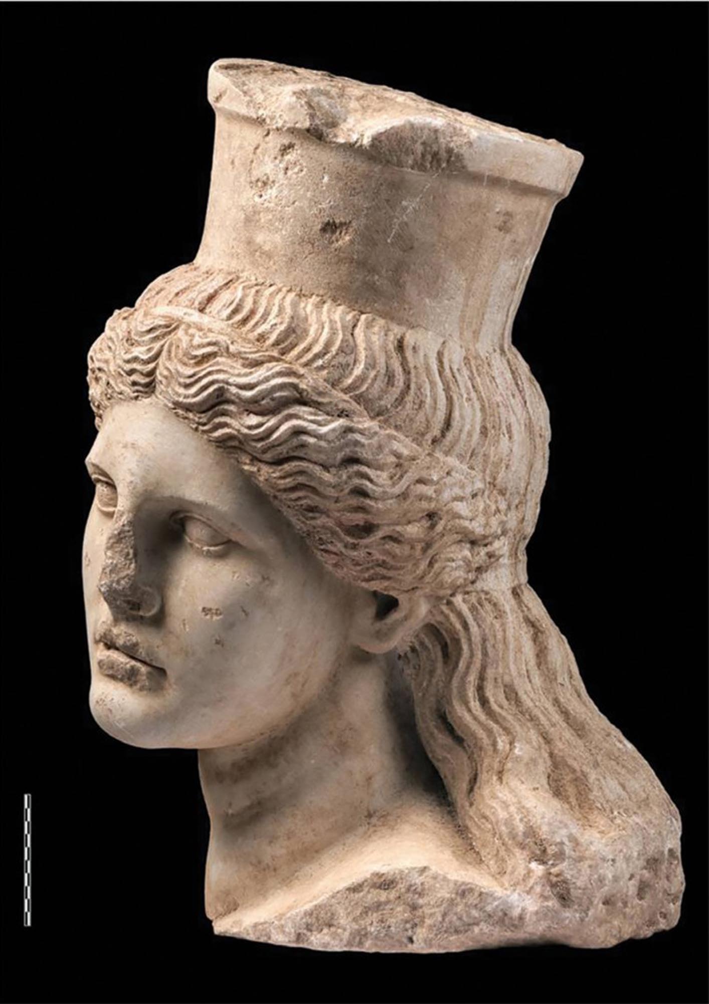
Amphipolis is associated with major figures of the Kingdom of Macedon, such as the three generals of Alexander the Great, Nearchus, Hephaestion and Laomedon, who resided in the city. After Alexander’s death, the city’s garrison remained loyal to his mother Olympias and only agreed to surrender the city to Cassander, one of Alexander’s successors, on her orders. Cassander imprisoned Alexander’s wife Roxana and his son Alexander IV in Amphipolis and ordered their murder. In 179 BC, King Philip V of Macedon died and was buried in Amphipolis.

The last chapter in the history of the Kingdom of Macedon was also written in Amphipolis. In 168 BC, after his defeat at the Battle of Pydna by the Roman general Lucius Aemilius Paullus, Perseus, son of Philip V and last king of Macedon, attempted unsuccessfully to resist in Amphipolis, his last stronghold in his struggle against the Romans. After his victory, Paullus settled in the city, where the official surrender of Macedonia to the Romans took place. To celebrate his victory, he established games in which Greeks and foreigners from various cities in Asia participated. Amphipolis was designated the capital of the First Meris, one of the four administrative regions (regiones) into which Macedonia was divided. When Macedonia became a Roman province in 148 BC, Amphipolis was declared a “free city” (civitas libera), retaining its autonomy, with local rulers to regulate its various affairs.

Ελεφαντοστέινο αγαλμάτιο ελληνιστικών χρόνων / Hellenistic vory statuette (Ephorate of Antiquities of Serres -INTERREG Greece-Bulgaria BORDERLESSCULTURE programme www.borderlessculture.eu)

During Roman times, the city continued to experience great economic and commercial prosperity. It had an important mint, where series of coins bearing the inscription ΜΑΚΕΔΟΝΩΝ ΠΡΩΤΗΣ (First Meris of Macedonia) were issued. Its rich buildings, its inscriptions and its splendid works of art bear witness to the city’s flourishing. In the years that followed, during the First Mithridatic War and until Sulla’s restoration of Roman rule in Macedonia (85 BC), Amphipolis found itself in a difficult situation due to the claims on the region by King Mithidrates VI of Pontus (120-63 BC), with whom the local Thracian tribes allied. In the mid-1st century BC, Thracians attacked the city, destroying its buildings.

Christianity arrived in Amphipolis at an early date, as St Paul the Apostle visited the city in 49/50 AD on his way from Philippi to Thessaloniki along the Via Egnatia. However, the Christian community of the city was established in the following centuries. Probably as early as the 5th century AD, Amphipolis became an episcopal see, although a bishop of the city is only mentioned for the first time later, at the Fifth Ecumenical Council of Constantinople (553 AD). The city, although smaller than it had been, gradually developed into an important ecclesiastical centre, as we see from the great number, size and splendid decoration of its Early Christian monuments.

At the end of the Early Christian period (late 6th-late 7th c. AD), a transverse wall with a five-sided tower was constructed inside the fortifications, leaving one of the city’s basilicas (Basilica C) outside the walls. This wall, together with a small single-nave church discovered in the central aisle of the basilica and dated after the mid-6th century, are the latest archaeological remains of Amphipolis. From this time on, the city seems to have gradually been abandoned, probably due to Slavic raids as well as natural disasters. In 692 AD, the participation of a bishop of the city is recorded in the minutes of the Quinisext Ecumenical Council of Constantinople, while the last reference to the city is in 739 AD, during the reign of Emperor Leo III (717-741 AD).

Ο Στρυμόνας περιβάλλει την Αμφίπολη / The Strymon River surrounding Amphipolis (Ephorate of Antiquities of Serres -INTERREG Greece-Bulgaria BORDERLESSCULTURE programme www.borderlessculture.eu)

It has been argued that after the abandonment of the city, probably in the 9th century, the inhabitants settled further south, on the site of ancient Eion. There they founded Byzantine Chrysopolis, which developed into an active port and a commercial/road station between Thessaloniki and Constantinople.

However, the area of Amphipolis was later inhabited once again. The Byzantine settlement of Marmari was established on the east bank of the Strymon, near the ancient bridge over the river; it is mentioned for the first time in 1083 as a “guesthouse … near the bridge”. Marmari served travellers who crossed the Strymon at the crossing referred to in written sources as the “Poros of Marmari” (ferry of Marmari). The requirement to pay a toll, called a poriatiko, to cross the river suggests that there was an organised ferry service here.

Marmari survived as a village until Early Ottoman times. It was last mentioned in 1547 by the French traveller Pierre Belon, when Chrysopolis was already in decline. However, the ferry here remained in use until the 18th or 19th century.

From the 17th or 18th century, the village of Marmari was succeeded by a new village called Neochori or Yeniköy (“new village” in Greek and Turkish), a short distance north-northeast of Marmari. The French consul Esprit Marie Cousinéry, who first passed through the area in 1779, reports that the village had been there for a hundred years. In 1922 the modern refugee settlement of Amphipolis was established in the north part of the walled ancient city.

MONUMENTS - ANTIQUITIES

Hellenistic and Roman city

The excavations carried out without interruption from 1956 to the present day have revealed much of the walls and some of the sanctuaries and private and public buildings of the large city, which covered an area of 250 hectares.

The fortifications of Amphipolis are among the most imposing in Macedonia. The oldest parts of the fortified enclosure date back to the founding of the city by Hagnon, who, according to Thucydides, reinforced the city with a “long wall”. The later building phases of the fortifications belong to the Roman imperial period. The long circuit wall is reinforced with rectangular and circular towers and is built according to the isodomic or pseudo-isodomic system, with regular courses of limestone ashlars with chiselled edges to fit closely together. The wall had a wall-walk, which the archers and soldiers accessed via stone stairways, and a complex system of large drains and conduits for the drainage of rainwater and water from the Strymon floods. The best-preserved part of the wall is the northern section, which in many places survives to a height of 7-8 m. Brasidas extended this part of the wall between 424 and 422 BC in order to connect it to the wooden bridge over the Strymon.

In the northern section of the wall is Gate C, the largest and most solid of the five gates in the wall revealed by the excavation (Gates A-E). It measures 13.9 x 9 m and is 2m thick. Gate D or the “Gate of Augustus” in the south wall was probably the official entrance to the city during the Roman period, as it was next to the Via Egnatia. Measuring 10 x 10.25 m, it is flanked by two marble pedestals of bronze statues with honorary inscriptions referring to the deified Augustus and the proconsul Lucius Calpurnius Piso. Of the other gates, the double Gate A in the north wall is particularly important.

Οι ξύλινοι πάσσαλοι της γέφυρας στην Πύλη Γ / Wooden piles of the Strymon bridge at Gate C (Ephorate of Antiquities of Serres -INTERREG Greece-Bulgaria BORDERLESSCULTURE programme www.borderlessculture.eu)

In contact with the northwest part of the walls of Amphipolis and Gate C is one of the most impressive excavation finds: the infrastructure of the wooden bridge that connected the city with its port on the River Strymon. This is the bridge to which Thucydides refers in his description of the battle between Brasidas and Cleon in 422 BC. At this site, 101 oak piles of circular or square cross-section have been discovered, embedded in the sandy ground: 77 were set outside the gate and 24 inside. They are arranged in groups of three or four on a surface 275 m long and 4-6 m wide, corresponding to the width of the bridge. Radiocarbon dating (C14) of the piles has confirmed that most of the bridge was built in Classical times, while also establishing that the bridge already existed on this spot in Archaic times (760 BC). It underwent many extensive repairs over the centuries, even into Byzantine and Ottoman times.

Many deities were worshipped in Amphipolis, but most of their sanctuaries have not yet been found. The River Strymon held a special place among them, worshipped as a god by the inhabitants of the city and depicted on Attic vases as a venerable, bearded old man.

The Thesmophorion or Nymphaeum is the oldest sanctuary of the city, dating from the second half of the 5th century BC, before the city was founded in 437 BC. It was uncovered almost in contact with the north wall and is associated with the worship of chthonic deities such as Kore and probably Aphrodite.

The sanctuary of the Muse Clio, which was identified on the basis of an inscription found on the site (late 5th-early 4th c. BC), is preserved in a fragmentary state. The existence of a sanctuary of Clio in Amphipolis is attested by the historian Marsyas, who was originally from Philippi. According to legend, she was the mother of the local hero and king of Thrace, Rhesus, whose horses were whiter than snow and ran like the wind. Rhesus was killed in the Trojan War and buried by Hector. There was an oracle that the Athenians could not establish a colony in Thrace unless they carried the bones of Rhesus with them there from Troy. The Athenian general Hagnon brought them to Amphipolis, where he erected a tomb near the sanctuary of the hero’s mother.

A third sanctuary, the remains of which have been brought to light by the excavations (late 2nd-early 1st c. BC), was probably dedicated to the god Attis, who belongs to the group of Eastern deities. The worship of Attis, like that of the Egyptian deities Isis, Sarapis and Horus, was widespread in Amphipolis.

In the area of the Archaeological Museum, in the eastern sector of the city, was discovered a building complex, the earliest phase of which belongs to the late 5th-early 4th century BC. Inside it was found a cist grave containing a silver urn and a gold wreath. The location of the simple tomb, within the walls, and the rich grave goods, combined with a trench deposit found next to it, indicate that it belongs to a person of special significance to the city; this may even be Brasidas himself, who was worshipped as the hero-founder of Amphipolis and was buried with honours in the city in 422 BC.

ΕΦΑ Σερρών / Ephorate of Antiquities of Serres -INTERREG Greece-Bulgaria BORDERLESSCULTURE programme www.borderlessculture.eu)

Discovered in the southern sector of the city, the house dates from the 2nd century BC. It is in the usual form of Hellenistic houses, with a central peristyle courtyard around which the rooms are laid out. The excavation of the house, which has not yet been completed, has revealed two rooms in the north part of the house decorated with  notable frescoes, that imitate architectural elements (masonry, cornices etc.).

The villa has come to light southwest of the acropolis, about 200 m from Basilica A, and dates from the 2nd or 3rd century AD. Its floors were decorated with magnificent mosaics including the Abduction of Europa, Poseidon and Amymone, and Hylas and the Nymphs.

The gymnasium, in the southeast sector of the city, is an extensive complex consisting of individual facilities: a gymnasium, a palaestra, cisterns, stoai, baths and other buildings. The complex also includes the xystos or katastegos dromos, an 80-metre-long covered gallery for runners to train in bad weather, and the paradromis, an open-air track parallel to the xystos, to exercise when conditions were good. The complex was accessed via a magnificent 8.70-metre-wide staircase with twelve steps. The complex was probably founded in the Late Classical era, flourished in the Hellenistic period and continued in use until the 1st century AD.

Outside the walls of ancientAmphipolis, within a radius of about 4.5 km, are a large number of graves of various periods. Τhe two main cemeteries of the city, containing graves dating from the Early Iron Age to the Late Roman period—with the majority belonging to the Classical and especially the Hellenistic periods—are located in the east and northeast of the archaeological site (the Classical and Hellenistic cemeteries, respectively). Among the tombs of Amphipolis a series of Macedonian tombs of particularly elaborate construction stand out. Most, however, were found partially destroyed by looters. The largest tomb of the Hellenistic cemetery is Macedonian Tomb 1, which was unlooted. Many valuable objects and gold ornaments were found inside.

The size of the cemeteries and the dispersion of the tombs, combined with the luxuriousness of several burial structures and their grave goods, is indicative of the high social, economic and cultural level of Amphipolis.

The tumulus is located northeast of Amphipolis, just outside the north walls. The excavation conducted between 2011 and 2014, attracting the interest of the international scientific community and the public, brought to light a monumental burial enclosure around the entire hill, 3 m high, and with a perimeter of 597 m, made entirely of Thasian marble. It encloses an area of approximately 2 hectares, making it the largest burial enclosure ever discovered in Greece. Inside the southern part of the enclosure was discovered a unique, complex Macedonian tomb. It is 24 m long, 4.5 m wide and 6 m high up to the barrel vault that covers the entire monument. The tomb consists of four rooms including the entrance area, which is accessed by a monumental staircase with 16 steps. The lintel of the doorway in the wall leading to the first chamber is decorated with two sphinxes of Thasian marble carved in the round, while the lintel of the doorway in the second wall is supported by two marble caryatids with integral pillars. The floor of the chamber behind the first wall is decorated with a pebble floor with geometric themes (rectangles and rhombuses), while that of the chamber behind the wall with the caryatids is covered with a pebble mosaic depicting the Abduction of Persephone. A large cist tomb was uncovered in the main burial chamber. It only contained a few grave goods, as it had already been looted in antiquity. Analysis of the skeletal remains showed that at least five people were buried in the tomb. The dating of the tomb has been the subject of debate. According to the excavator, Katerina Peristeri, it dates from the last quarter of the 4th century BC and was probably built on the orders of Alexander the Great for the dead General Hephaestion by the architect Deinocrates.

The trademark of the Serres region, the funerary monument depicting a seated lion stands today on the west bank of the Strymon, next to the provincial highway that connects Amphipolis with Serraiki Akti on the coast. Standing 5.3 m high, this is one of the most imposing sculptures of the late 4th century BC. Parts of the larger-than-life-size lion were found by Greek soldiers in 1912, then more by British soldiers in 1916, and finally the rest was discovered in 1930-1931 during the large-scale drainage works by Monks-Ulen & Co. that drained the plain of Serres and created Lake Kerkini. The present base of the monument, restored in 1936, is not the original one. It has recently been argued that the lion was originally set on the top of the Kasta hill, but this view is not widely accepted.

αρχείο ΔΒΜΑ, φωτ. Κ. Ξενικάκης / archive of DBMA, phot. K. Xenikakis

During the Early Christian period, Amphipolis was limited to the middle of the ancient city, the ancient acropolis, with an area of 40 hectares. It was protected by a fortified enclosure approximately 2,200 m long, mostly constructed of spolia, older architectural members. It is reinforced at intervals by four-sided towers, with a circular tower in the northeast corner.

Within the walled area, excavations have revealed four early Christian basilicas, conventionally termed Basilicas A-D, as well as a centrally planned church. The four basilicas are all three-aisled timber-roofed basilicas, the dominant architectural type in Early Christian times around the Mediterranean basin. On their west side they have spacious narthexes and large atria. Although large, they are smaller than the Early Christian basilicas of Philippi and Thessaloniki. They are adorned with excellent architectural sculptures and remarkable mosaic floors.

The excavations have also brought to light the remains of a large rectangular building to the east of Basilica I which is interpreted as a bishop’s palace. In its southwest corner are three long, rectangular rooms which were probably cisterns, as their walls and bottom are coated with hydraulic cement. Remains of houses and tomb inscriptions complete the picture of the Early Christian town. 

Basilica A dates from the first half of the 6th century AD and is the largest church of Amphipolis, with two narthexes and a spacious atrium. In the west part of the church are several annexes which served various religious needs.

αρχείο ΔΒΜΑ, φωτ. Κ. Ξενικάκης / archive of DBMA, phot. K. Xenikakis

Basilica B is located in the northeast corner of the circuit wall, 125 m northeast of Basilica A. It dates from around 500 AD.

The smallest of the basilicas of Amphipolis, is just west of Basilica A. The atrium is on the south side of the basilica rather than the usual west. Basilica C stands out for its fine mosaic floors and dates from the second half of the 5th century AD.

αρχείο ΔΒΜΑ, φωτ. Κ. Ξενικάκης / archive of DBMA, phot. K. Xenikakis

Lying 26.5 m southeast of Basilica A, it dates, like Basilica C, from the second half of the 5th century AD. On its west side is a quadriporticus, a square atrium surrounded on all four sides by a two-storey colonnaded portico. Basilica D stands out for its rich sculptural decoration.

The church was discovered 50 m south of Basilica B. It is the most imposing Early Christian monument of the city and one of the few centrally planned churches of this period in Greece. The nucleus of the church is a central hexagon surrounded on all except the eastern side by a peripheral corridor with an octagonal plan. The projecting apse on the east is five-sided and flanked by two rectangular spaces. West of the church was excavated a quadriporticus, an atrium surrounded on all four sides by a portico with two-storey colonnades. Against each of the two lateral sides of the atrium is a row of annexes. The floors of the church were adorned with rich opus sectile (marble inlay), while the walls were covered with inset mosaics, as we see from the fragments found in the excavation. Based on the rich sculptural decoration of its architectural elements, the church dates from the early 6th century.

In the mid-14th century, the brother adventurers, the Grand Stratopedarch Alexios and the Grand Primicerius John, were active in the Amphipolis area. As allies of Emperor John V Palaiologos (1341-1391),  they seized large tracts of land in Eastern Macedonia, which they took from the Serbs. In 1367 (according to a dedicatory inscription, now lost), they erected the Tower of Marmari near the Byzantine village of the same name. They granted the tower as a metochi (dependency) to the Monastery of Christ Pantocrator on Mount Athos, which was founded around the same time. The metochi covered a very large area and included other villages in the region. The tower has external dimensions of 10 x 10.65 m, stands 14 m high and was originally three-storey. It was constructed using spolia from the buildings of ancient Amphipolis. The entrance is roughly in the middle of the north side, 2.5 m above the ground for added security.

The Tower of Chandakas, on the west bank of the Strymon, takes its name from the settlement believed to have existed at this location. It predates the Tower of Marmari, since it is thought to have been ceded to the Monastery of Zographou on Mount Athos, together with the settlement of the same name, in 1342, by a chrysobull of Emperor John V Palaiologos. The tower is partially preserved to a height of 8 m. It is a square building with internal dimensions of 7 x 7 m. Like the Tower of Marmari, it was probably three storeys high. Material from earlier buildings of Amphipolis is also seen in its masonry. It is structurally reinforced by twelve buttresses embedded in the walls (three on each side), half of which are preserved today.

The two towers were not defensive, since, isolated as they were, they were an easy target for attackers. They were intended to control of the “Poros of Marmari”, collecting the ferry tax on behalf of the two monasteries, and collecting and distributing agricultural goods, mainly cereals, from the hinterland of the Strymon, using ships provided by the monasteries themselves. In the area of the two towers, a relatively short distance from Mount Athos, the monasteries owned a large number of watermills, the ownership of which was the subject of several disputes.

The castle of Chrysopolis is preserved next to the mouth of the Strymon, at Kaledes, very close to the site of ancient Eion. Based on surface finds, it was founded in the 9th or 10th century. Byzantine sources frequently confuse Chrysopolis with Amphipolis. Different building phases are identified in the masonry of the castle, the most important being that attributed to Emperor Andronikos III Palaiologos (1328-1341). The castle originally enclosed an area of 2.5 hectares and was then extended to the east with the addition of a larger enceinte, enclosing an area of 6.5 hectares.

The oldest of the colonies of Andros on the North Aegean coast has been excavated in recent years by the Archaeological Service in collaboration with the Canadian Institute in Greece and the University of Montreal. It is located on the coast of the Strymonic Gulf, about 6 km from ancient Amphipolis and 4 km west of the mouth of the Strymon. The excavation has brought to light public and private buildings of the city.

Museum

Archaeological Museum of Amphipolis

The museum is located in the modern village of Amphipolis. The great archaeological wealth of Amphipolis and the wider is represented by numerous artefacts. . Objects from Amphipolis are also exhibited in the Archaeological Museum of Kavala.

Other stops in the Regional Unit of Serres

error: